



Allendale, New Jersey
Allendale is a borough of 6,865 people in Bergen County, New Jersey, founded in November 8, 1894.
Why visit Allendale
Townapedia lists 76 museums and landmarks, 16 parks and trails, 56 places to eat, 3 places to stay and 5 attractions in and around town.
Highlights include Campgaw Mountain Reservation, Erie Railroad Signal Tower, Waldwick Yard, Aaron Winters House and James A. McFaul Environmental Center.
Weather in Allendale
Forecast from the National Weather Service. Full forecast
About Allendale
Allendale is a borough in Bergen County, in the U.S. state of New Jersey. As of the 2020 United States census, the borough's population was 6,848, the highest recorded in any decennial count and an increase of 343 (+5.3%) from the 2010 census count of 6,505, which in turn reflected a decline of 194 (−2.9%) from the 6,699 counted in 2000.
From the Wikipedia article Allendale, New Jersey (this version), under CC BY-SA 4.0.
Things to do5

Campgaw Mountain Reservation
Ski area · 3.7 mi
County park in Bergen County


Museums and landmarks76
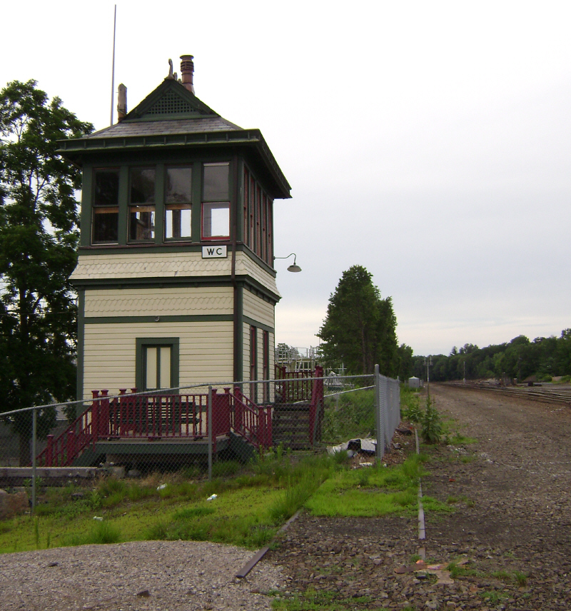
Erie Railroad Signal Tower, Waldwick Yard
Monument and historic site · National Register of Historic Places · 1.3 mi
Signal box in New Jersey, United States of America
3 Bohnert Place, Waldwick

Aaron Winters House
Monument and historic site · National Register of Historic Places · 2.9 mi
Historic house in Franklin Lakes, New Jersey

Abraham Van Gelder House
Monument and historic site · National Register of Historic Places · 1.9 mi
House in Ramsey, New Jersey

Abram Ackerman House
Monument and historic site · National Register of Historic Places · 1.8 mi
United States historic place

Achenbach House
Monument and historic site · National Register of Historic Places · 2.7 mi
House in Saddle River, New Jersey

Ackerman House
Monument and historic site · National Register of Historic Places · 2.5 mi
House in Saddle River, New Jersey

Ackerman-Dater House
Monument and historic site · National Register of Historic Places · 1.9 mi
Single-family detached home in Saddle River, New Jersey

Ackerman-Demarest House
Monument and historic site · National Register of Historic Places · 3.7 mi
Historic house in Ho-Ho-Kus, New Jersey
Ackerman-Smith House
Monument and historic site · National Register of Historic Places · 2.7 mi
House in Saddle River, New Jersey

Albert Pulis House
Monument and historic site · National Register of Historic Places · 3.2 mi
Historic house in Franklin Lakes, New Jersey
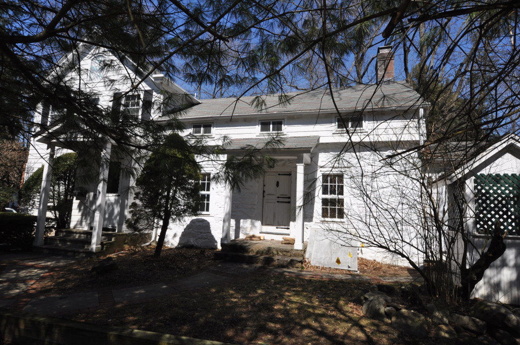
Albert Smith House
Monument and historic site · National Register of Historic Places · 1.7 mi
Historic house in New Jersey, United States

Albert Van Blarcom House
Monument and historic site · National Register of Historic Places · 1.7 mi
House in Wyckoff, New Jersey
64 more on the map.
Parks, trails and playgrounds16





4 more on the map.
Restaurants and cafes56

Allendale Steakhouse
Restaurant · Steak House
95 West Allendale Avenue, Allendale
Tu-Fr 16:00-22:00; Sa 16:00-22:30; Su 14:00-21:00
Hunan Garden
Restaurant · Chinese · 1.8 mi
10 Franklin Turnpike, Waldwick
Mo,We-Sa 11:00-22:00; Su 11:30-22:00
44 more on the map.
History
In 1888, Henry J. Appert, a Swiss immigrant, drained a bog for the cultivation of onions and celery. The business—Allendale Produce Gardens, or the "celery farm" to locals—supplied wholesale markets and Campbell Soup Company. Allendale was formed on November 8, 1894, from portions of Franklin Township (remainder now Wyckoff), Hohokus Township (remainder now Mahwah) and Orvil Township (remainder now Waldwick).
The borough was formed during the "Boroughitis" phenomenon then sweeping through Bergen County, in which 26 boroughs were formed in the county in 1894 alone. The borough was named for Joseph Warner Allen, a surveyor for the Erie Railroad.
Babe Ruth would frequently vacation at the Allendale Hotel, which remains in use as a rooming house.
From the History section of Allendale, New Jersey on Wikipedia, under CC BY-SA 4.0.
Where to stay3
Churches and places of worship11
Archer United Methodist Church
Church · United Methodist · 0.4 mi
37 East Allendale Avenue, Allendale
St John's Memorial Episcopal Church
Church · Episcopal · 1.8 mi
301 East Main Street, Ramsey
Christ Community Church / Metro Church
Church · 1.6 mi
136 Wyckoff Avenue, Waldwick
Shopping8
Commons at Saddle River
Shopping center · 1.8 mi
82 East Allendale Road, Saddle River
Gas and EV charging11
Schools, colleges and libraries54
Healthcare4
Map of Allendale
244 places. The map loads OpenStreetMap tiles when you open it.
People and cost of living
American Community Survey 5-year estimates, 2020-2024, U.S. Census Bureau. Estimates have margins of error, larger for small towns.
Disaster history
Bergen County has had 21 federal disaster declarations since 2000, most often for hurricanes.
- 2021-09-05: Remnants Of Hurricane Ida (Hurricane)
- 2021-09-02: Remnants Of Hurricane Ida (Hurricane)
- 2020-12-11: Tropical Storm Isaias (Hurricane)
- 2020-03-25: Covid-19 Pandemic (Biological)
- 2020-03-13: Covid-19 (Biological)
- 2018-06-08: Severe Winter Storm And Snowstorm (Severe Storm)
OpenFEMA disaster declarations summaries.
Getting there and nearby towns
Teterboro Airport (TEB) is the nearest airport with scheduled flights listed in OpenStreetMap, 13 miles away.
- Waldwick 1 mi south, about 2 min by car
- Ramsey 2 mi north, about 3 min by car
- Ridgewood 4 mi south, about 6 min by car
- Franklin Lakes 4 mi southwest, about 7 min by car
- Hillsdale 5 mi east, about 8 min by car
- Airmont 5 mi north, about 8 min by car
- Glen Rock 5 mi south, about 8 min by car
- Hawthorne 5 mi south, about 9 min by car
- Suffern 5 mi north, about 9 min by car
- Oakland 6 mi west, about 9 min by car
Drive times are estimates from straight-line distance, not routes.
Local news
Headlines from INDB, the NEMICO news database.
Reviews, tips and questions
Loading what members have shared...
Sources and licences
- NCES EDGE (Public domain): public schools
- OpenFEMA (Public domain): disaster declarations
- OpenStreetMap contributors (ODbL 1.0): places, airports, map data
- U.S. Census Bureau (Public domain): population, income, housing, education, commute
- Wikidata (CC0 1.0): elevation, founding date, time zone, website, landmarks and historic places
- Wikimedia Commons (see each image): photos
- Wikipedia (CC BY-SA 4.0): overview and history text
Photo credits
- Train approaching Allendale, NHRHS2010, CC BY-SA 3.0
- ErieSignalTowerWaldwick, Lithium6ion, CC0
- WESTERVELT-LYDECKER HOUSE, WOODCLIFF LAKE, BERGEN COUNTY, JERRYE & ROY KLOTZ MD, CC BY-SA 4.0
- ALBERT VAN BLARCOM HOUSE, WYCKOFF, BERGEN COUNTY, JERRYE & ROY KLOTZ MD, CC BY-SA 4.0
- HOPPER HOUSE, UPPER SADDLE RIVER, BERGEN COUNTY, NJ, JERRYE & ROY KLOTZ M.D., CC BY-SA 4.0
- ACKERMAN HOUSE, SADDLE RIVER, BERGEN COUNTY, NJ, JERRYE AND ROY KLOTZ M.D., CC BY-SA 4.0
- TERHUNE HOUSE, WYCKOFF, BERGEN COUNTY, JERRYE & ROY KLOTZ MD, CC BY-SA 4.0
- HOPPER HOUSE, SADDLE RIVER, BERGEN COUNTY, NJ, JERRYE & ROY KLOTZ M.D., CC BY-SA 4.0
- The Old Stone Church, Upper Saddle River, NJ - south view, Zeete, CC BY-SA 4.0
- CAIRNS-WHITTEN-BLAUVELT HOUSE, WYCKOFF, BERGEN COUNTY, NJ, JERRYE & ROY KLOTZ MD, CC BY-SA 4.0
- WaldwickNJ AlbertSmithHouse, Magicpiano, CC BY-SA 4.0
- Tea House, Texwipe Corporation Headquarters, Upper Saddle River, NJ, Zeete, CC BY-SA 4.0
- GARRET K. OSBORN HOUSE AND BARN, SADDLE RIVER, BERGEN COUNTY, NJ, JERRYE & ROY KLOTZ MD, CC BY-SA 4.0
- STILLWELL-PRESTON HOUSE, SADDLE RIVER, BERGEN COUNTY, KLOTZPLATE, CC BY-SA 4.0
- SaddleRiverNJ AchenbachHouseRemnant, Magicpiano, CC BY-SA 4.0
- DR. JOHN CHRISTIE WARE BUNGALOW, SADDLE RIVER, BERGEN COUNTY, NJ, JERRYE & ROY KLOTZ M.D., CC BY-SA 4.0
- JOE JEFFERSON CLUBHOUSE, SADDLE RIVER, BERGEN COUNTY, NJ, JERRYE & ROY KLOTZ M.D., CC BY-SA 4.0
- Hermitage (Ho-Ho-Kus, New Jersey) 9527, Richard Arthur Norton (1958- ), CC BY-SA 4.0
- GarretAugustusAckermanHouse, Unknown author Unknown author, Public domain
- David Van Gelder House, Elle829, CC BY-SA 3.0
- EVANGELICAL LUTHERAN CHURCH OF SADDLE RIVER, BERGEN COUNTY, NJ, JERRYE & ROY KLOTZ, MD, CC BY-SA 4.0
- RATHBONE-ZABRISKE HOUSE, RIDGEWOOD, BERGEN COUNTY, JERRYE & ROY KLOTZ M.D., CC BY-SA 4.0
- RIdgewood Station - October 2014, Mitchazenia, CC BY-SA 4.0
- ANDRIES THOMAS VAN BUSKIRK HOUSE, SADDLE RIVER, BERGEN COUNTY, NJ, JERRYE & ROY KLOTZ M.D., CC BY-SA 4.0
- O'BLENIS HOUSE, SADDLE RIVER, BERGEN COUNTY, NJ, JERRYE & ROY KLOTZ M.D., CC BY-SA 4.0
- BC. WANDELL HOUSE - THE CEDARS, SADDLE RIVER, BERGEN COUNTY, NJ, JERRYE & ROY KLOTZ M.D., CC BY-SA 4.0
- VAN VOORHIS QUACKENBUSH HOUSE, BERGEN COUNTY, NJ, JERRYE & ROY KLOTZ M.D., CC BY-SA 4.0
- FOLLY HOUSE, WYCKOFF, BERGER COUNTY, JERRYE & ROY KLOTZ MD, CC BY-SA 4.0
- DR. E.G. ROY HOUSE, SADDLE RIVER, BERGEN COUNTY, JERRYE & ROY KLOTZ M.D., CC BY-SA 4.0
- TERHUNE-RANLETT HOUSE, HO-HO-KUS, BERGEN COUNTY, JERRYE & ROY KLOTZ MD, CC BY-SA 4.0
- Aaron Winters House, Franklin Lakes, NJ, Unknown author Unknown author, Public domain
- 71 E. Allendale Road, Saddle River, NJ, JERRYE & ROY KLOTZ M.D., CC BY-SA 4.0
- Abraham Gelder House, Elle829, CC BY-SA 3.0
- SaddleRiverNJ AbramAckermanHouse, Magicpiano, CC BY-SA 4.0
- ACKERMAN-DEMAREST HOUSE, HO-HO-KUS, BERGEN COUNTY, JERRYE & ROY KLOTZ MD, CC BY-SA 4.0
- FranklinLakesNJ BlauveltHouse, Magicpiano, CC BY-SA 4.0
- ALBERT PULIS HOUSE, FRANKLIN LAKES, BERGEN COUNTY, JERRYE & ROY KLOTZ MD, CC BY-SA 4.0
- DUTCH REFORMED CHURCH OF WYCKOFF, BERGEN COUNTY, NJ, JERRYE & ROY KLOTZ M.D., CC BY-SA 4.0
- GARRET AND MARIA ACKERMAN HOUSE, SADDLE RIVER, BERGEN COUNTY, NJ, JERRYE & ROY KLOTZ M.D., CC BY-SA 4.0
- Westervelt - Ackerson House 9494, Richard Arthur Norton (1958- ), CC BY-SA 4.0


Page built October 30, 2026. Spotted a mistake? Tell us or suggest a place.