


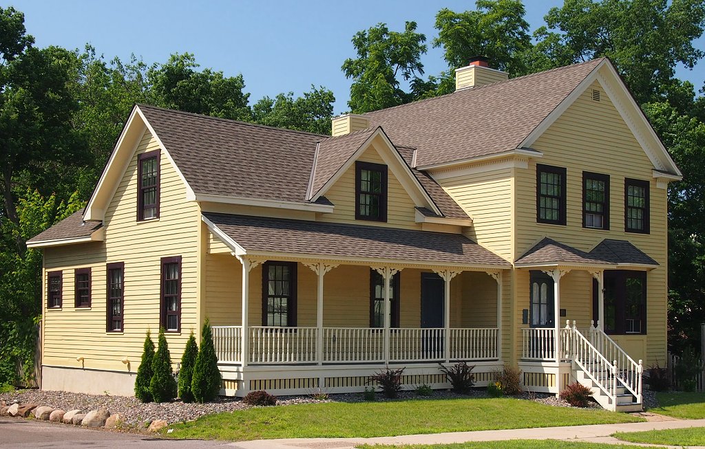
Andover, Minnesota
Andover is a city of 33,035 people in Anoka County, Minnesota, founded in 1857.
Why visit Andover
Townapedia lists 16 museums and landmarks, 103 parks and trails, 89 places to eat, 6 places to stay and 5 attractions in and around town.
Highlights include Anoka–Champlin Mississippi River Bridge, Andover Cinema, Anoka Post Office and Colonial Hall and Masonic Lodge No. 30.
July is the warmest month, with average highs of 82°F; January lows average 2°F, and about 44 inches of snow fall in a normal year.
Weather in Andover
Forecast from the National Weather Service. Full forecast
About Andover
Andover is a city in Anoka County, Minnesota, United States. The population was 32,601 at the 2020 census.
From the Wikipedia article Andover, Minnesota (this version), under CC BY-SA 4.0.
Things to do5

Anoka–Champlin Mississippi River Bridge
Bridge · National Register of Historic Places · 5.1 mi
Highway bridge across the Mississippi River between Anoka, Minnesota and Champlin, Minnesota


Museums and landmarks16

Anoka Post Office
Monument and historic site · National Register of Historic Places · 4.5 mi
Former post office building in Anoka, Minnesota, United States

Colonial Hall and Masonic Lodge No. 30
Monument and historic site · National Register of Historic Places · 4.5 mi
House in Anoka, United States of America

District No. 28 School
Monument and historic site · National Register of Historic Places · 3.4 mi
Historic school building in Ramsey, Minnesota, United States

Heman L. Ticknor House
Monument and historic site · National Register of Historic Places · 4.7 mi
Historic house in Anoka, Minnesota, United States

Jackson Hotel
Monument and historic site · National Register of Historic Places · 4.5 mi
Listed on the National Register of Historic Places in Anoka County, Minnesota
Shaw–Hammons House
Monument and historic site · National Register of Historic Places · 4.7 mi
Oldest standing residential building in Anoka, Minnesota, United States


Windego Park Auditorium/Open Air Theater
Monument and historic site · National Register of Historic Places · 4.7 mi
Amphitheatre in Anoka, United States of America

Old Ramsey Town Hall
Monument and historic site · 3.5 mi
14120 Saint Francis Boulevard, Ramsey
4 more on the map.
Parks, trails and playgrounds103

Bunker Hills Golf Course
Golf course · 3.9 mi
12800 Bunker Prairie Road NW, Coon Rapids
sunrise-sunset

Majestic Oaks Golf Club
Golf course · 4.8 mi
701 Bunker Lake Boulevard Northeast, Ham Lake
sunrise-sunset
Andrews Park (Champlin, Minnesota)
Park · 6.1 mi
Park in Minnesota, United States of America

Reilley West Park
Park · 2.8 mi
5160 156th Lane Northwest, Anoka
Mo-Fr 05:00-22:00
Timberline Park
Park · 3.8 mi
Park without services, path between neighborhoods with views of prairie/farm and small creek spillway dam
sunrise-sunset

91 more on the map.
Restaurants and cafes89

Anoka Hardware Store
Bar and pub · Burger, Local, Tea · 4.5 mi
201 Jackson Street
We 16:00-22:00; Th 17:00-22:00; Fr 16:00-23:00; Sa 15:00-23:00


Texas Roadhouse
Restaurant · Steak House · 3.9 mi
2780 Main Street Northwest, Coon Rapids
Su 11:00-22:00; Mo-We 15:00-22:00; Th 11:00-22:00; Fr-Sa 11:00-23:00
White Rabbit Kitchen
Restaurant · American, Regional, Chicken · 1.6 mi
15190 Bluebird Street Northwest, Andover
Tu-Sa 11:00-20:00

10k Brewing
Brewery and winery · 4.5 mi
2005 2nd Avenue, Anoka
Mo-Tu 16:00-21:00; We-Th 15:00-22:00; Fr 13:00 - 23:00; Sa 12:00 -...
Ambi Wine Bar & Desserts
Restaurant · 4.5 mi
2015 2nd Avenue, Anoka
Tu-Th 16:00-22:00; Fr 15:00-23:00; Sa 12:00-23:00; Su 13:00-19:00
JR's Outpost
Bar and pub · 4.8 mi
6141 US 10, Ramsey
Mo-We 07:00-25:00; Th-Sa 07:00-26:00; Su 08:00-25:00
201 Tavern & Grill
Restaurant · 4.5 mi
201 Jackson Street, Anoka
Su-Th 11:00 - 23:00; Fr-Sa 11:00-25:00
77 more on the map.
History
In 1860 after an Anoka, Minnesota speech by U.S. Representative Galusha Aaron Grow from Pennsylvania who was an abolitionist and a major figure in the Homestead Act, the town name was changed to Grow Township.
Ham Lake Township split from Andover, known as Grow Township at the time, in 1871.
Once a stop on the Great Northern Railway, Andover was established as a city in 1976.
A popular myth surrounding the origins of the name "Andover" describe a train tipping off the railroad tracks, and an eyewitness describing that the train "went over and over", however this proves to be false because an Anoka County Union Newspaper article first mentions the name in an articled dated March 14, 1899, before any railroad tracks went through the city. The article described the Great Northern Railway announcing the names of new stations being located throughout the area, including a station named "Andover Station". The origin of the name for the station is probably the town of Andover in the UK .
From the History section of Andover, Minnesota on Wikipedia, under CC BY-SA 4.0.
Where to stay6
AmericInn by Wyndham Coon Rapids
Motel and hotel · 3.3 mi
3430 Northdale Boulevard Northwest, Coon Rapids
Churches and places of worship13
Swedish Evangelical Lutheran Church
Church · National Register of Historic Places · 6.7 mi
Reedemer Lutheran Church
Church · Lutheran · 4.8 mi
2135 Northdale Boulevard Northwest, Coon Rapids
Independent Baptist Church
Church · Baptist · 4.3 mi
15650 Sunfish Lake Boulevard Northwest, Ramsey
United Methodist Church- Anoka
Church · Methodist · 4.7 mi
850 South Street, Anoka
Shopping15
Gas and EV charging15
Casey's General Store
Gas station · 4.8 mi
14131 Sunfish Lake Boulevard Northwest, Ramsey
Schools, colleges and libraries54
DaVinci Academy of Arts and Science
School · All · 4.6 mi
532 Bunker Lake Boulevard Northeast NE, Ham Lake
Healthcare8
Allina Health Mercy Pharmacy
Clinic and pharmacy · 4.9 mi
11850 Blackfoot Street Northwest, Coon Rapids
M Health Fairview Urgent Care - Andover
Clinic and pharmacy · 2.6 mi
13819 Hanson Boulevard Northwest, Andover
Walgreens
Clinic and pharmacy · 3.9 mi
3470 River Rapids Drive Northwest, Coon Rapids
Map of Andover
250 places. The map loads OpenStreetMap tiles when you open it.
Climate by month
Monthly table
| Month | High | Low | Rain | Snow |
|---|---|---|---|---|
| Jan | 22°F | 2°F | 0.6 in | 5.1 in |
| Feb | 28°F | 7°F | 0.8 in | 9.6 in |
| Mar | 41°F | 19°F | 1.4 in | 6.3 in |
| Apr | 56°F | 32°F | 2.9 in | 5.7 in |
| May | 68°F | 45°F | 3.6 in | 0.0 in |
| Jun | 78°F | 55°F | 3.8 in | 0.0 in |
| Jul | 82°F | 60°F | 4.5 in | 0.0 in |
| Aug | 80°F | 57°F | 3.6 in | 0.0 in |
| Sep | 72°F | 48°F | 2.5 in | 0.0 in |
| Oct | 58°F | 36°F | 2.7 in | 0.7 in |
| Nov | 41°F | 23°F | 1.4 in | 4.3 in |
| Dec | 27°F | 11°F | 1.0 in | 12.4 in |
U.S. Climate Normals 1991-2020 for Andover 1N (2 mi away), NOAA NCEI.
People and cost of living
American Community Survey 5-year estimates, 2020-2024, U.S. Census Bureau. Estimates have margins of error, larger for small towns.
Disaster history
Anoka County has had 6 federal disaster declarations since 2000, most often for biologicals.
- 2020-04-07: Covid-19 Pandemic (Biological)
- 2020-03-13: Covid-19 (Biological)
- 2011-06-07: Severe Storms And Tornadoes (Severe Storm)
- 2005-09-13: Hurricane Katrina Evacuation (Hurricane)
- 2001-05-16: Severe Winter Storms, Flooding, And Tornadoes (Flood)
- 2000-10-20: Mn - Carlos Edge Fire Complex - 10/19/2000 (Fire)
OpenFEMA disaster declarations summaries.
Getting there and nearby towns
Crystal Airport (MIC) is the nearest airport with scheduled flights listed in OpenStreetMap, 13 miles away.
- Anoka 4 mi southwest, about 6 min by car
- Coon Rapids 5 mi south, about 9 min by car
- Ramsey 6 mi west, about 9 min by car
- Champlin 6 mi southwest, about 10 min by car
- Oak Grove 7 mi north, about 11 min by car
- Ham Lake 7 mi east, about 11 min by car
- Blaine 9 mi southeast, about 14 min by car
- Minneapolis 20 mi south, about 33 min by car
- St. Paul 24 mi southeast, about 38 min by car
- Apple Valley 36 mi south, about 57 min by car
Drive times are estimates from straight-line distance, not routes.
Local news
Headlines from INDB, the NEMICO news database.
Reviews, tips and questions
Loading what members have shared...
Sources and licences
- NCES EDGE (Public domain): public schools
- NOAA NCEI U.S. Climate Normals 1991-2020 (Public domain): climate by month
- OpenFEMA (Public domain): disaster declarations
- OpenStreetMap contributors (ODbL 1.0): places, airports, map data
- U.S. Census Bureau (Public domain): population, income, housing, education, commute
- Wikidata (CC0 1.0): elevation, founding date, time zone, website, landmarks and historic places
- Wikimedia Commons (see each image): photos
- Wikipedia (CC BY-SA 4.0): overview and history text
Photo credits
- Windego Park 1, Elkman, CC BY-SA 3.0
- Anoka-Champlin Bridge, McGhiever, CC BY 4.0
- Heman L. Ticknor House, McGhiever, CC BY-SA 4.0
- Swedish Evangelical Lutheran Church summer, McGhiever, CC BY-SA 4.0
- Anoka Post Office, McGhiever, CC BY-SA 4.0
- Shaw-Hammons House 2013, McGhiever, CC BY-SA 3.0
- Jackson Hotel, McGhiever, CC BY-SA 3.0
- Colonial Hall and Masonic Lodge No 30, McGhiever, CC BY-SA 3.0
- Porter Kelsey House 3, Elkman, CC BY-SA 3.0
- Porter Kelsey House, McGhiever, CC BY-SA 4.0
- Anoka High School, Widgetkid, CC BY-SA 4.0
- District No. 28 School, Tiggr222, CC BY-SA 4.0
- TownHallRamseyMN, Jonathunder, GFDL 1.2
- District 28 School 3, Elkman, CC BY-SA 3.0
- Ramsey Historic Town Hall, Bradinator33, CC BY-SA 4.0
- Ramsey Town Hall, McGhiever, CC BY-SA 3.0
- Perdita dolichocephala, iNaturalist user: gonodactylus, CC BY 4.0
- ISS034-E-13733 - View of Earth, Earth Science and Remote Sensing Unit , Lyndon B. Johnson Space Center, Public domain
- ISS054-E-51065 - View of Earth, Earth Science and Remote Sensing Unit, NASA Johnson Space Center, Public domain
- ISS021-E-34830 - View of Earth, Earth Science and Remote Sensing Unit , Lyndon B. Johnson Space Center, Public domain
- ISS065-E-85831 - View of Earth, Earth Science and Remote Sensing Unit , Lyndon B. Johnson Space Center, Public domain
- ISS018-E-16176 - View of Earth, Earth Science and Remote Sensing Unit , Lyndon B. Johnson Space Center, Public domain
- Bunker Hills Regional Park, Minnesota (35331432836), Tony Webster from Minneapolis, Minnesota, United States, CC BY-SA 2.0
- Sunset at Bunker Hills Regional Park Minnesota (29316156750), Tony Webster from Minneapolis, Minnesota, CC BY-SA 2.0
- RV Surge Protector EMS-PT30X Progressive Industries (53243778830), Tony Webster, CC BY 2.0
- DecoPac Headquarters in Anoka, Minnesota, Scott Fillman, CC BY-SA 4.0
- Strobilomyces strobilaceus 30161300, jenniferf4, CC0
- 1979 Pontiac Sunbird coupe, Greg Gjerdingen, CC BY 2.0
- 1970 Mercury Marquis Brougham, Greg Gjerdingen, CC BY 2.0
- 1970 Mercury Marquis Brougham (cropped), Greg Gjerdingen, CC BY 2.0
- 1970 Mercury Marquis Brougham - 51352123100, Greg Gjerdingen, CC BY 2.0
- 1967 Buick Electra 225 (37440539135), Greg Gjerdingen from Willmar, USA, CC BY 2.0
- 1979 Pontiac Sunbird - 48740332407, Greg Gjerdingen, CC BY 2.0
- 1967 Buick Electra 225 (36628248403), Greg Gjerdingen from Willmar, USA, CC BY 2.0
- 1967 Buick Electra 225 (36628248403) (cropped), Greg Gjerdingen from Willmar, USA, CC BY 2.0
- 1967 Buick Electra 225 (36628241813), Greg Gjerdingen from Willmar, USA, CC BY 2.0
- 1967 Buick Electra 225 (36628237373), Greg Gjerdingen from Willmar, USA, CC BY 2.0
- Anoka Classic Car Show, Greg Gjerdingen, CC BY 2.0
- Northstar Commuter Coon Rapids Riverdale station, Mulad, Public domain
- 1961 Cadillac Coupe de Ville & 1961 Lincoln Continental Convertible (36690581524), Greg Gjerdingen from Willmar, USA, CC BY 2.0


Page built October 30, 2026. Spotted a mistake? Tell us or suggest a place.