




Andrews AFB, Maryland
Andrews AFB is a community of 3,130 people in Prince George's County, Maryland, founded in January 2, 1944.
Why visit Andrews AFB
Townapedia lists 6 museums and landmarks, 12 parks and trails, 46 places to eat, 10 places to stay and 1 attraction in and around town.
Highlights include His Lordship's Kindness, Melwood Park, Freedom Park and Camp Springs Recreation Center.
July is the warmest month, with average highs of 88°F; January lows average 25°F.
Weather in Andrews AFB
Forecast from the National Weather Service. Full forecast
About Andrews AFB
Joint Base Andrews (JBA; IATA: ADW, ICAO: KADW, FAA LID: ADW) is a United States military facility located in Prince George's County, Maryland. The facility is under the jurisdiction of the United States Air Force (USAF) 316th Wing, Air Force District of Washington (AFDW). The base was established in 2009, when Andrews Air Force Base and Naval Air Facility Washington were merged.
From the Wikipedia article Joint Base Andrews (this version), under CC BY-SA 4.0.
Things to do1

Museums and landmarks6

His Lordship's Kindness
Monument and historic site · National Register of Historic Places · 2.6 mi
Historic plantation estate near Rosaryville, Maryland, United States

Melwood Park
Monument and historic site · National Register of Historic Places · 2.8 mi
Building in Maryland, United States
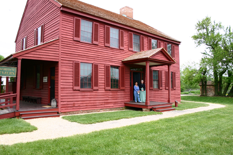
Surratt House & Tavern
Monument and historic site · National Register of Historic Places · 3.5 mi
Historic house museum in Clinton, Maryland, United States


The Cottage
Monument and historic site · National Register of Historic Places · 3.9 mi
Human settlement in Maryland, United States of America

Lockheed C-140 Jetstar
Monument and historic site · 0.8 mi
1418 Menoher Drive, Joint Base Andrews
Parks, trails and playgrounds12


The Courses at Andrews
Golf course · 1.8 mi
4442 West Perimeter Road, Joint Base Andrews
Restaurants and cafes46


Starbucks
Cafe · Coffee Shop · 0.9 mi
1811 G Street, Joint Base Andrews
Mo-Fr 05:30-18:00;Sa 08:00-17:00;Su 08:00-16:00


Sammiches Catering
Restaurant · 1.7 mi
8411 Old Marlboro Pike, Upper Marlboro

34 more on the map.
Where to stay10
Days Inn by Wyndham Camp Springs Andrews AFB
Motel and hotel · 1.4 mi
5151 Allentown Road, Camp Springs
Churches and places of worship21
Central Baptist Church of Camp Springs
Church · Baptist · 2.4 mi
5600 Old Branch Avenue, Camp Springs
The Church of Jesus Christ of Latter-day Saints
Church · Mormon · 1.7 mi
7979 Penn Randall Place, Upper Marlboro
Kingdom Hall of Jehovahs Witnesses Clinton Congregation
Church · Jehovahs Witness · 2.5 mi
6000 Kirby Road, Clinton
Ephesians New Testament Church of God in Christ
Church · 1.5 mi
4331 Forestville Road, District Heights
Shopping9
Gas and EV charging24
East Side Government Vehicle Service Station
Gas station · 0.8 mi
3286 Bainbridge Street, Joint Base Andrews
Schools, colleges and libraries61
Prince George's Community College at Joint Base Andrews
School · 0.8 mi
1413 Arkansas Avenue, Joint Base Andrews
University of Maryland Global Campus Joint Base Andrews
School · 0.8 mi
1413 Arkansas Avenue, Joint Base Andrews
Healthcare23
Allergy/Immunizations/Pediatrics
Clinic and pharmacy · 1.4 mi
1060 West Perimeter Road, Joint Base Andrews
Cardiology/Security Manager
Clinic and pharmacy · 1.4 mi
1060 West Perimeter Road, Joint Base Andrews
Dermatology/Gastroenterology/Neurology
Clinic and pharmacy · 1.4 mi
1060 West Perimeter Road, Joint Base Andrews
Diagnostic Imaging/Radiology
Clinic and pharmacy · 1.4 mi
1060 West Perimeter Road, Joint Base Andrews
Ear, Nose, and Throat/General Surgery/Urology
Clinic and pharmacy · 1.4 mi
1060 West Perimeter Road, Joint Base Andrews
Emergent Care Center
Hospital · 1.4 mi
1060 West Perimeter Road, Joint Base Andrews
En Route Patient Staging Facility
Hospital · 1.5 mi
1051 West Perimeter Road, Joint Base Andrews
Family Medicine/Behavioral Health Optimization Program
Clinic and pharmacy · 1.5 mi
1060 West Perimeter Road, Joint Base Andrews
Flight and Operational Medicine/Navy Flight Medicine
Clinic and pharmacy · 1.5 mi
1060 West Perimeter Road, Joint Base Andrews
Internal Medicine/Gym
Clinic and pharmacy · 1.4 mi
1060 West Perimeter Road, Joint Base Andrews
Map of Andrews AFB
213 places. The map loads OpenStreetMap tiles when you open it.
Climate by month
Monthly table
| Month | High | Low | Rain | Snow |
|---|---|---|---|---|
| Jan | 44°F | 25°F | 3.0 in | 5.7 in |
| Feb | 47°F | 26°F | 2.7 in | 6.3 in |
| Mar | 55°F | 33°F | 3.9 in | 1.7 in |
| Apr | 66°F | 44°F | 3.4 in | 0.0 in |
| May | 75°F | 54°F | 4.1 in | 0.0 in |
| Jun | 84°F | 63°F | 4.2 in | 0.0 in |
| Jul | 88°F | 67°F | 4.2 in | 0.0 in |
| Aug | 86°F | 65°F | 4.1 in | 0.0 in |
| Sep | 80°F | 58°F | 4.5 in | 0.0 in |
| Oct | 69°F | 46°F | 4.1 in | 0.0 in |
| Nov | 58°F | 36°F | 3.2 in | 0.0 in |
| Dec | 48°F | 29°F | 3.5 in | 2.2 in |
U.S. Climate Normals 1991-2020 for Upper Marlboro 3 Nnw (6 mi away), NOAA NCEI.
People and cost of living
American Community Survey 5-year estimates, 2020-2024, U.S. Census Bureau. Estimates have margins of error, larger for small towns.
Disaster history
Prince George's County has had 13 federal disaster declarations since 2000, most often for hurricanes.
- 2026-01-24: Severe Winter Storm (Winter Storm)
- 2020-03-26: Covid-19 Pandemic (Biological)
- 2020-03-13: Covid-19 (Biological)
- 2016-03-04: Severe Winter Storm And Snowstorm (Snowstorm)
- 2012-11-20: Hurricane Sandy (Hurricane)
- 2012-10-28: Hurricane Sandy (Hurricane)
OpenFEMA disaster declarations summaries.
Getting there and nearby towns
Joint Base Andrews (ADW) is the nearest airport with scheduled flights listed in OpenStreetMap, 0 miles away.
- Melwood 2 mi east, about 3 min by car
- Camp Springs 3 mi west, about 4 min by car
- Forestville 3 mi north, about 5 min by car
- Westphalia 3 mi northeast, about 5 min by car
- Rosaryville 4 mi southeast, about 6 min by car
- District Heights 4 mi north, about 6 min by car
- Suitland 4 mi northwest, about 6 min by car
- Marlow Heights 4 mi west, about 6 min by car
- Temple Hills 4 mi west, about 7 min by car
- Silver Hill 4 mi northwest, about 7 min by car
Drive times are estimates from straight-line distance, not routes.
Local news
Headlines from INDB, the NEMICO news database.
Reviews, tips and questions
Loading what members have shared...
Sources and licences
- NCES EDGE (Public domain): public schools
- NOAA NCEI U.S. Climate Normals 1991-2020 (Public domain): climate by month
- OpenFEMA (Public domain): disaster declarations
- OpenStreetMap contributors (ODbL 1.0): places, airports, map data
- U.S. Census Bureau (Public domain): population, income, housing, education, commute
- Wikidata (CC0 1.0): elevation, founding date, time zone, website, landmarks and historic places
- Wikimedia Commons (see each image): photos
- Wikipedia (CC BY-SA 4.0): overview and history text
Photo credits
- Melwood Park Dec 08, Pubdog ( talk ), Public domain
- His Lordships Kindness North Dec 08, Pubdog ( talk ), Public domain
- SurrattHouse, Hawkeye58, CC BY-SA 3.0
- Clagett Farm, The Cottage (21636884541), Preservation Maryland, CC BY-SA 2.0
- Anwar Sadat and Cyrus Vance (cropped), Unknown author Unknown author, Public domain
- Anwar Sadat and Cyrus Vance, Unknown author Unknown author, Public domain
- Prem Tinsulanonda, A1C ZURBRUEGY, Public domain
- Secretary Clinton Meeting With South African Minister of Foreign Affairs, U.S. Department of State from United States, Public domain
- Secretary Pompeo Departs Joint Base Andrews En Route to Simi Valley, California (28687195477), U.S. Department of State from United States, Public domain
- Secretary Kerry Prepares to Shake Hands With Air Force Protocol Officer Before Flying to Egypt, Switzerland, U.S. Department of State, Public domain
- Secretary Kerry Boards Plane at Andrews Air Force Base En Route to Egypt, Switzerland, U.S. Department of State, Public domain
- Secretary Kerry Says Goodbye to State Department Employees Who Came to See Him Off En Route to Egypt, Switzerland, U.S. Department of State, Public domain
- 23.JSOH.AirShow.JointBaseAndrewsMD.19May2012 (7230399624), Elvert Barnes, CC BY-SA 2.0
- 166.JSOH.AirShow.AndrewsJointBaseMD.19May2012 (8228319411), Elvert Barnes, CC BY-SA 2.0
- 127.JSOH.AirShow.JointBaseAndrewsMD.19May2012 (7241869210), Elvert Barnes, CC BY-SA 2.0
- 20.JSOH.AirShow.JointBaseAndrewsMD.19May2012 (7230363836), Elvert Barnes, CC BY-SA 2.0
- 118.JSOH.AirShow.JointBaseAndrewsMD.19May2012 (7241803140), Elvert Barnes, CC BY-SA 2.0
- 93.JSOH.AirShow.JointBaseAndrewsMD.19May2012 (7241474084), Elvert Barnes, CC BY-SA 2.0
- 199.JSOH.AirShow.AndrewsJointBaseMD.19May2012 (8380964617), Elvert Barnes, CC BY-SA 2.0
- 189.JSOH.AirShow.AndrewsJointBaseMD.19May2012 (8229459946), Elvert Barnes, CC BY-SA 2.0
- JSOH.AirShow58.JointBaseAndrewsMD.19May2012 (7231120334), Elvert Barnes, CC BY-SA 2.0
- 11.JSOH.AirShow.JointBaseAndrewsMD.19May2012 (7230335432), Elvert Barnes, CC BY-SA 2.0
- 89a.JSOH.AirShow.JointBaseAndrewsMD.19May2012 (7230806696), Elvert Barnes, CC BY-SA 2.0
- 113.JSOH.AirShow.JointBaseAndrewsMD.19May2012 (7241669262), Elvert Barnes, CC BY-SA 2.0
- 87.JSOH.AirShow.JointBaseAndrewsMD.19May2012 (7230801744), Elvert Barnes, CC BY-SA 2.0
- 06.JSOH.AirShow.JointBaseAndrewsMD.19May2012 (7230291042), Elvert Barnes, CC BY-SA 2.0
- 160a.JSOH.AirShow.AndrewsJointBaseMD.19May2012 (7187740003), Elvert Barnes, CC BY-SA 2.0
- JSOH.AirShow64.JointBaseAndrewsMD.19May2012 (7233782710), Elvert Barnes, CC BY-SA 2.0
- 143.JSOH.AirShow.AndrewsJointBaseMD.19May2012 (7187656665), Elvert Barnes, CC BY-SA 2.0
- 104.JSOH.AirShow.JointBaseAndrewsMD.19May2012 (7241573522), Elvert Barnes, CC BY-SA 2.0
- 64.JSOH.AirShow.JointBaseAndrewsMD.19May2012 (7230629050), Elvert Barnes, CC BY-SA 2.0
- 184.JSOH.AirShow.AndrewsJointBaseMD.19May2012 (8229451334), Elvert Barnes, CC BY-SA 2.0
- 195.JSOH.AirShow.AndrewsJointBaseMD.19May2012 (8380832593), Elvert Barnes, CC BY-SA 2.0
- 92.JSOH.AirShow.JointBaseAndrewsMD.19May2012 (7241466394), Elvert Barnes, CC BY-SA 2.0
- 31.JSOH.AirShow.JointBaseAndrewsMD.19May2012 (7230426914), Elvert Barnes, CC BY-SA 2.0
- 119a.JSOH.AirShow.JointBaseAndrewsMD.19May2012 (7241805374), Elvert Barnes, CC BY-SA 2.0
- 156.JSOH.AirShow.AndrewsJointBaseMD.19May2012 (7372953392), Elvert Barnes, CC BY-SA 2.0
- 140a.JSOH.AirShow.JointBaseAndrewsMD.19May2012 (7241913606), Elvert Barnes, CC BY-SA 2.0
- JSOH.AirShow48.JointBaseAndrewsMD.19May2012 (7231082902), Elvert Barnes, CC BY-SA 2.0


Page built October 30, 2026. Spotted a mistake? Tell us or suggest a place.