


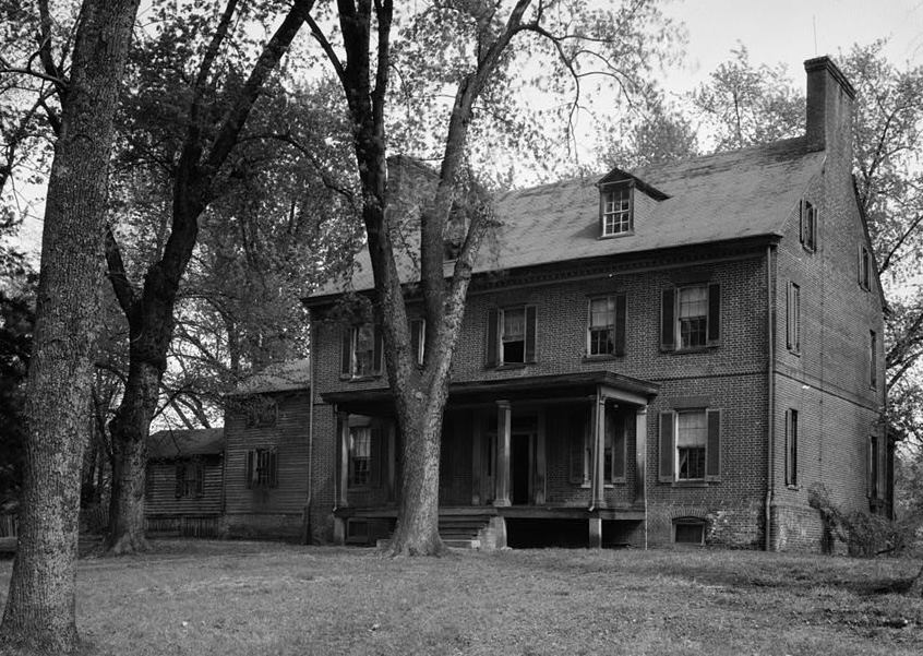

Forestville, Maryland
Forestville is a community of 10,495 people in Prince George's County, Maryland.
Why visit Forestville
Townapedia lists 5 museums and landmarks, 12 parks and trails, 36 places to eat and 1 place to stay in and around town.
Highlights include Concord, Mount Lubentia, Berkshire Neighborhood Park and Douglas Patterson Park.
July is the warmest month, with average highs of 88°F; January lows average 25°F.
Weather in Forestville
Forecast from the National Weather Service. Full forecast
About Forestville
Forestville is an unincorporated area and census-designated place (CDP) in Prince George's County, Maryland, United States. Per the 2020 census, the population was 12,831. The community is a mixture of garden apartments, single-family homes, and shopping centers built mostly from the 1930s through 1970s, adjacent to the communities of District Heights, Suitland, Morningside, Westphalia and Camp Springs.
From the Wikipedia article Forestville, Maryland (this version), under CC BY-SA 4.0.
Museums and landmarks5
Concord
Monument and historic site · National Register of Historic Places · 1.9 mi
Historic house in District Heights, Maryland, United States

Mount Lubentia
Monument and historic site · National Register of Historic Places · 3.7 mi
Human settlement in Maryland, United States of America


Ridgeley School
Monument and historic site · National Register of Historic Places · 2.7 mi
Historic school in Capitol Heights, Maryland, United States

Museum Conservation Institute
Museum · 3.7 mi
Center for materials conservation and technical research
Smithsonian Museum Support Center
Museum · 3.7 mi
Smithsonian Institution's museum collections management and research facility
Parks, trails and playgrounds12



Restaurants and cafes36


Buffalo Wild Wings
Restaurant · Wings · 1.7 mi
1630 Ritchie Station Court, Capitol Heights
11:00-24:00
Dave & Buster's
Diner · American · 1.5 mi
1851 Ritchie Station Court, Capitol Heights
Mo-Th 11:00-24:00, Fr 11:00-25:00, Sa 10:00-25:00, Su 10:00-24:00
Olive Garden
Restaurant · Italian · 1.6 mi
1681 Ritchie Station Court, Capitol Heights
Mo-Th,Su 11:00-22:00; Fr,Sa 11:00-23:00

Sammiches Catering
Restaurant · 1.3 mi
8411 Old Marlboro Pike, Upper Marlboro

Sonic
Fast food · Burger · 1.8 mi
8950 Walker Mill Road, Capitol Heights
Mo-Th 09:00-23:00; Fr-Sa 09:00-24:00; Su 10:00-23:00
Arby's
Fast food · Sandwich · 0.8 mi
3317 Donnell Drive, Forestville
Mo-Th 10:00-22:00; Fr-Sa 10:00-23:00; Su 10:00-22:00
24 more on the map.
Where to stay1

History
Forestville was originally known as Long Old Fields. During the War of 1812, Long Old Fields served as an encampment on August 23, 1814, for American forces opposing the invading British, who camped just a few miles away. These forces met at the Battle of Bladensburg the next day. Long Old Fields' name was changed to Forestville sometime after the end of the Civil War in 1865.
From the History section of Forestville, Maryland on Wikipedia, under CC BY-SA 4.0.
Churches and places of worship25
Ridgley Methodist Episcopal Church
Church · National Register of Historic Places · 3.0 mi
The Church of Jesus Christ of Latter-day Saints
Church · Mormon · 1.1 mi
7979 Penn Randall Place, Upper Marlboro
Kingdom Hall of Jehovahs Witnesses
Church · Jehovahs Witness · 0.6 mi
8009 Darcy Road, District Heights
New Jerusalem Baptist Church
Church · Baptist · 1.7 mi
6802 Walker Mill Road, Capitol Heights
Trinidad Baptist Church
Church · Baptist · 1.5 mi
6611 Walker Mill Road, Capitol Heights
Walker Mill Baptist Church
Church · Baptist · 1.6 mi
6801 Walker Mill Road, Capitol Heights
Ephesians New Testament Church of God in Christ
Church · 1.4 mi
4331 Forestville Road, District Heights
Shopping13
Gas and EV charging13
Schools, colleges and libraries57
Appletree Early Learning Center Pcs - Douglas Knoll
School · 5.5 mi
2017 Savannah Terrace Se, Washington
Appletree Early Learning Center Pcs - Parklands At Thearc
School · 5.7 mi
1801 Mississippi Avenue Se, Washington
Cesar Chavez Public Charter Schools For Public Policy
School · 5.5 mi
3701 Hayes Street Ne, Washington
Map of Forestville
162 places. The map loads OpenStreetMap tiles when you open it.
Climate by month
Monthly table
| Month | High | Low | Rain | Snow |
|---|---|---|---|---|
| Jan | 44°F | 25°F | 3.0 in | 5.7 in |
| Feb | 47°F | 26°F | 2.7 in | 6.3 in |
| Mar | 55°F | 33°F | 3.9 in | 1.7 in |
| Apr | 66°F | 44°F | 3.4 in | 0.0 in |
| May | 75°F | 54°F | 4.1 in | 0.0 in |
| Jun | 84°F | 63°F | 4.2 in | 0.0 in |
| Jul | 88°F | 67°F | 4.2 in | 0.0 in |
| Aug | 86°F | 65°F | 4.1 in | 0.0 in |
| Sep | 80°F | 58°F | 4.5 in | 0.0 in |
| Oct | 69°F | 46°F | 4.1 in | 0.0 in |
| Nov | 58°F | 36°F | 3.2 in | 0.0 in |
| Dec | 48°F | 29°F | 3.5 in | 2.2 in |
U.S. Climate Normals 1991-2020 for Upper Marlboro 3 Nnw (6 mi away), NOAA NCEI.
People and cost of living
American Community Survey 5-year estimates, 2020-2024, U.S. Census Bureau. Estimates have margins of error, larger for small towns.
Disaster history
Prince George's County has had 13 federal disaster declarations since 2000, most often for hurricanes.
- 2026-01-24: Severe Winter Storm (Winter Storm)
- 2020-03-26: Covid-19 Pandemic (Biological)
- 2020-03-13: Covid-19 (Biological)
- 2016-03-04: Severe Winter Storm And Snowstorm (Snowstorm)
- 2012-11-20: Hurricane Sandy (Hurricane)
- 2012-10-28: Hurricane Sandy (Hurricane)
OpenFEMA disaster declarations summaries.
Getting there and nearby towns
Joint Base Andrews (ADW) is the nearest airport with scheduled flights listed in OpenStreetMap, 3 miles away.
- Camp Springs 4 mi southwest, about 6 min by car
- Brock Hall 7 mi east, about 11 min by car
- Clinton 8 mi south, about 12 min by car
- East Riverdale 8 mi north, about 13 min by car
- Washington 9 mi northwest, about 14 min by car
- Bowie 10 mi northeast, about 16 min by car
- Chillum 10 mi northwest, about 16 min by car
- College Park 11 mi north, about 17 min by car
- Alexandria 12 mi west, about 19 min by car
- Arlington 12 mi west, about 20 min by car
Drive times are estimates from straight-line distance, not routes.
Local news
Headlines from INDB, the NEMICO news database.
Reviews, tips and questions
Loading what members have shared...
Sources and licences
- NCES EDGE (Public domain): public schools
- NOAA NCEI U.S. Climate Normals 1991-2020 (Public domain): climate by month
- OpenFEMA (Public domain): disaster declarations
- OpenStreetMap contributors (ODbL 1.0): places, airports, map data
- U.S. Census Bureau (Public domain): population, income, housing, education, commute
- Wikidata (CC0 1.0): elevation, founding date, time zone, website, landmarks and historic places
- Wikimedia Commons (see each image): photos
- Wikipedia (CC BY-SA 4.0): overview and history text
Photo credits
- New construction in Forestville Maryland, Ser Amantio di Nicolao, CC BY-SA 3.0
- Mt Lubentia Jan 09, Pubdog at en.wikipedia, Public domain
- Ridgley Methodist Episcopal Church Dec 08, Pubdog ( talk ), Public domain
- Concord 1936, Historic American Buildings Survey / Historic American Engineering Record, Public domain
- Ridgeley Rosenwald School, exterior (21636807881), Preservation Maryland, CC BY-SA 2.0
Page built October 30, 2026. Spotted a mistake? Tell us or suggest a place.