


Annapolis Neck, Maryland
Annapolis Neck is a community of 12,032 people in Anne Arundel County, Maryland.
Why visit Annapolis Neck
Townapedia lists 34 museums and landmarks, 52 parks and trails, 45 places to eat, 1 place to stay and 8 attractions in and around town.
Highlights include Thomas Point Shoal Light, Carr's Beach, Annapolis National Cemetery and Artisan's House.
July is the warmest month, with average highs of 86°F; January lows average 30°F.
Weather in Annapolis Neck
Forecast from the National Weather Service. Full forecast
About Annapolis Neck
Annapolis Neck, a suburb of Annapolis, is a census-designated place in Anne Arundel County, Maryland, United States. As of the 2010 census, its population was 10,950.
From the Wikipedia article Annapolis Neck, Maryland (this version), under CC BY-SA 4.0.
Things to do8
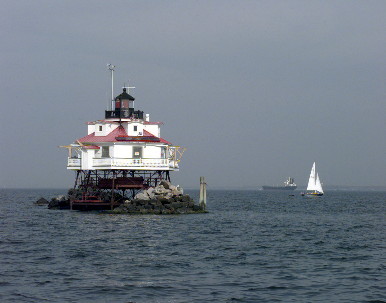
Thomas Point Shoal Light
Lighthouse · National Register of Historic Places · 4.2 mi
Lighthouse in Maryland, United States

Carr's Beach
Beach · 1.9 mi
Beach in Anne Arundel County, Maryland, United States

Greenbury Point Light
Lighthouse · 3.4 mi
Lighthouse in Maryland, United States

Naval Academy Bridge
Bridge · 3.9 mi
Bridge in Maryland, United States of America
Triton Light
Lighthouse · 3.2 mi
Lighthouse in Maryland, United States


River Deck
Scenic view · 2.4 mi
View of the South River
839 Londontown Road, Edgewater
Museums and landmarks34

Annapolis National Cemetery
Monument and historic site · National Register of Historic Places · 2.8 mi
United States historic place

Artisan's House
Monument and historic site · National Register of Historic Places · 2.9 mi
House in Annapolis, Maryland

Brice House
Monument and historic site · National Register of Historic Places · 2.9 mi
Georgian, five-part English Palladian country house adapted to an urban setting in Annapolis, Maryland, United States

Chance Boatyard
Monument and historic site · National Register of Historic Places · 2.6 mi
Historic buildings in Maryland, US

Chase-Lloyd House
Monument and historic site · National Register of Historic Places · 3.0 mi
Historic house in Maryland, United States

Colonial Annapolis Historic District
Monument and historic site · National Register of Historic Places · 2.8 mi
Historic district in Maryland, United States

Douglass Summer House
Monument and historic site · National Register of Historic Places · 1.7 mi
Historic house in Maryland, United States

Fort Nonsense
Monument and historic site · National Register of Historic Places · 3.7 mi
Fortification in Annapolis, Maryland

Gresham
Monument and historic site · National Register of Historic Places · 2.6 mi
House near Edgewater, Maryland
Hammond–Harwood House
Museum · National Register of Historic Places · 3.0 mi
National Historic Landmark colonial period townhouse in Annapolis, Maryland, United States

House by the "Town Gates"
Monument and historic site · National Register of Historic Places · 2.8 mi
Historic house in Maryland, United States


Howard's Inheritance
Monument and historic site · National Register of Historic Places · 4.2 mi
Historic house in Maryland, United States
22 more on the map.
Parks, trails and playgrounds52


Quiet Waters Park
Park · 0.4 mi
Park in Annapolis, United States of America
Jonas Green Park
Park · 4.1 mi
Park in Anne Arundel County, Maryland, United States of America

Chesapeake Bay Foundation Conservation Easement
Hiking and trails · 1.8 mi
Founded in 1967, the Chesapeake Bay Foundation (CBF) is the largest independent conservation organization dedicated solely to saving the...
6 Herndon Avenue, Annapolis
40 more on the map.
Restaurants and cafes45

Annapolis Smokehouse And Tavern
Restaurant · American, Barbecue · 0.9 mi
107 Hillsmere Drive
Mo-Su 11:00-00:00
Boatyard Bar & Grill
Restaurant · Seafood · 2.5 mi
400 4th Street, Annapolis
Mo-Fr 11:00-24:00; Sa 10:00-24:00; Su 09:00-24:00

Grump's Cafe
Restaurant · Burger, Breakfast · 0.8 mi
117 Hillsmere Drive, Annapolis
Mo 08:00-15:00; Tu-Fr 08:00-20:00; Sa-Su 08:00-16:00
Jack's Fortune
Restaurant · Chinese · 0.9 mi
960 Bay Ridge Road, Annapolis
Mo-Th 11:00-21:00; Fr-Sa 11:00-21:30; Su 12:00-21:00
Main & Market
Restaurant · American, Regional · 0.9 mi
914 Bay Ridge Road, Annapolis
Mo-Fr 11:00-20:00; Sa-Su 08:00-20:00
Rocco's Pizzeria
Restaurant · Pizza, Sandwich · 0.9 mi
954 Bay Ridge Road, Annapolis
Mo-Th,Su 11:00-23:00; Fr-Sa 11:00-24:00

Davis' Pub
Bar and pub · American · 2.4 mi
400 Chester Avenue, Annapolis
Su-Th 11:00-22:00; Fr-Sa 11:00-00:00

Forward Brewing
Brewery and winery · 2.4 mi
418 4th Street
Mo-Th 16:00-21:00; Fr 12:00-22:00; Sa 11:00-22:00; Su 11:00-21:00
33 more on the map.
Where to stay1
Churches and places of worship17
Banneker-Douglass Museum
Church · National Register of Historic Places · 2.8 mi
Saint Martins Evangelical Lutheran Church
Church · Lutheran · 2.1 mi
1120 Spa Road
Shopping4
Gas and EV charging7
Schools, colleges and libraries36
Healthcare1
Evolve Direct Primary Care & Urgent Care
Clinic and pharmacy · 2.4 mi
509 South Cherry Grove Avenue, Annapolis
Map of Annapolis Neck
205 places. The map loads OpenStreetMap tiles when you open it.
Climate by month
Monthly table
| Month | High | Low | Rain |
|---|---|---|---|
| Jan | 43°F | 30°F | 2.8 in |
| Feb | 45°F | 32°F | 2.4 in |
| Mar | 53°F | 38°F | 3.8 in |
| Apr | 64°F | 47°F | 3.4 in |
| May | 73°F | 57°F | 3.1 in |
| Jun | 82°F | 68°F | 4.0 in |
| Jul | 86°F | 72°F | 4.9 in |
| Aug | 84°F | 70°F | 4.3 in |
| Sep | 77°F | 65°F | 5.1 in |
| Oct | 67°F | 52°F | 4.0 in |
| Nov | 56°F | 42°F | 3.0 in |
| Dec | 47°F | 34°F | 3.0 in |
U.S. Climate Normals 1991-2020 for Annapolis Naf (4 mi away), NOAA NCEI.
People and cost of living
American Community Survey 5-year estimates, 2020-2024, U.S. Census Bureau. Estimates have margins of error, larger for small towns.
Disaster history
Anne Arundel County has had 14 federal disaster declarations since 2000, most often for hurricanes.
- 2026-01-24: Severe Winter Storm (Winter Storm)
- 2020-03-26: Covid-19 Pandemic (Biological)
- 2020-03-13: Covid-19 (Biological)
- 2016-03-04: Severe Winter Storm And Snowstorm (Snowstorm)
- 2012-11-20: Hurricane Sandy (Hurricane)
- 2012-10-28: Hurricane Sandy (Hurricane)
OpenFEMA disaster declarations summaries.
Getting there and nearby towns
Lee Airport (ANP) is the nearest airport with scheduled flights listed in OpenStreetMap, 4 miles away.
- Annapolis 2 mi north, about 4 min by car
- Baltimore 26 mi north, about 41 min by car
- Adelphi 26 mi west, about 41 min by car
- Columbia 27 mi northwest, about 43 min by car
- Washington 28 mi west, about 45 min by car
- Arlington 33 mi west, about 53 min by car
- Alexandria 33 mi west, about 52 min by car
- Accokeek 33 mi southwest, about 52 min by car
- Aberdeen 44 mi northeast, about 1 h 15 min by car
- Dover 55 mi east, about 1 h 30 min by car
Drive times are estimates from straight-line distance, not routes.
Local news
Headlines from INDB, the NEMICO news database.
Reviews, tips and questions
Loading what members have shared...
Sources and licences
- NCES EDGE (Public domain): public schools
- NOAA NCEI U.S. Climate Normals 1991-2020 (Public domain): climate by month
- OpenFEMA (Public domain): disaster declarations
- OpenStreetMap contributors (ODbL 1.0): places, airports, map data
- U.S. Census Bureau (Public domain): population, income, housing, education, commute
- Wikidata (CC0 1.0): elevation, founding date, time zone, website, landmarks and historic places
- Wikimedia Commons (see each image): photos
- Wikipedia (CC BY-SA 4.0): overview and history text
Photo credits
- Peggy Stewart House Jul 09, Pubdog ( talk ), Public domain
- London Town Publik House MD2, Acroterion, CC BY-SA 4.0
- Hammond-Harwood House HABS MD,2-ANNA,18-3, E. H. Pickering, Photographer, Public domain
- Annapolis National Cemetery, U.S. Department of Veterans Affairs, Public domain
- Mt Moriah Jul 09, Pubdog ( talk ), Public domain
- Maryland State House from College Ave, Martin Falbisoner, CC BY-SA 3.0
- Paca House Jul 09, Pubdog ( talk ), Public domain
- Artisans House Jul 09, Pubdog ( talk ), Public domain
- PRIMROSE HILL, ANNAPOLIS, ANNE ARUNDEL COUNTY, MD, JERRYE & ROY KLOTZ, M.D., CC BY-SA 4.0
- Old City Hall and Engine House Jul 09, Pubdog ( talk ), Public domain
- Fort Nonsense panoramic, Gillian Nolan, CC BY-SA 4.0
- Douglass Summer House Dec 09, Pubdog ( talk ), Public domain
- Upton Scott House Jul 09, Pubdog ( talk ), Public domain
- John Callahan House Jul 09, Pubdog ( talk ), Public domain
- Universal Lodge No 14 Jul 09, Pubdog at English Wikipedia, Public domain
- South River Club Jul 09, Pubdog ( talk ), Public domain
- Shiplap House Jul 09, Pubdog ( talk ), Public domain
- 63 West St Annapolis, MD, Dtcohen, CC BY-SA 3.0
- HOWARD'S INHERITANCE, ANNAPOLIS, ANNE ARUNDEL COUNTY, MD, JERRYE & ROY KLOTZ, M.D., CC BY-SA 4.0
- Brice House Jul 09, Pubdog ( talk ), Public domain
- Bates High School Jul 09, Pubdog ( talk ), Public domain
- Chase-Lloyd House Jul 09, Pubdog ( talk ), Public domain
- Patrick Creagh House Jul 09, Pubdog at en.wikipedia, Public domain
- Thomas Point Lighthouse Chesapeake Bay, United States Coast Guard, PA1 Pete Milnes, Public domain
- CHANCE BOATYARD, ANNE ARUNDEL COUNTY, MD, JERRYE & ROY KLOTZ, M.D., CC BY-SA 4.0
- Stanton Center Jul 09, Pubdog ( talk ), Public domain


Page built October 30, 2026. Spotted a mistake? Tell us or suggest a place.