

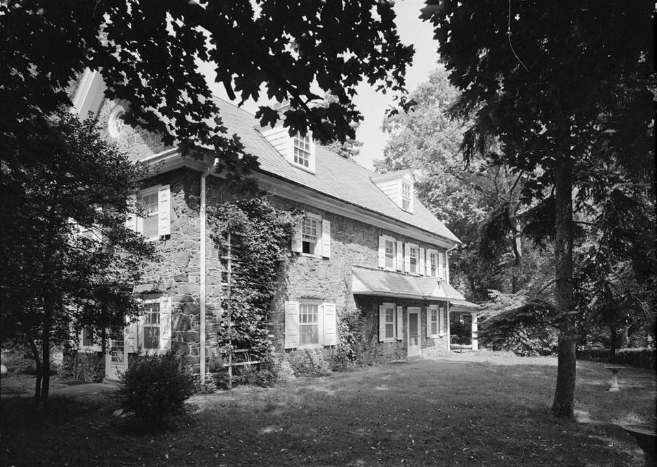


Bala Cynwyd, Pennsylvania
Bala Cynwyd is a community of 10,227 people in Montgomery County, Pennsylvania.
Why visit Bala Cynwyd
Townapedia lists 101 museums and landmarks, 55 parks and trails, 189 places to eat, 5 places to stay and 5 attractions in and around town.
Highlights include Regal UA Main Street Theatre, Greensgrow Mobile Market, James Dobson Elementary School and Wynnestay.
July is the warmest month, with average highs of 89°F; January lows average 28°F.
Weather in Bala Cynwyd
Forecast from the National Weather Service. Full forecast
Things to do5


Heritage Farm Farmstand
Farm and orchard · 1.1 mi
4300 Monument Road, Philadelphia
May 14-Oct 15: Th 15:30-18:00
Venice Island Performing Arts and Recreational Facility
Cinema and theater · 0.9 mi
7 Lock Street, Philadelphia
Museums and landmarks101

James Dobson Elementary School
Monument and historic site · National Register of Historic Places · 1.4 mi
Public elementary school in Philadelphia, Pennsylvania
4667 Umbria Street, Philadelphia
Wynnestay
Monument and historic site · National Register of Historic Places · 1.2 mi
Historic house in Pennsylvania, United States
5125 Woodbine Avenue, Philadelphia

Alden Park Manor
Monument and historic site · National Register of Historic Places · 2.4 mi
Building in Pennsylvania, United States

American Railway Express Company Garage
Monument and historic site · National Register of Historic Places · 3.0 mi
Multistorey car park in Philadelphia, Pennsylvania
Bala Cynwyd Junior High School Complex
Monument and historic site · National Register of Historic Places · 0.8 mi
Primary school in Pennsylvania, United States of America

Belmont Avenue Bridge in Philadelphia
Monument and historic site · National Register of Historic Places · 1.4 mi
Bridge in United States of America
Belmont Charter School
Monument and historic site · National Register of Historic Places · 3.3 mi
Charter school in Philadelphia, Pennsylvania

Brewerytown
Monument and historic site · National Register of Historic Places · 3.3 mi
Neighborhood in Philadelphia, Pennsylvania, United States

Chamounix
Monument and historic site · National Register of Historic Places · 2.3 mi
Building in Pennsylvania, United States

Church of St. James the Less
Monument and historic site · National Register of Historic Places · 2.4 mi
Church building in Philadelphia, Pennsylvania


City Line Avenue Bridge
Monument and historic site · National Register of Historic Places · 2.5 mi
Bridge in United States of America
City Park Brewery
Monument and historic site · National Register of Historic Places · 3.6 mi
Brewery in Pennsylvania, United States of America
89 more on the map.
Parks, trails and playgrounds55

Fairview Park
Park · 1.4 mi
Unofficial dog park of Roxborough. Several benches, a winding path, cherry trees, and a community parking lot.

43 more on the map.
Restaurants and cafes189

Al Sham 2 (City Line)
Restaurant · Middle Eastern · 1.1 mi
201 City Avenue, Bala Cynwyd
Mo-Th,Su 10:00-22:00; Fr-Sa 10:00-23:00
Hymie's Delicatessen
Restaurant · Deli, Sandwich, Bagel · 0.9 mi
342 Montgomery Avenue, Merion Station
Mo-Sa 07:00-21:00
La Collina
Restaurant · Italian · 1.1 mi
37 Ashland Avenue, Lower Merion Township
Mo-Th 11:00-22:00; Fr-Sa 11:00-23:00; Su 11:00-22:00
LongHorn Steakhouse
Restaurant · Steak House · 0.9 mi
555 City Avenue, Bala Cynwyd
Su-Th 11:00-22:00; Fr-Sa 11:00-23:00
Maki Han
Restaurant · Asian · 0.8 mi
138 Montgomery Avenue, Bala Cynwyd
Mo-Th 11:30-22:00; Fr-Sa 11:30-22:30; Su 11:30-22:30
Manayunk Indian Grille
Restaurant · Indian · 1.0 mi
4425 Main Street, Philadelphia
Tu-Su 11:30-22:00; Mo,PH off
Olive Garden
Restaurant · Italian · 0.6 mi
83 East City Avenue, Bala Cynwyd
Mo-Th,Su 11:00-22:00; Fr,Sa 11:00-23:00

177 more on the map.
Where to stay5
Courtyard by Marriott Philadelphia City Avenue
Motel and hotel · 1.0 mi
4100 Presidential Boulevard, Philadelphia
Churches and places of worship38
Merion Friends Meeting
Church · Quaker · 1.4 mi
615 East Montgomery Avenue, Lower Merion Township
Adath Israel
Place of worship · Conservative · 1.0 mi
250 North Highland Avenue, Merion Station
Saint Josephat's Church
Church · 1.1 mi
124 Cotton Street, Philadelphia
Shopping27
Gas and EV charging8
Schools, colleges and libraries64
Alliance For Progress Cs
School · 4.1 mi
1821-39 Cecil B Moore Avenue, Philadelphia
Antonia Pantoja Community Cs
School · 5.1 mi
4101 North American Street, Philadelphia
Healthcare14
Passport Health Bala Cynwyd Travel Clinic
Clinic and pharmacy · 0.7 mi
2 Bala Plaza, Bala Cynwyd
Map of Bala Cynwyd
250 places. The map loads OpenStreetMap tiles when you open it.
Climate by month
Monthly table
| Month | High | Low | Rain | Snow |
|---|---|---|---|---|
| Jan | 42°F | 28°F | 3.6 in | 6.4 in |
| Feb | 45°F | 30°F | 3.3 in | 4.0 in |
| Mar | 54°F | 36°F | 4.5 in | 2.0 in |
| Apr | 66°F | 46°F | 4.0 in | 0.1 in |
| May | 76°F | 56°F | 4.1 in | 0.0 in |
| Jun | 85°F | 66°F | 4.8 in | 0.0 in |
| Jul | 89°F | 71°F | 4.8 in | 0.0 in |
| Aug | 87°F | 70°F | 5.0 in | 0.0 in |
| Sep | 80°F | 63°F | 4.9 in | 0.0 in |
| Oct | 68°F | 51°F | 4.2 in | 0.0 in |
| Nov | 56°F | 41°F | 3.4 in | 0.1 in |
| Dec | 46°F | 33°F | 4.3 in | 3.5 in |
U.S. Climate Normals 1991-2020 for Phila Franklin Inst (5 mi away), NOAA NCEI.
People and cost of living
American Community Survey 5-year estimates, 2020-2024, U.S. Census Bureau. Estimates have margins of error, larger for small towns.
Disaster history
Montgomery County has had 19 federal disaster declarations since 2000, most often for hurricanes.
- 2021-09-10: Remnants Of Hurricane Ida (Hurricane)
- 2020-03-30: Covid-19 Pandemic (Biological)
- 2020-03-13: Covid-19 (Biological)
- 2016-03-23: Severe Winter Storm And Snowstorm (Snowstorm)
- 2014-02-06: Severe Winter Storm (Severe Ice Storm)
- 2013-01-10: Hurricane Sandy (Hurricane)
OpenFEMA disaster declarations summaries.
Getting there and nearby towns
Wings Field (BBX) is the nearest airport with scheduled flights listed in OpenStreetMap, 9 miles away.
- Ardmore 4 mi west, about 6 min by car
- Philadelphia 5 mi east, about 8 min by car
- Camden 8 mi southeast, about 13 min by car
- Gloucester City 10 mi southeast, about 16 min by car
- Collingswood 10 mi southeast, about 17 min by car
- Westmont 12 mi southeast, about 19 min by car
- Bellmawr 12 mi southeast, about 20 min by car
- Cherry Hill Mall 12 mi southeast, about 20 min by car
- Woodbury 13 mi south, about 20 min by car
- Haddonfield 13 mi southeast, about 21 min by car
Drive times are estimates from straight-line distance, not routes.
Local news
Headlines from INDB, the NEMICO news database.
Reviews, tips and questions
Loading what members have shared...
Sources and licences
- NCES EDGE (Public domain): public schools
- NOAA NCEI U.S. Climate Normals 1991-2020 (Public domain): climate by month
- OpenFEMA (Public domain): disaster declarations
- OpenStreetMap contributors (ODbL 1.0): places, airports, map data
- U.S. Census Bureau (Public domain): population, income, housing, education, commute
- Wikidata (CC0 1.0): landmarks and historic places
- Wikimedia Commons (see each image): photos
Photo credits
- Dobson School Philly, Smallbones, Public domain
- Wynnestay (cropped), Jack Boucher, Public domain
- Henry O. Tanner House, 2908 West Diamond Street, Philadelphia (Philadelphia County, Pennsylvania), Jack Boucher, Public domain
- MemorialHallPhila02, Davidt8, Public domain
- Brewerytown HD Philly, Smallbones, Public domain
- Shoemaker Jr HS Philly, Smallbones, Public domain
- Hatfield House Philly, Smallbones, Public domain
- General Wayne Inn PA, Smallbones, CC0
- Randolph House Philly, Smallbones, Public domain
- 32nd Street Philly, Smallbones, Public domain
- WEST PHILADELPHIA PASSENGER RAILWAY COMPANY CARHOUSE PHILADELPHIA PA, JERRYE & ROY KLOTZ, M.D., CC BY-SA 4.0
- Merion Friends Meeting House, 615 Montgomery Avenue (changed from Montgomery Avenue & Meetinghouse Lane), Merion Station (Montgomery County, Pennsylvania), Unknown author Unknown author, Public domain
- 18 Narbrook Montco PA, Smallbones, CC0
- Ridge Ave Bridge Philly, Smallbones, Public domain
- Plaza Apts Philly, Smallbones, Public domain
- Better Belmont Bridge, Smallbones, Public domain
- Gladwyne HD 1 Guard House, Hshuvaeva, CC BY-SA 3.0
- James the Less HABS, Jack Boucher, Public domain
- City Line Bridge Philly, Smallbones, Public domain
- Chamounix, Smallbones, Public domain
- Fairmount park 13 carousel playground, Seauton, CC BY-SA 4.0
- HenryAvenueBridge, Joseph Elliott, Public domain
- Beeber Jr HS, Smallbones, Public domain
- Fitzsimons School Philly, Smallbones, Public domain
- Dobson Mills Philly, Smallbones, Public domain
- 100 Pelham, Smallbones, Public domain
- Grumblethorpe Tennant, Smallbones, Public domain
- Lot at 401 W Johnson Philly, Smallbones, Public domain
- Alden Park Manor Philly, Smallbones, Public domain
- Ebenezer Maxwell House, Smallbones, Public domain
- Presser Home Philly, Smallbones, Public domain
- Germantown YMCA, Smallbones, Public domain
- Filter School Philly, Smallbones, Public domain
- Tulpehocken Station HD, Smallbones, Public domain
- Wissahickon Apts Philly, Smallbones, Public domain
- 260 W Johnson Philly, Smallbones, Public domain
- DRUIM MOIR HISTORIC DISTRICT, CHESTNUT HILL, PHILADELPHIA, Jerrye & Roy Klotz, MD, CC BY-SA 3.0
- Nugent Home for Baptists, Smallbones, Public domain
- Germantown Mennonite Meeting, Smallbones, Public domain
- Billmeyer, Smallbones, Public domain


Page built October 30, 2026. Spotted a mistake? Tell us or suggest a place.