


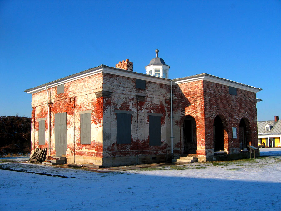


Philadelphia, Pennsylvania
Philadelphia is a city of 1,579,706 people in Philadelphia County, Pennsylvania, founded in 1682.
Why visit Philadelphia
Townapedia lists 102 museums and landmarks, 89 parks and trails, 118 places to eat and 6 attractions in and around town.
Highlights include Fairhill Square Park Farmers Market, Greensgrow Mobile Market, Beury Building and Clara Barton School.
July is the warmest month, with average highs of 89°F; January lows average 28°F.
Weather in Philadelphia
Forecast from the National Weather Service. Full forecast
About Philadelphia
Philadelphia, colloquially referred to as Philly, is the most populous city in the U.S. state of Pennsylvania and the sixth-most populous city in the United States. Its population was 1.60 million at the 2020 census and estimated at 1.57 million in 2025. The Philadelphia metropolitan area, also known as the Delaware Valley, is located in both the Mid-Atlantic and northeastern United States; home to 6.33 million residents, it is the nation's ninth-largest metropolitan area. Philadelphia is known for its culture, cuisine, and history, maintaining contemporary influence in technology and business, sports, and music.
From the Wikipedia article Philadelphia (this version), under CC BY-SA 4.0.
Things to do6

Fairhill Square Park Farmers Market
Farm and orchard · 1.3 mi
410 West Lehigh Avenue, Philadelphia
Jul-Oct: We 13:00-17:00
Greensgrow Mobile Market
Farm and orchard · 1.6 mi
1251 East Sedgley Avenue, Philadelphia
Jun-Aug Mo-Tu closed, Jun-Aug We-Fr 12:00-19:00, Jun-Aug Sa,Su 10:00-16:00
Hunting Park Farmers Market
Farm and orchard · 0.9 mi
4200 Old York Road, Philadelphia
Jun-Nov: Sa 10:00-14:00
Norris Square Park Farmers Market
Farm and orchard · 1.9 mi
Jun-Oct Sa 10:00-14:00
La Casa de las Frutas
Farm and orchard · 0.9 mi
3104 North Front Street, Philadelphia

Museums and landmarks102


Clara Barton School
Monument and historic site · National Register of Historic Places · 1.0 mi
Listed on the U.S. National Register of Historic Places
Abigail Vare School
Monument and historic site · National Register of Historic Places · 5.8 mi
School building located in Philadelphia, Pennsylvania
Alexander K. McClure School
Monument and historic site · National Register of Historic Places · 0.5 mi
School building in Philadelphia, Pennsylvania
Bartram's Garden
Monument and historic site · National Register of Historic Places · 6.9 mi
Historic house in Pennsylvania, United States
Belfield
Monument and historic site · National Register of Historic Places · 2.3 mi
American house

Breslyn Apartments
Monument and historic site · National Register of Historic Places · 5.7 mi
Building in Pennsylvania, United States
Carl Mackley Houses
Monument and historic site · National Register of Historic Places · 1.8 mi
Residential building in Pennsylvania, United States of America
Central High School
Monument and historic site · National Register of Historic Places · 2.0 mi
High school in Philadelphia, Pennsylvania, United States

Charles Y. Audenried Junior High School
Monument and historic site · National Register of Historic Places · 6.3 mi
High school in Pennsylvania, United States
City Line Avenue Bridge
Monument and historic site · National Register of Historic Places · 6.9 mi
Bridge in United States of America
Collen Brook Farm
Monument and historic site · National Register of Historic Places · 10.7 mi
Historic house in Pennsylvania, United States
90 more on the map.
Parks, trails and playgrounds89




77 more on the map.
Restaurants and cafes118

BAR ilu
Restaurant · Spanish · 1.9 mi
2118 East Dauphin Street
Su, Tu-We 16:00-00:00; Th-Sa 16:00-01:00
Deke's Bar-B-Que
Restaurant · Barbecue, Grill · 1.8 mi
137 Berkley Street, Philadelphia
Mo-We 15:00-21:00; Th 15:00-22:00; Fr,Sa 11:00-22:00; Su 11:00-21:00
Lee's Dumplings and Stuff
Restaurant · Chinese · 1.7 mi
2313 North Front Street, Philadelphia
Mo-Fr 11:00-21:00; Sa 15:00-20:00
Little Walter's
Restaurant · Polish · 1.8 mi
2049 East Hagert Street, Philadelphia
Tu-Th 16:00-21:00; Fr 16:00-22:00; Sa 17:00-22:00; Su 15:00-20:00

Picnic
Diner · American · 1.9 mi
2421 Martha Street, Philadelphia
Mo-Th 17:00-21:00, Fr 17:00-22:00, Sa 12:00-22:00, Su 12:00-20:00
Soko Lovers
Restaurant · Chinese · 1.7 mi
2308 North Front Street
Mo-Th 09:00-20:00; Fr 09:00-13:00; Sa 09:00-20:00; Su 09:00-19:00
Zig Zag BBQ
Restaurant · Barbecue · 1.9 mi
2111 East York Street, Philadelphia
We-Fr 15:30-21:00, Sa 12:00-20:00, Su 12:00-18:00

American Grammar
Cafe · Coffee Shop · 1.9 mi
2046 North Front Street
Mo-Tu 08:30-13:30; We-Th 08:30-12:00; Fr-Su 08:30-14:00

Attic Brewing Company
Brewery and winery · 1.8 mi
137 Berkley Street, Philadelphia
Mo-Th 04:00-10:00,16:00-22:00; Fr 15:00-00:00; Sa 13:00-00:00; Su...
106 more on the map.
Churches and places of worship165
In The Light Ministries
Church · Nondenominational · 0.4 mi
191 West Hunting Park Avenue, Philadelphia
Norris Square United Presbyterian Church
Church · Presbyterian · 1.8 mi
120 West Susquehanna Avenue, Philadelphia
North Providence Baptist Church
Church · Baptist · 1.1 mi
2909 North 8th Street, Philadelphia
St. Michael's Lutheran Church
Church · Lutheran · 1.9 mi
2139 East Cumberland Street, Philadelphia
Deliverance Evangelistic Church
Church · 1.9 mi
2001 West Lehigh Avenue, Philadelphia
God's Church by the Faith of Philadelphia
Place of worship · 1.7 mi
200 West Tabor Road, Philadelphia
Circle of Hope
Church · Anabaptist · 1.9 mi
2309 North Broad Street, Philadelphia
Union Temple Baptist Church
Church · Baptist · 1.4 mi
2610 Howard Street, Philadelphia
Shopping20
Gas and EV charging19
Schools, colleges and libraries129
One Bright Ray Community High School: Fairhill Campus
School · 1.1 mi
2820 North 4th Street, Philadelphia
Lancaster Bible College | Capital Seminary & Graduate School
School · 1.9 mi
2001 West Lehigh Avenue, Philadelphia
Healthcare29
Temple Health Northeastern Campus
Clinic and pharmacy · 2.0 mi
2301 East Allegheny Avenue, Philadelphia
Map of Philadelphia
250 places. The map loads OpenStreetMap tiles when you open it.
Climate by month
Monthly table
| Month | High | Low | Rain | Snow |
|---|---|---|---|---|
| Jan | 42°F | 28°F | 3.6 in | 6.4 in |
| Feb | 45°F | 30°F | 3.3 in | 4.0 in |
| Mar | 54°F | 36°F | 4.5 in | 2.0 in |
| Apr | 66°F | 46°F | 4.0 in | 0.1 in |
| May | 76°F | 56°F | 4.1 in | 0.0 in |
| Jun | 85°F | 66°F | 4.8 in | 0.0 in |
| Jul | 89°F | 71°F | 4.8 in | 0.0 in |
| Aug | 87°F | 70°F | 5.0 in | 0.0 in |
| Sep | 80°F | 63°F | 4.9 in | 0.0 in |
| Oct | 68°F | 51°F | 4.2 in | 0.0 in |
| Nov | 56°F | 41°F | 3.4 in | 0.1 in |
| Dec | 46°F | 33°F | 4.3 in | 3.5 in |
U.S. Climate Normals 1991-2020 for Phila Franklin Inst (4 mi away), NOAA NCEI.
People and cost of living
American Community Survey 5-year estimates, 2020-2024, U.S. Census Bureau. Estimates have margins of error, larger for small towns.
Disaster history
Philadelphia County has had 17 federal disaster declarations since 2000, most often for hurricanes.
- 2021-09-10: Remnants Of Hurricane Ida (Hurricane)
- 2020-03-30: Covid-19 Pandemic (Biological)
- 2020-03-13: Covid-19 (Biological)
- 2016-03-23: Severe Winter Storm And Snowstorm (Snowstorm)
- 2014-02-06: Severe Winter Storm (Severe Ice Storm)
- 2013-01-10: Hurricane Sandy (Hurricane)
OpenFEMA disaster declarations summaries.
Getting there and nearby towns
Northeast Philadelphia Airport (PNE) is the nearest airport with scheduled flights listed in OpenStreetMap, 8 miles away.
- Wilmington 28 mi southwest, about 46 min by car
- Hockessin 33 mi southwest, about 53 min by car
- Pike Creek Valley 36 mi southwest, about 58 min by car
- Brookside 39 mi southwest, about 1 h by car
- Newark 40 mi southwest, about 1 h by car
- Bear 40 mi southwest, about 1 h by car
- Glasgow 43 mi southwest, about 1 h 15 min by car
- Allentown 44 mi northwest, about 1 h 15 min by car
- Middletown 50 mi southwest, about 1 h 15 min by car
- Smyrna 55 mi southwest, about 1 h 30 min by car
Drive times are estimates from straight-line distance, not routes.
Local news
Headlines from INDB, the NEMICO news database.
Reviews, tips and questions
Loading what members have shared...
Sources and licences
- NCES EDGE (Public domain): public schools
- NOAA NCEI U.S. Climate Normals 1991-2020 (Public domain): climate by month
- OpenFEMA (Public domain): disaster declarations
- OpenStreetMap contributors (ODbL 1.0): places, airports, map data
- U.S. Census Bureau (Public domain): population, income, housing, education, commute
- Wikidata (CC0 1.0): elevation, founding date, time zone, website, landmarks and historic places
- Wikimedia Commons (see each image): photos
- Wikipedia (CC BY-SA 4.0): overview and history text
Photo credits
- Philadelphia skyline 20240528 (cropped), 颐园居, CC BY-SA 4.0
- Barton School Philly A, Smallbones, Public domain
- Overbrook High School, Smallbones, Public domain
- Mifflin Commandant's House03, Joe Minardi, CC BY 2.5
- Breslyn apts Philly, Smallbones, Public domain
- James Whitall Jr. House, National Park, NJ, Zeete, CC BY-SA 4.0
- WTP A17 youcanlookitup 2, See below, CC BY-SA 3.0
- Overbrook School 1913, Smallbones, Public domain
- Mann School Philly, Smallbones, Public domain
- Aerial view of the Philadelphia Naval Shipyard Reserve Basin on 19 May 1955 (80-G-668655), Unknown author Unknown author, Public domain
- Robesonhouse.Philadelphia, Ekem, CC BY-SA 3.0
- Brooks School Philly, Smallbones, Public domain
- Alcorn School Philly, Smallbones, Public domain
- FederalSchool, User:Smallbones on English Wikipedia., Public domain
- CY Audenreid HS Philly, Smallbones, Public domain
- Llanerch school, EytanMelech, CC BY-SA 4.0
- Pinehurst apts W Philly, Smallbones, Public domain
- University of Pennsylvania College Hall, R. Newell & Sons, Public domain
- Bartram HS Philly, Smallbones, Public domain
- Shaw School Philly, Smallbones, Public domain
- Furness School Philly, Smallbones, Public domain
- Montevista apts, Smallbones, Public domain
- Thomas School Philly, Smallbones, Public domain
- Lea School Philly, Smallbones, Public domain


Page built October 30, 2026. Spotted a mistake? Tell us or suggest a place.