


Balcones Heights, Texas
Balcones Heights is a city of 2,715 people in Bexar County, Texas, founded in 1948.
Why visit Balcones Heights
Townapedia lists 6 museums and landmarks, 7 parks and trails, 64 places to eat, 9 places to stay and 5 attractions in and around town.
Highlights include Santikos Northwest 14, St. Mary's University, Buckeye Park Gate and Thomas Jefferson High School.
August is the warmest month, with average highs of 95°F; January lows average 40°F.
Weather in Balcones Heights
Forecast from the National Weather Service. Full forecast
About Balcones Heights
Balcones Heights is a city in Bexar County, Texas, United States. Its population was 2,746 at the 2020 census, and it was incorporated in 1948. Balcones Heights is an enclave of San Antonio, surrounded entirely by the city, thus some residents and out-of-town visitors erroneously consider it merely a neighborhood of the larger city rather than its own unique community that did so to prevent annexation.
From the Wikipedia article Balcones Heights, Texas (this version), under CC BY-SA 4.0.
Things to do5


St. Mary's University
School · 2.7 mi
University in San Antonio, Texas, United States
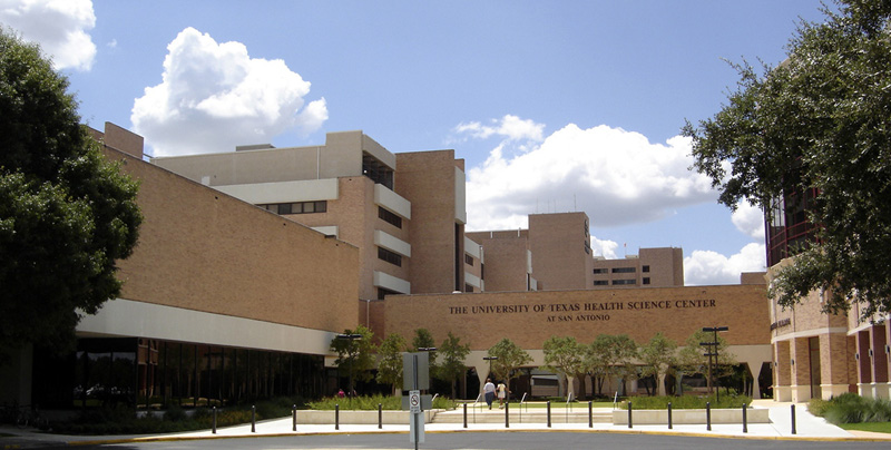
University of Texas Health Science Center at San Antonio
School · 1.9 mi
Hospital in Texas, United States

Woodlawn Theatre
Cinema and theater · 2.4 mi
Theater in San Antonio, Texas

Museums and landmarks6

Buckeye Park Gate
Monument and historic site · National Register of Historic Places · 1.8 mi
Structure in San Antonio, Bexar County, Texas

Thomas Jefferson High School
Monument and historic site · National Register of Historic Places · 1.8 mi
Historic high school in San Antonio, Bexar County, Texas

Old Spanish Trail City Limit Marker and Bench
Monument and historic site · 0.8 mi
Parks, trails and playgrounds7




Oak Hills Country Club
Golf course · 1.5 mi
5403 Fredericksburg Road, San Antonio
Restaurants and cafes64

Nadler's Bakery & Deli
Bakery · 1.2 mi
1621 Babcock Road, San Antonio
Mo-Fr 08:00-16:00; Sa 09:00-16:00; Su off

Lucy Cafe
Restaurant · Mexican · 1.4 mi
2517 West Avenue
Mo-Sa 06:30-14:00; Su 09:00-14:00

Big John's Pizza
Restaurant · Pizza · 1.3 mi
7806 Callaghan Road, San Antonio
52 more on the map.
Where to stay9
San Antonio Marriott Northwest Medical Center
Motel and hotel · 1.1 mi
3233 Northwest Loop 410, San Antonio
Churches and places of worship18
Basilica of the National Shrine of the Little Flower
Church · National Register of Historic Places · 3.4 mi
Saint Gregory the Great Catholic Church
Church · Roman Catholic · 0.6 mi
700 Dewhurst Road, San Antonio
First Unitarian Universalist Church of San Antonio
Place of worship · 0.7 mi
7150 Interstate Highway 10 West, San Antonio
Gethsemane Lutheran Church
Church · Lutheran · 1.4 mi
610 Avalon Street, San Antonio
Bethany Garden United Church of Christ
Church · United Church Of Christ · 1.1 mi
500 Pilgrim Drive, San Antonio
Saint Marks United Methodist Church
Church · United Methodist · 0.9 mi
1902 Vance Jackson Road, San Antonio
Iglesia del Nazareno- El Arca Del Pacto
Church · 1.3 mi
102 Saxon Street, San Antonio
Shopping7
Gas and EV charging20
Schools, colleges and libraries53
Basis San Antonio Pri- Medical Center Campus
School · 3.2 mi
8519 Floyd Curl Dr, San Antonio
Basis San Antonio- Pri North Central Campus
School · 4.3 mi
318 E Ramsey Rd, San Antonio
Basis San Antonio- Shavano Campus
School · 5.7 mi
4114 Lockhill Selma Rd, San Antonio
Healthcare4
Map of Balcones Heights
193 places. The map loads OpenStreetMap tiles when you open it.
Climate by month
Monthly table
| Month | High | Low | Rain | Snow |
|---|---|---|---|---|
| Jan | 63°F | 40°F | 2.2 in | 0.0 in |
| Feb | 68°F | 44°F | 1.9 in | 0.0 in |
| Mar | 74°F | 51°F | 2.4 in | 0.0 in |
| Apr | 80°F | 57°F | 2.3 in | 0.0 in |
| May | 86°F | 66°F | 4.4 in | 0.0 in |
| Jun | 92°F | 72°F | 3.5 in | 0.0 in |
| Jul | 94°F | 74°F | 2.4 in | 0.0 in |
| Aug | 95°F | 74°F | 2.4 in | 0.0 in |
| Sep | 90°F | 69°F | 3.9 in | 0.0 in |
| Oct | 82°F | 59°F | 3.9 in | 0.0 in |
| Nov | 71°F | 49°F | 2.5 in | 0.0 in |
| Dec | 64°F | 41°F | 2.1 in | 0.1 in |
U.S. Climate Normals 1991-2020 for San Antonio Incarnate Word (5 mi away), NOAA NCEI.
People and cost of living
American Community Survey 5-year estimates, 2020-2024, U.S. Census Bureau. Estimates have margins of error, larger for small towns.
Disaster history
Bexar County has had 24 federal disaster declarations since 2000, most often for hurricanes.
- 2026-07-18: Flooding (Flood)
- 2025-03-05: Duke Fire (Fire)
- 2021-02-19: Severe Winter Storms (Severe Ice Storm)
- 2021-02-14: Severe Winter Storm (Severe Ice Storm)
- 2020-08-24: Tropical Storms Marco And Laura (Hurricane)
- 2020-07-26: Hurricane Hanna (Hurricane)
OpenFEMA disaster declarations summaries.
Getting there and nearby towns
San Antonio International Airport (SAT) is the nearest airport with scheduled flights listed in OpenStreetMap, 6 miles away.
- San Antonio 3 mi southeast, about 4 min by car
- Leon Valley 4 mi west, about 6 min by car
- Live Oak 13 mi east, about 21 min by car
- Converse 15 mi east, about 24 min by car
- Timberwood Park 15 mi north, about 24 min by car
- Universal City 15 mi east, about 24 min by car
- Selma 16 mi northeast, about 25 min by car
- Scenic Oaks 16 mi northwest, about 26 min by car
- Fair Oaks Ranch 18 mi north, about 29 min by car
- Schertz 19 mi east, about 30 min by car
Drive times are estimates from straight-line distance, not routes.
Local news
Headlines from INDB, the NEMICO news database.
Reviews, tips and questions
Loading what members have shared...
Sources and licences
- NCES EDGE (Public domain): public schools
- NOAA NCEI U.S. Climate Normals 1991-2020 (Public domain): climate by month
- OpenFEMA (Public domain): disaster declarations
- OpenStreetMap contributors (ODbL 1.0): places, airports, map data
- U.S. Census Bureau (Public domain): population, income, housing, education, commute
- Wikidata (CC0 1.0): elevation, founding date, time zone, website, landmarks and historic places
- Wikimedia Commons (see each image): photos
- Wikipedia (CC BY-SA 4.0): overview and history text
Photo credits
- Basicilica Minor SA5, Zereshk, CC BY 3.0
- Thomas Jefferson High School, San Antonio, TX, Highlycaffeinated, CC BY-SA 3.0
- Buckey Park Gate, 25or6to4, CC BY-SA 3.0
- Gwangju San Antonio2, Nightryder84, CC BY-SA 3.0
- Reinbolt Hall at St Marys University 2021, Larry D. Moore, CC BY 4.0
- UTHSCSAmain, Zereshk, CC BY 2.5
- Woodlawn Theatre July 4 2009, wsssst, CC BY 2.0
- COVID-19 Vaccination (20210318-OC-LSC-0002), USDAgov, Public domain
- COVID-19 Vaccination (20210318-OC-LSC-0001), USDAgov, Public domain
- Intersection out of mall 2 fredecksburg rd - panoramio, organic_veggie, CC BY-SA 3.0
- Highway281South, Leslie Kelly, San Antonio, Texas, Attribution
- Seno Medical (United States), Wynne-Candy, CC BY-SA 3.0
- Peniophora albobadia 342423019, Sam Kieschnick, CC BY 4.0
- Lago en Denman Estate Park - panoramio, pepelinarviejo, CC BY-SA 3.0
- Dental imaging UTHSCSA1, Nightryder84, CC0
- Dental imaging UTHSCSA2, Nightryder84, Public domain


Page built October 30, 2026. Spotted a mistake? Tell us or suggest a place.