


Baton Rouge, Louisiana
Baton Rouge is a city of 222,771 people in East Baton Rouge Parish, Louisiana, founded in 1719.
Why visit Baton Rouge
Townapedia lists 66 museums and landmarks, 60 parks and trails, 168 places to eat, 29 places to stay and 13 attractions in and around town.
Highlights include Citiplace Cinema, Blue Bayou and Dixie Landin', LSU Rural Life Museum and Baton Rouge Magnet High School.
Weather in Baton Rouge
Forecast from the National Weather Service. Full forecast
About Baton Rouge
Baton Rouge ( BAT-ən ROOZH; French: Bâton-Rouge, pronounced [bɑtɔ̃ ʁuʒ] ; lit. 'Red Baton') is the capital city of the U.S. state of Louisiana. It had a population of 227,470 at the 2020 United States census, making it Louisiana's second-most populous city. It is the seat of Louisiana's most populous parish, East Baton Rouge Parish, and the center of Louisiana's second-largest metropolitan area, Greater Baton Rouge, which had 870,569 residents in 2020.
From the Wikipedia article Baton Rouge, Louisiana (this version), under CC BY-SA 4.0.
Things to do13


Blue Bayou and Dixie Landin'
Monument and historic site · 9.2 mi
Amusement parks in Baton Rouge, Louisiana
Greek Theatre
Cinema and theater · 3.3 mi
Outdoor theater in Baton Rouge, Louisiana, United States

Huey P. Long Bridge (Baton Rouge)
Bridge · 6.0 mi
Bridge in United States of America

Louisiana State University
School · 3.2 mi
Public university in Baton Rouge, Louisiana, United States
Louisiana State University Agricultural Center
School · 3.2 mi
Agriculture research center in Baton Rouge, Louisiana
Southern University
School · 6.7 mi
College located in Baton Rouge, Louisiana
Swine Palace
Cinema and theater · 3.4 mi
Theater company and theater on the campus of Louisiana State University in Baton Rouge, Louisiana, United States
Louisiana State University Business Education Complex
School · 3.6 mi
1 more on the map.
Museums and landmarks66

LSU Rural Life Museum
Museum · 2.3 mi
History museum in Baton Rouge, Louisiana
4560 Essen Lane
Mo-Su 08:00-16:30; Jan 01 off; easter off; Nov Th[4] off; Dec 24-25 off

Baton Rouge Magnet High School
Monument and historic site · National Register of Historic Places · 1.6 mi
High school in Baton Rouge, Louisiana
Baton Rouge National Cemetery
Monument and historic site · National Register of Historic Places · 2.1 mi
Historic veterans cemetery in East Baton Rouge Parish, Louisiana
Beauregard Town
Monument and historic site · National Register of Historic Places · 3.1 mi
Historic district in downtown Baton Rouge, Louisiana
City Park Golf Course
Monument and historic site · National Register of Historic Places · 2.1 mi
Golf course in Baton Rouge, Louisiana, US
1515 Dalrymple Drive, Baton Rouge
Magnolia Cemetery
Monument and historic site · National Register of Historic Places · 2.2 mi
Cemetery in Baton Rouge, Louisiana
422 North 19th Street, Baton Rouge
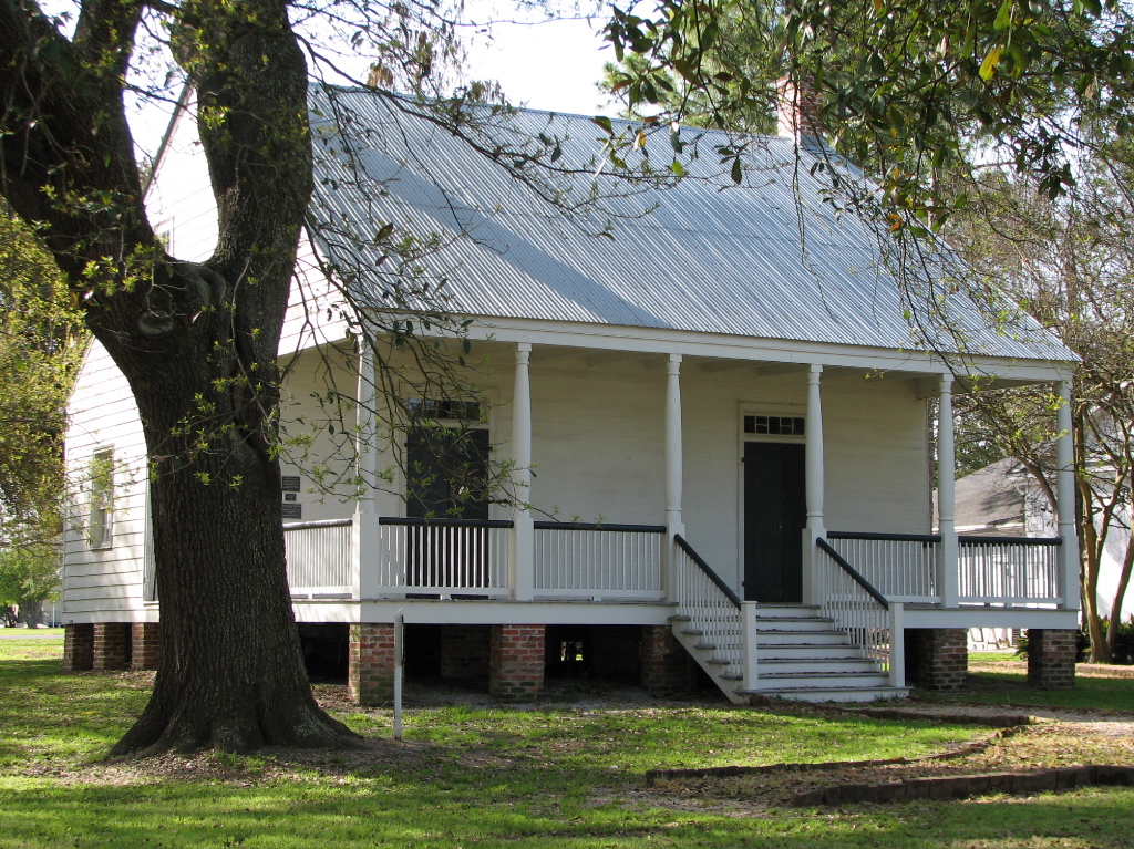
Aillet House
Monument and historic site · National Register of Historic Places · 4.5 mi
Historic plantation house in Port Allen, Louisiana

Allendale Plantation
Monument and historic site · National Register of Historic Places · 9.0 mi
Historic site, former sugar cane plantation, home of Henry Watkins Allen

Antonia
Monument and historic site · National Register of Historic Places · 5.7 mi
United States historic place

Central Fire Station
Monument and historic site · National Register of Historic Places · 3.3 mi
Fire station in Baton Rouge, Louisiana, United States


Downtown Baton Rouge Historic District
Monument and historic site · National Register of Historic Places · 3.3 mi
Historic district in Louisiana, USA
Garden District
Monument and historic site · National Register of Historic Places · 1.9 mi
Human settlement in Baton Rouge, Louisiana, United States of America
54 more on the map.
Parks, trails and playgrounds60

Botanical Gardens
Park · 1.6 mi
Public gardens & horticulture education center with 2 miles of walking trails & activities for kids
7950 Independence Blvd
Mo-Su 07:00-19:00
North 14th Street Park
Park · 2.5 mi
100 North 14th Street, Baton Rouge
sunrise-sunset
Highland Road Community Park
Park · 4.1 mi
Information and technology
48 more on the map.
Restaurants and cafes168

Acme Oyster House
Restaurant · Seafood · 1.8 mi
3535 Perkins Road
Tu-Th 11:00-20:00; Fr-Sa 11:00-21:00; Su 11:00-20:00
Burgersmith Perkins & Acadian
Restaurant · Burger · 1.7 mi
3613 Perkins Road, Baton Rouge
Mo-Su 11:00-21:00

City Roots Coffee Bar
Cafe · Coffee Shop · 2.4 mi
1509 Government Street, Baton Rouge
Mo-Sa 06:30-18:00; Su 08:30-18:00
Daruma Ramen Bar & Grill
Restaurant · Japanese, Ramen, Hibachi · 1.2 mi
3669 Government Street, Baton Rouge
Mo-Fr 11:00-22:00; Sa-Su 11:00-23:00

George's
Restaurant · American, Sandwich, Burger · 1.8 mi
2943 Perkins Road, Baton Rouge
Mo-Su 11:00-22:00
Gino's
Restaurant · Italian · 1.4 mi
4542 Bennington Avenue
Mo-Fr 11:00-14:00, 17:00-22:00; Sa 17:00-22:30
Hannah Q Smokehouse
Restaurant · Barbecue · 0.5 mi
4808 Government Street, Baton Rouge
Mo-Sa 11:00-21:00; Su 11:00-20:00
Heather V's Cafe
Restaurant · Cafe, Deli Sandwich · 1.7 mi
3655 Perkins Road, Baton Rouge
Mo-Fr 10:30-15:00
KOK Wings & Things
Restaurant · Chicken, Seafood · 2.4 mi
1509 Government Street, Baton Rouge
Su-Th 11:00-00:00; Fr-Sa 11:00-02:00
156 more on the map.
Where to stay29
Crowne Plaza Executive Center Baton Rouge
Motel and hotel · 1.3 mi
4728 Constitution Avenue, Baton Rouge
Courtyard Baton Rouge Acadian Centre/LSU Area
Motel and hotel · 1.5 mi
2421 South Acadian Thruway, Baton Rouge
Residence Inn by Marriott Baton Rouge near LSU
Motel and hotel · 1.2 mi
7061 Commerce Circle, Baton Rouge
Tru Baton Rouge Citiplace
Motel and hotel · 1.2 mi
2562 Citiplace Court, Baton Rouge
Churches and places of worship139
St. James Episcopal Church
Church · National Register of Historic Places · 3.2 mi
St. Joseph Cathedral
Church · National Register of Historic Places · 3.3 mi
Berean Seventh-day Adventist Church
Church · Seventh Day Adventist · 2.0 mi
4555 Fairfields Avenue, Baton Rouge
Christ The King Parish and Catholic Student Center
Church · Roman Catholic · 3.0 mi
11 West Fraternity Lane, Baton Rouge
Saint Francis Chapel at Our Lady of the Lake Regional Medical Center
Church · Roman Catholic · 3.0 mi
5000 Hennessy Boulevard, Baton Rouge
Shopping39
Big Family Electrical Services & EV Charger Installation
Grocery · 2.2 mi
6800 South Choctaw Drive, Baton Rouge
Gas and EV charging25
Schools, colleges and libraries102
Healthcare25
LSU Health Baton Rouge MidCity Clinic
Clinic and pharmacy · 1.5 mi
1401 North Foster Drive, Baton Rouge
Map of Baton Rouge
250 places. The map loads OpenStreetMap tiles when you open it.
People and cost of living
American Community Survey 5-year estimates, 2020-2024, U.S. Census Bureau. Estimates have margins of error, larger for small towns.
Disaster history
East Baton Rouge Parish has had 37 federal disaster declarations since 2000, most often for hurricanes.
- 2026-01-24: Severe Winter Storm (Winter Storm)
- 2024-09-16: Hurricane Francine (Hurricane)
- 2024-09-10: Tropical Storm Francine (Hurricane)
- 2021-09-13: Tropical Storm Nicholas (Coastal Storm)
- 2021-08-29: Hurricane Ida (Hurricane)
- 2021-08-27: Tropical Storm Ida (Hurricane)
OpenFEMA disaster declarations summaries.
Getting there and nearby towns
Baton Rouge Metropolitan Airport (BTR) is the nearest airport with scheduled flights listed in OpenStreetMap, 6 miles away.
- Merrydale 4 mi north, about 7 min by car
- Port Allen 4 mi west, about 7 min by car
- Gardere 6 mi south, about 9 min by car
- Brownfields 7 mi north, about 11 min by car
- Brusly 8 mi southwest, about 12 min by car
- Addis 9 mi southwest, about 15 min by car
- Central 10 mi northeast, about 16 min by car
- Baker 10 mi north, about 16 min by car
- Denham Springs 11 mi east, about 17 min by car
- Prairieville 14 mi southeast, about 22 min by car
Drive times are estimates from straight-line distance, not routes.
Local news
Headlines from INDB, the NEMICO news database.
Reviews, tips and questions
Loading what members have shared...
Sources and licences
- NCES EDGE (Public domain): public schools
- OpenFEMA (Public domain): disaster declarations
- OpenStreetMap contributors (ODbL 1.0): places, airports, map data
- U.S. Census Bureau (Public domain): population, income, housing, education, commute
- Wikidata (CC0 1.0): elevation, founding date, time zone, website, landmarks and historic places
- Wikimedia Commons (see each image): photos
- Wikipedia (CC BY-SA 4.0): overview and history text
Photo credits
- Baton Rouge Louisiana waterfront aerial view, Michael Maples, U.S. Army Corps of Engineers, Public domain
- Baton Rouge High School, Oct 2024, Paul Lowry, CC BY 2.0
- Mount Hope Plantation House, Tjean314, CC BY-SA 3.0
- OldLAGovMan, Avazina at en.wikipedia, Public domain
- U.S. Post Office and Court House, 1933, Baton Rouge (East Baton Rouge Parish, Louisiana), not dated; photo looks to have been taken soon after building was completed in 1933., Public domain
- Heidelberg Hotel, Tjean314, CC BY-SA 3.0
- USS Kidd (DD-661) at Baton Rouge, Louisiana (USA), on 26 August 1988, Cobatfor, CC BY-SA 3.0
- Reiley-Reeves House 02, CaseyG.Photograpy, CC BY-SA 4.0
- Antoniahouse12, Z28scrambler, CC BY-SA 3.0
- Aillet House, Tjean314, CC BY-SA 3.0
- SandbarHouse11, Z28scrambler, CC BY-SA 3.0
- Central Fire Station (Baton Rouge, Louisiana), Tjean314, CC BY-SA 3.0
- Main Street Historic District (Baton Rouge, Louisiana), Tjean314, CC BY-SA 3.0
- KnoxWM, Z28scrambler, CC BY-SA 3.0
- Allendale Plantation Historic District, Tjean314, CC BY-SA 3.0
- Southern University Historic District, Tjean314, CC BY-SA 3.0
- Poplar Grove Plantation, Port Allen, LA 2014-06-28 01-10, User:Lbuck8182, CC BY-SA 3.0


Page built October 30, 2026. Spotted a mistake? Tell us or suggest a place.