


Port Allen, Louisiana
Port Allen is a city of 4,942 people in West Baton Rouge Parish, Louisiana, founded in 1916.
Why visit Port Allen
Townapedia lists 68 museums and landmarks, 19 parks and trails, 29 places to eat, 9 places to stay and 7 attractions in and around town.
Highlights include Greek Theatre, Horace Wilkinson Bridge, Louisiana State Capitol and USS Kidd.
August is the warmest month, with average highs of 92°F; January lows average 40°F.
Weather in Port Allen
Forecast from the National Weather Service. Full forecast
About Port Allen
Port Allen is a city in and the parish seat of West Baton Rouge Parish, Louisiana, United States. Located on the west bank of the Mississippi River, it is bordered by Interstate 10 and US Highway 190. The population was 4,939 in 2020. It is part of the Baton Rouge metropolitan statistical area.
From the Wikipedia article Port Allen, Louisiana (this version), under CC BY-SA 4.0.
Things to do7

Greek Theatre
Cinema and theater · 2.5 mi
Outdoor theater in Baton Rouge, Louisiana, United States


Louisiana State University
School · 2.7 mi
Public university in Baton Rouge, Louisiana, United States
Louisiana State University Agricultural Center
School · 2.7 mi
Agriculture research center in Baton Rouge, Louisiana
Swine Palace
Cinema and theater · 3.1 mi
Theater company and theater on the campus of Louisiana State University in Baton Rouge, Louisiana, United States
Louisiana State University Business Education Complex
School · 3.0 mi
River Center Performing Arts Theater
Cinema and theater · 1.2 mi
240 Saint Louis Street, Baton Rouge
Museums and landmarks68

Louisiana State Capitol
Monument and historic site · National Register of Historic Places · 1.5 mi
State capitol building of the U.S. state of Louisiana
900 North 3rd Street, Baton Rouge

USS Kidd
Monument and historic site · National Register of Historic Places · 0.9 mi
1943 Fletcher-class destroyer
305 South River Road, Baton Rouge

Baton Rouge Magnet High School
Monument and historic site · National Register of Historic Places · 2.9 mi
High school in Baton Rouge, Louisiana
2825 Government St, Baton Rouge

Beauregard Town
Monument and historic site · National Register of Historic Places · 1.4 mi
Historic district in downtown Baton Rouge, Louisiana

Central Fire Station
Monument and historic site · National Register of Historic Places · 1.3 mi
Fire station in Baton Rouge, Louisiana, United States
427 Laurel Street, Baton Rouge
Louisiana Art and Science Museum
Museum · 1.0 mi
100 South River Road, Baton Rouge
We-Fr 10:00-15:00, Sa 10:00-17:00, Su 13:00-17:00, Mo-Tu off, PH off
Old State Capitol
Museum · 1.1 mi
100 North Boulevard, Baton Rouge
Tu-Fr 10:00-16:00, Sa 09:00-15:00, Su off
Spanish Town
Monument and historic site · National Register of Historic Places · 1.6 mi
Human settlement in Baton Rouge, Louisiana, United States of America
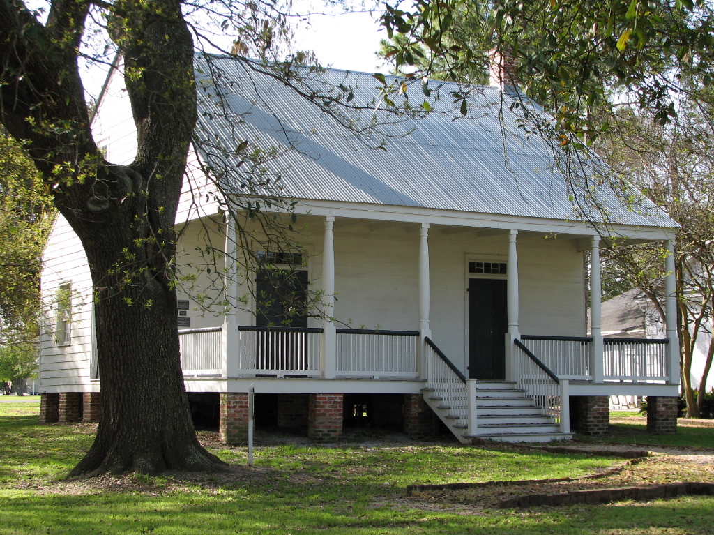
Aillet House
Monument and historic site · National Register of Historic Places · 1.1 mi
Historic plantation house in Port Allen, Louisiana


Antonia
Monument and historic site · National Register of Historic Places · 2.8 mi
United States historic place
Baton Rouge National Cemetery
Monument and historic site · National Register of Historic Places · 2.4 mi
Historic veterans cemetery in East Baton Rouge Parish, Louisiana
56 more on the map.
Parks, trails and playgrounds19

Louisiana Veterans Memorial Park
Park · 1.7 mi
300 Capitol Access Road
sunrise-sunset

13th Gate Necropolis
Sports field and stadium · 1.2 mi
813 Saint Philip Street, Baton Rouge
Seventh Street Park
Park · 1.6 mi
Also known as the Seventh Street Senior Citizens' Park. There are raised beds for gardening and a small playground.
7 more on the map.
Restaurants and cafes29

Court Street Cafe
Cafe · American · 0.6 mi
805 Court Street, Port Allen
Mo-Fr 07:00-21:00; Sa 08:00-21:00
Demi Nola Blends Smoothie & Juice Bar
Cafe · Juice, Smoothie · 1.2 mi
307 3rd Street, Baton Rouge
Mo-Fr 08:30-15:00; Sa 08:00-14:00

Frostop
Restaurant · Burger, Sandwich · 1.3 mi
402 Government Street, Baton Rouge
Mo-Sa 10:00-20:00; Su 11:00-18:00

Pastime Restuarant
Diner · American · 1.2 mi
252 South Boulevard, Baton Rouge
Mo-Th 10:00-22:00; Fr 10:00-23:00; Sa 10:00-22:00
Pizza Hut
Restaurant · Pizza
520 South Alexander Avenue, Port Allen
Tu-Th 12:00-21:00; Fr-Sa 12:00-20:00
The Jambalaya Shoppe
Restaurant · Cajun · 1.7 mi
3265 LA-1, Port Allen
Mo-Sa 10:30-20:00; Su 10:30-19:00
The Little Village
Restaurant · Italian · 1.2 mi
447 3rd Street, Baton Rouge
Mo-Fr 11:00-14:00, 17:00-22:00; Sa 17:00-22:00


17 more on the map.
Where to stay9
Hilton Baton Rouge Capitol Center
Motel and hotel · National Register of Historic Places · 1.1 mi
201 Lafayette Street, Baton Rouge
Hotel Indigo Baton Rouge Downtown
Motel and hotel · 1.1 mi
200 Convention Street, Baton Rouge
Belle of Baton Rouge Hotel
Motel and hotel · 1.1 mi
103 France Street, Baton Rouge
Churches and places of worship32
St. James Episcopal Church
Church · National Register of Historic Places · 1.3 mi
St. Joseph Cathedral
Church · National Register of Historic Places · 1.4 mi
Shopping3
Gas and EV charging6
Schools, colleges and libraries52
Louisiana State Library
Library · 1.3 mi
701 North 4th Street, Baton Rouge
B. R. Foreign Language Acad. Immersion Magnet
School · 4.0 mi
4510 Bawell Street, Baton Rouge
Healthcare1
Map of Port Allen
226 places. The map loads OpenStreetMap tiles when you open it.
Climate by month
Monthly table
| Month | High | Low | Rain |
|---|---|---|---|
| Jan | 62°F | 40°F | 6.1 in |
| Feb | 66°F | 43°F | 5.0 in |
| Mar | 73°F | 49°F | 4.3 in |
| Apr | 79°F | 55°F | 5.5 in |
| May | 85°F | 64°F | 5.4 in |
| Jun | 90°F | 70°F | 6.7 in |
| Jul | 91°F | 72°F | 5.1 in |
| Aug | 92°F | 71°F | 6.4 in |
| Sep | 88°F | 67°F | 5.2 in |
| Oct | 81°F | 56°F | 5.3 in |
| Nov | 71°F | 46°F | 4.0 in |
| Dec | 64°F | 41°F | 5.4 in |
U.S. Climate Normals 1991-2020 for Brusly 2 W (5 mi away), NOAA NCEI.
People and cost of living
American Community Survey 5-year estimates, 2020-2024, U.S. Census Bureau. Estimates have margins of error, larger for small towns.
Disaster history
West Baton Rouge Parish has had 33 federal disaster declarations since 2000, most often for hurricanes.
- 2026-01-24: Severe Winter Storm (Winter Storm)
- 2024-09-10: Tropical Storm Francine (Hurricane)
- 2021-09-13: Tropical Storm Nicholas (Coastal Storm)
- 2021-08-29: Hurricane Ida (Hurricane)
- 2021-08-27: Tropical Storm Ida (Hurricane)
- 2021-03-09: Severe Winter Storms (Severe Ice Storm)
OpenFEMA disaster declarations summaries.
Getting there and nearby towns
Baton Rouge Metropolitan Airport (BTR) is the nearest airport with scheduled flights listed in OpenStreetMap, 7 miles away.
- Baton Rouge 4 mi east, about 7 min by car
- Brusly 4 mi southwest, about 7 min by car
- Addis 6 mi southwest, about 10 min by car
- Gardere 7 mi southeast, about 12 min by car
- Brownfields 8 mi northeast, about 14 min by car
- Baker 10 mi north, about 16 min by car
- Central 13 mi northeast, about 21 min by car
- Zachary 15 mi north, about 25 min by car
- Prairieville 17 mi southeast, about 28 min by car
- Gonzales 23 mi southeast, about 38 min by car
Drive times are estimates from straight-line distance, not routes.
Local news
Headlines from INDB, the NEMICO news database.
Reviews, tips and questions
Loading what members have shared...
Sources and licences
- NCES EDGE (Public domain): public schools
- NOAA NCEI U.S. Climate Normals 1991-2020 (Public domain): climate by month
- OpenFEMA (Public domain): disaster declarations
- OpenStreetMap contributors (ODbL 1.0): places, airports, map data
- U.S. Census Bureau (Public domain): population, income, housing, education, commute
- Wikidata (CC0 1.0): elevation, founding date, time zone, website, landmarks and historic places
- Wikimedia Commons (see each image): photos
- Wikipedia (CC BY-SA 4.0): overview and history text
Photo credits
- Port Allen Lock Louisiana aerial view, Michael Maples, U.S. Army Corps of Engineers, Public domain
- USS Kidd (DD-661) at Baton Rouge, Louisiana (USA), on 26 August 1988, Cobatfor, CC BY-SA 3.0
- Heidelberg Hotel, Tjean314, CC BY-SA 3.0
- Louisiana State Capitol Building, Chrismiceli, CC0
- Baton Rouge High School, Oct 2024, Paul Lowry, CC BY 2.0
- Central Fire Station (Baton Rouge, Louisiana), Tjean314, CC BY-SA 3.0
- Lsu french house, Jsmi128, Public domain
- Pentagon Barracks (Baton Rouge), 2013, Spatms, CC BY-SA 3.0
- Old Louisiana State Capitol stained glass dome, view from ground floor, Jami430, CC BY-SA 4.0
- Kleinert Terrace Historic District, Tjean314, CC BY-SA 3.0
- LSU Campus Indian Mounds, Spatms, CC BY-SA 3.0
- Prince Hall Masonic Temple (Baton Rouge, Louisiana), Tjean314, CC BY-SA 3.0
- Magnolia Mound Plantation House, David J. Kaminsky, Public domain
- St. James Episcopal Church, Baton Rouge, David J. Kaminsky, Public domain
- Yazoo and Mississippi Valley Railroad Company Depot, Niagara, CC BY-SA 3.0
- OldLAGovMan, Avazina at en.wikipedia, Public domain
- U.S. Post Office and Court House, 1933, Baton Rouge (East Baton Rouge Parish, Louisiana), not dated; photo looks to have been taken soon after building was completed in 1933., Public domain
- St. Joseph Cathedral - Baton Rouge, Louisiana, Farragutful, CC BY-SA 3.0
- Reiley-Reeves House 02, CaseyG.Photograpy, CC BY-SA 4.0
- Antoniahouse12, Z28scrambler, CC BY-SA 3.0
- Main Street Historic District (Baton Rouge, Louisiana), Tjean314, CC BY-SA 3.0
- KnoxWM, Z28scrambler, CC BY-SA 3.0
- Aillet House, Tjean314, CC BY-SA 3.0
- SandbarHouse11, Z28scrambler, CC BY-SA 3.0
- Poplar Grove Plantation, Port Allen, LA 2014-06-28 01-10, User:Lbuck8182, CC BY-SA 3.0
- Former post office in downtown Baton Rouge, David J. Kaminsky, Public domain


Page built October 30, 2026. Spotted a mistake? Tell us or suggest a place.