



Battle Ground, Indiana
Battle Ground is a town of 1,969 people in Tippecanoe County, Indiana, founded in 1867.
Why visit Battle Ground
Townapedia lists 10 museums and landmarks, 4 parks and trails and 3 places to eat in and around town.
Highlights include Battle Ground Historic District, Indiana State Soldiers Home Historic District, Wolf Park and Prophetstown Aquatic Center.
July is the warmest month, with average highs of 83°F; January lows average 16°F.
Weather in Battle Ground
Forecast from the National Weather Service. Full forecast
About Battle Ground
Battle Ground is a town in Tippecanoe Township, Tippecanoe County in the U.S. state of Indiana. The population was 1,838 at the 2020 census. It is near the site of the Battle of Tippecanoe.
From the Wikipedia article Battle Ground, Indiana (this version), under CC BY-SA 4.0.
Museums and landmarks10

Battle Ground Historic District
Monument and historic site · National Register of Historic Places · 0.7 mi
Historic district in Battle Ground, Indiana

Indiana State Soldiers Home Historic District
Monument and historic site · National Register of Historic Places · 3.2 mi
Historic district in Indiana, United States
Tippecanoe Battlefield Park
Monument and historic site · National Register of Historic Places · 0.4 mi
The location of the Battle of Tippecanoe fought on November 7, 1811

Parks, trails and playgrounds4



Prophetstown Aquatic Center
Sports field and stadium · 1.2 mi
The Aquatic Center features a 30-foot tube slide, body flume, lazy river float area, adventure channel, zero-entry pool with play...
5545 Swisher Road, West Lafayette


Restaurants and cafes3

Taco Bell
Fast food · Tex-Mex · 0.9 mi
5829 State Road 43 North, West Lafayette
Mo-Th 09:00-01:00; Fr-Sa 09:00-02:00; Su 09:00-01:00
Churches and places of worship1

History
In the late summer and the fall of 1811, William Henry Harrison, the governor of the Indiana Territory, organized a military expedition against the increasing resistance of the federation of Native American tribes being formed by the Shawnee brothers and chiefs, Tecumseh and Tenskwatawa, who was also known as the Prophet. With their community of Prophetstown as his objective, General Harrison marched from Vincennes, Indiana, at the head of a small army of about 1,000 men.
General Harrison met with representatives of the Prophet on November 6, 1811, when he arrived at Prophetstown. He presented demands in the name of his government. Harrison was to meet with the Prophet and his council the next day about the demands of the government. Harrison set up his encampment on a ridge about a mile northwest of Prophet's Town.
Fearing a surprise attack by the Prophet's forces, General Harrison placed his troops in battle formation, instructed his men to sleep fully clothed, and assigned a large detail of men for sentinel duty. On the morning of November 7, 1811, after 4:00, the camp was attacked by the Prophet.
After a fierce battle, Harrison and his army defeated the Prophet's Indian confederation at the Battle of Tippecanoe. The defeat all but ended the Indian wars in the Midwest, especially as Tecumseh was killed at the Battle of the Thames in Canada in 1813.
From the History section of Battle Ground, Indiana on Wikipedia, under CC BY-SA 4.0.
Gas and EV charging2
Schools, colleges and libraries14
Paramount School of Excellence Lafayette
School · 5.6 mi
1904 Elmwood Ave, Lafayette
West Lafayette Elementary School
School · 4.3 mi
600 Cumberland Ave, West Lafayette
West Lafayette Intermediate School
School · 5.3 mi
1838 N Salisbury, West Lafayette
Map of Battle Ground
34 places. The map loads OpenStreetMap tiles when you open it.
Climate by month
Monthly table
| Month | High | Low | Rain | Snow |
|---|---|---|---|---|
| Jan | 32°F | 16°F | 2.2 in | 5.9 in |
| Feb | 37°F | 20°F | 1.9 in | 5.2 in |
| Mar | 48°F | 29°F | 2.6 in | 2.3 in |
| Apr | 61°F | 39°F | 4.0 in | 0.4 in |
| May | 72°F | 51°F | 4.7 in | 0.0 in |
| Jun | 81°F | 60°F | 4.8 in | 0.0 in |
| Jul | 83°F | 62°F | 4.2 in | 0.0 in |
| Aug | 82°F | 60°F | 3.7 in | 0.0 in |
| Sep | 77°F | 52°F | 3.1 in | 0.0 in |
| Oct | 64°F | 41°F | 3.0 in | 0.0 in |
| Nov | 50°F | 32°F | 3.0 in | 0.9 in |
| Dec | 37°F | 22°F | 2.4 in | 4.2 in |
U.S. Climate Normals 1991-2020 for W Lafayette 6 Nw (8 mi away), NOAA NCEI.
People and cost of living
American Community Survey 5-year estimates, 2020-2024, U.S. Census Bureau. Estimates have margins of error, larger for small towns.
Disaster history
Tippecanoe County has had 10 federal disaster declarations since 2000, most often for severe storms.
- 2026-01-24: Severe Winter Storm (Winter Storm)
- 2020-04-03: Covid-19 Pandemic (Biological)
- 2020-03-13: Covid-19 (Biological)
- 2008-06-08: Severe Storms, Flooding, And Tornadoes (Severe Storm)
- 2008-01-30: Severe Storms And Flooding (Severe Storm)
- 2007-03-12: Snow (Snowstorm)
OpenFEMA disaster declarations summaries.
Getting there and nearby towns
Purdue University Airport (LAF) is the nearest airport with scheduled flights listed in OpenStreetMap, 8 miles away.
- West Lafayette 6 mi southwest, about 9 min by car
- Lafayette 7 mi south, about 12 min by car
- Dayton 10 mi southeast, about 16 min by car
- Frankfort 23 mi southeast, about 37 min by car
- Attica 26 mi southwest, about 41 min by car
- Thorntown 29 mi southeast, about 47 min by car
- Logansport 31 mi northeast, about 50 min by car
- Crawfordsville 32 mi south, about 52 min by car
- Kokomo 38 mi east, about 1 h by car
- Lebanon 39 mi southeast, about 1 h by car
Drive times are estimates from straight-line distance, not routes.
Local news
Headlines from INDB, the NEMICO news database.
Reviews, tips and questions
Loading what members have shared...
Sources and licences
- NCES EDGE (Public domain): public schools
- NOAA NCEI U.S. Climate Normals 1991-2020 (Public domain): climate by month
- OpenFEMA (Public domain): disaster declarations
- OpenStreetMap contributors (ODbL 1.0): places, airports, map data
- U.S. Census Bureau (Public domain): population, income, housing, education, commute
- Wikidata (CC0 1.0): elevation, founding date, time zone, website, landmarks and historic places
- Wikimedia Commons (see each image): photos
- Wikipedia (CC BY-SA 4.0): overview and history text
Photo credits
- Battle Ground, Indiana, Huw Williams ( Huwmanbeing ), Public domain
- Indiana State Soldiers Home house, Nyttend, Public domain
- Sparrow and Niko, Gray Wolves, Wolf Park (51095899581), Raed Mansour from Chicago, USA, CC BY 2.0
- Overlook from Top of Prophet's Rock Trail, j_m_d_imagery, CC BY-SA 4.0
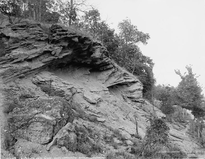
- Prophet's Rock Ridge near Tippecanoe battleground, Ind., 1902, Detroit Publishing Co., Public domain
- Prophet's Rock view, Huw Williams ( Huwmanbeing ), CC0
- Prophet's Rock Park - November 2023 - Sarah Stierch 01, Missvain, CC0
- Prophet's Rock, sarahstierch, CC0
- Prophet's Rock Park - November 2023 - Sarah Stierch 04, Missvain, CC0
- Prophet's Rock Park - November 2023 - Sarah Stierch 03, Missvain, CC0
- Prophet's Rock Park - November 2023 - Sarah Stierch 02, Missvain, CC0
- Tippecanoe Battlefield Memorial - November 2023 - Sarah Stierch 03, Missvain, CC BY 4.0
- Tippecanoe Battlefield Memorial - November 2023 - Sarah Stierch 04, Missvain, CC BY 4.0
- Tippecanoe Battlefield Memorial - November 2023 - Sarah Stierch 02, Missvain, CC BY 4.0
- Tippecanoe Battlefield Memorial - November 2023 - Sarah Stierch 05, Missvain, CC BY 4.0
- Wah-ba-shik-a Nature Center - November 2023 - Sarah Stierch 06, Missvain, CC BY 4.0
- Wah-ba-shik-a Nature Center - November 2023 - Sarah Stierch 05, Missvain, CC BY 4.0
- Wah-ba-shik-a Nature Center - November 2023 - Sarah Stierch 07, Missvain, CC BY 4.0
- Wah-ba-shik-a Nature Center - November 2023 - Sarah Stierch 04, Missvain, CC BY 4.0
- Wah-ba-shik-a Nature Center - November 2023 - Sarah Stierch 01, Missvain, CC BY 4.0
- Wah-ba-shik-a Nature Center - November 2023 - Sarah Stierch 02, Missvain, CC BY 4.0
- Wah-ba-shik-a Nature Center - November 2023 - Sarah Stierch 03, Missvain, CC BY 4.0
- Tippecanoe Battlefield Memorial - November 2023 - Sarah Stierch 01, Missvain, CC BY 4.0
- Tippecanoe Battlefield Memorial - November 2023 - Sarah Stierch 14, Missvain, CC BY 4.0
- Tippecanoe Battlefield Moument, Jim Hammer from Lafayette, Indiana, USA, CC BY-SA 2.0
- Battle of Tippecanoe Monument, j_m_d_imagery, CC BY-SA 4.0
- Tippecanoe Battlefield Memorial - November 2023 - Sarah Stierch 13, Missvain, CC0
- Tippecanoe Battlefield Memorial - November 2023 - Sarah Stierch 11, Missvain, CC0
- Tippecanoe Battlefield Memorial - November 2023 - Sarah Stierch 12, Missvain, CC0
- Monumento Tippecanoe, The original uploader was Casito at English Wikipedia ., CC BY-SA 3.0
- Tippecanoe Battlefield Memorial - November 2023 - Sarah Stierch 09, Missvain, CC BY 4.0
- Tippecanoe Battlefield Memorial - November 2023 - Sarah Stierch 07, Missvain, CC BY 4.0
- Tippecanoe Battlefield Memorial - November 2023 - Sarah Stierch 08, Missvain, CC BY 4.0
- Tippecanoe Battlefield Museum - November 2023 - Sarah Stierch 03, Missvain, CC BY 4.0
- Tippecanoe Battlefield Museum - November 2023 - Sarah Stierch 05, Missvain, CC BY 4.0
- Tippecanoe Battlefield Museum - November 2023 - Sarah Stierch 01, Missvain, CC BY 4.0
- Tippecanoe Battlefield Memorial - November 2023 - Sarah Stierch 10, Missvain, CC0
- Trail of Death, Battleground 5-13-14 042, Chris Light, CC BY-SA 4.0
- Trail of Death, Battleground 5-13-14 040, Chris Light, CC BY-SA 4.0
- Harrisonville Cemetery, j_m_d_imagery, CC BY-SA 4.0


Page built October 30, 2026. Spotted a mistake? Tell us or suggest a place.