

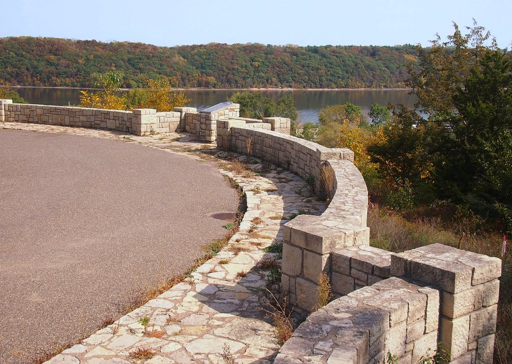


Bayport, Minnesota
Bayport is a city of 3,905 people in Washington County, Minnesota, founded in 1873.
Why visit Bayport
Townapedia lists 25 museums and landmarks, 15 parks and trails, 7 places to eat, 1 place to stay and 2 attractions in and around town.
Highlights include Stillwater Bridge, St. Croix Crossing, Albert Lammers House and Captain Austin Jenks House.
July is the warmest month, with average highs of 85°F; January lows average 9°F.
Weather in Bayport
Forecast from the National Weather Service. Full forecast
About Bayport
Bayport is a city in Washington County, Minnesota, United States. The population was 4,024 at the 2020 census.
From the Wikipedia article Bayport, Minnesota (this version), under CC BY-SA 4.0.
Things to do2

Stillwater Bridge
Bridge · National Register of Historic Places · 3.1 mi
Vertical-lift bridge connecting Stillwater, Minnesota and Houlton, Wisconsin over the St. Croix River

St. Croix Crossing
Bridge · 1.9 mi
Bridge between St. Joseph, Wisconsin, and Oak Park Heights, Minnesota (near Stillwater)
Museums and landmarks25

Albert Lammers House
Monument and historic site · National Register of Historic Places · 2.4 mi
House in Stillwater, Minnesota

Captain Austin Jenks House
Monument and historic site · National Register of Historic Places · 2.9 mi
Historic house in Minnesota, United States

Captain John Oliver House
Monument and historic site · National Register of Historic Places · 3.0 mi
Historic house in Lakeland, Minnesota

Chicago, Milwaukee and St. Paul Freight House
Monument and historic site · National Register of Historic Places · 3.0 mi
Railway station in Stillwater, the United States of America

Chicago, St. Paul, Minneapolis and Omaha Railroad Car Shop Historic District
Monument and historic site · National Register of Historic Places · 1.6 mi
Historic district in Wisconsin, United States

Frederick L. Darling House
Monument and historic site · National Register of Historic Places · 2.9 mi
House in Hudson, Wisconsin, United States

Herman L. Humphrey House
Monument and historic site · National Register of Historic Places · 2.9 mi
House in Hudson, Wisconsin, United States

Hudson Public Library
Monument and historic site · National Register of Historic Places · 2.9 mi
Library building in Hudson, Wisconsin, United States

Isaac Staples' Sawmill
Monument and historic site · National Register of Historic Places · 3.4 mi
Historic building in Stillwater, Minnesota, United States
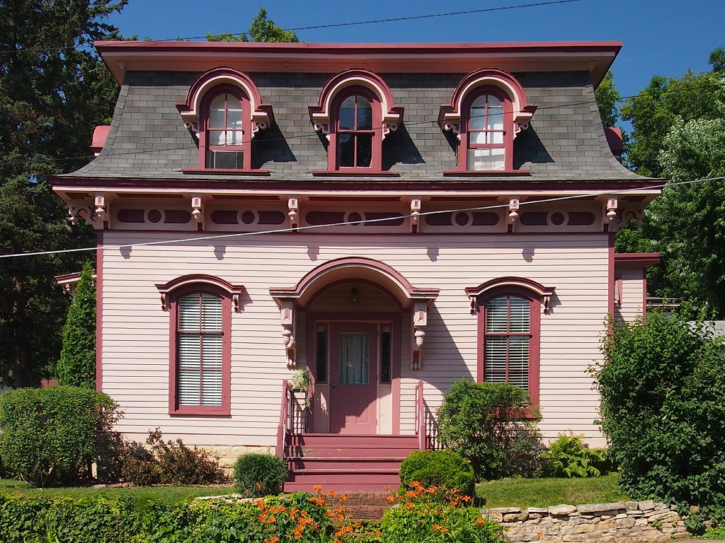
Ivory McKusick House
Monument and historic site · National Register of Historic Places · 3.5 mi
Historic house in Minnesota, United States

John S. Moffat House
Monument and historic site · National Register of Historic Places · 2.6 mi
Historic house in Wisconsin, United States


Lewis-Williams House
Monument and historic site · National Register of Historic Places · 3.2 mi
House in Hudson, Wisconsin, United States
13 more on the map.
Parks, trails and playgrounds15



Jens & Gurian Jenson Memorial Park
Park · 1.5 mi
759 Lund Street North, North Hudson
3 more on the map.
Restaurants and cafes7

Son's Deli
Restaurant · Sandwich
110 3rd Street North, Bayport
We-Sa 08:00-19:00

The Village Inn Sports Bar & Grill
Bar and pub · 1.4 mi
723 Sixth Street North, North Hudson
Mo-Fr 00:00-02:00,07:00-24:00; Sa,Su 00:00-02:30,07:00-24:00
El Loro Mexican Restaurant
Restaurant · Mexican · 1.5 mi
800 Sixth Street North, North Hudson
History
The City of Bayport began as three small settlements along the St. Croix River. In 1873, the St. Croix Railway Improvement Company combined the three settlements into South Stillwater, which was incorporated as a village in 1881. Because many people confused South Stillwater with the city of Stillwater, the city changed its name to Bayport in 1922.
Like Stillwater's, Bayport's early economy centered on the lumber industry. From 1852 to 1916, several sawmills operated in the city. The Andersen Corporation is the successor to Bayport's early lumbering firms. The Andersen Corporation (then the Andersen Lumber Company) moved to Bayport in 1913 to take advantage of the city's rail lines, among other reasons. It prospered in Bayport, becoming the world's largest window and patio door manufacturer.
In 1914, the Minnesota Correctional Facility - Stillwater moved from Stillwater to Bayport. Experts at the time considered it one of the world's most modern penal institutions. As of 2010, the prison housed about 1600 inmates, who are counted as Bayport residents for census purposes. The maximum-security Minnesota Correctional Facility - Oak Park Heights opened just beyond Bayport's western boundary in 1982.
From the History section of Bayport, Minnesota on Wikipedia, under CC BY-SA 4.0.
Where to stay1
Churches and places of worship3
Gas and EV charging3
Schools, colleges and libraries37
Healthcare1
Map of Bayport
94 places. The map loads OpenStreetMap tiles when you open it.
Climate by month
Monthly table
| Month | High | Low | Rain |
|---|---|---|---|
| Jan | 27°F | 9°F | 1.0 in |
| Feb | 32°F | 14°F | 0.9 in |
| Mar | 44°F | 25°F | 1.5 in |
| Apr | 60°F | 38°F | 3.1 in |
| May | 73°F | 50°F | 4.2 in |
| Jun | 81°F | 60°F | 5.4 in |
| Jul | 85°F | 64°F | 4.5 in |
| Aug | 84°F | 62°F | 5.3 in |
| Sep | 76°F | 55°F | 3.2 in |
| Oct | 62°F | 42°F | 3.2 in |
| Nov | 45°F | 28°F | 1.6 in |
| Dec | 32°F | 16°F | 1.1 in |
U.S. Climate Normals 1991-2020 for Stillwater 1 Se (2 mi away), NOAA NCEI.
People and cost of living
American Community Survey 5-year estimates, 2020-2024, U.S. Census Bureau. Estimates have margins of error, larger for small towns.
Disaster history
Washington County has had 8 federal disaster declarations since 2000, most often for floods.
- 2020-04-07: Covid-19 Pandemic (Biological)
- 2020-03-13: Covid-19 (Biological)
- 2019-06-12: Severe Winter Storm, Straight-Line Winds, And Flooding (Flood)
- 2011-05-10: Severe Storms And Flooding (Flood)
- 2010-03-19: Flooding (Flood)
- 2005-09-13: Hurricane Katrina Evacuation (Hurricane)
OpenFEMA disaster declarations summaries.
Getting there and nearby towns
St. Paul Downtown Airport (STP) is the nearest airport with scheduled flights listed in OpenStreetMap, 15 miles away.
- Stillwater 4 mi northwest, about 6 min by car
- Hudson 4 mi southeast, about 7 min by car
- Lake Elmo 7 mi west, about 11 min by car
- Afton 8 mi south, about 13 min by car
- Oakdale 9 mi west, about 15 min by car
- Woodbury 10 mi southwest, about 17 min by car
- North St. Paul 11 mi west, about 18 min by car
- White Bear Lake 12 mi west, about 19 min by car
- Maplewood 12 mi west, about 20 min by car
- River Falls 13 mi southeast, about 21 min by car
Drive times are estimates from straight-line distance, not routes.
Local news
Headlines from INDB, the NEMICO news database.
Reviews, tips and questions
Loading what members have shared...
Sources and licences
- NCES EDGE (Public domain): public schools
- NOAA NCEI U.S. Climate Normals 1991-2020 (Public domain): climate by month
- OpenFEMA (Public domain): disaster declarations
- OpenStreetMap contributors (ODbL 1.0): places, airports, map data
- U.S. Census Bureau (Public domain): population, income, housing, education, commute
- Wikidata (CC0 1.0): elevation, founding date, time zone, website, landmarks and historic places
- Wikimedia Commons (see each image): photos
- Wikipedia (CC BY-SA 4.0): overview and history text
Photo credits
- Samuel T. Merritt house, AlexiusHoratius, CC BY-SA 3.0
- Stillwater Overlook, McGhiever, CC BY-SA 3.0
- William Dwelley house, AlexiusHoratius, CC BY-SA 3.0
- Isaac Staples Sawmill, McGhiever, CC BY-SA 4.0
- William H. Phipps house, AlexiusHoratius, CC BY-SA 3.0
- Lewis-Williams house, AlexiusHoratius, CC BY-SA 3.0
- 2009-0620-Hudson-Octagon, Bobak Ha'Eri, CC BY 3.0
- Moritz Bergstein Shoddy Mill & Warehouse, McGhiever, CC BY-SA 4.0
- Freight House 1, Elkman, CC BY-SA 3.0
- Frederick L. Darling house, AlexiusHoratius, CC BY-SA 3.0
- Roscoe Hersey 1, Elkman, CC BY-SA 3.0
- Hudson CStPM&O Shops, Znns, CC BY-SA 4.0
- Stillwater Minnesota, Autoshade~commonswiki, Public domain
- Downtown Stillwater Main St N 100 block, McGhiever, CC BY-SA 4.0
- Minnesota Correctional Facility–Stillwater, McGhiever, CC BY-SA 3.0
- Herman L. Humphrey house, AlexiusHoratius, CC BY-SA 3.0
- St. Croix County Courthouse 1, AlexiusHoratius, CC BY-SA 3.0
- Nelson School 2015, McGhiever, CC BY-SA 4.0
- Phil's Tara Hideaway, McGhiever, CC BY-SA 3.0
- Ivory McKusick House, McGhiever, CC BY-SA 3.0
- Capt. Austin Jenks House, McGhiever, CC BY-SA 4.0
- Mortimer Webster House, McGhiever, CC BY-SA 4.0
- Albert Lammers House, McGhiever, CC BY-SA 3.0
- Stillwater Courthouse, Iulus Ascanius at English Wikipedia, Public domain
- Hudson, WI Public Library 1, AlexiusHoratius, CC BY-SA 3.0
- Capt. John Oliver House, McGhiever, CC BY-SA 3.0
- St. Croix Crossing Bridge - Minnesota-Wisconsin (35635244673), Tony Webster from Minneapolis, Minnesota, United States, CC BY-SA 2.0


Page built October 30, 2026. Spotted a mistake? Tell us or suggest a place.