


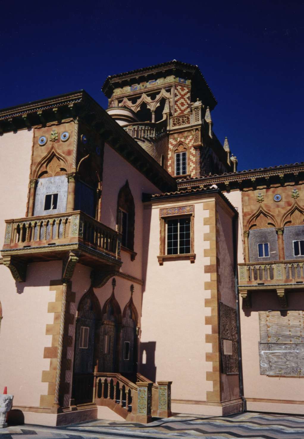

Bayshore Gardens, Florida
Bayshore Gardens is a community of 18,131 people in Manatee County, Florida.
Why visit Bayshore Gardens
Townapedia lists 16 museums and landmarks, 7 parks and trails, 46 places to eat and 5 places to stay in and around town.
Highlights include Austin House, Caples'-Ringlings' Estates Historic District and IMG Academy Golf Club.
August is the warmest month, with average highs of 92°F; January lows average 52°F.
Weather in Bayshore Gardens
Forecast from the National Weather Service. Full forecast
About Bayshore Gardens
Bayshore Gardens is a census-designated place (CDP) and planned community in Manatee County, Florida, United States. The population was 19,904 at the 2020 census, up from 16,323 in 2010. It is part of the North Port-Bradenton-Sarasota, Florida Metropolitan Statistical Area.
From the Wikipedia article Bayshore Gardens, Florida (this version), under CC BY-SA 4.0.
Museums and landmarks16

Austin House
Monument and historic site · National Register of Historic Places · 2.0 mi
Listed on the National Register of Historic Places in Manatee County, Florida
Caples'-Ringlings' Estates Historic District
Monument and historic site · National Register of Historic Places · 3.6 mi
Historic district in Florida, United States

Egbert Reasoner House
Monument and historic site · National Register of Historic Places · 3.3 mi
Demolished historic house in Oneco, Florida, United States

John M. Beasley House
Monument and historic site · National Register of Historic Places · 2.1 mi
Historic house near Sarasota, Florida, USA

Johnson Helm House
Monument and historic site · National Register of Historic Places · 2.6 mi
Historic house in Florida, United States

Kreissle Forge
Monument and historic site · National Register of Historic Places · 2.4 mi
Building in Florida, United States

Midway Subdivision Historic District
Monument and historic site · National Register of Historic Places · 2.5 mi
Historic district in Florida, United States

Paul M. Souder House
Monument and historic site · National Register of Historic Places · 2.0 mi
Historic house in Florida, United States

Reid-Woods House
Monument and historic site · National Register of Historic Places · 1.5 mi
Building in Florida, United States

Seagate
Monument and historic site · National Register of Historic Places · 3.0 mi
Historic estate built in Florida in 1929

Stevens-Gilchrist House
Monument and historic site · National Register of Historic Places · 2.1 mi
Sarasota, Florida, NRHP-listed


Whitfield Estates-Lantana Avenue Historic District
Monument and historic site · National Register of Historic Places · 1.5 mi
Historic district in Florida, United States
4 more on the map.
Parks, trails and playgrounds7


Marina @ Bayshore Gardens
Marina and boat launch · 1.0 mi
6919 26th Street West, Bradenton


Restaurants and cafes46

Cafe Havana
Restaurant · Cuban · 1.9 mi
1440 63rd Avenue East, Bradenton
Su 09:00-19:00; Mo-Sa 09:00-21:00
Mission Bar-B-Q
Restaurant · Barbecue · 1.9 mi
4501 14th Street West, Bradenton
Mo-Sa 11:00-21:00; Su 11:30-20:00
Tiramisu Ristorante Italiano
Restaurant · Italian · 1.1 mi
5215 14th Street West, Bradenton
Mo-Sa 17:00-21:30



34 more on the map.
Where to stay5

Quality Inn Bradenton - Sarasota North
Motel and hotel · 0.9 mi
6727 14th Street West, Bradenton
History
In 1955, a New York syndicate led by developer Sydney R. Newman purchased the area now known as Bayshore Gardens on the west side of U.S. 41 along the eastern shore of Sarasota Bay, just north of the Sarasota/Manatee county line, and platted an area between what was dubbed Bayshore Gardens Parkway running from U.S. 41 to 26th Street West and Sarasota Bay that would become Bayshore Gardens. The property was purchased for about 2 million dollars, making it the most expensive land purchase in the area since the 1920s. The 3,200-acre (1,300 ha) area, once fields for growing tomatoes, would include recreation areas and a marina, schools, churches, shopping centers and medical facilities as well as homes in the popular style of that time, now called mid-century modern.
By its grand opening in 1956, four model homes were built and seven available designs had been created for future residents to pick from, including the Seagrape, the Gladiola, and the most popular, the Bird of Paradise. Prices ranged from $8,000 to $15,000 for a home with a lot, and lower rates for veterans were advertised. The first home in Bayshore Gardens was sold in July 1956 to Jennie and Samuel Gibson in the Hibiscus style.
From the History section of Bayshore Gardens, Florida on Wikipedia, under CC BY-SA 4.0.
Churches and places of worship11
Shopping18
Gas and EV charging9
Schools, colleges and libraries50
Bayshore High School
School · 1.2 mi
5401 34th Street West, Bradenton
Healthcare7
Passport Health Bradenton Travel Clinic
Clinic and pharmacy · 1.3 mi
5190 26th Street West, Bradenton
Map of Bayshore Gardens
169 places. The map loads OpenStreetMap tiles when you open it.
Climate by month
Monthly table
| Month | High | Low | Rain |
|---|---|---|---|
| Jan | 72°F | 52°F | 2.8 in |
| Feb | 75°F | 55°F | 1.9 in |
| Mar | 78°F | 58°F | 2.9 in |
| Apr | 82°F | 63°F | 2.5 in |
| May | 88°F | 68°F | 2.6 in |
| Jun | 90°F | 74°F | 7.0 in |
| Jul | 91°F | 75°F | 7.4 in |
| Aug | 92°F | 75°F | 9.1 in |
| Sep | 90°F | 74°F | 6.0 in |
| Oct | 86°F | 68°F | 2.8 in |
| Nov | 80°F | 60°F | 1.8 in |
| Dec | 75°F | 55°F | 2.3 in |
U.S. Climate Normals 1991-2020 for Sarasota Bradenton Ap (2 mi away), NOAA NCEI.
People and cost of living
American Community Survey 5-year estimates, 2020-2024, U.S. Census Bureau. Estimates have margins of error, larger for small towns.
Disaster history
Manatee County has had 34 federal disaster declarations since 2000, most often for hurricanes.
- 2024-10-11: Hurricane Milton (Hurricane)
- 2024-10-07: Hurricane Milton (Hurricane)
- 2024-09-28: Hurricane Helene (Hurricane)
- 2024-09-24: Tropical Storm Helene (Tropical Storm)
- 2024-08-10: Hurricane Debby (Tropical Storm)
- 2024-08-03: Tropical Storm Debby (Tropical Storm)
OpenFEMA disaster declarations summaries.
Getting there and nearby towns
Sarasota-Bradenton International Airport (SRQ) is the nearest airport with scheduled flights listed in OpenStreetMap, 3 miles away.
- South Bradenton 2 mi north, about 3 min by car
- Whitfield 2 mi southeast, about 3 min by car
- West Samoset 3 mi northeast, about 5 min by car
- Bradenton 4 mi north, about 6 min by car
- Samoset 4 mi northeast, about 6 min by car
- Longboat Key 5 mi southwest, about 7 min by car
- West Bradenton 5 mi northwest, about 8 min by car
- Palmetto 6 mi north, about 10 min by car
- Cortez 6 mi northwest, about 10 min by car
- Sarasota 7 mi south, about 11 min by car
Drive times are estimates from straight-line distance, not routes.
Local news
Headlines from INDB, the NEMICO news database.
Reviews, tips and questions
Loading what members have shared...
Sources and licences
- NCES EDGE (Public domain): public schools
- NOAA NCEI U.S. Climate Normals 1991-2020 (Public domain): climate by month
- OpenFEMA (Public domain): disaster declarations
- OpenStreetMap contributors (ODbL 1.0): places, airports, map data
- U.S. Census Bureau (Public domain): population, income, housing, education, commute
- Wikidata (CC0 1.0): elevation, founding date, time zone, website, landmarks and historic places
- Wikimedia Commons (see each image): photos
- Wikipedia (CC BY-SA 4.0): overview and history text
Photo credits
- Sarasota FL Whitfield Estates Lantana Ave 332-01, Ebyabe, CC BY-SA 3.0
- Sarasota FL Stevens-Gilchrist House01, Ebyabe, CC BY-SA 3.0
- Oneco FL Reasoner House05, Ebyabe, CC BY-SA 3.0
- Sarasota FL Kreissle Forge01, Ebyabe, CC BY-SA 3.0
- Sarasota Ringling estate, Unknown author, CC BY-SA 3.0
- Sarasota FL Souder House01, Ebyabe, CC BY-SA 3.0
- Sarasota FL Seagate Estate01, Ebyabe, CC BY-SA 3.0
- Sarasota FL Beasley House01, Ebyabe, CC BY-SA 3.0
- Sarasota FL Midway Subdivision HD01a, Ebyabe, CC BY-SA 3.0
- Sarasota FL Whitfield Estates-Broughton St HD 7219-02, Ebyabe, CC BY-SA 3.0
- Sarasota FL Austin House01, Ebyabe, CC BY-SA 3.0
- Sarasota FL Reid-Woods House01, Ebyabe, CC BY-SA 3.0
- Oneco FL Helm House01, Ebyabe, CC BY-SA 3.0
- Fuente de las Tortugas-John and Mable Ringling Museum of Art, Taty2007, CC BY 3.0
- Sarasota FL Classic Car msm02, Ebyabe, CC BY-SA 3.0
- USDM Galant, OutlierForLife, CC BY 2.0
- MCAT Gillig bus March 2024, ElToAn123, CC BY-SA 4.0
- Central Pointe Basketball Tean (IMG Tournament Champion 2018), Nperdomopaz, CC BY-SA 4.0
- Whitfield 1, Russwilkins, CC BY-SA 4.0
- Whitfield 2, Russwilkins, CC BY-SA 4.0


Page built October 30, 2026. Spotted a mistake? Tell us or suggest a place.