


Why visit Whitfield
Townapedia lists 22 museums and landmarks, 4 parks and trails, 11 places to eat and 7 places to stay in and around town.
Highlights include Austin House, Bay Haven School and Sarasota Jungle Gardens.
August is the warmest month, with average highs of 92°F; January lows average 52°F.
Weather in Whitfield
Forecast from the National Weather Service. Full forecast
About Whitfield
Whitfield, also known as Whitfield Estates, is an unincorporated community and census-designated place (CDP) in Manatee County, Florida, United States. As of the 2020 census, it had a population of 2,989. It is part of the North Port–Bradenton–Sarasota Metropolitan Statistical Area. The unincorporated area has a Sarasota mailing address.
From the Wikipedia article Whitfield, Manatee County, Florida (this version), under CC BY-SA 4.0.
Museums and landmarks22

Austin House
Monument and historic site · National Register of Historic Places · 0.5 mi
Listed on the National Register of Historic Places in Manatee County, Florida

Bay Haven School
Monument and historic site · National Register of Historic Places · 3.4 mi
School building in Sarasota, Florida, United States

Bryson-Crane House
Monument and historic site · National Register of Historic Places · 2.2 mi
Historic house in Florida, United States
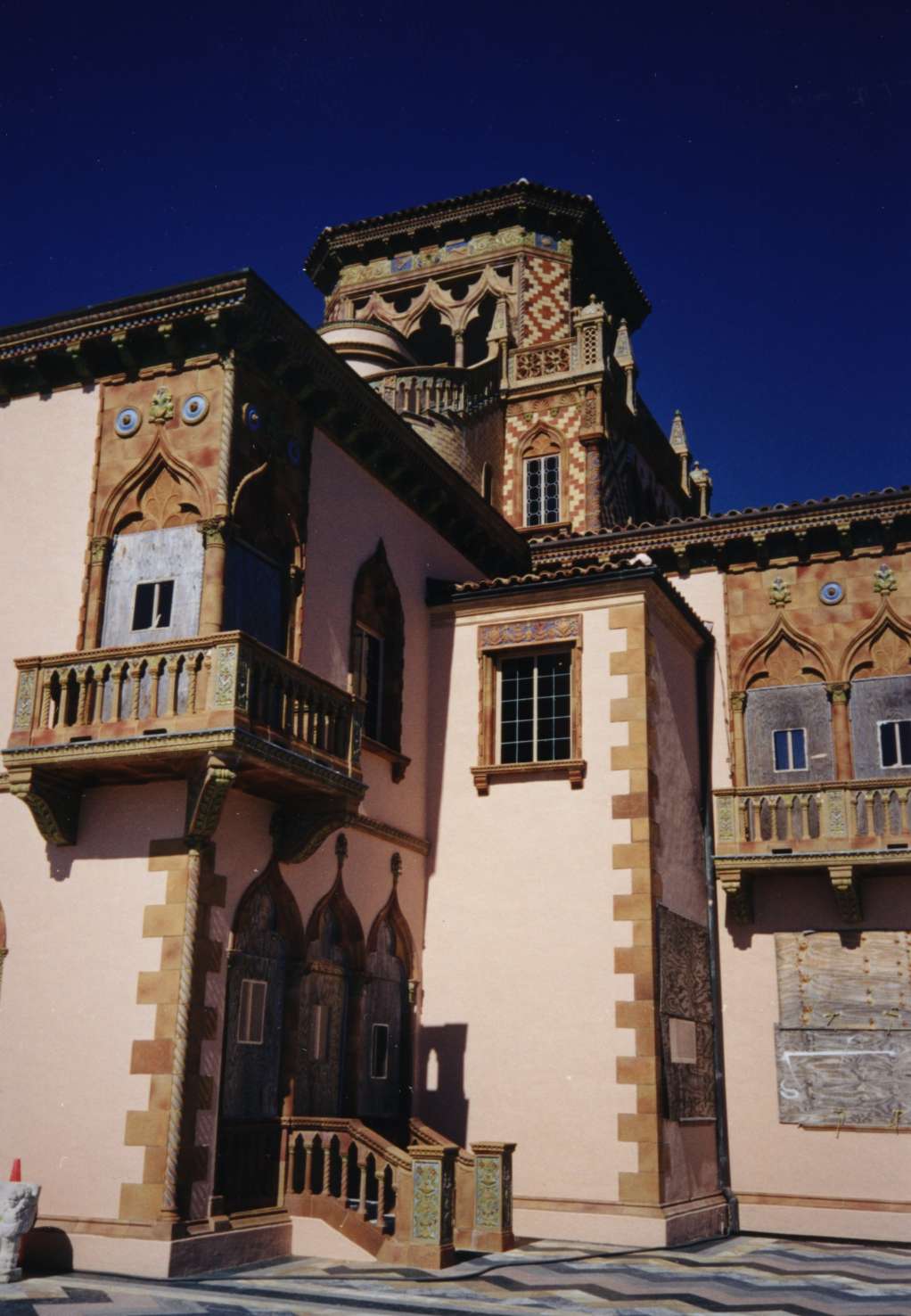
Caples'-Ringlings' Estates Historic District
Monument and historic site · National Register of Historic Places · 1.8 mi
Historic district in Florida, United States

Capt. W. F. Purdy House
Monument and historic site · National Register of Historic Places · 3.1 mi
Historic house in Florida, United States

Corrigan House
Monument and historic site · National Register of Historic Places · 2.2 mi
Historic home in Sarasota, Florida

Earle House
Monument and historic site · National Register of Historic Places · 2.5 mi
Listed on the NRHP in Sarasota County, Florida

Frank and Matilda Binz House
Monument and historic site · National Register of Historic Places · 2.2 mi
Historic house in Florida, United States

John M. Beasley House
Monument and historic site · National Register of Historic Places · 0.6 mi
Historic house near Sarasota, Florida, USA

Johnson Helm House
Monument and historic site · National Register of Historic Places · 3.1 mi
Historic house in Florida, United States

Kreissle Forge
Monument and historic site · National Register of Historic Places · 0.6 mi
Building in Florida, United States

Midway Subdivision Historic District
Monument and historic site · National Register of Historic Places · 1.2 mi
Historic district in Florida, United States
10 more on the map.
Parks, trails and playgrounds4



Marina @ Bayshore Gardens
Marina and boat launch · 1.5 mi
6919 26th Street West, Bradenton

Restaurants and cafes11




Subway
Fast food · Sandwich · 1.3 mi
8421 North Tamiami Trail, Sarasota
Mo-We 08:00-21:00; Th-Fr 08:00-21:30; Sa 08:00-21:00; Su 09:00-21:00
Where to stay7

Quality Inn Bradenton - Sarasota North
Motel and hotel · 1.0 mi
6727 14th Street West, Bradenton
History
Whitfield Estates was formerly a 682-acre (276 ha) wooded area that had been homesteaded by General John Riggin, aide-de-camp to Ulysses S. Grant. The property included the 218-acre (88 ha) bayfront estate of Alfred Ringling. In 1924, the property was purchased from Richard T. Ringling, son of Alfred, by a corporation called Whitfield Estates, Inc., held by Louis Broughton Whitfield, D. G. Haley, E. H. Price, and E. S. Delaplane Jr., who were from Alabama.
Louis Whitfield, a native of Montgomery, Alabama and president of the development, was founder and president of the Alaga Syrup Company and the W. W. Pickle Company. Many streets in the subdivision were named for the Whitfield family, including Broughton and Pearl. The original plan for Whitfield Estates called for a housing development, an 18-hole golf course, a hotel, a yacht basin, and man-made islands in the bay. Donald Ross was retained as the golf course architect. Sometime during late 1925 or very early into 1926, L. B. Whitfield abandoned the development and his interest was taken over by Adair Realty. In 1926, the developing neighborhood was incorporated as a city with E.S. Bond acting as mayor.
From the History section of Whitfield, Manatee County, Florida on Wikipedia, under CC BY-SA 4.0.
Churches and places of worship4
Shopping1
Gas and EV charging3
Schools, colleges and libraries45
Map of Whitfield
97 places. The map loads OpenStreetMap tiles when you open it.
Climate by month
Monthly table
| Month | High | Low | Rain |
|---|---|---|---|
| Jan | 72°F | 52°F | 2.8 in |
| Feb | 75°F | 55°F | 1.9 in |
| Mar | 78°F | 58°F | 2.9 in |
| Apr | 82°F | 63°F | 2.5 in |
| May | 88°F | 68°F | 2.6 in |
| Jun | 90°F | 74°F | 7.0 in |
| Jul | 91°F | 75°F | 7.4 in |
| Aug | 92°F | 75°F | 9.1 in |
| Sep | 90°F | 74°F | 6.0 in |
| Oct | 86°F | 68°F | 2.8 in |
| Nov | 80°F | 60°F | 1.8 in |
| Dec | 75°F | 55°F | 2.3 in |
U.S. Climate Normals 1991-2020 for Sarasota Bradenton Ap (1 mi away), NOAA NCEI.
People and cost of living
American Community Survey 5-year estimates, 2020-2024, U.S. Census Bureau. Estimates have margins of error, larger for small towns.
Disaster history
Manatee County has had 34 federal disaster declarations since 2000, most often for hurricanes.
- 2024-10-11: Hurricane Milton (Hurricane)
- 2024-10-07: Hurricane Milton (Hurricane)
- 2024-09-28: Hurricane Helene (Hurricane)
- 2024-09-24: Tropical Storm Helene (Tropical Storm)
- 2024-08-10: Hurricane Debby (Tropical Storm)
- 2024-08-03: Tropical Storm Debby (Tropical Storm)
OpenFEMA disaster declarations summaries.
Getting there and nearby towns
Sarasota-Bradenton International Airport (SRQ) is the nearest airport with scheduled flights listed in OpenStreetMap, 1 miles away.
- Bayshore Gardens 2 mi northwest, about 3 min by car
- South Bradenton 4 mi north, about 6 min by car
- West Samoset 4 mi north, about 7 min by car
- North Sarasota 4 mi southeast, about 7 min by car
- Desoto Lakes 4 mi southeast, about 7 min by car
- Sarasota 5 mi south, about 8 min by car
- Longboat Key 5 mi west, about 8 min by car
- Samoset 5 mi north, about 8 min by car
- Bradenton 6 mi north, about 9 min by car
- Kensington Park 6 mi southeast, about 9 min by car
Drive times are estimates from straight-line distance, not routes.
Local news
Headlines from INDB, the NEMICO news database.
Reviews, tips and questions
Loading what members have shared...
Sources and licences
- NCES EDGE (Public domain): public schools
- NOAA NCEI U.S. Climate Normals 1991-2020 (Public domain): climate by month
- OpenFEMA (Public domain): disaster declarations
- OpenStreetMap contributors (ODbL 1.0): places, airports, map data
- U.S. Census Bureau (Public domain): population, income, housing, education, commute
- Wikidata (CC0 1.0): elevation, founding date, time zone, website, landmarks and historic places
- Wikimedia Commons (see each image): photos
- Wikipedia (CC BY-SA 4.0): overview and history text
Photo credits
- Whitfield 1, Russwilkins, CC BY-SA 4.0
- Whitfield 2, Russwilkins, CC BY-SA 4.0
- Sarasota FL Whitfield Estates Lantana Ave 332-01, Ebyabe, CC BY-SA 3.0
- Sarasota FL Binz House01, Ebyabe, CC BY-SA 3.0
- Sarasota FL Stevens-Gilchrist House01, Ebyabe, CC BY-SA 3.0
- Sarasota FL Purdy House outside01, Ebyabe, CC BY-SA 3.0
- Sarasota FL Kreissle Forge01, Ebyabe, CC BY-SA 3.0
- Sarasota Ringling estate, Unknown author, CC BY-SA 3.0
- Sarasota FL Thoms House01, Ebyabe, CC BY-SA 3.0
- Sarasota FL Earle House01, Ebyabe, CC BY-SA 3.0
- Sarasota FL Bay Haven School01, Ebyabe, CC BY-SA 3.0
- Sarasota FL Souder House01, Ebyabe, CC BY-SA 3.0
- Sarasota FL Seagate Estate01, Ebyabe, CC BY-SA 3.0
- Sarasota FL Beasley House01, Ebyabe, CC BY-SA 3.0
- Sarasota FL Midway Subdivision HD01a, Ebyabe, CC BY-SA 3.0
- Sarasota FL Corrigan House01, Ebyabe, CC BY-SA 3.0
- Sarasota FL Bryson-Crane House01, Ebyabe, CC BY-SA 3.0
- Sarasota FL Whitfield Estates-Broughton St HD 7219-02, Ebyabe, CC BY-SA 3.0
- Sarasota FL Austin House01, Ebyabe, CC BY-SA 3.0
- Sarasota FL Overtown HD01, Ebyabe, CC BY-SA 3.0
- Sarasota FL Reid-Woods House01, Ebyabe, CC BY-SA 3.0
- Oneco FL Helm House01, Ebyabe, CC BY-SA 3.0
- Fuente de las Tortugas-John and Mable Ringling Museum of Art, Taty2007, CC BY 3.0
- Sarasota FL Classic Car msm02, Ebyabe, CC BY-SA 3.0
- CZ Lake, Rpgray, Public domain
- Austin House - Sarasota, Upstateherd, CC BY-SA 4.0
- Kreissle Forge - Sarasota, Upstateherd, CC BY-SA 4.0
- Sarasota-Bradenton International Airport (6762142747), redlegsfan21 from Vandalia, OH, United States, CC BY-SA 2.0
- MCAT Gillig bus March 2024, ElToAn123, CC BY-SA 4.0
- USF Sarasota, Alaska Miller, CC BY-SA 4.0
- USFcourtyard, Tommy2010, CC BY-SA 3.0
- SGLR Sarasota, Sanibel sun, CC BY-SA 4.0
- Chinese Creature, Hal Dunn, CC BY 3.0
- USDM Galant, OutlierForLife, CC BY 2.0


Page built October 30, 2026. Spotted a mistake? Tell us or suggest a place.