


Netrakona, Bangladesh
নেত্রকোণা
Netrakona is a town of 79,016 people in Mymensingh Division, Bangladesh.
Why visit Netrakona
Townapedia lists 2 museums and landmarks, 7 parks and trails, 10 places to eat, 4 places to stay and 2 attractions in and around town.
Highlights include Netrokona University.
Weather in Netrakona
Forecast from MET Norway (CC BY 4.0). Full forecast
About Netrakona
Netrokona (Bengali: নেত্রকোনা) is a major town and the district headquarters of Netrokona District in Mymensingh Division. It is the largest town and urban centre of Netrokona District.
From the Wikipedia article Netrokona (this version), under CC BY-SA 4.0.
Things to do2


Museums and landmarks2
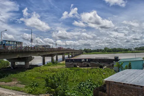



Parks, trails and playgrounds7

Netrokona jela Stadium
Sports field and stadium · 0.6 km
এন আকন্দ দাখিল মাদরাসা purbodola Road

Restaurants and cafes10

Salti Cafe & Resturant
Restaurant · Barbecue, Chinese, Indian, Ice Cream, Kebab, Asian, Thai


Where to stay4
Churches and places of worship18
Shopping4
Gas and EV charging2
Schools, colleges and libraries17
Netrokona Govt. College
School · 0.8 km
political science Netrokona purbodola Rode
Healthcare18
Map of Netrakona
84 places. The map loads OpenStreetMap tiles when you open it.
Getting there and nearby towns
M.A.G. Osmani International Airport (ZYL) is the nearest airport with scheduled flights listed in OpenStreetMap, 115 km away.
- Mymensingh 35 km southwest, about 35 min by car
- Bāghamāra 35 km north, about 35 min by car
- Ballabhpur 48 km southeast, about 48 min by car
- Ādampur 49 km southeast, about 49 min by car
- Kishorganj 50 km south, about 50 min by car
- Muktāgācha 49 km west, about 49 min by car
- Zaherpur 51 km southeast, about 51 min by car
- Gafargaon 53 km south, about 53 min by car
- Krishnapur 54 km southeast, about 54 min by car
- Jamālpur 79 km west, about 1 h 15 min by car
Drive times are estimates from straight-line distance, not routes.
Local news
Headlines from INDB.
Reviews, tips and questions
Loading what members have shared...
Sources and licences
- GeoNames (CC BY 4.0): population, coordinates, regions and time zone
- OpenStreetMap contributors (ODbL 1.0): places, airports, map data
- Openverse (see each image): photos
- Wikidata (CC0 1.0): elevation, founding date, time zone, website, landmarks and historic places
- Wikimedia Commons (see each image): photos
- Wikipedia (CC BY-SA 4.0): overview and history text
Photo credits
- Ashraf Ali Khan Khasru at Netrakona Govt. Mahila College (2), Anup Sadi, CC BY-SA 4.0
- Ashraf Ali Khan Khasru at Netrakona Govt. Mahila College, Anup Sadi, CC BY-SA 4.0
- Bangladesh Students Union 1, Anup Sadi, CC BY-SA 4.0
- Ekushey WikiShamabesh 2025, Mymensingh (3), Wikimedia Bangladesh, CC BY-SA 4.0
- Ekushey WikiShamabesh 2025, Mymensingh (2), Wikimedia Bangladesh, CC BY-SA 4.0
- Ekushey WikiShamabesh 2025, Mymensingh (1), Wikimedia Bangladesh, CC BY-SA 4.0
- Bangladesh Students Union 4, Anup Sadi, CC BY-SA 4.0
- Bangladesh Students Union 2, Anup Sadi, CC BY-SA 4.0
- Bangladesh Students Union 3, Anup Sadi, CC BY-SA 4.0
- Bangladesh Students Union 5, Anup Sadi, CC BY-SA 4.0
- Ashraf Ali Khan Khasru and Md. Sirajul Islam at Shahid Minar, Anup Sadi, CC BY-SA 4.0
- Graffiti in Netrokona, Bangladesh after July revolution 0912, Galib Tufan, CC BY 4.0
- Graffiti in Netrokona, Bangladesh after July revolution 0976, Galib Tufan, CC BY 4.0
- Graffiti in Netrokona, Bangladesh after July revolution 09778, Galib Tufan, CC BY 4.0
- Graffiti in Netrokona, Bangladesh after July revolution 0978, Galib Tufan, CC BY 4.0
- Graffiti in Netrokona, Bangladesh after July revolution 099, Galib Tufan, CC BY 4.0
- Graffiti in Netrokona, Bangladesh after July revolution 0967, Galib Tufan, CC BY 4.0
- Rose of Bangladesh, Salim_Khandoker, CC BY-SA 3.0
- Netrokona Circuit House, Salim Khandoker, CC BY-SA 4.0
- Tiles Mural, Salim_Khandoker, CC BY-SA 3.0
- Road in front of Netrokona Circuit House, Salim_Khandoker, CC BY-SA 3.0
- Netrokona Circuit House, Salim_Khandoker, CC BY-SA 3.0
- A road in Netrokona Municipality, Salim_Khandoker, CC BY-SA 3.0
- Geese, Salim_Khandoker, CC BY-SA 3.0
- Schumannianthus dichotomus ( মুর্তা), Salim_Khandoker, CC BY-SA 3.0
- Schumannianthus dichotomus ( মুর্তা), Salim_Khandoker, CC BY-SA 3.0
- Geese 13, Salim_Khandoker, CC BY-SA 3.0
- কংস,দেওটুকুন, Salim_Khandoker, CC0
- Imran1, Credits to Al Imran /Wikimedia Commons, CC BY-SA 4.0
- সন্ধ্যামালতী সাদা ফুল, ফ্যামিলি গার্ডেন, বনোয়াপাড়া, নেত্রকোণা সদর, তানিন, CC BY-SA 4.0
- Shambhuganj Bridge, Mymensingh, Topu Saha, CC BY-SA 2.0


Page built November 4, 2026. Spotted a mistake? Tell us or suggest a place.