


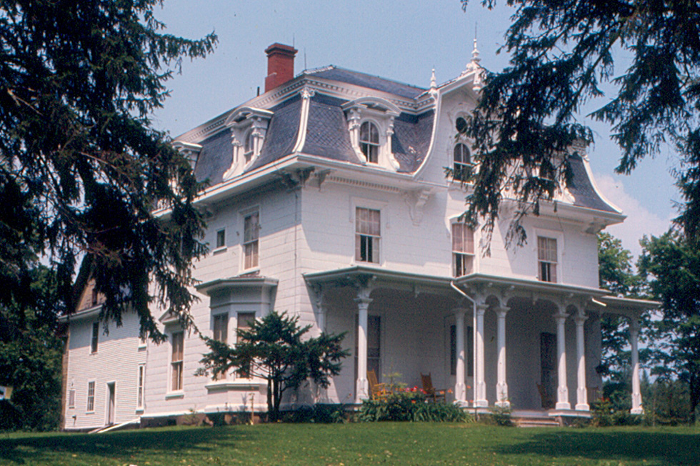


Why visit Belfast
Townapedia lists 29 museums and landmarks, 28 parks and trails, 35 places to eat, 10 places to stay and 6 attractions in and around town.
Highlights include Colonial Theater, Belfast Maskers, Bayside Historic District and Belfast Commercial Historic District.
July is the warmest month, with average highs of 77°F; January lows average 10°F, and about 72 inches of snow fall in a normal year.
Weather in Belfast
Forecast from the National Weather Service. Full forecast
About Belfast
Belfast is a city in Waldo County, Maine, United States. As of the 2020 census, the city population was 6,938. Located at the mouth of the Passagassawakeag River estuary on Belfast Bay and Penobscot Bay. Belfast is the county seat of Waldo County.
From the Wikipedia article Belfast, Maine (this version), under CC BY-SA 4.0.
Things to do6



Museums and landmarks29

Bayside Historic District
Monument and historic site · National Register of Historic Places · 4.3 mi
Historic district in Maine, United States

Belfast Commercial Historic District
Monument and historic site · National Register of Historic Places · 0.9 mi
Historic district in Belfast, Maine, United States

Belfast Historic District
Monument and historic site · National Register of Historic Places · 1.0 mi
Historic district in Belfast, Maine

Belfast National Bank
Monument and historic site · National Register of Historic Places · 0.9 mi
Bank building in Belfast, United States of America

Black Horse Tavern
Monument and historic site · National Register of Historic Places · 2.1 mi
Listed on the NRHP in Belfast

Capt. John McGilvery House
Monument and historic site · National Register of Historic Places · 5.9 mi
House in Searsport, Maine

Capt. John P. Nichols House
Monument and historic site · National Register of Historic Places · 5.9 mi
House in Searsport, Maine, United States
Capt. William McGilvery House
Monument and historic site · National Register of Historic Places · 6.0 mi
Historic house in Maine, United States

Carver Memorial Library
Monument and historic site · National Register of Historic Places · 5.6 mi
Library building in Searsport, Maine
Church Street Historic District
Monument and historic site · National Register of Historic Places · 1.1 mi
Historic district in Belfast, Maine
Cobe Estate
Monument and historic site · National Register of Historic Places · 4.6 mi
Historic house in Maine, United States


College Club Inn
Monument and historic site · National Register of Historic Places · 4.7 mi
Inn in Searsport, Maine
17 more on the map.
Parks, trails and playgrounds28




16 more on the map.
Restaurants and cafes35

Bay Wrap
Restaurant · Sandwich, Wrap · 1.0 mi
20 Beaver Street, Belfast
Mo-Fr 07:30-18:00; Sa 09:00-17:00

Belfast Co-op and Cafe
Cafe · Sandwich, Burger, Salad · 1.0 mi
123 High Street, Belfast
Mo-Su 07:30-20:00
Chase's Daily
Restaurant · American, Pastry, Sandwich, Salad · 1.0 mi
96 Main Street, Belfast
Mo 09:00-17:00; Tu-Sa 07:00-17:00; Su 08:00-14:00
Darby's
Restaurant · American, Burger, Salad, Sandwich, Seafood, Chicken, Soup · 0.9 mi
155 High Street
Mo-Su 11:30-21:00
Delvino's Grill & Pasta House
Restaurant · Italian · 1.0 mi
52 Main Street, Belfast
Mo-Sa 11:00-21:00; Su 11:00-20:00
Dockside Family Restaurant
Restaurant · American, Seafood · 1.1 mi
30 Main Street, Belfast
Tu-Th 11:00-19:00; Fr, Sa 11:00-20:00; Su 07:00-15:00
Harborwalk Restaurant and Front Street Pub
Restaurant · American, Burger, Seafood · 1.0 mi
37 Front Street, Belfast
Mo-Fr 11:00-21:00; Sa 07:00-21:00; Su 08:00-21:00

Pulling Corks Wine Bar & Shop
Bar and pub · Pastry · 1.0 mi
31 Pendleton Street
Th-Fr,Sa-Su,Mo 16:00-21:00
Rice&Noodle Thai Restaurant
Restaurant · Thai · 2.4 mi
160 Searsport Avenue, Belfast
Mo 11:30-21:00, Tu-Su 11:00-21:00
23 more on the map.
History
About 1720, General Samuel Waldo of Boston bought the Muscongus Patent, which had evolved into outright ownership of the land, and was thereafter known as the Waldo Patent.
Waldo died in 1759, and his heirs would sell the plantation of Passagassawakeag (named after its river) to 35 Scots-Irish proprietors from Londonderry, New Hampshire.
Renamed after Belfast, then the principal port of embarkation for emigrants from the north of Ireland, it was settled in 1770, and incorporated as a town in 1773. The village was mostly abandoned during the Revolution while British forces occupied Bagaduce (now Castine).
The British military burned Belfast in 1779, then held it for five days in September 1814 during the War of 1812.
Following the war, the seaport rebuilt and thrived. It was a port of entry, and designated county seat of Waldo County in 1827, although land would be set off in 1845 to form part of Searsport. Belfast was incorporated on August 17, 1850, as a city, the 8th in Maine, adopting its charter on April 3, 1852.
It developed into a shipbuilding center, producing hundreds of three, four and five masted schooners. Materials for wooden boat construction were shipped down the Penobscot River from Bangor, the lumber capital of North America during the later 19th century.
From the History section of Belfast, Maine on Wikipedia, under CC BY-SA 4.0.
Where to stay10
Colonial Gables Oceanfront Village
Motel and hotel · 2.8 mi
7 Eagle Avenue, Belfast
Churches and places of worship10
First Church of Belfast
Church · National Register of Historic Places · 0.9 mi
Saint Francis of Assisi Catholic Church
Church · Roman Catholic · 1.2 mi
81 Court Street, Belfast
Shopping20
Gas and EV charging3
Schools, colleges and libraries15
Captain Albert W. Stevens Elementary School
School · 0.8 mi
31 Elementary Avenue, Belfast
Healthcare3
Map of Belfast
159 places. The map loads OpenStreetMap tiles when you open it.
Climate by month
Monthly table
| Month | High | Low | Rain | Snow |
|---|---|---|---|---|
| Jan | 30°F | 10°F | 3.9 in | 19.2 in |
| Feb | 32°F | 12°F | 3.2 in | 22.4 in |
| Mar | 40°F | 20°F | 4.1 in | 11.7 in |
| Apr | 52°F | 31°F | 4.4 in | 2.2 in |
| May | 63°F | 41°F | 3.9 in | 0.0 in |
| Jun | 72°F | 50°F | 4.3 in | 0.0 in |
| Jul | 77°F | 57°F | 3.2 in | 0.0 in |
| Aug | 76°F | 56°F | 3.1 in | 0.0 in |
| Sep | 70°F | 48°F | 4.1 in | 0.0 in |
| Oct | 57°F | 38°F | 5.4 in | 0.3 in |
| Nov | 46°F | 29°F | 4.7 in | 2.5 in |
| Dec | 35°F | 18°F | 4.7 in | 13.2 in |
U.S. Climate Normals 1991-2020 for Belfast (3 mi away), NOAA NCEI.
People and cost of living
American Community Survey 5-year estimates, 2020-2024, U.S. Census Bureau. Estimates have margins of error, larger for small towns.
Disaster history
Waldo County has had 18 federal disaster declarations since 2000, most often for severe storms.
- 2024-03-20: Severe Storms And Flooding (Severe Storm)
- 2024-01-30: Severe Storm And Flooding (Severe Storm)
- 2023-09-14: Hurricane Lee (Hurricane)
- 2023-07-06: Severe Storm And Flooding (Flood)
- 2023-03-22: Severe Storm And Flooding (Severe Storm)
- 2022-03-15: Severe Storm And Flooding (Coastal Storm)
OpenFEMA disaster declarations summaries.
Getting there and nearby towns
Knox County Regional Airport (RKD) is the nearest airport with scheduled flights listed in OpenStreetMap, 25 miles away.
- Searsport 6 mi northeast, about 10 min by car
- Castine 11 mi east, about 18 min by car
- Camden 15 mi south, about 24 min by car
- Bucksport 16 mi northeast, about 26 min by car
- Winterport 17 mi northeast, about 28 min by car
- Rockland 21 mi south, about 35 min by car
- Bangor 30 mi northeast, about 49 min by car
- Waterville 32 mi west, about 52 min by car
- Orono 35 mi northeast, about 57 min by car
- Augusta 36 mi west, about 57 min by car
Drive times are estimates from straight-line distance, not routes.
Local news
Headlines from INDB, the NEMICO news database.
Reviews, tips and questions
Loading what members have shared...
Sources and licences
- NCES EDGE (Public domain): public schools
- NOAA NCEI U.S. Climate Normals 1991-2020 (Public domain): climate by month
- OpenFEMA (Public domain): disaster declarations
- OpenStreetMap contributors (ODbL 1.0): places, airports, map data
- U.S. Census Bureau (Public domain): population, income, housing, education, commute
- Wikidata (CC0 1.0): elevation, founding date, time zone, website, landmarks and historic places
- Wikimedia Commons (see each image): photos
- Wikipedia (CC BY-SA 4.0): overview and history text
Photo credits
- Belfast, Maine, Unknown author, CC BY-SA 3.0
- Captain John McGilvery House, Jim Roberts, CC BY-SA 4.0
- Schooner Timberwind, Mary Petersen from Danielson, CT, USA, CC BY 2.0
- William McGilvery House, Searsport, Maine, Roger Wollstadt from Sarasota, Florida, U.S.A., CC BY-SA 2.0
- The First Church of Belfast, Maine, Doug Kerr, CC BY-SA 2.0
- JamesWhiteHouseBelfastME, Cervin Robinson, HABS Survey, Public domain
- SearsportME NicholsHouse, Doug Kerr, CC BY-SA 2.0
- BelfastME FormerCustomHouse, Doug Kerr, CC BY-SA 2.0
- A fascinating building at the main crossroads in Belfast Maine, Haydn Blackey, CC BY-SA 2.0
- Hayford Block, Belfast, Maine, Doug Kerr from Albany, NY, United States, CC BY-SA 2.0
- Carver Memorial Library, Jim Roberts, CC BY-SA 4.0
- UnionHall (Searsport, Maine), Jim Roberts, CC BY-SA 4.0
- Belfast National Bank building, Belfast, Maine, Doug Kerr from Albany, NY, United States, CC BY-SA 2.0
- James G. Pendleton House, Jim Roberts, CC BY-SA 4.0
- SearsportME HistoricDistrictHousing, Doug Kerr, CC BY-SA 2.0
- Black Horse Tavern, Belfast, Allen L. Hubbard, Public domain
- College Club Inn, Jim Roberts, CC BY-SA 4.0
- Old Masonic Temple, Belfast, Maine, Doug Kerr from Albany, NY, United States, CC BY-SA 2.0


Page built October 30, 2026. Spotted a mistake? Tell us or suggest a place.