


Benton, Arkansas
Benton is a city of 36,595 people in Saline County, Arkansas, founded in 1833.
Why visit Benton
Townapedia lists 19 museums and landmarks, 5 parks and trails, 44 places to eat, 8 places to stay and 3 attractions in and around town.
Highlights include Old Benton-Sardis Road Bridge, Old River Bridge, Andrew Hunter House and Benton Commercial Historic District.
July is the warmest month, with average highs of 93°F; January lows average 31°F.
Weather in Benton
Forecast from the National Weather Service. Full forecast
About Benton
Benton is a city in and the county seat of Saline County, Arkansas, United States. A suburb of Little Rock, it was established in 1837. At the 2020 census, the city had a population of 35,014, making it the 12th most populous city in Arkansas. It is part of the Little Rock-North Little Rock-Conway metropolitan area.
From the Wikipedia article Benton, Arkansas (this version), under CC BY-SA 4.0.
Things to do3

Old Benton-Sardis Road Bridge
Bridge · National Register of Historic Places · 4.1 mi
Bridge in Bauxite, Arkansas
Old River Bridge
Bridge · National Register of Historic Places · 3.2 mi
Bridge in Benton, Arkansas

Museums and landmarks19
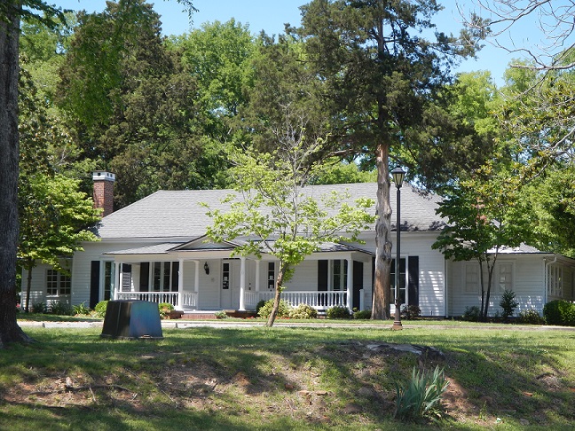
Andrew Hunter House
Monument and historic site · National Register of Historic Places · 5.4 mi
Historic house Arkansas Highway 5, a short way east of its junction with Arkansas Highway 183 in Bryant, Arkansas
Benton Commercial Historic District
Monument and historic site · National Register of Historic Places · 1.2 mi
Historic district in Arkansas, United States
Charles "Bullet" Dean Hyten House
Monument and historic site · National Register of Historic Places · 1.3 mi
Historic house in Arkansas, United States
Dr. James Wyatt Walton House
Monument and historic site · National Register of Historic Places · 1.3 mi
Historic house in Arkansas, United States

Dr. T.E. Buffington House
Monument and historic site · National Register of Historic Places · 1.4 mi
Historic house in Arkansas, United States
Gann Building
Museum · National Register of Historic Places · 1.4 mi
Historic building and museum in Benton, Arkansas

Gann House
Monument and historic site · National Register of Historic Places · 1.4 mi
Historic house in Arkansas, United States

Gann Row Historic District
Monument and historic site · National Register of Historic Places · 1.5 mi
Historic district in Arkansas, United States

Hester-Lenz House
Monument and historic site · National Register of Historic Places · 2.5 mi
Historic house in Arkansas, United States
Independent Order of Odd Fellows Building
Monument and historic site · National Register of Historic Places · 1.2 mi
Building in Arkansas, United States


J. W. and Ann Lowe Clary House
Monument and historic site · National Register of Historic Places · 1.1 mi
Historic house in Arkansas, United States
Royal Theatre
Monument and historic site · National Register of Historic Places · 1.3 mi
Movie theater in Benton, Arkansas, United States
7 more on the map.
Parks, trails and playgrounds5

Restaurants and cafes44

Tacos 4 Life
Restaurant · Tacos · 3.1 mi
7821 Alcoa Road, Benton
Mo-Th 11:00-21:00; Fr-Sa 11:00-22:00; Su closed


Carmelita's Mexican Diner
Restaurant · Mexican
1415 Military Road, Benton
Blue Haven Restaurant & Bar
Diner · American · 2.5 mi
15228 I-30 Frontage Road, Benton
La Hacienda de Benton
Restaurant · Mexican · 0.4 mi
17401 I-30 Frontage Road, Benton
32 more on the map.
History
Early industry in Benton included a salt works opened in 1827, pottery making from local deposits of kaolin beginning around 1900, and logging and furniture making from surrounding timber. It had a racetrack preceding Oaklawn as early as 1838.
From the History section of Benton, Arkansas on Wikipedia, under CC BY-SA 4.0.
Where to stay8
Churches and places of worship39
First Christian Church of Benton
Church · Disciples Of Christ · 1.6 mi
16218 I- 30 Service Road, Benton
First Lutheran Church of Benton
Church · Lutheran · 0.5 mi
18181 I- 30 Service Road, Benton
Our Lady of Fatima Catholic Church
Church · Roman Catholic · 1.5 mi
900 West Cross Street, Benton
Seventh-Day Adventist Church
Church · Seventh Day Adventist · 0.8 mi
2615 Lincoln Road, Benton
Holland Chapel Baptist Church
Church · Baptist · 2.2 mi
15523 I-30 Frontage Road, Benton
Shopping10
Gas and EV charging15
Schools, colleges and libraries28
Healthcare3
Map of Benton
174 places. The map loads OpenStreetMap tiles when you open it.
Climate by month
Monthly table
| Month | High | Low | Rain | Snow |
|---|---|---|---|---|
| Jan | 52°F | 31°F | 3.8 in | 0.6 in |
| Feb | 57°F | 34°F | 4.2 in | 0.4 in |
| Mar | 66°F | 41°F | 5.0 in | 0.3 in |
| Apr | 74°F | 50°F | 5.6 in | 0.0 in |
| May | 82°F | 60°F | 5.2 in | 0.0 in |
| Jun | 89°F | 69°F | 3.9 in | 0.0 in |
| Jul | 93°F | 72°F | 4.2 in | 0.0 in |
| Aug | 93°F | 71°F | 3.5 in | 0.0 in |
| Sep | 87°F | 63°F | 3.8 in | 0.0 in |
| Oct | 76°F | 51°F | 4.4 in | 0.0 in |
| Nov | 64°F | 40°F | 4.8 in | 0.0 in |
| Dec | 55°F | 33°F | 4.9 in | 0.0 in |
U.S. Climate Normals 1991-2020 for Benton (2 mi away), NOAA NCEI.
People and cost of living
American Community Survey 5-year estimates, 2020-2024, U.S. Census Bureau. Estimates have margins of error, larger for small towns.
Disaster history
Saline County has had 17 federal disaster declarations since 2000, most often for severe storms.
- 2026-01-24: Severe Winter Storm (Winter Storm)
- 2025-05-21: Severe Storms, Tornadoes, And Flooding (Flood)
- 2025-04-05: Severe Storms, Tornadoes, And Flooding (Severe Storm)
- 2020-08-27: Hurricane Laura (Hurricane)
- 2020-04-03: Covid-19 Pandemic (Biological)
- 2020-03-13: Covid-19 (Biological)
OpenFEMA disaster declarations summaries.
Getting there and nearby towns
Bill and Hillary Clinton National Airport (LIT) is the nearest airport with scheduled flights listed in OpenStreetMap, 22 miles away.
- Bryant 5 mi northeast, about 9 min by car
- Little Rock 16 mi northeast, about 26 min by car
- Malvern 20 mi southwest, about 32 min by car
- Maumelle 21 mi northeast, about 34 min by car
- Hot Springs Village 23 mi west, about 37 min by car
- North Little Rock 24 mi northeast, about 38 min by car
- Hot Springs 28 mi west, about 45 min by car
- Sherwood 28 mi northeast, about 45 min by car
- Jacksonville 33 mi northeast, about 52 min by car
- Conway 35 mi north, about 56 min by car
Drive times are estimates from straight-line distance, not routes.
Local news
Headlines from INDB, the NEMICO news database.
Reviews, tips and questions
Loading what members have shared...
Sources and licences
- NCES EDGE (Public domain): public schools
- NOAA NCEI U.S. Climate Normals 1991-2020 (Public domain): climate by month
- OpenFEMA (Public domain): disaster declarations
- OpenStreetMap contributors (ODbL 1.0): places, airports, map data
- U.S. Census Bureau (Public domain): population, income, housing, education, commute
- Wikidata (CC0 1.0): elevation, founding date, time zone, website, landmarks and historic places
- Wikimedia Commons (see each image): photos
- Wikipedia (CC BY-SA 4.0): overview and history text
Photo credits
- Saline County Courthouse (Benton, Arkansas), User:Rmcclen . Original uploader was Rmcclen at en.wikipedia, Public domain
- Old Benton-Sardis Road Bridge, Valis55, CC BY-SA 4.0
- Benton Commercial Historic District, South St., Benton, AR, Marlo B. Krueger, CC BY-SA 3.0
- Dr. James Wyatt Walton House, Sevier St., Benton, AR, Marlo B. Krueger, CC BY-SA 3.0
- Hyten House, Main St., Benton, AR, Marlo B. Krueger, CC BY-SA 3.0
- Gann Building, Market St., Benton, AR, Marlo B. Krueger, CC BY-SA 3.0
- DR. T. E. BUFFINGTON HOUSE, BENTON, SALINE COUNTY, AR, JERRYE & ROY KLOTZ M.D., CC BY-SA 4.0
- Clary House, East St., Benton, AR, Marlo B. Krueger, CC BY-SA 3.0
- Gann House, Market St., Benton, AR, Marlo B. Krueger, CC BY-SA 3.0
- Hunter-Dearborn House, Hwy 5N, Bryant, AR, Marlo B. Krueger, CC BY-SA 3.0
- Gann Row Historic District, Market St., Benton, AR, Marlo B. Krueger, CC BY-SA 3.0
- Brown's Purple Flowers (4535550873), BFS Man from Webster, TX, USA, CC BY 2.0
- Saline County Courthouse, miketnorton, CC BY 2.0
- Saline County Courthouse, Christmas 2011, Svomike, CC BY-SA 3.0
- ISS067-E-265675 - View of Earth, Earth Science and Remote Sensing Unit , Lyndon B. Johnson Space Center, Public domain
- ISS060-E-966 - View of Earth, Earth Science and Remote Sensing Unit, NASA Johnson Space Center, Public domain
- Old River Bridge, Louise T. Taft, Public domain
- Rucker House, Bauxite, AR, Valis55, CC BY-SA 4.0


Page built October 30, 2026. Spotted a mistake? Tell us or suggest a place.