


Berwyn, Illinois
Berwyn is a city of 55,595 people in Cook County, Illinois, founded in 1908.
Why visit Berwyn
Townapedia lists 63 museums and landmarks, 68 parks and trails, 142 places to eat, 3 places to stay and 1 attraction in and around town.
Highlights include Classic Cinemas North Riverside Luxury 6 Theatre, Oak Park Conservatory, American State Bank and Riverside Golf Club.
July is the warmest month, with average highs of 85°F; January lows average 19°F.
Weather in Berwyn
Forecast from the National Weather Service. Full forecast
About Berwyn
Berwyn () is a suburban city in Cook County, Illinois, United States. It is coterminous with Berwyn Township, which was formed in 1908 after breaking off from Cicero Township. As of the 2020 census, the city had a total population of 57,250. It is part of the Chicago metropolitan area.
From the Wikipedia article Berwyn, Illinois (this version), under CC BY-SA 4.0.
Things to do1

Classic Cinemas North Riverside Luxury 6 Theatre
Cinema and theater · 1.0 mi
7501 Cermak Road, North Riverside
Museums and landmarks63

Oak Park Conservatory
Monument and historic site · National Register of Historic Places · 1.9 mi
United States historic place
615 Garfield Street, Oak Park

American State Bank
Monument and historic site · National Register of Historic Places · 0.5 mi
Historic bank building in Berwyn, Illinois, United States

Anton Cermak House
Monument and historic site · National Register of Historic Places · 3.9 mi
House in Chicago, Illinois

Arcade Building
Monument and historic site · National Register of Historic Places · 1.8 mi
Historic building in Riverside, Illinois, United States

Arthur Heurtley House
Monument and historic site · National Register of Historic Places · 3.4 mi
House in the Chicago suburb of Oak Park, Illinois, United States

Arthur J. Dunham House
Monument and historic site · National Register of Historic Places · 0.8 mi
Historic house in Berwyn, Illinois

Austin Historic District
Monument and historic site · National Register of Historic Places · 3.2 mi
Residential historic district in central Austin, Chicago, Illinois
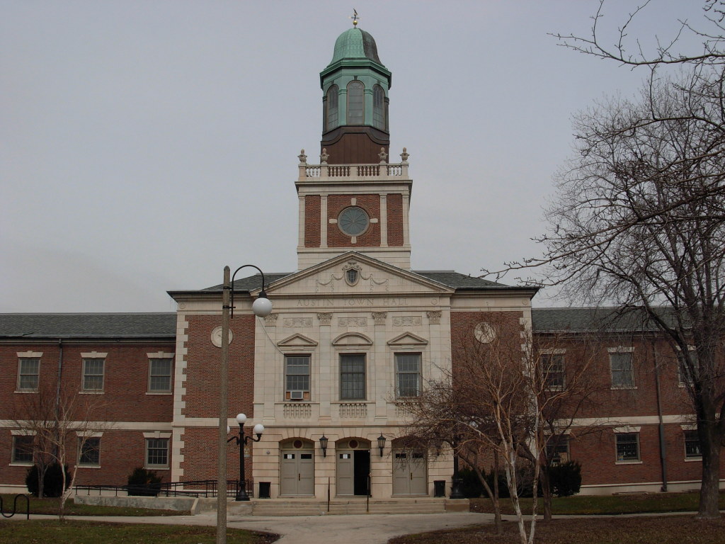
Austin Town Hall Park Historic District
Monument and historic site · National Register of Historic Places · 3.4 mi
Park and historic district in the Austin neighborhood of Chicago, Illinois
Baptist Retirement Home
Monument and historic site · National Register of Historic Places · 3.7 mi
Retirement home in Maywood, Illinois
Benda House
Monument and historic site · National Register of Historic Places · 1.2 mi
Historic house in Illinois, United States

Berwyn Health Center
Monument and historic site · National Register of Historic Places
Historic public health clinic at 6600 W. 26th Street in Berwyn, Illinois
Berwyn Municipal Building
Monument and historic site · National Register of Historic Places
Building in Illinois, United States
51 more on the map.
Parks, trails and playgrounds68





56 more on the map.
Restaurants and cafes142

Autre Monde Cafe
Restaurant · Mediterranean · 1.5 mi
6727 West Roosevelt Road, Berwyn
Tu-Th 17:00-21:30; Fr-Sa 17:00-22:30; Su 17:00-20:30

Baskin-Robbins
Ice cream · Ice Cream · 1.7 mi
5600 West 16th Street, Cicero
Mo-Sa 04:30-22:00; Su 05:00-22:00
Di’vino
Restaurant · Mediterranean, Italian · 1.3 mi
1527 South Harlem Avenue, Forest Park
Mo-Th 16:00-21:00; Fr 16:00-22:00; Sa-Su 11:00-23:00
Hacienda Calavera
Restaurant · Mexican · 1.6 mi
5503 West Cermak Road, Cicero
Tu 17:00-23:00; We 17:00-22:00; Th 17:00-22:00; Fr 17:00-24:00; Sa...


James Joyce Irish Pub
Bar and pub · 1.0 mi
7138 Windsor Avenue, Berwyn
Su-Th 12:00-01:00; Fr-Sa 11:00-03:00
130 more on the map.
History
Before being settled, the land that is now Berwyn was traversed by Native American trails. The most important trails converged near the Chicago portage, and two notable routes crossed what is today Berwyn. A branch of the Trail to Green Bay crossed Berwyn at what is now Riverside Drive, and the Ottawa Trail spanned the southern end of the city.
In 1846, the first land in "Berwyn" was deeded to Theodore Doty, who built the 8-foot-wide (2.4 m) plank road from Chicago to Ottawa along the Ottawa Trail. The trail had been used as a French and Indian trade route and more recently as a stagecoach route to Lisle. This thoroughfare, then known as Old Plank Road, became what is now Ogden Avenue in South Berwyn. In 1856, Thomas F. Baldwin purchased 347 acres (1.40 km2) of land, bordered by what is now Ogden Avenue, Ridgeland Avenue, 31st Street, and Harlem Avenue, in hopes of developing a rich and aristocratic community called "LaVergne". However, few people were interested in grassy marshland. Mud Lake extended nearly to the southern border of today's Berwyn, and the land regularly flooded during heavy rains. The only mode of transportation to LaVergne was horse and buggy on the Plank Road.
From the History section of Berwyn, Illinois on Wikipedia, under CC BY-SA 4.0.
Where to stay3
Churches and places of worship61
St. George Antiochian Orthodox Church
Church · Eastern Orthodox · 1.7 mi
1220 South 60th Court, Cicero
Fiftyeighth Avenue Baptist Church
Church · Baptist · 1.2 mi
South 58th Avenue, Cicero
First United Church of Christ
Church · United Church Of Christ · 1.9 mi
Elgin Avenue, Forest Park
Shopping30
North Riverside Park Mall
Shopping center · 1.1 mi
7501 Cermak Road, North Riverside
Gas and EV charging35
Schools, colleges and libraries96
Morton Freshman Center
School · 1.8 mi
1801 South 55th Avenue, Cicero
Healthcare19
Loyola Medical Group - Multispecialty Riverside
Clinic and pharmacy · 1.5 mi
3722 South Harlem Avenue, Riverside
Pilsen Wellness Center
Clinic and pharmacy · 0.4 mi
2600 Ridgeland Avenue, Berwyn
Morton East Adolescent Health Center
Clinic and pharmacy · 0.9 mi
2423 South Austin Boulevard, Cicero
Map of Berwyn
250 places. The map loads OpenStreetMap tiles when you open it.
Climate by month
Monthly table
| Month | High | Low | Rain |
|---|---|---|---|
| Jan | 33°F | 19°F | 1.5 in |
| Feb | 37°F | 23°F | 1.5 in |
| Mar | 48°F | 32°F | 1.9 in |
| Apr | 60°F | 41°F | 3.6 in |
| May | 71°F | 52°F | 4.1 in |
| Jun | 81°F | 62°F | 4.0 in |
| Jul | 85°F | 68°F | 3.5 in |
| Aug | 83°F | 66°F | 4.0 in |
| Sep | 76°F | 59°F | 2.8 in |
| Oct | 63°F | 46°F | 3.5 in |
| Nov | 49°F | 35°F | 2.4 in |
| Dec | 38°F | 25°F | 1.8 in |
U.S. Climate Normals 1991-2020 for Chicago Midway Ap 72534 (4 mi away), NOAA NCEI.
People and cost of living
American Community Survey 5-year estimates, 2020-2024, U.S. Census Bureau. Estimates have margins of error, larger for small towns.
Disaster history
Cook County has had 12 federal disaster declarations since 2000, most often for severe storms.
- 2024-09-20: Severe Storms, Tornadoes, Straight-Line Winds, And Floodng (Flood)
- 2023-11-20: Severe Storms And Flooding (Flood)
- 2023-08-15: Severe Storms And Flooding (Severe Storm)
- 2020-03-26: Covid-19 Pandemic (Biological)
- 2020-03-13: Covid-19 (Biological)
- 2013-05-10: Severe Storms, Straight-Line Winds, And Flooding (Flood)
OpenFEMA disaster declarations summaries.
Getting there and nearby towns
Chicago Midway International Airport (MDW) is the nearest airport with scheduled flights listed in OpenStreetMap, 4 miles away.
- Chicago 5 mi east, about 9 min by car
- Bellwood 5 mi northwest, about 8 min by car
- Bensenville 11 mi northwest, about 18 min by car
- Alsip 12 mi south, about 20 min by car
- Addison 13 mi northwest, about 21 min by car
- Bloomingdale 17 mi northwest, about 27 min by car
- Naperville 20 mi west, about 32 min by car
- Arlington Heights 20 mi northwest, about 32 min by car
- Bartlett 21 mi west, about 35 min by car
- Aurora 26 mi west, about 42 min by car
Drive times are estimates from straight-line distance, not routes.
Local news
Headlines from INDB, the NEMICO news database.
Reviews, tips and questions
Loading what members have shared...
Sources and licences
- NCES EDGE (Public domain): public schools
- NOAA NCEI U.S. Climate Normals 1991-2020 (Public domain): climate by month
- OpenFEMA (Public domain): disaster declarations
- OpenStreetMap contributors (ODbL 1.0): places, airports, map data
- U.S. Census Bureau (Public domain): population, income, housing, education, commute
- Wikidata (CC0 1.0): elevation, founding date, time zone, website, landmarks and historic places
- Wikimedia Commons (see each image): photos
- Wikipedia (CC BY-SA 4.0): overview and history text
Photo credits
- Berwyn Municipal Building, Teemu08, CC BY-SA 3.0
- Greetings from Berwyn, Illinois - Large Letter Postcard (4237436798), Steve Shook from Moscow, Idaho, USA, CC BY 2.0
- Berwyn City Hall, Milos Necas, CC0
- The Berwyn Hotel 2020, Tdl1060, CC BY-SA 4.0
- The Berwyn Hotel - 2017, Tdl1060, CC BY-SA 4.0
- The Berwyn Hotel - 2019, Tdl1060, CC BY-SA 4.0
- Berwyn Hotel 2017 from SW, Tdl1060, CC BY-SA 4.0
- 19990905 19 BNSF Berwyn, IL (6711951881), David Wilson from Oak Park, Illinois, USA, CC BY 2.0
- BNSF Berwyn, IL, David Wilson from Oak Park, Illinois, USA, CC BY 2.0
- 19990905 22 BNSF Amtrak Berwyn, IL (6711952425), David Wilson from Oak Park, Illinois, USA, CC BY 2.0
- 19990905 21 BNSF Berwyn, IL (6711952145), David Wilson from Oak Park, Illinois, USA, CC BY 2.0
- 20130406 07 Metra Pub Crawl @ George's Tavern in Berwyn, David Wilson from Oak Park, Illinois, USA, CC BY 2.0
- 20031130 03 BNSF Berwyn, IL (6670529021), David Wilson from Oak Park, Illinois, USA, CC BY 2.0
- 20171205 01 Two Sons Restaurant, Berwyn, Illinois (49611434863), David Wilson from Oak Park, Illinois, USA, CC BY 2.0
- 20110903 01 BNSF Berwyn, Illinois (6888840107), David Wilson from Oak Park, Illinois, USA, CC BY 2.0
- 20160624 03 BNSF Berwyn, Illinois (39228745031), David Wilson from Oak Park, Illinois, USA, CC BY 2.0
- 20170720 20 Metra BNSF Berwyn, Illinois (44195883815), David Wilson from Oak Park, Illinois, USA, CC BY 2.0
- 19981019 03 BNSF Berwyn, IL (6551961091), David Wilson from Oak Park, Illinois, USA, CC BY 2.0
- Oak Park Il Conservatory1, IvoShandor, CC BY 2.5
- Austintownhallfront, Steven Kevil, Public domain
- William Drummond House, Teemu08 at en.wikipedia, CC BY-SA 3.0
- Oak Park Il Heurtley House4, IvoShandor, CC BY 2.5
- Harry H Nichols House 2012-09-05 1, JPSousa, CC BY-SA 3.0
- Arcade Building in 2011, partway through restoration - Riverside, IL, David Wilson from Oak Park, Illinois, USA, Public domain
- Austin Historic District 2, Thshriver, CC BY-SA 3.0
- Oak Park Il Mrs. Gale House4, IvoShandor, CC BY 2.5
- Haymarket Martyr's Memorial, Zol87 from Chicago, IL, USA, CC BY-SA 3.0
- OldBrookfieldStation, Teemu08 at en.wikipedia, CC BY-SA 3.0
- Oak Park Il Balch House2, IvoShandor, CC BY 2.5
- The Akin House, Boscophotos, CC BY-SA 3.0
- Shedd Park Fieldhouse, Arturo Duarte Jr., CC BY-SA 3.0
- Gunderson HD, Teemu08 at en.wikipedia, CC BY-SA 3.0
- Oak Park Il Unity Temple9, IvoShandor, CC BY 2.5
- Image Cermack House, Boscophotos, CC BY-SA 3.0
- Arthur J. Dunham House, Berwyn, IL, ChicagoGeek, CC BY-SA 2.0
- Berwyn Health Center, Teemu08, CC BY-SA 3.0
- Frank Lloyd Wright Home and Studio (west side zoom), John Delano, Attribution
- Mads C Larson House 2012-09-05 1, JPSousa, CC BY-SA 3.0
- Image 6727 Riverside, Boscophotos, CC BY-SA 3.0
- CN SD75IACC locomotive August 2025, G Pei, Public domain


Page built October 30, 2026. Spotted a mistake? Tell us or suggest a place.