
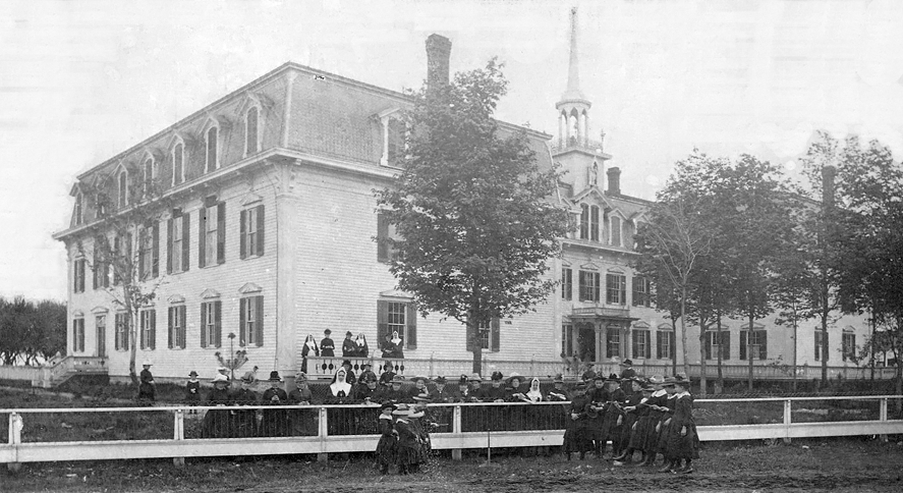


Bourbonnais, Illinois
Bourbonnais is a village of 18,078 people in Kankakee County, Illinois, founded in 1832.
Why visit Bourbonnais
Townapedia lists 8 museums and landmarks, 19 parks and trails, 40 places to eat, 11 places to stay and 1 attraction in and around town.
Highlights include Cinemark Movies 10, Kankakee, Kankakee County Courthouse and Lils Park.
July is the warmest month, with average highs of 85°F; January lows average 16°F, and about 21 inches of snow fall in a normal year.
Weather in Bourbonnais
Forecast from the National Weather Service. Full forecast
About Bourbonnais
Bourbonnais is a village in Kankakee County, Illinois, United States. The population was 18,164 at the 2020 census.
From the Wikipedia article Bourbonnais, Illinois (this version), under CC BY-SA 4.0.
Things to do1

Museums and landmarks8

Kankakee
Monument and historic site · National Register of Historic Places · 4.4 mi
Amtrak station in the Illinois city

Kankakee County Courthouse
Monument and historic site · National Register of Historic Places · 4.5 mi
Local government building in the United States

Kankakee Downtown Historic District
Monument and historic site · National Register of Historic Places · 4.4 mi
Historic district in Kankakee, Illinois

Lemuel Milk Carriage House
Monument and historic site · National Register of Historic Places · 4.3 mi
Historic building in Kankakee, Illinois

Pope Brace Company Building
Monument and historic site · National Register of Historic Places · 4.4 mi
Industrial building in Kankakee, Illinois


Durham–Perry Farmstead
Monument and historic site · National Register of Historic Places · 2.3 mi

Parks, trails and playgrounds19


7 more on the map.
Restaurants and cafes40

Burgers & Beer
Restaurant · Burger, Chicken, Sandwich, Grill · 2.8 mi
Founded in 2013, Burgers & Beer has become a culinary staple in Bradley, IL, that serves the wider Kankakee County with a hearty array...
180 S Kennedy Dr, Bradley
Su 11:00-21:00, Mo closed, Tu-Th 11:00-21:00, Fr-Sa 11:00-21:30

Cracker Barrel
Diner · American · 1.7 mi
50 Ken Hayes Drive, Bourbonnais
Su-Th 06:00-22:00; Fr-Sa 06:00-23:00


Texas Roadhouse
Restaurant · Steak House · 2.1 mi
1290 N Kinzie Ave, Bradley
28 more on the map.
History
The village is named for François Jace Bourbonnais père, a fur trapper, hunter and agent of the American Fur Company, who had married a Native American woman and arrived in the area near the fork of two major Indian trails and the Kankakee River circa 1830. John Jacob Astor had founded the company in 1808, and when the United States banned foreign (i.e. British and Canadian) companies (such as the Hudson's Bay Company) from competing in the country after the War of 1812, it flourished. By 1830 it had a near monopoly of fur trading in the midwest, but the number of local trappable wild animals had declined.
From the History section of Bourbonnais, Illinois on Wikipedia, under CC BY-SA 4.0.
Where to stay11
Best Western Plus Bourbonnais Hotel & Suites
Motel and hotel · 1.8 mi
62 Ken Hayes Drive, Bourbonnais
Holiday Inn Express & Suites Bourbonnais East - Bradley
Motel and hotel · 1.8 mi
Churches and places of worship14
Maternity of the Blessed Virgin Mary Roman Catholic Church
Church · Roman Catholic · 1.8 mi
Shopping15
Northfield Square Mall
Shopping center · 1.7 mi
1600 North State Route 50, Bourbonnais
Gas and EV charging6
Schools, colleges and libraries39
Bradley-Bourbonnais Community High School
School · 2.3 mi
700 West North Street, Bradley
Healthcare6
Kankakee County VA Clinic
Clinic and pharmacy · 1.3 mi
581 William Latham Drive, Bourbonnais
Midwest Express Clinic
Clinic and pharmacy · 1.5 mi
2070 North State Road 50, Bourbonnais
Riverside Medical Center Bourbonnais Community Health Center
Clinic and pharmacy · 0.4 mi
Map of Bourbonnais
159 places. The map loads OpenStreetMap tiles when you open it.
Climate by month
Monthly table
| Month | High | Low | Rain | Snow |
|---|---|---|---|---|
| Jan | 32°F | 16°F | 2.4 in | 8.1 in |
| Feb | 37°F | 20°F | 1.9 in | 3.4 in |
| Mar | 49°F | 29°F | 2.5 in | 3.0 in |
| Apr | 61°F | 39°F | 3.9 in | 0.3 in |
| May | 72°F | 51°F | 5.2 in | 0.0 in |
| Jun | 82°F | 61°F | 5.2 in | 0.0 in |
| Jul | 85°F | 65°F | 4.7 in | 0.0 in |
| Aug | 83°F | 63°F | 3.9 in | 0.0 in |
| Sep | 78°F | 55°F | 3.6 in | 0.0 in |
| Oct | 65°F | 43°F | 3.4 in | 0.0 in |
| Nov | 50°F | 32°F | 2.8 in | 0.6 in |
| Dec | 38°F | 22°F | 2.4 in | 5.3 in |
U.S. Climate Normals 1991-2020 for Kankakee Metro Wastewater (3 mi away), NOAA NCEI.
People and cost of living
American Community Survey 5-year estimates, 2020-2024, U.S. Census Bureau. Estimates have margins of error, larger for small towns.
Disaster history
Kankakee County has had 5 federal disaster declarations since 2000, most often for biologicals.
- 2020-03-26: Covid-19 Pandemic (Biological)
- 2020-03-13: Covid-19 (Biological)
- 2005-09-07: Hurricane Katrina Evacuation (Hurricane)
- 2004-04-23: Severe Storms And Tornadoes (Severe Storm)
- 2001-01-17: Illinois Winter Snow Storms (Snowstorm)
OpenFEMA disaster declarations summaries.
Getting there and nearby towns
Greater Kankakee Airport (IKK) is the nearest airport with scheduled flights listed in OpenStreetMap, 7 miles away.
- Joliet 27 mi northwest, about 43 min by car
- Blue Island 34 mi north, about 55 min by car
- Alsip 34 mi north, about 56 min by car
- Naperville 42 mi north, about 1 h by car
- Aurora 45 mi northwest, about 1 h 15 min by car
- Chicago 46 mi north, about 1 h 15 min by car
- Berwyn 46 mi north, about 1 h 15 min by car
- Bellwood 48 mi north, about 1 h 15 min by car
- Batavia 51 mi northwest, about 1 h 15 min by car
- Addison 52 mi north, about 1 h 30 min by car
Drive times are estimates from straight-line distance, not routes.
Local news
Headlines from INDB, the NEMICO news database.
Reviews, tips and questions
Loading what members have shared...
Sources and licences
- NCES EDGE (Public domain): public schools
- NOAA NCEI U.S. Climate Normals 1991-2020 (Public domain): climate by month
- OpenFEMA (Public domain): disaster declarations
- OpenStreetMap contributors (ODbL 1.0): places, airports, map data
- U.S. Census Bureau (Public domain): population, income, housing, education, commute
- Wikidata (CC0 1.0): elevation, founding date, time zone, website, landmarks and historic places
- Wikimedia Commons (see each image): photos
- Wikipedia (CC BY-SA 4.0): overview and history text
Photo credits
- Bourbonnais, Unknown author Unknown author, Public domain
- P1010052 Kankakee County Courthouse, Chris Light, CC BY-SA 4.0
- Kankakee Illinois Central Railroad Depot, Michael, CC BY-SA 2.0
- Lemuel Milk Carriage House, Teemu08, CC BY-SA 3.0
- Kankakee County Courthouse, MrHarman at English Wikipedia, Public domain
- Durham-Perry Farmstead, Teemu08, CC BY-SA 3.0
- Phallus duplicatus 4577218, ksandsman, CC BY 4.0
- ISS065-E-239668 - View of Earth, Earth Science and Remote Sensing Unit , Lyndon B. Johnson Space Center, Public domain
- ISS053-E-2696 - View of Earth, Earth Science and Remote Sensing Unit , Lyndon B. Johnson Space Center, Public domain
- ISS067-E-106290 - View of Earth, Earth Science and Remote Sensing Unit , Lyndon B. Johnson Space Center, Public domain
- ISS067-E-106291 - View of Earth, Earth Science and Remote Sensing Unit , Lyndon B. Johnson Space Center, Public domain
- Chicago Bears 2018 Summer Camp (43629158332), Jim Larrison from Glen Ellyn, IL, USA, CC BY 2.0
- Chicago Bears 2018 Summer Camp (43629157022), Jim Larrison from Glen Ellyn, IL, USA, CC BY 2.0
- Chicago Bears 2018 Summer Camp (41867480500), Jim Larrison from Glen Ellyn, IL, USA, CC BY 2.0
- Chicago Bears 2018 Summer Camp (43629158132), Jim Larrison from Glen Ellyn, IL, USA, CC BY 2.0
- Chicago Bears 2018 Summer Camp (43629157472), Jim Larrison from Glen Ellyn, IL, USA, CC BY 2.0
- Chicago Bears 2018 Summer Camp (43629157912), Jim Larrison from Glen Ellyn, IL, USA, CC BY 2.0
- Chicago Bears 2018 Summer Camp (41867479720), Jim Larrison from Glen Ellyn, IL, USA, CC BY 2.0
- Chicago Bears 2018 Summer Camp (43629156602), Jim Larrison from Glen Ellyn, IL, USA, CC BY 2.0
- Chicago Bears 2018 Summer Camp (43629158592), Jim Larrison from Glen Ellyn, IL, USA, CC BY 2.0
- Chicago Bears 2018 Summer Camp (41867479990), Jim Larrison from Glen Ellyn, IL, USA, CC BY 2.0
- Chicago Bears 2018 Summer Camp (43629157712), Jim Larrison from Glen Ellyn, IL, USA, CC BY 2.0
- Chicago Bears 2018 Summer Camp (41867479520), Jim Larrison from Glen Ellyn, IL, USA, CC BY 2.0
- Chicago Bears 2018 Summer Camp (41867480150), Jim Larrison from Glen Ellyn, IL, USA, CC BY 2.0
- Bradley, IL, TCP04, CC BY 4.0


Page built October 30, 2026. Spotted a mistake? Tell us or suggest a place.