


Why visit Barcarena
Townapedia lists 23 museums and landmarks, 23 parks and trails, 42 places to eat, 6 places to stay and 9 attractions in and around town.
Highlights include Belém Lighthouse, Museu Paraense Emílio Goeldi, Forte do Castelo and Museu Histórico do Estado do Pará.
Weather in Barcarena
Forecast from MET Norway (CC BY 4.0). Full forecast
About Barcarena
Barcarena is a Brazilian municipality in the state of Pará adjacent to the Tocantins River. It has a population of 127,027 and is part of the Belém metropolitan area. The city's economy relies largely on agriculture and bauxite. There are also facilities for pig iron nearby.
From the Wikipedia article Barcarena, Pará (this version), under CC BY-SA 4.0.
Things to do9


Museu Paraense Emílio Goeldi
Monument and historic site · 17.6 km
Natural history museum, arboretum, zoological garden in Pará, Brazil

Theatro da Paz
Cinema and theater · 15.8 km
Theatre in city Belém of Pará, at North Regional in Brazil

University of the Amazon
School · 18.0 km
Private University in Pará state, Brazil

Museums and landmarks23

Forte do Castelo
Monument and historic site · 14.6 km
Tu-Fr 10:00-18:00; PH,Su,Sa 10:00-14:00

Museu Histórico do Estado do Pará
Museum · 14.7 km
Tu-Fr 10:00-18:00; PH,Su,Sa 09:00-13:00


State Historical Museum of Pará
Museum · 14.7 km
Museum in Belém, Pará

Memorial de Navegação da Amazônia
Museum · 14.1 km
Passagem Carneiro da Rocha, Belém
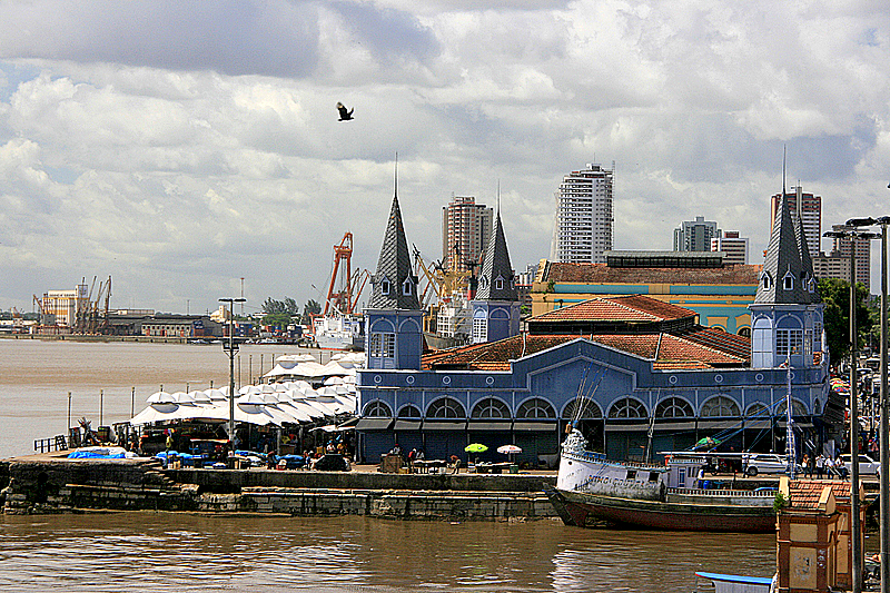
11 more on the map.
Parks, trails and playgrounds23







11 more on the map.
Restaurants and cafes42

Caffeto
Cafe · Coffee Shop, Breakfast, Merendaria, Lanchonete, Café, Lanches, Doces, Salgados · 8.2 km
3 Avenida Francisco Vinagre, QD. 262, Barcarena

Casa Apoena
Bar and pub · 14.3 km
171 Rua São Boaventura
Fr 08:00-04:00, Sa 08:00-03:00, Su 12:00-12:00

Casa do Galeto
Restaurant · Chicken, Wings
Rua Capitão Tomé Serrão
Mo-Su 07:00-22:00
Caffeto
Cafe · Coffee Shop · 7.1 km
SN Avenida Francisco Vinagre, Qd. 229, Lt. 11 - Ed.SmartVille, Lojas 1 e 2, Barcarena
Praça de Alimentação do Complexo Comercial de Barcarena
Restaurant · Coffee Shop, Burger, Chicken, Regional, Pizza, Barbecue, Breakfast, Fish And Chips, Ice Cream, Fish, Sandwich
24/7
Páprika
Restaurant · Italian · 14.5 km
302 Rua Padre Champagnat
Casa do Saulo das Onze Janelas
Restaurant · Regional · 14.5 km
Rua Siqueira Mendes
30 more on the map.
History
The town was originally inhabited by the Aruã people. In 1709 Jesuits came.
On October 6, 2015, the livestock vessel "MV Haidar" capsized in the Vila do Conde port due to an unsuccessful turning maneuver. It had 4,900 live cattle and almost 700 metric tonnes of oil on board. 4,400 cattle drowned while locked in the ship's cargo area. About 500 animals could free themselves, but only about 100 survived the accident. Fuel and oil seeped from the wreck into the water and contaminated the Pará river and surrounding beaches, which deprived many local fisher families of their livelihood. Since the removal of the oil slick proved to be complicated, and no consensus regarding responsibility and suitable cleanup efforts could be reached, hundreds of carcasses rotted at the beach and inside the shipwreck for months – a huge burden on the fishery and tourism of the region. The competent Federal Ministry estimated the damage to the residents to be 71 million reais (about 21 million US$). By July 2016 nothing had been paid out yet.
From the History section of Barcarena, Pará on Wikipedia, under CC BY-SA 4.0.
Where to stay6
Hotel de Trânsito de Oficiais
Motel and hotel · 15.0 km
300 Avenida 16 de Novembro, Belém
Samaúma Park Hotel
Motel and hotel · 9.3 km
Avenida Beira Mar, Barcarena, Vila dos Cabanos
Churches and places of worship28
Igreja da Matriz de São José
Church · Roman Catholic · 8.1 km
Rua Germano Aranha, Barcarena
1º igreja presbiteriana de vila dos cabanos
Church · Protestant · 7.4 km
Rua Lucas Espinosa
Shopping19
Gas and EV charging1
Schools, colleges and libraries30
EMEIF Vereador Genaro Apollar
School · 7.7 km
Travessa Minas Gerais, Vila dos Cabanos
Uepa - Universidade da Amazonia
School · 8.2 km
Rua Tomás Lourenço Fernandes, Barcarena
Healthcare12
Hospital Regional Público Materno Infantil de Barcarena
Hospital · 1.8 km
258 Rua José Pinheiro Rodrigues
Map of Barcarena
193 places. The map loads OpenStreetMap tiles when you open it.
Getting there and nearby towns
Val de Cans International Airport (BEL) is the nearest airport with scheduled flights listed in OpenStreetMap, 22 km away.
- Belém 15 km east, about 15 min by car
- Ponta de Pedras 30 km northwest, about 30 min by car
- Ananindeua 32 km northeast, about 32 min by car
- Marituba 36 km northeast, about 36 min by car
- Abaetetuba 37 km southwest, about 37 min by car
- Moju 45 km south, about 45 min by car
- Benevides 45 km east, about 45 min by car
- Santa Bárbara do Pará 48 km northeast, about 48 min by car
- Santa Isabel do Pará 57 km northeast, about 57 min by car
- Igarapé Miri 64 km southwest, about 1 h by car
Drive times are estimates from straight-line distance, not routes.
Local news
Headlines from INDB.
Reviews, tips and questions
Loading what members have shared...
Sources and licences
- GeoNames (CC BY 4.0): population, coordinates, regions and time zone
- OpenStreetMap contributors (ODbL 1.0): places, airports, map data
- Wikidata (CC0 1.0): elevation, founding date, time zone, website, landmarks and historic places
- Wikimedia Commons (see each image): photos
- Wikipedia (CC BY-SA 4.0): overview and history text
Photo credits
- Igreja de Nossa Senhora das Dores - Barcarena - 20230924131237, Túllio F, CC BY-SA 4.0
- Parque Zoobotânico Museu Paraense Emílio Goeldi 2023-8316, Prburley, CC BY 4.0
- Belem-TeatroPaz1, Celso Roberto de Abreu Silva from Belém, Brasil, CC BY 2.0
- Unama e BR-316, Hallel, CC BY-SA 3.0
- Palácio Lauro Sodré (2916166107), Celso Abreu from Belém, Brasil, CC BY 2.0
- Palacete Azul-03, JLPizzol, CC BY-SA 4.0
- Basílica de Nossa Senhora de Nazaré., Nando1462 - Fernando Santos Cunha Filho, CC BY-SA 4.0
- Igreja de Santana DSC 3453- (6766140361), Celso Abreu from Belém, Brasil, CC BY 2.0
- Belém town hall, Pará, 2018, Jcornelius, CC BY-SA 4.0
- Casa das Onze Janelas Belém Pará 2023-7864, Prburley, CC BY 4.0
- Palácio Lauro Sodré-04, JLPizzol, CC BY-SA 4.0
- Igreja de São João Batista Belém Pará 2023-7908, Prburley, CC BY 4.0
- Igreja do Carmo Belém Pará 2023-7816, Prburley, CC BY 4.0
- Catedral Metropolitana de Belém 2024, Sintegrity, CC BY-SA 4.0
- Farol de Belem, Ygor Oliveira, CC BY 2.0
- Forte do Castelo em Belém-Pará, Túllio Franca, CC BY-SA 4.0
- Igreja e Colégio de Santo Alexandre Belém Pará 2023-7835, Prburley, CC BY 4.0
- Mangal das Garças DSC 8656 (9514030210), Celso Abreu from Belém, Brasil, CC BY 2.0
- Palacete Pinho, Imóvel situado à Rua Dr. Assis nº 587, Socorrosimonetti, CC BY-SA 4.0
- Praia do Caripi - Barcarena 03, Túllio F, CC BY-SA 4.0
- Praça Frei Caetano Brandão, Vinicius Alexandre, CC BY-SA 4.0
- Belém Praça do Relógio Clock Place 01, Cayambe, CC BY-SA 3.0
- Arquitetura de Belém (6038522811), Celso Abreu from Belém, Brasil, CC BY 2.0
- Mercado de Carnes Francisco Bolonha - Belém - 20231226095544, Donatas Dabravolskas, CC BY-SA 4.0
- Memorial Amazônico da Navegação - 09, Ajmcbarreto, CC BY-SA 4.0
- Edifício Rua Dr Assis 834 Belém Pará 2023-8126, Prburley, CC BY 4.0
- Igreja de Nossa Senhora das Dores - Barcarena - 20230924131336, Túllio F, CC BY-SA 4.0
- EMEIF Santa Maria (Barcarena), Túllio F, CC BY-SA 4.0
- Igreja de São José - Vila dos Cabanos 01, Túllio F, CC BY-SA 4.0
- Ver-oPeso-Belem, Mauricio Mercer [2], CC BY-SA 2.0
- Brasaouepa, Makssaints, CC BY-SA 4.0
- Belem-Cathedral1, Celso Roberto de Abreu Silva from Belém, Brasil, CC BY 2.0
- Portal da Amazônia, Elilopes, CC BY-SA 4.0


Page built November 3, 2026. Spotted a mistake? Tell us or suggest a place.