


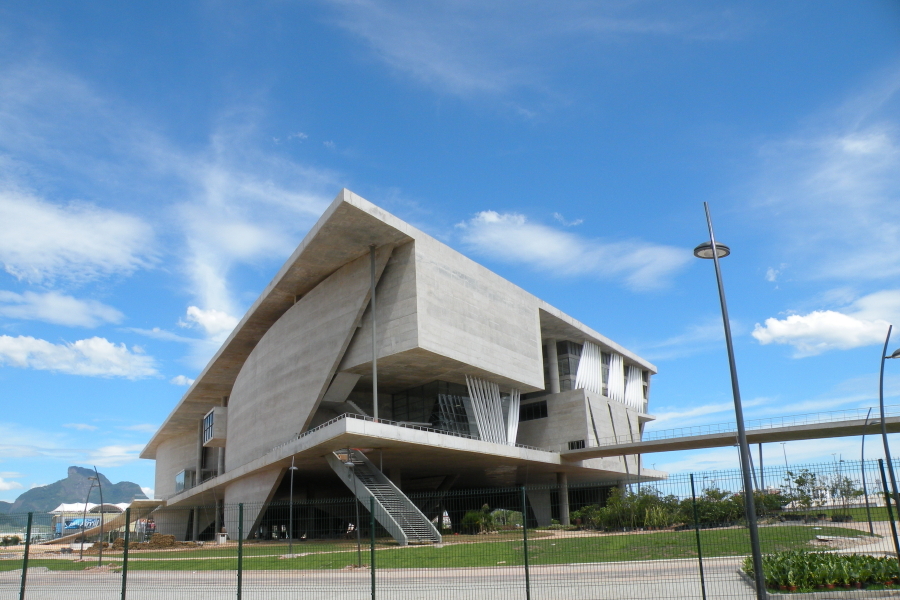


Barra da Tijuca, Brazil
Barra da Tijuca is a town of 421,438 people in Rio de Janeiro, Brazil.
Why visit Barra da Tijuca
Townapedia lists 9 museums and landmarks, 25 parks and trails, 102 places to eat, 4 places to stay and 9 attractions in and around town.
Highlights include UCI New York City Center, Terra Encantada, Cidade das Artes and Museu Seleção Brasileira.
Weather in Barra da Tijuca
Forecast from MET Norway (CC BY 4.0). Full forecast
About Barra da Tijuca
Barra da Tijuca (Brazilian Portuguese pronunciation: [ˈbaʁɐ dɐ tʃiˈʒukɐ]), usually known as just Barra, is an upper-middle class neighborhood (or bairro) in the Southwest Zone of Rio de Janeiro, Brazil, located in the western portion of the city on the Atlantic Ocean. Barra is well known for its beaches, its many lakes and rivers, and its lifestyle. This neighbourhood represents 4.7% of the city population and 13% of the total area of Rio de Janeiro.
From the Wikipedia article Barra da Tijuca (this version), under CC BY-SA 4.0.
Things to do9
Terra Encantada
Monument and historic site · 1.6 km
Amusement park in Rio de Janeiro, Brazil



Museums and landmarks9


Inauguração do Centro de Visitantes do Parque Municipal Natural Bosque da Barra
Monument and historic site · 0.6 km


Parks, trails and playgrounds25

Parque Natural Municipal Bosque da Barra
Park · 0.6 km
6000 Avenida das Américas, Rio de Janeiro
Tu-Su 08:00-17:00



13 more on the map.
Restaurants and cafes102

Abobrinhas Gourmet
Restaurant · Brazilian, Diner, Italian Pizza · 1.3 km
55 Rua José Maria Ortigão Sampaio
Mo-Su 08:00-23:00
Pampa Grill
Restaurant · Brazilian, Barbecue, Grill, Steak House
5150 Avenida das Américas
Mo-Sa 12:00-24:00; Su 12:00-22:00


Vino Veritas
Bar and pub · 1.2 km
4200 Bloco 07 Sala 112A Avenida das Américas, Rio de Janeiro
Mo-Fr 09:00-18:00
Barra Bakery
Bakery · 1.8 km
7607 Avenida das Américas, Rio de Janeiro
90 more on the map.
History
The region of Barra da Tijuca was originally a large beach, with typical undergrowth and sandbanks. The area, full of swamps and unsuitable for planting, remained unoccupied until the middle of the twentieth century, even though occasional groups of fishermen frequented the region. In 1667, the region was given to religious Benedictines, who settled only in the neighborhoods of Camorim, Vargem Pequena, and Vargem Grande. In 1900, the lands of Barra da Tijuca and Baixada Jacarepaguá were sold to the company Remedial Territorial Agricultural and SA, ESTA, which remains a large landowner in the area. The concentration of large tracts of land in the hands of a few was one of the causes of its late growth. Additionally, it is separated from the rest of the municipality by large, difficult-to-cross mountain ranges with peaks ranging from 800–1200 meters.
From the History section of Barra da Tijuca on Wikipedia, under CC BY-SA 4.0.
Where to stay4
Novotel Rio de Janeiro Barra da Tijuca Hotel
Motel and hotel · 1.9 km
5210 Av Lucio Costa, Rio de Janeiro
Churches and places of worship3
Union Church
Church · Protestant · 1.1 km
4351 Avenida Prefeito Dulcídio Cardoso, Rio de Janeiro
Shopping53
Gas and EV charging6
Schools, colleges and libraries25
Escola Municipal Professor Albert Einstein
School · 1.9 km
166 Rua Guimarães Rosa, Rio de Janeiro
Escola Municipal Tristão de Athayde
School · 1.2 km
405 Rua Bráulio Eugênio Muller
Universidade Estácio de Sá - Barra I Tom Jobim
School · 1.3 km
4200 Avenida das Américas
Escola Municipal Sérgio Buarque de Holanda
School · 2.1 km
455 Rua Jornalista Ricardo Marinho, Rio de Janeiro
Universidade Veiga de Almeida - Campus Marapendi
School · 1.5 km
500 Avenida General Felicíssimo Cardoso
Healthcare25
Clínica da Família José de Souza Herdy
Clinic and pharmacy · 1.9 km
3383 Avenida Ayrton Senna, Rio de Janeiro
Hospital Municipal Lourenço Jorge
Hospital
2000 Avenida Ayrton Senna, Rio de Janeiro
Drogaria Cristal
Clinic and pharmacy · 1.4 km
6700 Bloco 1 Loja 114 Avenida das Américas
Map of Barra da Tijuca
250 places. The map loads OpenStreetMap tiles when you open it.
Getting there and nearby towns
Jacarepaguá - Roberto Marinho Airport (RRJ) is the nearest airport with scheduled flights listed in OpenStreetMap, 1 km away.
- São Conrado 10 km east, about 10 min by car
- Rocinha 12 km east, about 12 min by car
- Vidigal 13 km east, about 13 min by car
- Leblon 15 km east, about 15 min by car
- Ipanema 17 km east, about 17 min by car
- Rio de Janeiro 21 km northeast, about 21 min by car
- Niterói 30 km northeast, about 30 min by car
- São Gonçalo 37 km northeast, about 37 min by car
- Magé 51 km northeast, about 51 min by car
- Maricá 57 km east, about 57 min by car
Drive times are estimates from straight-line distance, not routes.
Local news
Headlines from INDB.
Reviews, tips and questions
Loading what members have shared...
Sources and licences
- GeoNames (CC BY 4.0): population, coordinates, regions and time zone
- OpenStreetMap contributors (ODbL 1.0): places, airports, map data
- Wikidata (CC0 1.0): elevation, founding date, time zone, website, landmarks and historic places
- Wikimedia Commons (see each image): photos
- Wikipedia (CC BY-SA 4.0): overview and history text
Photo credits
- Cabhum..., Samwell Neves, CC BY-SA 3.0
- Vista da Reserva de Marapendi, Ana Carolina do Nascimento Guimarães, CC BY-SA 3.0
- Barra da Tijuca seen from Pedra da Gávea^ - panoramio, paulsmithrj, CC BY-SA 3.0
- Cidade da musica city of music, Osmar Carioca., Public domain
- NYCC, Arthur Jacob, CC BY-SA 3.0
- Village Mall, carlosdgrodrigs, CC BY-SA 4.0
- Parque Natural Municipal Bosque da Barra - panoramio (4), TMbux, CC BY-SA 3.0
- Cidade das Artes nov 2017 18, NMaia, CC BY-SA 4.0
- BarraShopping, Arthur Jacob, CC BY-SA 3.0
- Caminho ao paraiso, Edson S. Moreira, CC BY-SA 3.0
- Barra Panorama, Barrazine da Barra, CC BY 2.0
- Cidade das Artes, Tomaz Silva/Agência Brasil, CC BY 3.0 br
- Cidade das Artes nov 2017 06, NMaia, CC BY-SA 4.0
- Cidade das Artes Bibi Ferreira - Rio de Janeiro - 20250913212523, Rafael Lemieszek, CC BY-SA 4.0
- Cidade das Artes Bibi Ferreira - Rio de Janeiro - 20250913212515, Rafael Lemieszek, CC BY-SA 4.0
- Cidade das Artes Bibi Ferreira - Rio de Janeiro - 20250913212424, Rafael Lemieszek, CC BY-SA 4.0
- Cidade das Artes Bibi Ferreira - Rio de Janeiro - 20180421165101, Rafael Lemieszek, CC BY-SA 4.0
- Cidade das Artes Bibi Ferreira - Rio de Janeiro - 20180421160054, Rafael Lemieszek, CC BY-SA 4.0
- Cidade das Artes Bibi Ferreira - Rio de Janeiro - 20180421154746, Rafael Lemieszek, CC BY-SA 4.0
- Cidade das Artes Bibi Ferreira - Rio de Janeiro - 20250913211921, Rafael Lemieszek, CC BY-SA 4.0
- Cidade das Artes nov 2017 11, NMaia, CC BY-SA 4.0
- Cidade das Artes Bibi Ferreira - Rio de Janeiro - 20180421155519, Rafael Lemieszek, CC BY-SA 4.0
- Cidade das Artes Bibi Ferreira - Rio de Janeiro - 20180421165605, Rafael Lemieszek, CC BY-SA 4.0
- Cidade das Artes Bibi Ferreira - Rio de Janeiro - 20180421160154, Rafael Lemieszek, CC BY-SA 4.0
- Cidade das Artes Bibi Ferreira - Rio de Janeiro - 20180421155429, Rafael Lemieszek, CC BY-SA 4.0
- Cidade das Artes Bibi Ferreira - Rio de Janeiro - 20180421164303, Rafael Lemieszek, CC BY-SA 4.0
- Cidade das Artes Bibi Ferreira - Rio de Janeiro - 20180421160345, Rafael Lemieszek, CC BY-SA 4.0
- Cidade das Artes Bibi Ferreira - Rio de Janeiro - 20180421154736, Rafael Lemieszek, CC BY-SA 4.0
- Cidade das Artes Bibi Ferreira - Rio de Janeiro - 20250913212314, Rafael Lemieszek, CC BY-SA 4.0
- Cidade das Artes Bibi Ferreira - Rio de Janeiro - 20180421164327, Rafael Lemieszek, CC BY-SA 4.0
- Cidade das Artes nov 2017 09, NMaia, CC BY-SA 4.0
- Cidade das Artes nov 2017 14, NMaia, CC BY-SA 4.0
- Cidade das Artes nov 2017 10, NMaia, CC BY-SA 4.0
- Cidade das Artes Bibi Ferreira - Rio de Janeiro - 20180421155720, Rafael Lemieszek, CC BY-SA 4.0
- Cidade das Artes nov 2017 08, NMaia, CC BY-SA 4.0
- Cidade das Artes nov 2017 07, NMaia, CC BY-SA 4.0
- Cidade das Artes nov 2017 13, NMaia, CC BY-SA 4.0
- Cidade das Artes Bibi Ferreira - Rio de Janeiro - 20180421165700, Rafael Lemieszek, CC BY-SA 4.0
- Cidade das Artes nov 2017 12, NMaia, CC BY-SA 4.0
- Cidade das Artes - Sala de Leitura 05, NMaia, CC BY-SA 4.0
- Marco de Inauguração do Bosque da Barra, Avelludo, CC BY-SA 4.0


Page built November 3, 2026. Spotted a mistake? Tell us or suggest a place.