
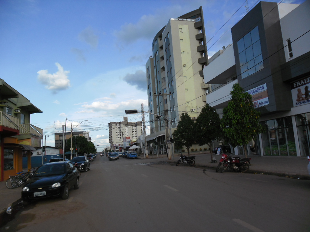


Luis Eduardo Magalhães, Brazil
Luís Eduardo Magalhães
Luis Eduardo Magalhães is a town of 107,909 people in Bahia, Brazil.
Why visit Luis Eduardo Magalhães
Townapedia lists 1 museum or landmark, 15 parks and trails, 38 places to eat, 13 places to stay and 1 attraction in and around town.
Weather in Luis Eduardo Magalhães
Forecast from MET Norway (CC BY 4.0). Full forecast
About Luis Eduardo Magalhães
Luís Eduardo Magalhães is a municipality in western Bahia, Brazil. The town's main business is agriculture, and it is known as the capital of agribusiness. The city is located in the heart of a rapidly growing agribusiness region and as a result it is the fastest growing city in Brazil. As recently as the 1990s the community was little more than a gas station.
From the Wikipedia article Luís Eduardo Magalhães, Bahia (this version), under CC BY-SA 4.0.
Things to do1

Museums and landmarks1

Parks, trails and playgrounds15

Clube Piscina
Sports field and stadium · 2.6 km
1365 Rua Goias, Luis Eduardo Magalhaes


3 more on the map.
Restaurants and cafes38


26 more on the map.
Where to stay13
Churches and places of worship11
Salão do Reino das Testemunhas de Jeová
Church · Jehovahs Witness · 2.0 km
Quadra 51, Lote 1 Rua Rui Barbosa
Igreja do Evangelho Quadrangular
Church · Neo-Pentecostal · 1.7 km
Avenida Juscelino Kubitschek
Igreja do Evangelho Quadrangular
Church · Neo-Pentecostal · 4.0 km
Avenida Antônio Carlos Magalhães
Shopping81
Gas and EV charging16
Schools, colleges and libraries20
Healthcare22
Fernando Franconn Farmácia Econômica
Clinic and pharmacy · 2.6 km
Rua das Acacias
Map of Luis Eduardo Magalhães
218 places. The map loads OpenStreetMap tiles when you open it.
Getting there and nearby towns
Aeródromo Taguatinga (QHN) is the nearest airport with scheduled flights listed in OpenStreetMap, 77 km away.
- Ponte Alta do Bom Jesus 75 km west, about 1 h 15 min by car
- Taguatinga 79 km southwest, about 1 h 15 min by car
- Barreiras 87 km east, about 1 h 30 min by car
Drive times are estimates from straight-line distance, not routes.
Local news
Headlines from INDB.
Reviews, tips and questions
Loading what members have shared...
Sources and licences
- GeoNames (CC BY 4.0): population, coordinates, regions and time zone
- OpenStreetMap contributors (ODbL 1.0): places, airports, map data
- Wikidata (CC0 1.0): elevation, founding date, time zone, website
- Wikimedia Commons (see each image): photos
- Wikipedia (CC BY-SA 4.0): overview and history text
Photo credits
- LEM BA - panoramio, Roberto de vasconcel…, CC BY-SA 3.0
- LEM BA - panoramio (1), Roberto de vasconcel…, CC BY-SA 3.0
- LEM BA - panoramio (3), Roberto de vasconcel…, CC BY-SA 3.0
- LUIS EDUARDO MAGALHAES BA - panoramio, Roberto de vasconcel…, CC BY-SA 3.0
- LUIS EDUARDO MAGALHAES-BA - panoramio (1), Roberto de vasconcel…, CC BY-SA 3.0
- LUIS EDUARDO-BAHIA - panoramio, Roberto de vasconcel…, CC BY-SA 3.0
- CENTRO ADMINISTRATIVO DE LEM - panoramio, Roberto de vasconcel…, CC BY-SA 3.0
- LEM - panoramio, Roberto de vasconcel…, CC BY-SA 3.0
- Luis eduardo magalhaes bahia - panoramio, Roberto de vasconcel…, CC BY-SA 3.0
- LUIS EDUARDO MAGALHAES-BA - panoramio, Roberto de vasconcel…, CC BY-SA 3.0
- LUIS EDUARDO -BAHIA - panoramio, Roberto de vasconcel…, CC BY-SA 3.0
- LUIS EDUARDO BAHIA - panoramio (1), Roberto de vasconcel…, CC BY-SA 3.0
- ISS039-E-4958 - View of Earth, Earth Science and Remote Sensing Unit , Lyndon B. Johnson Space Center, Public domain
- Lem - panoramio (1), Roberto de vasconcel…, CC BY-SA 3.0
- Lem - panoramio (3), Roberto de vasconcel…, CC BY-SA 3.0
- LEM BA - panoramio (2), Roberto de vasconcel…, CC BY-SA 3.0
- Luis eduardo magalhaes - bahia - panoramio, Roberto de vasconcel…, CC BY-SA 3.0
- Lem - panoramio (5), Roberto de vasconcel…, CC BY-SA 3.0
- Luis eduardo magalhaes - bahia - panoramio (1), Roberto de vasconcel…, CC BY-SA 3.0
- Lem - bahia - panoramio, Roberto de vasconcel…, CC BY-SA 3.0
- Praça (marcha para jesus) - panoramio, anderson.higo2@gmail…, CC BY 3.0
- Lem - panoramio (4), Roberto de vasconcel…, CC BY-SA 3.0
- Lem bahia - panoramio, Roberto de vasconcel…, CC BY-SA 3.0
- Lem - panoramio (2), Roberto de vasconcel…, CC BY-SA 3.0
- Lem - panoramio (11), Roberto de vasconcel…, CC BY-SA 3.0
- Lem - panoramio (8), Roberto de vasconcel…, CC BY-SA 3.0
- Lem - panoramio (9), Roberto de vasconcel…, CC BY-SA 3.0
- Lem - panoramio (6), Roberto de vasconcel…, CC BY-SA 3.0


Page built November 3, 2026. Spotted a mistake? Tell us or suggest a place.