


Natal, Brazil
Natal is a regional capital of 896,708 people in Rio Grande do Norte, Brazil, founded in 1599.
Why visit Natal
Townapedia lists 25 museums and landmarks, 37 parks and trails, 177 places to eat, 12 places to stay and 14 attractions in and around town.
Highlights include Alberto Maranhão Theatre, Federal University of Rio Grande do Norte, Forte dos Reis Magos and Museu Café Filho.
Weather in Natal
Forecast from MET Norway (CC BY 4.0). Full forecast
About Natal
Natal (Brazilian Portuguese: [naˈtaw]) is a Brazilian municipality and the capital of the state of Rio Grande do Norte, located in the Northeast Region of Brazil. Situated 2,227 kilometers from Brasília, the federal capital, it is the second smallest Brazilian state capital in area, covering an area of approximately 167 km2 (64 sq mi). With just over 750,000 inhabitants (2022), it is the most populous municipality in its state, the eighth in the Northeast, and the 24th in Brazil. The Greater Natal, composed of thirteen other municipalities in Rio Grande do Norte, has more than 1.5 million inhabitants, making it the fourth largest urban agglomeration in the Northeast and the nineteenth largest in Brazil.
From the Wikipedia article Natal, Rio Grande do Norte (this version), under CC BY-SA 4.0.
Travel tips from other travellers: Natal on Wikivoyage (CC BY-SA 4.0).
Things to do14

Alberto Maranhão Theatre
Cinema and theater · 1.8 km
Theatre in Natal, Brazil

Federal University of Rio Grande do Norte
School · 5.0 km
Federal public university in Natal, Rio Grande do Norte and notable example of brutalist archtecture


Via Costeira
Beach · 3.7 km
Expressway and coastal connecting the south and east of Natal, capital of the Brazilian state of Rio Grande do Norte

Teatro Municipal Sandorval Wanderley
Cinema and theater · 1.0 km
Avenida Presidente Bandeira, Natal
2 more on the map.
Museums and landmarks25


Museu Café Filho
Museum · 1.1 km
601 Rua Coronel Cascudo, Natal
Tu-Fr 09:00-17:00; Sa 08:00-12:00



Museu de Cultura Popular Djalma Maranhão
Museum · 1.7 km
Praça Augusto Severo, Natal


13 more on the map.
Parks, trails and playgrounds37

Dunas de Natal State Park
Park · 3.7 km
State park in Rio Grande do Norte, Brazil



Praça e Parquinho Palazzo Teodorico
Park · 2.7 km
3673 Avenida Amintas Barros, Natal
24/7
Bosque Doutor Paulo Viveiros
Park · 2.1 km
Bosque arborizado de uso comunitário, situado ao final da rua e acessível ao público.
Rua Doutor Paulo Viveiros, Natal
Praça Gentil Ferreira
Park · 1.1 km
Também conhecida como Praça do Relógio do Alecrim
Rua Doutor Manoel Miranda, Natal
Praça Pedro Velho (Praça Cívica)
Park · 1.5 km
Na praça Pedro Velho é onde acontece grandes eventos na Cidade, como desfiles de 7 de setembro, apresentações musicais e teatrais. Na...
Avenida Prudente de Morais, Natal

Estádio Juvenal Lamartine
Sports field and stadium · 1.5 km
Avenida Hermes da Fonseca
Parque Ney Aranha Marinho
Park
Espaço Público com local para estacionamento de carros, bancos e locais para caminhada. A praça é bem arborizada e contém academia para...
25 more on the map.
Restaurants and cafes177

Colonial Café & Sabor
Cafe · Coffee Shop, Sandwich, Salad, Dessert, Cake · 1.5 km
628 Avenida Afonso Pena, Natal
Mo-Su 11:00-18:00
Muso Café
Cafe · Coffee Shop · 0.8 km
637 Praça Augusto Leite
Mo-We 08:00-19:00; Th-Su 13:00-19:00


Rollab Coffee
Cafe · Coffee Shop · 2.8 km
430 Rua Professor Almeida Barreto, natal

Sushi & Seafood House
Restaurant · Asian, Chinese · 2.4 km
1901 Avenida Nascimento de Castro
Takami Japanese Restaurant
Restaurant · Japanese · 2.7 km
Avenida Prudente de Morais
165 more on the map.
Where to stay12
Brisa do Mar Beach Hotel
Motel and hotel · 2.8 km
786 Avenida Presidente Café Filho
Churches and places of worship35
Igreja de Nossa Senhora do Rosário dos Pretos
Church · Roman Catholic · 1.3 km
Praça Dom Vital, Natal
Catedral Metropolitana de Natal
Church · Catholic · 1.0 km
Avenida Deodoro da Fonseca, Natal
Igreja Matriz de Nossa Senhora da Apresentação
Church · Catholic · 1.0 km
Praça André de Albuquerque, Natal
Igreja Batista do Avivamento Mundial Sede
Church · Baptist · 2.7 km
2045 Rua Doutor Mário Negócio, Natal - RN
Centro Espírita Bezerra de Menezes
Place of worship · Espírita · 1.7 km
382 Rua dos Tororós, Natal
Cpela de Nossa Senhora de Fátima
Church · Roman Catholic · 2.5 km
Rua Pedro Afonso, Natal
Shopping57
Armazém Pará Home Center
Hardware store · 2.1 km
1788 Avenida Antônio Basílio, Natal
Gas and EV charging13
Schools, colleges and libraries91
Centro de Apoio Pedagógico para Atendimento às Pessoas com Deficiência Visual Professora Iapssara Aguiar
School · 2.4 km
Rua dos Potiguares, Natal
Centro de Formação de Pessoal para Serviços de Saúde - CEFOPE
School · 2.3 km
Avenida Almirante Alexandrino de Alencar, Natal
Healthcare124
Hospital Geral Doutor João Machado - HGJM
Hospital · 2.2 km
1700 Avenida Almirante Alexandrino de Alencar, Natal
CEOP - Odontologia e Psicologia
Clinic and pharmacy · 1.1 km
610 Av. Deodoro da Fonseca, Natal
Map of Natal
250 places. The map loads OpenStreetMap tiles when you open it.
Getting there and nearby towns
Governador Aluízio Alves International Airport (NAT) is the nearest airport with scheduled flights listed in OpenStreetMap, 18 km away.
- São Gonçalo do Amarante 13 km west, about 13 min by car
- Parnamirim 15 km southwest, about 15 min by car
- Extremoz 15 km northwest, about 15 min by car
- Macaíba 17 km southwest, about 17 min by car
- Ceará-Mirim 30 km northwest, about 30 min by car
- São José de Mipibu 31 km south, about 31 min by car
- Maxaranguape 31 km north, about 31 min by car
- Nísia Floresta 33 km south, about 33 min by car
- Monte Alegre 33 km southwest, about 33 min by car
- Vera Cruz 37 km southwest, about 37 min by car
Drive times are estimates from straight-line distance, not routes.
Local news
Headlines from INDB.
Reviews, tips and questions
Loading what members have shared...
Sources and licences
- GeoNames (CC BY 4.0): population, coordinates, regions and time zone
- OpenStreetMap contributors (ODbL 1.0): places, airports, map data
- Wikidata (CC0 1.0): elevation, founding date, time zone, website, landmarks and historic places
- Wikimedia Commons (see each image): photos
- Wikipedia (CC BY-SA 4.0): overview and history text
Photo credits
- Natal, capital do Rio Grande do Norte, Brasil, Ney Douglas/MTur Destinos, Attribution
- PÔR-DO-SOL EM NATAL-RN - panoramio, MACÍLIO GOMES, CC BY 3.0
- Dunas de Natal, Bertachini, CC BY-SA 4.0
- Natal2, Bertachini, CC BY-SA 4.0
- Um passeio de barco sob a Ponte Newton Navarro - Natal - RN (7558139714), Marinelson Almeida - Traveling through Brazil from Niteroi, Brasil, CC BY 2.0
- Natal - RN - Eleitores rodearam "Dilma Móvel" em corpo a corpo de candidata (4838383289), Roberto Stuckert Filho, CC BY-SA 2.0
- Uma visão diferente da Ponte Newton Navarro - Natal - RN (7558149514), Marinelson Almeida - Traveling through Brazil from Niteroi, Brasil, CC BY 2.0
- Vai uma fruta ai? Perto do maior Cajueiro do Mundo - Natal. (5582700994), Marinelson Almeida - Traveling through Brazil from Niteroi, Brasil, CC BY 2.0
- Ponte Newton Navarro - NatalRNBrasil, Victor Camilo, CC BY 2.0
- Museu Parque das Dunas Obra de Oscar Niemeyer - Natal. (5577704061), Marinelson Almeida - Traveling through Brazil from Niteroi, Brasil, CC BY 2.0
- Pirangí do Sul - Natal. (5578288916), Marinelson Almeida - Traveling through Brazil from Niteroi, Brasil, CC BY 2.0
- Um bom lugar para uma musica. Iate Clube de Natal. (7558119652), Marinelson Almeida - Traveling through Brazil from Niteroi, Brasil, CC BY 2.0
- Um Pôr do sol no Iate Clube de Natal - Brasil (7469099468), Marinelson Almeida - Traveling through Brazil from Niteroi, Brasil, CC BY 2.0
- Hospital Memorial São Francisco, Natal (RN), Marcos Elias de Oliveira Júnior, CC0
- Igreja Matriz de São Pedro Apóstolo, Natal (RN), Marcos Elias de Oliveira Júnior, CC0
- Cidade de Natal-RN 16, Túllio F, CC BY-SA 4.0
- Igreja Matriz de São Pedro, Natal (RN), Marcos Elias de Oliveira Júnior, CC0
- Interior da Igreja Matriz de São Pedro Apóstolo, Natal (RN), Marcos Elias de Oliveira Júnior, CC0
- Imagem de Nossa Senhora da Apresentação de Natal (RN), Marcos Elias de Oliveira Júnior, CC0
- Rua Alberto Maranhão, Natal (RN), Marcos Elias de Oliveira Júnior, CC0
- Avenida Prudente de Morais, Barro Vermelho, Natal (RN), Marcos Elias de Oliveira Júnior, CC0
- Feira do Alecrim – Natal (RN), Marcos Elias de Oliveira Júnior, CC0
- Feira do Alecrim, Natal (RN), Marcos Elias de Oliveira Júnior, CC0
- Avenida Coronel Estevam, Natal (RN), Marcos Elias de Oliveira Júnior, CC0
- Igreja de Santo Antônio - Natal - 20240921103723, Srteuzo, CC BY-SA 4.0
- Igreja de Santo Antônio - Natal - 20240921103724, Srteuzo, CC BY-SA 4.0
- Avenida 2, Alecrim, Natal (RN), Marcos Elias de Oliveira Júnior, CC0
- Teatro Sandoval Wanderley, Natal (RN), Marcos Elias de Oliveira Júnior, CC0
- Residência do arcebispo de Natal (RN), Marcos Elias de Oliveira Júnior, CC0
- Igreja do Galo, Natal (RN), Marcos Elias de Oliveira Júnior, CC0
- Catedral Metropolitana de Natal (RN), Marcos Elias de Oliveira Júnior, CC0
- Igreja de Santo Antônio - Natal - 20240921102820, Srteuzo, CC BY-SA 4.0
- Igreja de Santo Antônio - Natal - 20240921102819, Srteuzo, CC BY-SA 4.0
- Igreja de Santo Antônio - Natal - 20240921102818, Srteuzo, CC BY-SA 4.0
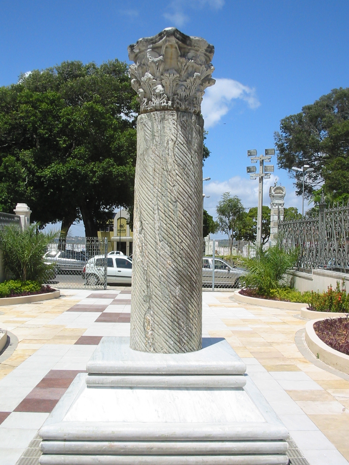
- Legitima Coluna Capitolina em Natal - RN. (8622284777), Marinelson Almeida - Traveling through Brazil from Niteroi, Brasil, CC BY 2.0
- Memorial Câmara Cascudo, Natal (RN), Marcos Elias de Oliveira Júnior, CC0
- Centro-de-Ciências-Sociais-Aplicadas-UFRN, Patrick - Patrick, CC BY-SA 3.0
- Genipabu 2, Fabricio Ferreira Silva, CC BY-SA 3.0
- Ponte Newton Navarro, Thiago Pedrosa / Flickr, CC BY-SA 2.0
- Praia da Ponta Negra 20150814-DSC05653, Matti Blume, CC BY-SA 4.0
- Praia-da-Redinha-Natal, Patrick - Patrick, CC BY-SA 3.0
- Natal-via-costeira, Unknown author, CC BY-SA 3.0
- Forte-reis-magos, Onesimo.santos, CC BY-SA 3.0
- Pqdunasinfantil, User:Mansueto77, Public domain
- Mirante à espreita, Marvin.danque, CC BY-SA 3.0
- Catedral Metropolitana de Nossa Senhora da Apresentação, Natal (RN), Marcos Elias de Oliveira Júnior, CC0
- Palacio Potengi, Natal 20150922-DSC06020, Matti Blume, CC BY-SA 4.0
- Catedral Velha, trabalho próprio, CC BY-SA 3.0
- Igreja do Rosário dos Pretos, Natal (RN), Marcos Elias de Oliveira Júnior, CC0
- Natal-Coluna-Capitolina, Patrick – Patrick, CC BY-SA 3.0
- Museu Cafe Filho, Natal 20150922-DSC06029, Matti Blume, CC BY-SA 4.0
- Instituto Histórico e Geográfico do Rio Grande do Norte, Natal (RN), Marcos Elias de Oliveira Júnior, CC0
- Natal - RN - panoramio (4), FernandoSantos, CC BY-SA 3.0


Page built November 3, 2026. Spotted a mistake? Tell us or suggest a place.