

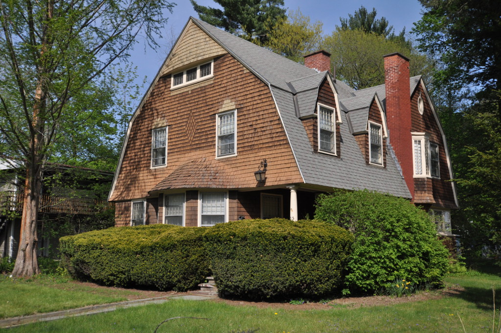


Brattleboro, Vermont
Brattleboro is a community of 7,657 people in Windham County, Vermont.
Why visit Brattleboro
Townapedia lists 25 museums and landmarks, 15 parks and trails, 36 places to eat, 12 places to stay and 8 attractions in and around town.
Highlights include Latchis Theatre, Hooker-Dunham Theater and Gallery, Brattleboro Downtown Historic District and Brattleboro Museum & Art Center.
July is the warmest month, with average highs of 82°F; January lows average 10°F, and about 60 inches of snow fall in a normal year.
Weather in Brattleboro
Forecast from the National Weather Service. Full forecast
About Brattleboro
Brattleboro is a census-designated place (CDP) corresponding to the densely populated core of the town of Brattleboro in Windham County, Vermont, United States. The population was 8,289 at the 2000 census.
From the Wikipedia article Brattleboro (CDP), Vermont (this version), under CC BY-SA 4.0.
Things to do8



New England Youth Theatre
Cinema and theater · 0.8 mi
100 Flat Street, Brattleboro

Museums and landmarks25

Brattleboro Downtown Historic District
Monument and historic site · National Register of Historic Places · 0.5 mi
Historic district in Vermont, United States


Brattleboro Retreat
Monument and historic site · National Register of Historic Places
Private not-for-profit mental health and addictions hospital in Brattleboro, Vermont, United States

Creamery Covered Bridge
Bridge · National Register of Historic Places · 1.6 mi
Covered bridge in West Brattleboro
Arthur D. and Emma J. Wyatt House
Monument and historic site · National Register of Historic Places
House in Brattleboro, Vermont
Brooks House
Monument and historic site · National Register of Historic Places · 0.6 mi
Built for hotelier George Brooks in Brattleboro, Vermont, United States
Canal Street Schoolhouse
Monument and historic site · National Register of Historic Places · 0.8 mi
Historic school building in Brattleboro Vermont


Canal Street–Clark Street Neighborhood Historic District
Monument and historic site · National Register of Historic Places · 0.9 mi
Historic district in Brattleboro, Vermont, United States
Deacon John Holbrook House
Monument and historic site · National Register of Historic Places · 0.4 mi
Historic house at 80 Linden Street in Brattleboro, Vermont
Dickinson Estate Historic District
Monument and historic site · National Register of Historic Places · 2.1 mi
Estate in Brattleboro, Vermont, United States
Estey Organ Company Factory
Monument and historic site · National Register of Historic Places · 1.0 mi
Historic buildings in Brattleboro, Vermont, United States
Guilford Country Store
Monument and historic site · National Register of Historic Places · 3.1 mi
Tavern in Guilford, Vermont
13 more on the map.
Parks, trails and playgrounds15



Winston Prouty Campus
Hiking and trails · 1.7 mi
209 Augustine Drive, Brattleboro
sunrise-sunset
3 more on the map.
Restaurants and cafes36



Fast Eddie's Bakery
Restaurant · Burger, Seafood, Ice Cream · 1.1 mi
833 Putney Road, Brattleboro
Th-Su 11:00-19:00

The Works Cafe
Restaurant · Coffee Shop, Sandwich, Soup · 0.6 mi
118 Main Street
Mo-Su 06:00-19:00

Ninety Nine Restaurant & Pub
Diner · American · 1.7 mi
1184 Putney Road, Brattleboro
Ramunto's Brick Oven Pizza
Restaurant · Pizza · 1.6 mi
1111 Putney Road, Brattleboro
24 more on the map.
Where to stay12
Holiday Inn Express & Suites
Motel and hotel · 1.2 mi
100 Chickering Drive, Brattleboro
Riverside Hotel, an Ascend Hotel Collection Member
Motel and hotel · 1.6 mi
20 Riverside Drive, West Chesterfield
Churches and places of worship18
Christ Church
Church · National Register of Historic Places · 3.2 mi
Buoyant Heart Art Collective
Place of worship · 1.0 mi
120 Birge Street, Brattleboro
Church of Christ
Church · Nondenominational · 1.2 mi
303 Western Avenue, Brattleboro
Rivertown Church
Church · Assemblies Of God · 1.1 mi
28 Birge Street, Brattleboro
Saint Michaels Episcopal Church
Church · Episcopal
16 Bradley Avenue, Brattleboro
Trinity Lutheran Church
Church · Lutheran · 0.9 mi
161 Western Avenue, Brattleboro
Shopping12
Fairfield Plaza Shopping Center
Shopping center · 0.9 mi
766 Putney Road, Brattleboro
Gas and EV charging10
Schools, colleges and libraries24
Chesterfield Central School
School · 4.9 mi
535 Old Chesterfield Rd., Chesterfield
Saint Michael's Catholic School
School · Roman Catholic · 0.4 mi
48 Walnut Street, Brattleboro
The I.N.S.P.I.R.E. School for Autism
School · 1.5 mi
60 Austine Drive, Brattleboro
Healthcare3
Map of Brattleboro
163 places. The map loads OpenStreetMap tiles when you open it.
Climate by month
Monthly table
| Month | High | Low | Rain | Snow |
|---|---|---|---|---|
| Jan | 30°F | 10°F | 3.1 in | 15.2 in |
| Feb | 34°F | 11°F | 2.8 in | 14.4 in |
| Mar | 43°F | 20°F | 3.4 in | 11.0 in |
| Apr | 57°F | 30°F | 3.4 in | 2.2 in |
| May | 69°F | 41°F | 3.8 in | 0.0 in |
| Jun | 77°F | 51°F | 4.4 in | 0.0 in |
| Jul | 82°F | 56°F | 4.5 in | 0.0 in |
| Aug | 80°F | 54°F | 4.3 in | 0.0 in |
| Sep | 73°F | 47°F | 4.3 in | 0.0 in |
| Oct | 60°F | 36°F | 4.9 in | 0.2 in |
| Nov | 47°F | 27°F | 3.5 in | 2.4 in |
| Dec | 36°F | 18°F | 3.9 in | 14.4 in |
U.S. Climate Normals 1991-2020 for Keene Hcn (13 mi away), NOAA NCEI.
People and cost of living
American Community Survey 5-year estimates, 2020-2024, U.S. Census Bureau. Estimates have margins of error, larger for small towns.
Disaster history
Windham County has had 18 federal disaster declarations since 2000, most often for severe storms.
- 2024-08-08: Tropical Depression Debby (Tropical Storm)
- 2024-03-02: Severe Storm And Flooding (Severe Storm)
- 2023-07-14: Severe Storms, Flooding, Landslides, And Mudslides (Flood)
- 2023-07-10: Flooding (Flood)
- 2021-09-29: Severe Storm And Flooding (Flood)
- 2021-08-22: Tropical Storm Henri (Hurricane)
OpenFEMA disaster declarations summaries.
Getting there and nearby towns
Dillant-Hopkins Airport (EEN) is the nearest airport with scheduled flights listed in OpenStreetMap, 15 miles away.
- Hinsdale 6 mi southeast, about 10 min by car
- Winchester 11 mi southeast, about 17 min by car
- West Swanzey 12 mi east, about 19 min by car
- Northfield 12 mi southeast, about 20 min by car
- Keene 14 mi northeast, about 23 min by car
- Greenfield 17 mi south, about 28 min by car
- Turners Falls 18 mi south, about 29 min by car
- Marlborough 18 mi east, about 29 min by car
- Bellows Falls 20 mi north, about 31 min by car
- Shelburne Falls 20 mi southwest, about 32 min by car
Drive times are estimates from straight-line distance, not routes.
Local news
Headlines from INDB, the NEMICO news database.
Reviews, tips and questions
Loading what members have shared...
Sources and licences
- NCES EDGE (Public domain): public schools
- NOAA NCEI U.S. Climate Normals 1991-2020 (Public domain): climate by month
- OpenFEMA (Public domain): disaster declarations
- OpenStreetMap contributors (ODbL 1.0): places, airports, map data
- U.S. Census Bureau (Public domain): population, income, housing, education, commute
- Wikidata (CC0 1.0): elevation, founding date, time zone, website, landmarks and historic places
- Wikimedia Commons (see each image): photos
- Wikipedia (CC BY-SA 4.0): overview and history text
Photo credits
- Main Street, Brattleboro VT, John Phelan, CC BY-SA 4.0
- BrattleboroVT WyattHouse, Magicpiano, CC BY-SA 3.0
- Brattleboro Retreat 3, Beyond My Ken, CC BY-SA 4.0
- Brattleboro Retreat 2 Lawton Hall, Beyond My Ken, CC BY-SA 4.0
- Brattleboro Retreat 1, Beyond My Ken, CC BY-SA 4.0
- Brattleboro, Vermont Commons and Civil War memorial, Kenneth C. Zirkel, CC BY-SA 4.0
- BPOE Elks Lodge 1499 75 Putney Road downtown Brattleboro VT May 2025 03, Artaxerxes, CC BY 4.0
- Brattleboro, Vermont Commons and Civil War memorial-wide, Kenneth C. Zirkel, CC BY-SA 4.0
- 20240911 Town of Brattleboro planting (53999491013), usfs_Eastern_Region, Public domain
- First Generation Ford Thunderbird First Church of Christ, Scientist 57 Putney Road Brattleboro VT July 2026 02, Artaxerxes, CC BY 4.0
- First Generation Ford Thunderbird First Church of Christ, Scientist 57 Putney Road Brattleboro VT July 2026 01, Artaxerxes, CC BY 4.0
- First Generation Ford Thunderbird First Church of Christ, Scientist 57 Putney Road Brattleboro VT July 2026 03, Artaxerxes, CC BY 4.0
- First Church of Christ, Scientist 57 Putney Road downtown Brattleboro VT May 2025 02, Artaxerxes, CC BY 4.0
- BPOE Elks Lodge 1499 75 Putney Road downtown Brattleboro VT May 2025 02, Artaxerxes, CC BY 4.0
- BPOE Elks Lodge 1499 75 Putney Road downtown Brattleboro VT May 2025 01, Artaxerxes, CC BY 4.0
- First Church of Christ, Scientist 57 Putney Road downtown Brattleboro VT May 2025 01, Artaxerxes, CC BY 4.0
- Brattleboro Christian Science church, built 1920, Nyttend, Public domain
- First Church of Christ, Scientist, Brattleboro, Vermont, Kenneth C. Zirkel, CC BY-SA 4.0
- Granite marker Vermont Veterans Memorial Bridge Putney Road (US Rte 5) Brattleboro VT September 2026, Artaxerxes, CC BY 4.0
- Deacon John Holbrooke House 80 Linden Street Brattleboro Vermont, Beyond My Ken, CC BY-SA 4.0
- Painting First Church of Christ, Scientist 57 Putney Road Brattleboro VT September 2025, Artaxerxes, CC BY 4.0
- Polling station American Legion 32 Linden Street Brattleboro VT 5 November 2024 03, Artaxerxes, CC BY 4.0
- Polling station American Legion 32 Linden Street Brattleboro VT 5 November 2024 04, Artaxerxes, CC BY 4.0
- Polling station American Legion 32 Linden Street Brattleboro VT 5 November 2024 05, Artaxerxes, CC BY 4.0
- Polling station American Legion 32 Linden Street Brattleboro VT 5 November 2024 01, Artaxerxes, CC BY 4.0
- Polling station American Legion 32 Linden Street Brattleboro VT 5 November 2024 07, Artaxerxes, CC BY 4.0
- Polling station American Legion 32 Linden Street Brattleboro VT 5 November 2024 02, Artaxerxes, CC BY 4.0
- Polling station American Legion 32 Linden Street Brattleboro VT 5 November 2024 09, Artaxerxes, CC BY 4.0
- Polling station American Legion 32 Linden Street Brattleboro VT 5 November 2024 08, Artaxerxes, CC BY 4.0
- Polling station American Legion 32 Linden Street Brattleboro VT 5 November 2024 06, Artaxerxes, CC BY 4.0
- Timothy J. O'Connor Dining Room St. Brigid's Kitchen and Pantry 38 Walnut Street downtown Brattleboro VT February 2026, Artaxerxes, CC BY 4.0
- St. Brigid's Kitchen and Pantry 38 Walnut Street Brattleboro VT February 2026 05, Artaxerxes, CC BY 4.0
- St. Brigid's Kitchen and Pantry 38 Walnut Street Brattleboro VT February 2026 04, Artaxerxes, CC BY 4.0
- St. Brigid's Kitchen and Pantry 38 Walnut Street Brattleboro VT February 2026 03, Artaxerxes, CC BY 4.0
- St. Brigid's Kitchen and Pantry 38 Walnut Street Brattleboro VT February 2026 02, Artaxerxes, CC BY 4.0
- St. Brigid's Kitchen and Pantry 38 Walnut Street Brattleboro VT February 2026 01, Artaxerxes, CC BY 4.0
- Post Office and Court House Brattleboro, Beyond My Ken, CC BY-SA 4.0
- Creamery Covered Bridge West Brattleboro, Beyond My Ken, CC BY-SA 4.0
- Brattleboro Vermont Amtrak station, Beyond My Ken, CC BY-SA 4.0
- The Abbott Brattleboro, Beyond My Ken, CC BY-SA 4.0


Page built October 30, 2026. Spotted a mistake? Tell us or suggest a place.