


Shelburne Falls, Massachusetts
Shelburne Falls is a community of 1,845 people in Franklin County, Massachusetts.
Why visit Shelburne Falls
Townapedia lists 17 museums and landmarks, 4 parks and trails, 8 places to eat, 2 places to stay and 8 attractions in and around town.
Highlights include Bridge of Flowers, Massaemett Mountain, Hill Cemetery and Parson Hubbard House Historic District and Maj. Joseph Griswold House.
July is the warmest month, with average highs of 75°F; January lows average 9°F.
Weather in Shelburne Falls
Forecast from the National Weather Service. Full forecast
About Shelburne Falls
Shelburne Falls is a historic village in the towns of Shelburne and Buckland in Franklin County, Massachusetts, United States. The village is a census-designated place (CDP); as of the 2020 census, Shelburne Falls had a population of 1,719. It is part of the Springfield, Massachusetts, Metropolitan Statistical Area.
From the Wikipedia article Shelburne Falls, Massachusetts (this version), under CC BY-SA 4.0.
Things to do8

Bridge of Flowers
Bridge · 0.5 mi
Bridge connecting the towns of Shelburne and Buckland

Museums and landmarks17

Hill Cemetery and Parson Hubbard House Historic District
Monument and historic site · National Register of Historic Places · 3.1 mi
Shelburne, Massachusetts, NRHP-listed
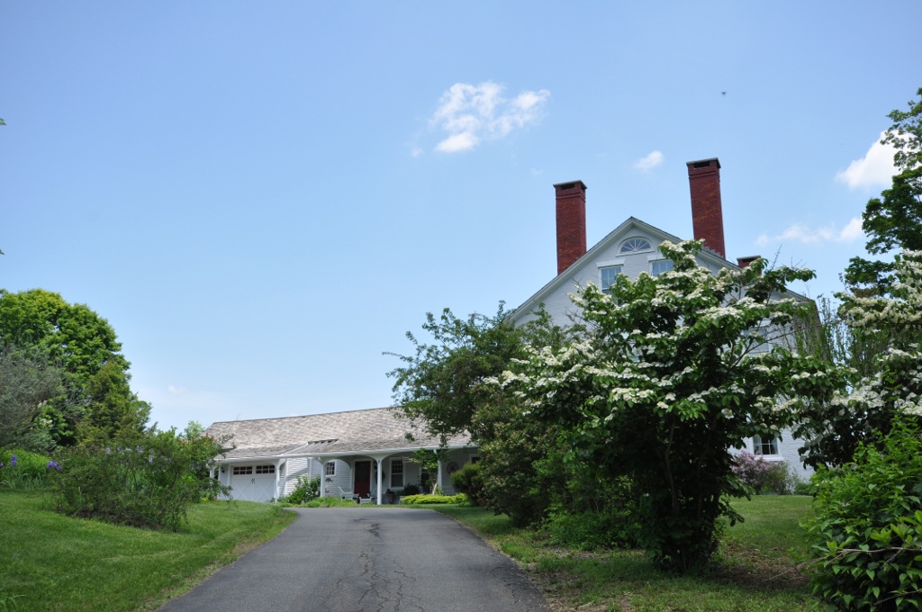
Maj. Joseph Griswold House
Monument and historic site · National Register of Historic Places · 2.6 mi
Historic house in Massachusetts, United States
Odd Fellows' Hall
Monument and historic site · National Register of Historic Places · 0.5 mi
Building in Massachusetts, United States

Robert Strong Woodward House and Studio
Monument and historic site · National Register of Historic Places · 2.8 mi
Historic house in Massachusetts, United States
Shelburne Falls
Monument and historic site · National Register of Historic Places · 0.5 mi
Census-designated place in Franklin County, Massachusetts

Shelburne Falls Trolley Museum
Museum · 0.7 mi
Transport museum in Massachusetts, United States
14 Depot Street, Shelburne Falls
Shelburne Free Public Library
Monument and historic site · National Register of Historic Places · 3.3 mi
Public library in Massachusetts


The Wilder Homestead
Museum · National Register of Historic Places · 1.8 mi
Buckland, Massachusetts, listed on the NRHP in Franklin County, Massachusetts
East Charlemont District School
Monument and historic site · National Register of Historic Places · 2.2 mi

5 more on the map.
Parks, trails and playgrounds4


Restaurants and cafes8

Blue Rock Restaurant
Diner · American · 0.6 mi
The Blue Rock is on the lower level of this building; the upper level is the Salmon Falls Art Gallery
1 Ashfield Street, Shelburne Falls
Th-Mo 17:00-21:00+ "sometimes until 22:00?"

Mocha Maya's
Cafe · Coffee Shop · 0.6 mi
47 Bridge Street, Shelburne Falls
Mo-Su 07:00-17:00 "generally"

Foxtown Diner
Restaurant · American, Diner · 0.6 mi
25 Bridge Street, Shelburne Falls
Mo-Fr 05:00-07:00; Sa-Su 05:00-18:00
Mo's Fudge Factor
Cafe · Dessert, Chocolate · 0.5 mi
9 State Street, Shelburne Falls
Mo-Fr 10:00-19:00; Sa-Su 10:00-20:00

Floodwater Brewing Company
Brewery and winery · 0.5 mi
40 State Street, Buckland
Fr-Su

History
Silas Lamson was a 19th-century American inventor and manufacturer of scythe handles, agricultural implements, knives and cutlery. In 1834, Lamson patented a method for manufacturing curved snath handles for scythes used to harvest hay and wheat. The downward curve of the handle was an ergonomic improvement over straight-handled scythes. Three years later he partnered with two of his sons and with Abel Goodnow to found Lamson & Goodnow, a knife manufacturing company, in Shelburne Falls. By the time of the Civil War, the company employed more than 500 workers, making it one of the largest cutlery companies in the United States. The company exists in the 21st century as Lamson, with an outlet store in Shelburne Falls.
From the History section of Shelburne Falls, Massachusetts on Wikipedia, under CC BY-SA 4.0.
Where to stay2
Churches and places of worship1
Shopping4
Schools, colleges and libraries7
Mohawk Trail Regional High School and Middle School
School · 0.7 mi
24 Ashfield Road, Shelburne Falls
Healthcare1
Map of Shelburne Falls
52 places. The map loads OpenStreetMap tiles when you open it.
Climate by month
Monthly table
| Month | High | Low | Rain |
|---|---|---|---|
| Jan | 28°F | 9°F | 4.0 in |
| Feb | 31°F | 11°F | 3.4 in |
| Mar | 39°F | 19°F | 3.8 in |
| Apr | 51°F | 30°F | 4.4 in |
| May | 63°F | 40°F | 4.2 in |
| Jun | 70°F | 50°F | 4.5 in |
| Jul | 75°F | 53°F | 5.0 in |
| Aug | 74°F | 52°F | 4.8 in |
| Sep | 68°F | 46°F | 4.5 in |
| Oct | 56°F | 34°F | 5.2 in |
| Nov | 45°F | 27°F | 3.7 in |
| Dec | 34°F | 18°F | 4.7 in |
U.S. Climate Normals 1991-2020 for E Hawley (7 mi away), rain and snow from Buckland 1.8 Ese, NOAA NCEI.
People and cost of living
American Community Survey 5-year estimates, 2020-2024, U.S. Census Bureau. Estimates have margins of error, larger for small towns.
Disaster history
Franklin County has had 18 federal disaster declarations since 2000, most often for severe storms.
- 2023-09-15: Hurricane Lee (Hurricane)
- 2020-03-27: Covid-19 Pandemic (Biological)
- 2020-03-13: Covid-19 (Biological)
- 2013-04-19: Severe Winter Storm, Snowstorm, And Flooding (Severe Storm)
- 2012-10-28: Hurricane Sandy (Hurricane)
- 2012-01-06: Severe Storm And Snowstorm (Severe Storm)
OpenFEMA disaster declarations summaries.
Getting there and nearby towns
Northampton Airport (7B2) is the nearest airport with scheduled flights listed in OpenStreetMap, 21 miles away.
- Greenfield 8 mi east, about 12 min by car
- Millers Falls 13 mi east, about 21 min by car
- Hatfield 18 mi southeast, about 29 min by car
- Northfield 18 mi northeast, about 29 min by car
- North Adams 19 mi west, about 31 min by car
- Northampton 20 mi south, about 32 min by car
- Amherst Town 21 mi southeast, about 34 min by car
- Easthampton 24 mi south, about 39 min by car
- Holyoke 28 mi south, about 45 min by car
- Pittsfield 28 mi west, about 46 min by car
Drive times are estimates from straight-line distance, not routes.
Local news
Headlines from INDB, the NEMICO news database.
Reviews, tips and questions
Loading what members have shared...
Sources and licences
- NCES EDGE (Public domain): public schools
- NOAA NCEI U.S. Climate Normals 1991-2020 (Public domain): climate by month
- OpenFEMA (Public domain): disaster declarations
- OpenStreetMap contributors (ODbL 1.0): places, airports, map data
- U.S. Census Bureau (Public domain): population, income, housing, education, commute
- Wikidata (CC0 1.0): elevation, founding date, time zone, website, landmarks and historic places
- Wikimedia Commons (see each image): photos
- Wikipedia (CC BY-SA 4.0): overview and history text
Photo credits
- Bridge of Flowers, ToddC4176 ( talk ), CC BY-SA 3.0
- Shelburne Falls October 2021 007, King of Hearts, CC BY-SA 4.0
- Shelburne Falls October 2021 006, King of Hearts, CC BY-SA 4.0
- Shelburne Falls, MA 01370, USA - panoramio (8), LEONARDO DASILVA, CC BY 3.0
- Shelburne Falls, MA 01370, USA - panoramio (5), LEONARDO DASILVA, CC BY 3.0
- Bridge Of Flowers Shelburne Falls Ma, Shadar86, CC BY-SA 4.0
- Bridge Flowers, 18 Water Street, Shelburne Falls, MA 01370, USA - panoramio (7), davidpinter, CC BY 3.0
- Bridge Flowers, 18 Water Street, Shelburne Falls, MA 01370, USA - panoramio (6), davidpinter, CC BY 3.0
- Bridge Flowers, 18 Water Street, Shelburne Falls, MA 01370, USA - panoramio (11), davidpinter, CC BY 3.0
- Bridge Flowers, 18 Water Street, Shelburne Falls, MA 01370, USA - panoramio (9), davidpinter, CC BY 3.0
- Bridge Flowers, 18 Water Street, Shelburne Falls, MA 01370, USA - panoramio (12), davidpinter, CC BY 3.0
- Bridge of Flowers - Shelburne Falls, Massachusetts - 7266811696, Dougtone, CC BY-SA 2.0
- Bridge of Flowers - Shelburne Falls, Massachusetts - 7266815272, Dougtone, CC BY-SA 2.0
- Bridge of Flowers - Shelburne Falls, Massachusetts - 7266820754, Dougtone, CC BY-SA 2.0
- Bridge of Flowers - Shelburne Falls, Massachusetts - 7266813038, Dougtone, CC BY-SA 2.0
- Bridge of Flowers - Shelburne Falls, Massachusetts - 7266819016, Dougtone, CC BY-SA 2.0
- Bridge of Flowers - Shelburne Falls, Massachusetts - 7266818660, Dougtone, CC BY-SA 2.0
- Bridge of Flowers - Shelburne Falls, Massachusetts - 7266820516, Dougtone, CC BY-SA 2.0
- Bridge of Flowers - Shelburne Falls, Massachusetts - 7266814204, Dougtone, CC BY-SA 2.0
- Bridge of Flowers - Shelburne Falls, Massachusetts - 7266817798, Dougtone, CC BY-SA 2.0
- Bridge of Flowers - Shelburne Falls, Massachusetts - 7266817298, Dougtone, CC BY-SA 2.0
- Bridge of Flowers - Shelburne Falls, Massachusetts - 7266840764, Dougtone, CC BY-SA 2.0
- Bridge of Flowers - Shelburne Falls, Massachusetts - 7266821680, Dougtone, CC BY-SA 2.0
- Bridge of Flowers - Shelburne Falls, Massachusetts - 7266840328, Dougtone, CC BY-SA 2.0
- Bridge of Flowers - Shelburne Falls, Massachusetts - 7266816982, Dougtone, CC BY-SA 2.0
- Bridge of Flowers - Shelburne Falls, Massachusetts - 7266822088, Dougtone, CC BY-SA 2.0
- Bridge of Flowers - Shelburne Falls, Massachusetts - 7266813818, Dougtone, CC BY-SA 2.0
- Bridge of Flowers - Shelburne Falls, Massachusetts - 7266811446, Dougtone, CC BY-SA 2.0
- Bridge of Flowers - Shelburne Falls, Massachusetts - 7266816368, Dougtone, CC BY-SA 2.0
- Bridge of Flowers - Shelburne Falls, Massachusetts - 7266814632, Dougtone, CC BY-SA 2.0
- Bridge of Flowers - Shelburne Falls, Massachusetts - 7266814014, Dougtone, CC BY-SA 2.0
- Bridge of Flowers - Shelburne Falls, Massachusetts - 7266840938, Dougtone, CC BY-SA 2.0
- Bridge of Flowers - Shelburne Falls, Massachusetts - 7266812802, Dougtone, CC BY-SA 2.0
- Bridge of Flowers - Shelburne Falls, Massachusetts - 7266813186, Dougtone, CC BY-SA 2.0
- Bridge of Flowers - Shelburne Falls, Massachusetts - 7266819182, Dougtone, CC BY-SA 2.0
- Bridge of Flowers - Shelburne Falls, Massachusetts - 7266816732, Dougtone, CC BY-SA 2.0
- Bridge of Flowers - Shelburne Falls, Massachusetts - 7266812564, Dougtone, CC BY-SA 2.0
- Robert Strong Woodward Home and Studio, BrianCharlesMiller, CC BY-SA 4.0
- BucklandMA WilderHomestead, User:Magicpiano, CC BY-SA 4.0
- BucklandMA GriswoldHouse, User:Magicpiano, CC BY-SA 4.0


Page built October 30, 2026. Spotted a mistake? Tell us or suggest a place.