
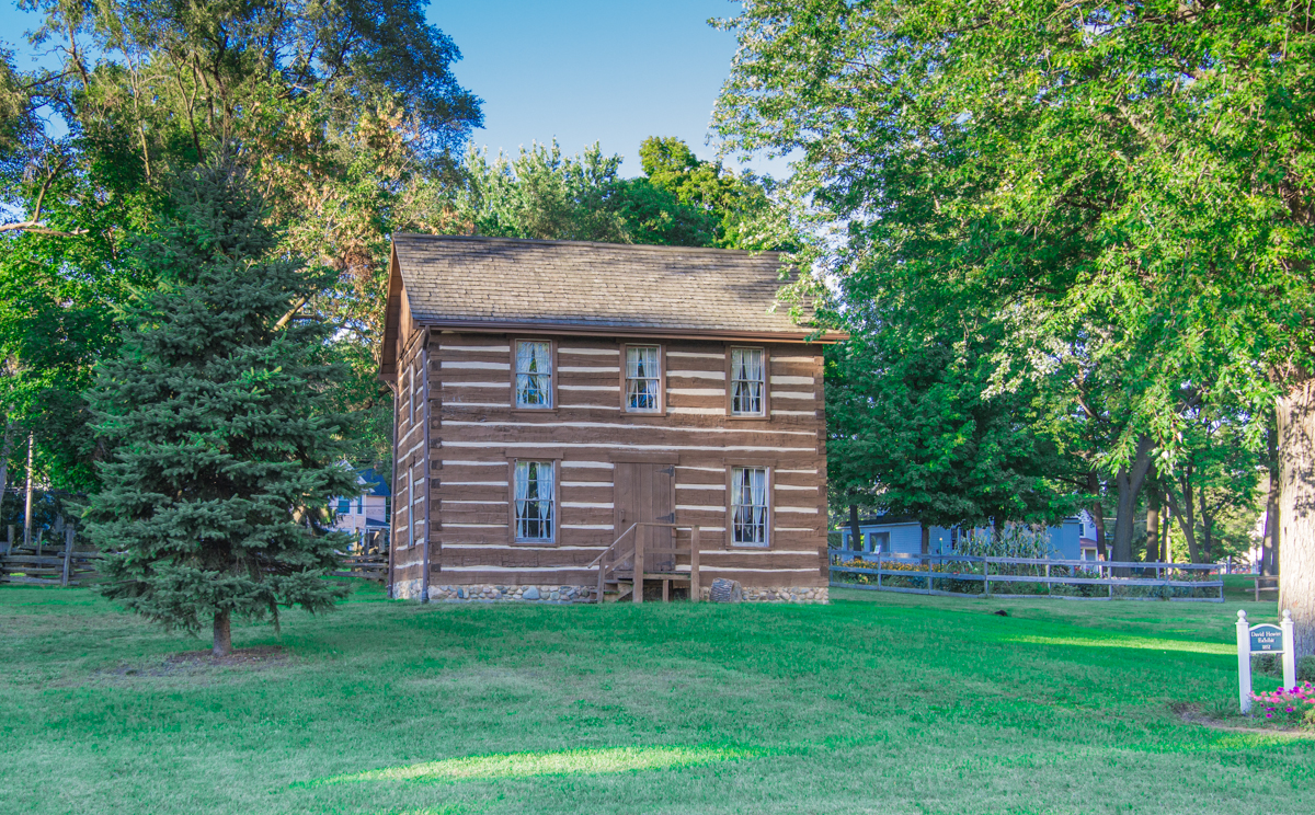


Brownlee Park, Michigan
Brownlee Park is a community of 1,661 people in Calhoun County, Michigan.
Why visit Brownlee Park
Townapedia lists 17 museums and landmarks, 8 parks and trails and 21 places to eat in and around town.
Highlights include Adam C. Arnold Block, Advent Historic District, Bailey Park and Piper Park.
July is the warmest month, with average highs of 83°F; January lows average 17°F.
Weather in Brownlee Park
Forecast from the National Weather Service. Full forecast
About Brownlee Park
Brownlee Park is a census-designated place (CDP) in Calhoun County in the U.S. state of Michigan.The population was 2,021 at the 2020 census. The CDP is immediately east of the city of Battle Creek and is part of the Battle Creek Metropolitan Statistical Area.
From the Wikipedia article Brownlee Park, Michigan (this version), under CC BY-SA 4.0.
Museums and landmarks17

Adam C. Arnold Block
Monument and historic site · National Register of Historic Places · 2.5 mi
Demolished commercial building in Battle Creek, Michigan
Advent Historic District
Monument and historic site · National Register of Historic Places · 3.2 mi
United States historic place

Battle Creek City Hall
Monument and historic site · National Register of Historic Places · 2.5 mi
City hall in Battle Creek, Michigan, USA

Battle Creek Sanitarium
Monument and historic site · National Register of Historic Places · 2.8 mi
Health resort

Battle Creek Tower
Monument and historic site · National Register of Historic Places · 2.6 mi
Mixed-use commercial and residential building located at 70 West Michigan Avenue in Battle Creek, Michigan
City Hall Historic District
Monument and historic site · National Register of Historic Places · 2.5 mi
Historic district in Battle Creek, Michigan
Heritage Tower
Monument and historic site · National Register of Historic Places · 2.6 mi
Mixed-use commercial and residential building in Battle Creek, Michigan

Maple Street Historic District
Monument and historic site · National Register of Historic Places · 2.0 mi
Residential historic district located at 161-342 Capital Avenue NE in Battle Creek, Michigan

Michigan Central Railroad Depot
Monument and historic site · National Register of Historic Places · 2.8 mi
Station in Battle Creek, Michigan
Milk Producers Company Barn
Monument and historic site · National Register of Historic Places · 3.1 mi
Historic building in Battle Creek, Michigan, United States

Old Battle Creek Post Office
Monument and historic site · National Register of Historic Places · 2.5 mi
Post office in Battle Creek, Michigan, United States
Penniman Castle
Monument and historic site · National Register of Historic Places · 2.4 mi
House
5 more on the map.
Parks, trails and playgrounds8



Restaurants and cafes21

Biggby Coffee
Cafe · Coffee Shop · 1.2 mi
1125 East Michigan Avenue, Battle Creek
Mo-Sa 06:00-20:00, Su 07:00-20:00



McDonald's
Fast food · Burger · 1.3 mi
1085 Capital Avenue Northeast, Battle Creek
Mo 07:00-23:00; Tu 06:00-23:00; We 16:00-23:00; Th-Su 06:00-23:00
9 more on the map.
Churches and places of worship2


Dime Tabernacle
Church · 2.9 mi
Fourth Seventh-day Adventist church built in Battle Creek, Michigan

Shopping1
Gas and EV charging6
Schools, colleges and libraries38
Battle Creek Central High School
School · 2.5 mi
100 Van Buren St W, Battle Creek
Battle Creek Stem Innovation Center
School · 2.6 mi
100 Van Buren St W, Battle Creek
Healthcare1
Map of Brownlee Park
94 places. The map loads OpenStreetMap tiles when you open it.
Climate by month
Monthly table
| Month | High | Low | Rain |
|---|---|---|---|
| Jan | 31°F | 17°F | 1.6 in |
| Feb | 34°F | 19°F | 1.2 in |
| Mar | 45°F | 27°F | 1.7 in |
| Apr | 59°F | 37°F | 2.9 in |
| May | 70°F | 49°F | 3.7 in |
| Jun | 79°F | 58°F | 3.4 in |
| Jul | 83°F | 62°F | 3.4 in |
| Aug | 81°F | 61°F | 3.4 in |
| Sep | 74°F | 53°F | 3.2 in |
| Oct | 61°F | 42°F | 3.5 in |
| Nov | 47°F | 32°F | 2.1 in |
| Dec | 36°F | 24°F | 1.4 in |
U.S. Climate Normals 1991-2020 for Battle Creek Kellogg Ap (6 mi away), NOAA NCEI.
People and cost of living
American Community Survey 5-year estimates, 2020-2024, U.S. Census Bureau. Estimates have margins of error, larger for small towns.
Disaster history
Calhoun County has had 5 federal disaster declarations since 2000, most often for biologicals.
- 2020-03-27: Covid-19 Pandemic (Biological)
- 2020-03-13: Covid-19 (Biological)
- 2005-09-07: Hurricane Katrina Evacuation (Hurricane)
- 2003-09-23: Power Outage (Other)
- 2001-01-10: Snow (Snowstorm)
OpenFEMA disaster declarations summaries.
Getting there and nearby towns
W. K. Kellogg Regional Airport (BTL) is the nearest airport with scheduled flights listed in OpenStreetMap, 6 miles away.
- Battle Creek 5 mi west, about 8 min by car
- Bellevue 10 mi northeast, about 16 min by car
- Kalamazoo 24 mi west, about 38 min by car
- Portage 25 mi west, about 40 min by car
- Coldwater 27 mi south, about 44 min by car
- Bronson 32 mi south, about 51 min by car
- Jackson 38 mi east, about 1 h by car
- Holt 38 mi northeast, about 1 h by car
- Waverly 38 mi northeast, about 1 h by car
- Lansing 40 mi northeast, about 1 h by car
Drive times are estimates from straight-line distance, not routes.
Local news
Headlines from INDB, the NEMICO news database.
Reviews, tips and questions
Loading what members have shared...
Sources and licences
- NCES EDGE (Public domain): public schools
- NOAA NCEI U.S. Climate Normals 1991-2020 (Public domain): climate by month
- OpenFEMA (Public domain): disaster declarations
- OpenStreetMap contributors (ODbL 1.0): places, airports, map data
- U.S. Census Bureau (Public domain): population, income, housing, education, commute
- Wikidata (CC0 1.0): elevation, founding date, time zone, website, landmarks and historic places
- Wikimedia Commons (see each image): photos
- Wikipedia (CC BY-SA 4.0): overview and history text
Photo credits
- Advent Historic District, rossograph, CC BY-SA 4.0
- Adam C Arnold Block Battle Creek, Randy L Case, Public domain
- Battle Creek City Hall-Battle Creek, rossograph, CC BY-SA 4.0
- The Merrit House, Jim Roberts, CC BY-SA 4.0
- The Kellogg House (battlecreekcvb) 002, Battle Creek CVB, CC BY 2.0
- Penniman Castle, rossograph, CC BY-SA 4.0
- Record Printing and Box Battle Creek, Battle Creek City Directory, Public domain
- ClarasontheRiver1, Claramare, Public domain
- The Battle Creek Federal Center (battlecreekcvb) 001, Battle Creek CVB, CC BY 2.0
- Phelps Sanitarium Battle Creek, AC Besselman and Co, Public domain
- Battle Creek, Michigan (2008), battlecreekcvb, CC BY 2.0
- Battle Creek Post Office, rossograph, CC BY-SA 4.0
- 209 Emmett St, Jim Roberts, CC BY-SA 4.0
- Dime Tabernacle, Unknown author Unknown author, Public domain
- Danny Young (9203858903) (cropped), Joel Dinda, CC BY 2.0
- Danny Young (9203858903), Joel Dinda, CC BY 2.0
- Tanner Tully (14301241472) (cropped), Joel Dinda, CC BY 2.0
- Tanner Tully (14301241472), Joel Dinda, CC BY 2.0
- Cody Sedlock (14162870370), Joel Dinda, CC BY 2.0
- Sterling Sharp (14200921199), Joel Dinda, CC BY 2.0
- Dakota Mekkes 1, Joel Dinda, CC BY 2.0
- Sterling Sharp (14200921199) (cropped), Joel Dinda, CC BY 2.0
- Cody Sedlock (14162870370) (cropped), Joel Dinda, CC BY 2.0
- Skeeter Barnes 2, Joel Dinda from Mulliken, Michigan, CC BY 2.0
- Manny Trillo 1, Joel Dinda, CC BY 2.0
- Lugnuts-Sean Marshall1, Joel Dinda from Mulliken, Michigan, CC BY 2.0
- Brady Williams (166934860), Joel Dinda, CC BY 2.0
- Sterling Sharp color, Joel Dinda, CC BY 2.0
- Sterling Sharp color (cropped), Joel Dinda, CC BY 2.0


Page built October 30, 2026. Spotted a mistake? Tell us or suggest a place.