


Why visit Portage
Townapedia lists 51 museums and landmarks, 42 parks and trails, 138 places to eat, 8 places to stay and 7 attractions in and around town.
Highlights include Celebration! Cinema Crossroads & IMAX, State Theatre, Air Zoo and Alonzo T. Prentice House.
July is the warmest month, with average highs of 83°F; January lows average 18°F.
Weather in Portage
Forecast from the National Weather Service. Full forecast
About Portage
Portage is a city in Kalamazoo County, Michigan, United States. The population was 48,891 at the 2020 census. It is the smaller of the two main cities included in the Kalamazoo-Portage Metropolitan Statistical Area, which had a population of 261,670 in 2020.
From the Wikipedia article Portage, Michigan (this version), under CC BY-SA 4.0.
Things to do7


State Theatre
Cinema and theater · National Register of Historic Places · 6.3 mi
Theatre and movie theater in Kalamazoo, Michigan, United States
Miller Auditorium
Cinema and theater · 5.8 mi
Theater at Western Michigan University in Kalamazoo, Michigan, United States

Western Michigan University
School · 6.1 mi
Public university located in Kalamazoo, Michigan, United States
Celery Flats Ampitheatre
Cinema and theater · 0.9 mi
Small open air amphitheater.
7335 Garden Lane, Portage
Museums and landmarks51

Air Zoo
Museum · 2.8 mi
Aerospace museum and amusement park in Portage, Michigan, USA
Mo-Sa 09:00-17:00; Su 12:00-17:00

Alonzo T. Prentice House
Monument and historic site · National Register of Historic Places · 6.3 mi
House in Kalamazoo, Michigan

Andrew J. Stevens House
Monument and historic site · National Register of Historic Places · 4.0 mi
Single-family home in Kalamazoo, Michigan

Booth-Dunham Estate
Monument and historic site · National Register of Historic Places · 4.9 mi
Single-family home located at 6059 South Ninth Street Texas Charter Township near Kalamazoo, Michigan

Bronson Park Historic District
Monument and historic site · National Register of Historic Places · 6.4 mi
Historic district of Kalamazoo, Michigan, USA

David Lilienfeld House
Monument and historic site · National Register of Historic Places · 6.4 mi
House in Kalamazoo, Michigan

Desenberg Building
Monument and historic site · National Register of Historic Places · 6.6 mi
Commercial building in Michigan
Dr. Nathan M. Thomas House
Monument and historic site · National Register of Historic Places · 5.9 mi
Single-family home located at 613 East Cass Street in Schoolcraft, Michigan
East Campus
Monument and historic site · National Register of Historic Places · 6.2 mi
Site of the original campus of Western Michigan University

Eric and Margaret Ann (Davis) Brown House
Monument and historic site · National Register of Historic Places · 5.0 mi
Single-family home located at 2806 Taliesin Drive in Kalamazoo, Michigan

Fanckboner-Nichols Farmstead
Monument and historic site · National Register of Historic Places · 6.4 mi
Farmhouse in Prairie Ronde Township, Michigan


Haymarket Historic District
Monument and historic site · National Register of Historic Places · 6.6 mi
Historic district in Kalamazoo, Michigan, USA
39 more on the map.
Parks, trails and playgrounds42

Millennium Park
Park · 1.3 mi
Fountain in the Summer and Ice Skating Rink in the Winter
280 Romence Road, Portage


30 more on the map.
Restaurants and cafes138

Cove Lakeside Bistro
Restaurant · American, Seafood · 1.7 mi
9110 Portage Road
Mo-Sa 11:00-21:00; Su 12:00-20:00
Dak Good
Restaurant · 3.0 mi
Welcome to Dak Good, Portage’s premier Asian fusion restaurant, proudly serving the community since 2025. We specialize in bold,...
5317 South Westnedge Avenue, Portage
Su-Th 11:00-21:30, Fr-Sa 11:00-22:00
Great Wall Express
Restaurant · Chinese · 4.4 mi
3025 South Westnedge Avenue, Kalamazoo
Mo-Th 11:00-22:00; Fr 11:00-23:00; Sa 12:00-23:00; Su 12:00-22:00
Kumo Hibachi & Sushi
Restaurant · Japanese · 1.9 mi
6396 South Westnedge Avenue, Portage
Mo-Fr 11:00-14:30

Presidential Brewing
Bar and pub · American · 1.5 mi
8302 Portage Road
Tu-Sa 12:00-22:00; Su 12:00-20:00


Super Carniceria Las Palmas
Restaurant · Pizza · 4.5 mi
911 East Cork Street, Kalamazoo
Mo-Su 09:00-21:00
126 more on the map.
History
Portage was settled in 1830, and incorporated as a city in 1963.
On May 7, 2024, the city was struck by a high-end EF2 tornado, causing significant damage to homes and properties. A FedEx distribution center was severely damaged after the tornado caused part of the roof to collapse. Over 500 buildings were damaged, with 60 being destroyed, including a strip mall.
From the History section of Portage, Michigan on Wikipedia, under CC BY-SA 4.0.
Where to stay8
Homewood Suites by Hilton Kalamazoo-Portage
Motel and hotel · 2.9 mi
500 Trade Centre Way, Portage
Churches and places of worship26
Grace Christian Reformed Church
Church · Reformed · 4.5 mi
3215 Oakland Drive, Kalamazoo
Shopping35
Gas and EV charging28
Schools, colleges and libraries54
Healthcare11
Map of Portage
250 places. The map loads OpenStreetMap tiles when you open it.
Climate by month
Monthly table
| Month | High | Low | Rain |
|---|---|---|---|
| Jan | 32°F | 18°F | 1.7 in |
| Feb | 35°F | 20°F | 1.3 in |
| Mar | 46°F | 27°F | 2.0 in |
| Apr | 59°F | 38°F | 3.1 in |
| May | 70°F | 49°F | 3.7 in |
| Jun | 80°F | 58°F | 3.2 in |
| Jul | 83°F | 62°F | 3.4 in |
| Aug | 81°F | 60°F | 3.7 in |
| Sep | 74°F | 52°F | 3.3 in |
| Oct | 61°F | 42°F | 3.7 in |
| Nov | 48°F | 32°F | 2.5 in |
| Dec | 36°F | 24°F | 1.7 in |
U.S. Climate Normals 1991-2020 for Kalamazoo Battle Ck Intl Ap (3 mi away), NOAA NCEI.
People and cost of living
American Community Survey 5-year estimates, 2020-2024, U.S. Census Bureau. Estimates have margins of error, larger for small towns.
Disaster history
Kalamazoo County has had 6 federal disaster declarations since 2000, most often for biologicals.
- 2026-06-30: Severe Storms, Tornadoes, And Flooding (Flood)
- 2020-03-27: Covid-19 Pandemic (Biological)
- 2020-03-13: Covid-19 (Biological)
- 2005-09-07: Hurricane Katrina Evacuation (Hurricane)
- 2003-09-23: Power Outage (Other)
- 2001-01-10: Snow (Snowstorm)
OpenFEMA disaster declarations summaries.
Getting there and nearby towns
Kalamazoo-Battle Creek International Airport (AZO) is the nearest airport with scheduled flights listed in OpenStreetMap, 3 miles away.
- Kalamazoo 5 mi north, about 9 min by car
- Battle Creek 20 mi east, about 32 min by car
- Coldwater 35 mi southeast, about 56 min by car
- Elkhart 39 mi southwest, about 1 h by car
- Granger 42 mi southwest, about 1 h 15 min by car
- Niles 42 mi southwest, about 1 h 15 min by car
- Goshen 45 mi south, about 1 h 15 min by car
- Cutlerville 45 mi north, about 1 h 15 min by car
- Mishawaka 47 mi southwest, about 1 h 15 min by car
- Kentwood 48 mi north, about 1 h 15 min by car
Drive times are estimates from straight-line distance, not routes.
Local news
Headlines from INDB, the NEMICO news database.
Reviews, tips and questions
Loading what members have shared...
Sources and licences
- NCES EDGE (Public domain): public schools
- NOAA NCEI U.S. Climate Normals 1991-2020 (Public domain): climate by month
- OpenFEMA (Public domain): disaster declarations
- OpenStreetMap contributors (ODbL 1.0): places, airports, map data
- U.S. Census Bureau (Public domain): population, income, housing, education, commute
- Wikidata (CC0 1.0): elevation, founding date, time zone, website, landmarks and historic places
- Wikimedia Commons (see each image): photos
- Wikipedia (CC BY-SA 4.0): overview and history text
Photo credits
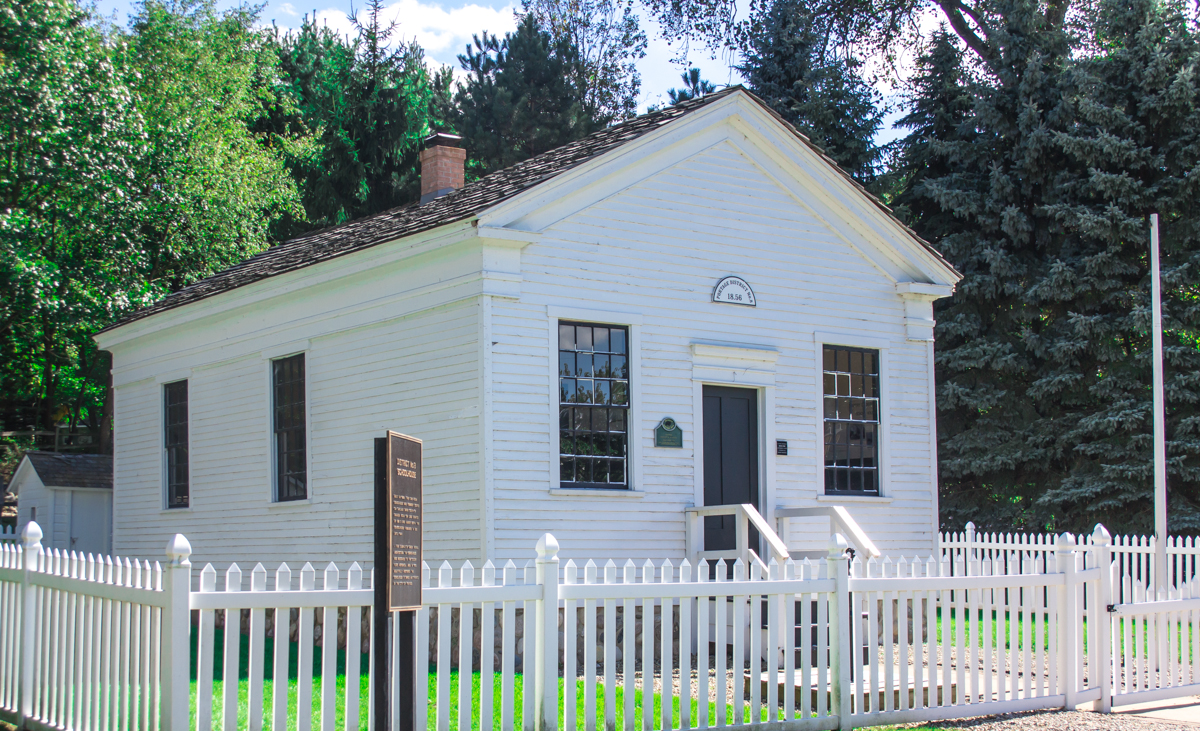
- Portage District No. 8 School, rossograph, CC BY-SA 4.0
- EF2 damage Portage, MI 2024 (5), National Weather Service Grand Rapids MI, Public domain
- EF2 damage Portage, MI 2024 (4), National Weather Service Grand Rapids MI, Public domain
- EF2 damage Portage, MI 2024 (6), National Weather Service Grand Rapids MI, Public domain
- EF2 damage Portage, MI 2024 (1), National Weather Service Grand Rapids MI, Public domain
- EF2 damage Portage, MI 2024 (2), National Weather Service Grand Rapids MI, Public domain
- EF2 damage Portage, MI 2024 (3), National Weather Service Grand Rapids MI, Public domain
- EF2 damage Portage, MI 2024 (8), National Weather Service Grand Rapids MI, Public domain
- EF2 damage Portage, MI 2024 (7), National Weather Service Grand Rapids MI, Public domain
- Slab of where a mobile home once stood in Portage, MI, The Rochelle EF4, CC0
- SEARS - Portage MI, Kzoo Cowboy, CC BY 2.0
- Crossroads Mall (Portage, Michigan) 1, Kzoo Cowboy, CC BY 2.0
- The Crossroads Mall, Portage Mich. (32794815847), Kzoo Cowboy, CC BY 2.0
- Indo American Cultural Center Portage MI 2019 11 10 13 57 09, Shibamouli Lahiri, CC BY-SA 4.0
- Wendy's - W. Centre Ave, Portage, MI (43375509390), Kzoo Cowboy, CC BY 2.0
- Air Zoo Main Entrance, User:my name, CC BY-SA 3.0
- PeterBAppledornHouseKalamazooMI, Andrew Jameson, CC BY-SA 3.0
- MartinWRobertsHouseKalamazooMI, Andrew Jameson, CC BY-SA 3.0
- State Hospital Gatehouse, rossograph, CC BY-SA 4.0
- State Theatre, Gpwitteveen, CC BY-SA 3.0
- Haymarket Historic District, rossograph, CC BY-SA 4.0
- The Desenberg Building, Jim Roberts, CC BY-SA 4.0
- The Henderson Castle at 100 Monroe St, Jim Roberts, CC BY-SA 4.0
- HenryGilbertHouseKalamazooMI, Andrew Jameson, CC BY-SA 3.0
- Booth-Dunham Estate, rossograph, CC BY-SA 4.0
- The Alonzo T. prentice House, Jim Roberts, CC BY-SA 4.0
- VineAreaHistoricDistrictBKalamazooMI, Andrew Jameson, CC BY-SA 3.0
- Andre J. Stevens House, rossograph, CC BY-SA 4.0
- Fanckboner-Nichols Farmstead, rossograph, CC BY-SA 4.0
- The Portage Street Fire Station, Jim Roberts, CC BY-SA 4.0
- DavidLilienfeldHouseKalamazooMI, Andrew Jameson, CC BY-SA 3.0
- The Eric and Margaret Brown House, Jim Roberts, CC BY-SA 4.0
- John Gibbs House, rossograph, CC BY-SA 4.0
- ISS046-E-46359 - View of Earth, Earth Science and Remote Sensing Unit , Lyndon B. Johnson Space Center, Public domain
- ISS046-E-46361 - View of Earth, Earth Science and Remote Sensing Unit , Lyndon B. Johnson Space Center, Public domain
- ISS046-E-46360 - View of Earth, Earth Science and Remote Sensing Unit , Lyndon B. Johnson Space Center, Public domain
- Quercus palustris - Adam DeHollander - 701262630, Adam DeHollander, CC0
- Quercus palustris - Adam DeHollander - 701262492, Adam DeHollander, CC0
- Quercus palustris - Adam DeHollander - 701262556, Adam DeHollander, CC0
- Avatar 2 IMAX screening room entrance, Celebration Cinema Crossroads, ShadZ01, CC BY 4.0


Page built October 30, 2026. Spotted a mistake? Tell us or suggest a place.