


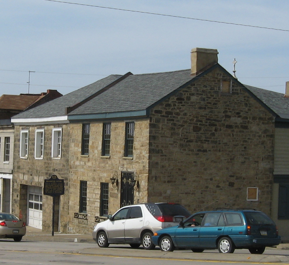


Brownsville, Pennsylvania
Brownsville is a borough of 2,412 people in Fayette County, Pennsylvania, founded in 1785.
Why visit Brownsville
Townapedia lists 23 museums and landmarks, 1 park or trail, 8 places to eat and 5 attractions in and around town.
Highlights include Lane Bane Bridge, Mon-Fayette Expressway Bridge, Dunlap's Creek Bridge and Bowman's Castle.
July is the warmest month, with average highs of 85°F; January lows average 21°F.
Weather in Brownsville
Forecast from the National Weather Service. Full forecast
About Brownsville
Brownsville is a borough in Fayette County, Pennsylvania, United States, first settled in 1785 as the site of a trading post a few years after the defeat of the Iroquois enabled a resumption of westward migration after the American Revolutionary War. The trading post soon became a tavern and inn and was receiving emigrants heading west, as it was located above the cut bank overlooking the first ford that could be reached to those descending from the Allegheny Mountains. Brownsville is located 40 miles (64 km) south of Pittsburgh along the east bank of the Monongahela River.
From the Wikipedia article Brownsville, Pennsylvania (this version), under CC BY-SA 4.0.
Things to do5


Mon-Fayette Expressway Bridge
Bridge · 2.5 mi
Bridge in United States of America

PennWest California
School · 3.0 mi
Public university located in California, Pennsylvania, United States

West Brownsville Junction Bridge
Bridge · 1.3 mi
Bridge in United States of America

Museums and landmarks23
Dunlap's Creek Bridge
Bridge · National Register of Historic Places
Bridge in United States of America

Bowman's Castle
Monument and historic site · National Register of Historic Places · 0.4 mi
Brownsville, Pennsylvania, NRHP-listed

Brownsville Bridge
Bridge · National Register of Historic Places
Bridge in United States of America

Brownsville Commercial Historic District
Monument and historic site · National Register of Historic Places
Historic district in Pennsylvania, United States
Brownsville Northside Historic District
Monument and historic site · National Register of Historic Places · 0.5 mi
Historic district in Pennsylvania, United States

California Area Public Library
Monument and historic site · National Register of Historic Places · 3.4 mi
Public library in Pennsylvania

Hugh Laughlin House
Monument and historic site · National Register of Historic Places · 3.0 mi
Historic house in Pennsylvania, United States

Jennings-Gallagher House
Monument and historic site · National Register of Historic Places · 3.1 mi
California, Pennsylvania

Joseph Dorsey House
Monument and historic site · National Register of Historic Places · 1.8 mi
Historic house in Pennsylvania, United States

Malden Inn
Monument and historic site · National Register of Historic Places · 2.5 mi
Hotel in Blainsburg, United States of America

Molly Fleming House
Monument and historic site · National Register of Historic Places · 3.1 mi
Historic building in California, Pennsylvania


Mount Saint Macrina
Monument and historic site · National Register of Historic Places · 3.2 mi
Building in Pennsylvania, United States
11 more on the map.
Parks, trails and playgrounds1

Restaurants and cafes8



History
In pre-Columbian times, the right bank of the Monongahela River held several mounds where iron-rich red stone predominated, now believed to have been constructed by a branch of the Mound Builders cultures, but believed by colonials to have been forts. This led to the area near the river crossing being called Redstone Old Fort in various colonial government records and later Fort Burd when an arms cache was built there. By the time the region first became known to Dutch colonists and traders and the French in the 1640s, the lands were largely unoccupied, but under the management of one tribe or shared by several groups of Iroquoian peoples, likely the Erie people or Wenro people and possibly shared with the Seneca, the Shawnee people and the Susquehannocks. With all the rivers and streams tributary to the Monongahela, Youghiogheny, and Allegheny Rivers, there is little known about the region's precise role in the Beaver Wars of the 17th century, but when French, Dutch and Swedish fur traders penetrated to the Greater Ohio Basin in the 1640s and 1650s, the one thing that seemed clear to those observers was that the lands later termed the Ohio Country seemed empty and unpopulated.
From the History section of Brownsville, Pennsylvania on Wikipedia, under CC BY-SA 4.0.
Churches and places of worship5
St. Peter's Church
Church · National Register of Historic Places · 0.7 mi
Saint Peter's Church
Church · Roman Catholic · 0.7 mi
304 Shaffner Avenue, Brownsville
Holy Resurrection Orthodox Church
Church · Orthodox · 0.4 mi
118 Main Street, West Brownsville
Shopping3
Gas and EV charging5
Schools, colleges and libraries14
Healthcare2
Map of Brownsville
66 places. The map loads OpenStreetMap tiles when you open it.
Climate by month
Monthly table
| Month | High | Low | Rain | Snow |
|---|---|---|---|---|
| Jan | 39°F | 21°F | 3.2 in | 3.8 in |
| Feb | 42°F | 22°F | 2.8 in | 2.7 in |
| Mar | 51°F | 29°F | 3.4 in | 2.1 in |
| Apr | 64°F | 39°F | 3.5 in | 0.0 in |
| May | 74°F | 51°F | 3.9 in | 0.0 in |
| Jun | 81°F | 60°F | 4.3 in | 0.0 in |
| Jul | 85°F | 64°F | 4.0 in | 0.0 in |
| Aug | 84°F | 62°F | 3.5 in | 0.0 in |
| Sep | 78°F | 56°F | 3.3 in | 0.0 in |
| Oct | 66°F | 44°F | 2.9 in | 0.0 in |
| Nov | 54°F | 34°F | 2.9 in | 0.2 in |
| Dec | 43°F | 27°F | 3.3 in | 1.5 in |
U.S. Climate Normals 1991-2020 for Charleroi Lock 4 (9 mi away), NOAA NCEI.
People and cost of living
American Community Survey 5-year estimates, 2020-2024, U.S. Census Bureau. Estimates have margins of error, larger for small towns.
Disaster history
Fayette County has had 10 federal disaster declarations since 2000, most often for severe storms.
- 2020-03-30: Covid-19 Pandemic (Biological)
- 2020-03-13: Covid-19 (Biological)
- 2016-03-23: Severe Winter Storm And Snowstorm (Snowstorm)
- 2013-10-01: Severe Storms, Tornadoes, And Flooding (Severe Storm)
- 2012-10-29: Hurricane Sandy (Hurricane)
- 2010-04-16: Severe Winter Storms And Snowstorms (Snowstorm)
OpenFEMA disaster declarations summaries.
Getting there and nearby towns
Greene County Airport (WAY) is the nearest airport with scheduled flights listed in OpenStreetMap, 15 miles away.
- West Brownsville 1 mi north, about 1 min by car
- Hiller 1 mi southwest, about 2 min by car
- Republic 4 mi south, about 6 min by car
- Speers 7 mi north, about 12 min by car
- Fairhope 7 mi north, about 12 min by car
- North Belle Vernon 8 mi north, about 13 min by car
- Perryopolis 9 mi northeast, about 14 min by car
- Bentleyville 9 mi northwest, about 15 min by car
- North Charleroi 9 mi north, about 15 min by car
- Nemacolin 10 mi south, about 16 min by car
Drive times are estimates from straight-line distance, not routes.
Local news
Headlines from INDB, the NEMICO news database.
Reviews, tips and questions
Loading what members have shared...
Sources and licences
- NCES EDGE (Public domain): public schools
- NOAA NCEI U.S. Climate Normals 1991-2020 (Public domain): climate by month
- OpenFEMA (Public domain): disaster declarations
- OpenStreetMap contributors (ODbL 1.0): places, airports, map data
- U.S. Census Bureau (Public domain): population, income, housing, education, commute
- Wikidata (CC0 1.0): elevation, founding date, time zone, website, landmarks and historic places
- Wikimedia Commons (see each image): photos
- Wikipedia (CC BY-SA 4.0): overview and history text
Photo credits
- BrownsvilleNeck, Breakfastchief a/k/a Jonathan R. Henke, Public domain
- Dunlap creek bridge jet lowe 1983, Jet Lowe, Public domain
- Calpubliclib, VitaleBaby ( talk ), Public domain
- Brashear House, Brownsville_Northside_Historic_District.jpg : Nyttend derivative work: Sisyphos23 ( talk ), Public domain
- Oldbrownsville, VitaleBaby ( talk ), Public domain
- Malden Inn, Generic1139, CC BY-SA 3.0
- Hugh Laughlin Farm driveway, Nyttend, Public domain
- Nemacolin Castle PA1, Acroterion, CC BY-SA 4.0
- St. Peters from Church Street in Brownsville, The original uploader was Ikcerog at English Wikipedia ., Public domain
- CalOldMain, Wjmoore17, CC BY-SA 3.0
- Joseph Dorsey House, Jack Boucher, Public domain
- Jennings-Gallagher House south side, Generic1139, CC BY-SA 3.0
- Springer Farm buildings, Jet Lowe, Public domain
- Wallace-Baily Tavern, Generic1139, CC BY-SA 3.0
- Molly Fleming House, Generic1139, CC BY-SA 3.0
- Thomas H. Thompson House angle, Generic1139, CC BY-SA 3.0
- Oak Hill Estate and west gate, Generic1139, CC BY 3.0
- Brown-Moore Blacksmith Shop, Generic1139, CC BY-SA 3.0
- Wbvillerr, VitaleBaby at en.wikipedia, Public domain
- Lanebane, VitaleBaby ( talk ), Public domain


Page built October 30, 2026. Spotted a mistake? Tell us or suggest a place.