


Calverton, New York
Calverton is a community of 5,618 people in Suffolk County, New York.
Why visit Calverton
Townapedia lists 10 museums and landmarks, 35 parks and trails, 35 places to eat, 9 places to stay and 8 attractions in and around town.
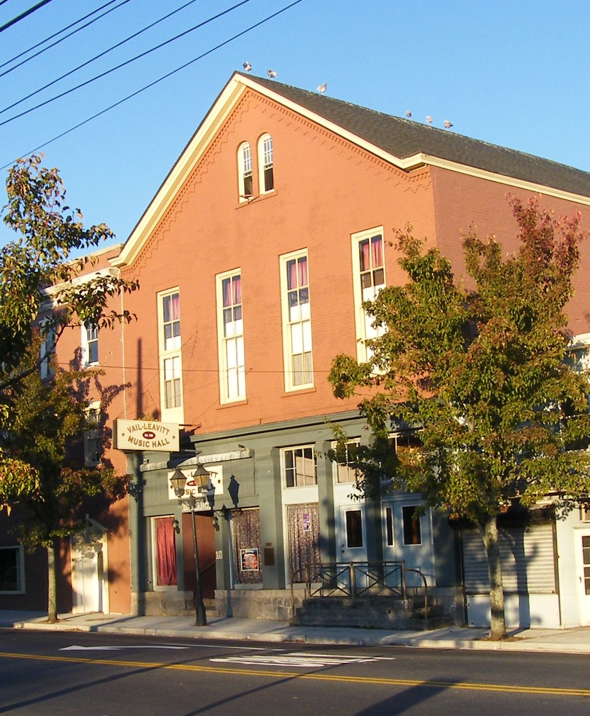
Highlights include Vail-Leavitt Music Hall, Long Island Aquarium and Exhibition Center, Benjamin King Woodhull House and Benson House.
July is the warmest month, with average highs of 83°F; January lows average 22°F.
Weather in Calverton
Forecast from the National Weather Service. Full forecast
About Calverton
Calverton is a hamlet and census-designated place (CDP) on eastern Long Island in Suffolk County, New York, United States. As of the 2020 census, Calverton had a population of 5,934.
From the Wikipedia article Calverton, New York (this version), under CC BY-SA 4.0.
Things to do8
Vail-Leavitt Music Hall
Cinema and theater · National Register of Historic Places · 5.8 mi
Theater and former movie theater in Riverhead, New York, United States

Long Island Aquarium and Exhibition Center
Monument and historic site · 6.1 mi
Aquarium in Riverhead, New York, United States


Sujecki Farms & Nurseries
Farm and orchard · 1.6 mi
758 Edwards Avenue, Calverton

Museums and landmarks10

Benjamin King Woodhull House
Monument and historic site · National Register of Historic Places · 4.8 mi
Historic house in New York, United States

Benson House
Monument and historic site · National Register of Historic Places · 4.8 mi
Site of a World War II counterintelligence operation, NRHP-listed

Josiah Woodhull House
Monument and historic site · National Register of Historic Places · 5.7 mi
Historic house in New York, United States

Suffolk County Historical Society Building
Monument and historic site · National Register of Historic Places · 5.5 mi
Building in New York, United States

Tuthill-Lapham House
Monument and historic site · National Register of Historic Places · 5.1 mi
Also known as Friendly Hall, historic home at Wading River in Suffolk County, New York

United States Post Office
Monument and historic site · National Register of Historic Places · 5.7 mi
Government building in Riverhead, New York

Parks, trails and playgrounds35





23 more on the map.
Restaurants and cafes35

J & R's Steakhouse
Restaurant · Steak House · 0.6 mi
4362 Middle Country Road, Calverton
Su-Fr 11:00-22:00; Fr 11:00-23:00

Bean & Bagel Cafe
Cafe · Bagel · 0.6 mi
4426 Middle Country Road, Calverton
Mo-Fr 05:30-15:00; Sa 06:00-15:00; Su 06:00-14:00


Golden Jalapenos Cafe
Restaurant · Tex-Mex · 0.7 mi
4486 Middle Country Road, Calverton
Mo-Su 10:00-20:00
23 more on the map.
History
Calverton was first referred to as "Baiting Hollow Station" when the Long Island Rail Road arrived in 1844. The station closed in 1958, but the sheltered shed for the station remained standing as of 2007.
The area's Native American name was Conungum or Kanungum, meaning "fixed line" or "boundary". In 1868, the Calverton post office opened, named for Bernard J. Calvert. It remained a small farming community specializing in cranberries, which grew in swampy areas along the Peconic River until the Navy purchase.
Calverton's history is tied closely to Naval Weapons Industrial Reserve Plant, Calverton. In 1953, the United States Navy purchased 6,000 acres (24 km2) around Calverton from a local farmer named Harry Edwards, including the mansion of a grandson of Frank Winfield Woolworth's, so that Grumman could test and finish jets. A 10,000-foot (3,000 m) runway was built, and most of Grumman's F-14 Tomcat and E-2C Hawkeye aircraft were to pass through the plant.
In 1965, Nelson Rockefeller proposed using the base as the fourth major airport for the New York metropolitan area. Grumman and local opposition ended the quest.
From the History section of Calverton, New York on Wikipedia, under CC BY-SA 4.0.
Where to stay9
Churches and places of worship5
Shopping16
Bloomingdale's The Outlet Store
Shopping center · 3.2 mi
1770 West Main Street, Riverhead
Gas and EV charging12
Schools, colleges and libraries13
Healthcare1
Map of Calverton
144 places. The map loads OpenStreetMap tiles when you open it.
Climate by month
Monthly table
| Month | High | Low | Rain |
|---|---|---|---|
| Jan | 38°F | 22°F | 3.8 in |
| Feb | 40°F | 23°F | 2.7 in |
| Mar | 47°F | 29°F | 5.0 in |
| Apr | 57°F | 38°F | 4.2 in |
| May | 68°F | 47°F | 3.7 in |
| Jun | 77°F | 56°F | 4.0 in |
| Jul | 83°F | 63°F | 3.3 in |
| Aug | 81°F | 62°F | 3.8 in |
| Sep | 75°F | 55°F | 4.3 in |
| Oct | 64°F | 44°F | 4.7 in |
| Nov | 53°F | 35°F | 3.9 in |
| Dec | 43°F | 27°F | 5.1 in |
U.S. Climate Normals 1991-2020 for Baiting Hollow (2 mi away), NOAA NCEI.
People and cost of living
American Community Survey 5-year estimates, 2020-2024, U.S. Census Bureau. Estimates have margins of error, larger for small towns.
Disaster history
Suffolk County has had 25 federal disaster declarations since 2000, most often for hurricanes.
- 2024-10-21: Severe Storm And Flooding (Severe Storm)
- 2024-08-25: Severe Storm And Flooding (Severe Storm)
- 2023-03-15: Severe Winter Storm And Snowstorm (Snowstorm)
- 2021-09-05: Remnants Of Hurricane Ida (Hurricane)
- 2021-09-02: Remnants Of Hurricane Ida (Hurricane)
- 2021-08-22: Hurricane Henri (Hurricane)
OpenFEMA disaster declarations summaries.
Getting there and nearby towns
Calverton Executive Airpark (CTO) is the nearest airport with scheduled flights listed in OpenStreetMap, 1 miles away.
- Baiting Hollow 3 mi north, about 5 min by car
- Manorville 4 mi south, about 7 min by car
- Riverhead 6 mi northeast, about 9 min by car
- Ridge 6 mi west, about 10 min by car
- Remsenburg-Speonk 8 mi southeast, about 13 min by car
- Northville 8 mi northeast, about 14 min by car
- Mastic 9 mi southwest, about 14 min by car
- Rocky Point 9 mi west, about 14 min by car
- Middle Island 9 mi west, about 15 min by car
- Shirley 10 mi southwest, about 16 min by car
Drive times are estimates from straight-line distance, not routes.
Local news
Headlines from INDB, the NEMICO news database.
Reviews, tips and questions
Loading what members have shared...
Sources and licences
- NCES EDGE (Public domain): public schools
- NOAA NCEI U.S. Climate Normals 1991-2020 (Public domain): climate by month
- OpenFEMA (Public domain): disaster declarations
- OpenStreetMap contributors (ODbL 1.0): places, airports, map data
- U.S. Census Bureau (Public domain): population, income, housing, education, commute
- Wikidata (CC0 1.0): elevation, founding date, time zone, website, landmarks and historic places
- Wikimedia Commons (see each image): photos
- Wikipedia (CC BY-SA 4.0): overview and history text
Photo credits
- Grumman-memorial-park, Americasroof at en.wikipedia, CC BY-SA 3.0
- Josiah Woodhull House, Team jib, CC BY-SA 3.0
- Benjamin King Woodhull House, Wading River, NY, DanTD, CC BY-SA 4.0
- Riverhead-post-office, Americasroof, CC BY-SA 3.0
- Suffolk-historic, Americasroof, CC BY-SA 3.0
- Vail-leavitt, Americasroof, CC BY-SA 3.0
- BensonWinter, AnthonySuggs, CC BY-SA 4.0
- Tuthill-Lapham House, Team jib, CC BY-SA 3.0
- Long Island Aquarium 2018 106, Photograph by Mike Peel ( www.mikepeel.net )., CC BY-SA 4.0
- At Long Island Game Farm 2024 13, Photograph by Mike Peel ( www.mikepeel.net )., CC BY-SA 4.0
- RP-1, Maxhaot, CC BY-SA 4.0
- ISS041-E-87302 - View of Earth, Earth Science and Remote Sensing Unit , Lyndon B. Johnson Space Center, Public domain
- ISS016-E-36259 - View of New York, Earth Science and Remote Sensing Unit , Lyndon B. Johnson Space Center, Public domain
- ISS065-E-155330 - View of Earth, Earth Science and Remote Sensing Unit , Lyndon B. Johnson Space Center, Public domain
- ISS065-E-155329 - View of Earth, Earth Science and Remote Sensing Unit , Lyndon B. Johnson Space Center, Public domain
- ISS065-E-88564 - View of Earth, Earth Science and Remote Sensing Unit , Lyndon B. Johnson Space Center, Public domain
- Ambystoma tigrinum 109010865, Dean Stavrides, CC BY 4.0
- Grave of Isaac Woodard Jr, U.S. Department of Veterans Affairs, Public domain
- Dr. VonDark´s Tunnel of Terror - panoramio, Pablo Costa Tirado (…, CC BY-SA 3.0
- Hollywood Stunt Rider - panoramio, Pablo Costa Tirado (…, CC BY-SA 3.0
- Going to Dr. Von Dak´s Tunnel of Terror - panoramio, Pablo Costa Tirado (…, CC BY-SA 3.0
- Indicadores - panoramio, Pablo Costa Tirado (…, CC BY-SA 3.0
- Giant Twister - panoramio (1), Pablo Costa Tirado (…, CC BY-SA 3.0
- Mapa - panoramio (1), Pablo Costa Tirado (…, CC BY-SA 3.0
- Alien Invasion - panoramio, Pablo Costa Tirado (…, CC BY-SA 3.0
- Giant Twister - panoramio (2), Pablo Costa Tirado (…, CC BY-SA 3.0
- Shotgun Falls - panoramio, Pablo Costa Tirado (…, CC BY-SA 3.0
- Zona de recreo - panoramio, Pablo Costa Tirado (…, CC BY-SA 3.0
- Giant Twister - panoramio, Pablo Costa Tirado (…, CC BY-SA 3.0
- MaxTrax - panoramio, Pablo Costa Tirado (…, CC BY-SA 3.0
- Abyss - panoramio, Pablo Costa Tirado (…, CC BY-SA 3.0
- SplishSplashMainEntrance, Railroadwiki, CC BY-SA 3.0
- Casetas del parque - panoramio, Pablo Costa Tirado (…, CC BY-SA 3.0
- Vista de la vegetación del parque - panoramio, Pablo Costa Tirado (…, CC BY-SA 3.0
- Carriles - panoramio, Pablo Costa Tirado (…, CC BY-SA 3.0
- Cliff Diver - panoramio (1), Pablo Costa Tirado (…, CC BY-SA 3.0
- Cliff Diver - panoramio, Pablo Costa Tirado (…, CC BY-SA 3.0
- Indicaciones - panoramio, Pablo Costa Tirado (…, CC BY-SA 3.0
- Grave of Albert Paulsen, U.S. Department of Veterans Affairs, Public domain
- Dragon´s Den - panoramio, Pablo Costa Tirado (…, CC BY-SA 3.0


Page built October 30, 2026. Spotted a mistake? Tell us or suggest a place.