


Castleton-on-Hudson, New York
Castleton-on-Hudson is a village of 1,591 people in Rensselaer County, New York, founded in 1827.
Why visit Castleton-on-Hudson
Townapedia lists 10 museums and landmarks, 3 parks and trails, 1 place to eat and 5 attractions in and around town.
Highlights include Alfred H. Smith Memorial Bridge, Castleton Bridge, Bethlehem House and Bethlehem Grange No. 137.
July is the warmest month, with average highs of 84°F; January lows average 16°F.
Weather in Castleton-on-Hudson
Forecast from the National Weather Service. Full forecast
About Castleton-on-Hudson
Castleton-on-Hudson is a village located in the southwestern part of the town of Schodack in Rensselaer County, New York, United States. As of the 2020 census, Castleton-on-Hudson had a population of 1,477. The village is southeast of Albany.
From the Wikipedia article Castleton-on-Hudson, New York (this version), under CC BY-SA 4.0.
Things to do5

Alfred H. Smith Memorial Bridge
Bridge · 2.4 mi
Bridge between Albany and Rensselaer Counties, New York

Castleton Bridge
Bridge · 2.3 mi
Bridge in Castleton-on-Hudson, New York


Museums and landmarks10
Bethlehem House
Monument and historic site · National Register of Historic Places · 1.1 mi
Historic house in Bethlehem, New York, United States

Bethlehem Grange No. 137
Monument and historic site · National Register of Historic Places · 3.3 mi
Building in New York, United States of America
Blink Bonnie
Monument and historic site · National Register of Historic Places · 3.2 mi
Listed on the National Register of Historic Places in Rensselaer County, New York

District School No. 1
Monument and historic site · National Register of Historic Places · 1.6 mi
High school in Bethlehem, New York, United States

District School No. 3
Monument and historic site · National Register of Historic Places · 3.1 mi
Listed on the NRHP in Castleton-on-Hudson, New York, USA
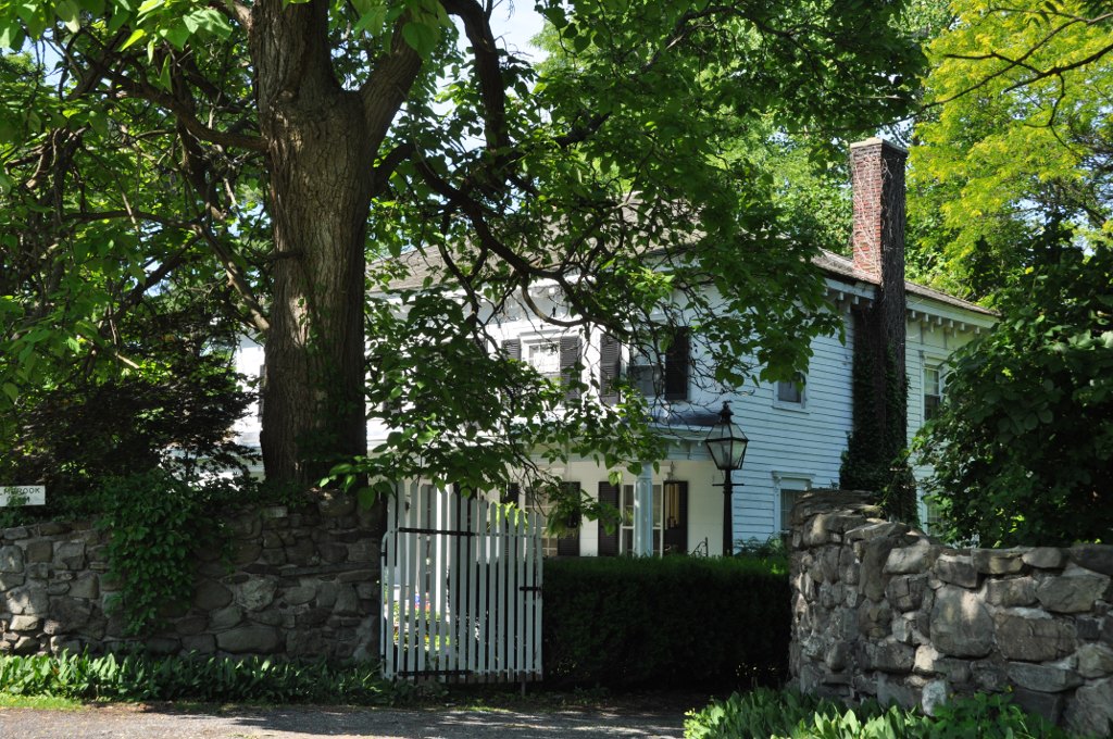
Elmbrook Farm
Monument and historic site · National Register of Historic Places · 3.1 mi
Building in New York, United States

Joachim Staats House and Gerrit Staats Ruin
Monument and historic site · National Register of Historic Places · 2.4 mi
Historic house in New York, United States

Mull House and Cemetery
Monument and historic site · National Register of Historic Places · 2.8 mi
Historic house in New York, United States


Schoonmaker House
Monument and historic site · National Register of Historic Places · 2.5 mi
Historic house in New York, United States
Tobias Ten Eyck House and Cemeteries
Monument and historic site · National Register of Historic Places · 3.3 mi
Historic house in New York, United States
Parks, trails and playgrounds3


Restaurants and cafes1

History
Castleton gets its name from the exploration of the North (Hudson) River by Henry Hudson. While traveling up the river, he came upon a Mahican Indian village noted for a large structure located on a rise above the river. This structure was a storehouse for foodstuffs, but was of such size that it was thought to be a "castle". Another theory for the derivation of the name "Castleton" comes from Rutherford Hayner's Troy and Rensselaer County New York: A History (1925). Hayner states "Although the exact location of this landing of Hudson's has been more or less conjectural, the weight of opinion places it at or near the present site of the village of Castleton, for on Castle Hill, back of the village, stood the dwelling of the chief of the Mohicans."
The area of Castleton was settled in 1792. When the small village was incorporated into Rensselaer County on April 13, 1827, there were about 100 people living in the area, mostly along the banks of the river. Between 1890 and 1920, the village had a booming economy, with small industry, a hotel, and a small port to gain access to river traffic. However, a large flood destroyed much of the business district in 1936, and the industry took the opportunity to relocate. These days the town is a very residential suburb, with some light agriculture.
The name of the village was changed from Castleton to Castleton-on-Hudson in 1927.
From the History section of Castleton-on-Hudson, New York on Wikipedia, under CC BY-SA 4.0.
Churches and places of worship5
First Reformed Dutch Church of Bethlehem
Church · National Register of Historic Places · 3.4 mi
Saint Paul's United Methodist Church
Church · Methodist · 1.5 mi
1583 Carney Road, Castleton-On-Hudson
Sacred Heart Catholic Church
Church · Roman Catholic · 0.8 mi
3 Catholic Way, Castleton-on-Hudson
Gas and EV charging1
Schools, colleges and libraries12
Maple Hill Junior/Senior High School
School · 2.1 mi
1216 Maple Hill Rd, Castleton
Rensselaer-Columbia-Greene Boces
School · 4.3 mi
10 Empire State Blvd-2Nd Fl, Castleton
Castleton Public Library
Library · 0.8 mi
85 South Main Street, Castleton-on-hudso
Map of Castleton-on-Hudson
37 places. The map loads OpenStreetMap tiles when you open it.
Climate by month
Monthly table
| Month | High | Low | Rain |
|---|---|---|---|
| Jan | 34°F | 16°F | 2.2 in |
| Feb | 37°F | 18°F | 2.2 in |
| Mar | 45°F | 27°F | 2.9 in |
| Apr | 59°F | 37°F | 3.3 in |
| May | 71°F | 48°F | 3.8 in |
| Jun | 79°F | 58°F | 4.5 in |
| Jul | 84°F | 62°F | 3.8 in |
| Aug | 82°F | 60°F | 4.4 in |
| Sep | 75°F | 52°F | 4.6 in |
| Oct | 62°F | 41°F | 4.3 in |
| Nov | 50°F | 32°F | 3.2 in |
| Dec | 39°F | 23°F | 2.9 in |
U.S. Climate Normals 1991-2020 for Valatie 1 N (8 mi away), NOAA NCEI.
People and cost of living
American Community Survey 5-year estimates, 2020-2024, U.S. Census Bureau. Estimates have margins of error, larger for small towns.
Disaster history
Rensselaer County has had 20 federal disaster declarations since 2000, most often for severe storms.
- 2021-08-22: Hurricane Henri (Hurricane)
- 2020-03-20: Covid-19 Pandemic (Biological)
- 2020-03-13: Covid-19 (Biological)
- 2017-07-12: Severe Winter Storm And Snowstorm (Snowstorm)
- 2012-10-28: Hurricane Sandy (Hurricane)
- 2011-09-08: Remnants Of Tropical Storm Lee (Severe Storm)
OpenFEMA disaster declarations summaries.
Getting there and nearby towns
Albany International Airport (ALB) is the nearest airport with scheduled flights listed in OpenStreetMap, 15 miles away.
- Albany 9 mi north, about 15 min by car
- Roessleville 11 mi north, about 18 min by car
- Loudonville 12 mi north, about 19 min by car
- Averill Park 12 mi northeast, about 20 min by car
- Watervliet 13 mi north, about 21 min by car
- Troy 14 mi north, about 23 min by car
- Latham 14 mi north, about 23 min by car
- Cohoes 16 mi north, about 26 min by car
- Niskayuna 20 mi north, about 32 min by car
- Schenectady 21 mi northwest, about 33 min by car
Drive times are estimates from straight-line distance, not routes.
Local news
Headlines from INDB, the NEMICO news database.
Reviews, tips and questions
Loading what members have shared...
Sources and licences
- NCES EDGE (Public domain): public schools
- NOAA NCEI U.S. Climate Normals 1991-2020 (Public domain): climate by month
- OpenFEMA (Public domain): disaster declarations
- OpenStreetMap contributors (ODbL 1.0): places, airports, map data
- U.S. Census Bureau (Public domain): population, income, housing, education, commute
- Wikidata (CC0 1.0): elevation, founding date, time zone, website, landmarks and historic places
- Wikimedia Commons (see each image): photos
- Wikipedia (CC BY-SA 4.0): overview and history text
Photo credits
- Former church in Castleton-on-Hudson, New York, Tyler A. McNeil, CC BY-SA 4.0
- Bethlehem HABS NY1, Norman R. Sturgis, HABS photographer, Public domain
- SchodackNY BlinkBonnie, User:Magicpiano, CC BY-SA 4.0
- Schoonmaker House, TrudiJ, CC BY-SA 4.0
- First Dutch Reformed Church Selkirk, TrudiJ, CC BY-SA 4.0
- Castleton District 3 School (side), UtsukushiHikariNY, CC BY-SA 4.0
- District School No. 1, New York, TrudiJ, CC BY-SA 4.0
- SchodackNY ElmbrookFarm, User:Magicpiano, CC BY-SA 4.0
- Mull Cemetery, Kent M. Miller, CC BY-SA 3.0
- Bethlehem Grange No. 137, New York, TrudiJ, CC BY-SA 4.0
- Castleton bridges, Kedalfax at en.wikipedia, Public domain
- Castleton Bridge 20091020, Jag9889, CC BY-SA 4.0
- Hudson Subdivision tracks along route 9J in East Greenbush, New York July 2026, 4300streetcar, CC BY 4.0
- Caesar Grave Marker, Findagrave.com Username: tofftroy, CC0


Page built October 30, 2026. Spotted a mistake? Tell us or suggest a place.