
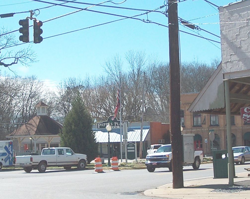


Why visit Cave Spring
Townapedia lists 4 museums and landmarks and 5 parks and trails in and around town.
Highlights include Cave Spring Commercial Historic District and John M. Carroll House.
July is the warmest month, with average highs of 91°F; January lows average 32°F.
Weather in Cave Spring
Forecast from the National Weather Service. Full forecast
About Cave Spring
Floyd County, Georgia, United States. It is located 17 miles (27 km) southwest of Rome, the county seat. As of the 2020 census, Cave Spring had a population of 1,174. It is part of the Rome, Georgia, metropolitan area.
From the Wikipedia article Cave Spring, Georgia (this version), under CC BY-SA 4.0.
Museums and landmarks4

Cave Spring Commercial Historic District
Monument and historic site · National Register of Historic Places
Historic district in Cave Spring, Georgia, USA
John M. Carroll House
Monument and historic site · National Register of Historic Places · 0.4 mi
House in Cave Spring, Georgia, United States of America


Wesley O. Conner House
Monument and historic site · National Register of Historic Places · 0.8 mi
Farmhouse in Cave Spring, Georgia
William S. Simmons Plantation
Monument and historic site · National Register of Historic Places · 0.6 mi
Also known as Wesley House, listed on the National Register of Historic Places (NRHP) in Georgia
Parks, trails and playgrounds5

Churches and places of worship6

Schools, colleges and libraries4


History
The town of Cave Spring dates to 1832, but the community is much older. Historically, indigenous peoples of the area (both Cherokee and the earlier Mississippian culture) used the site for drinking water, tribal meetings, and games, according to legend.
The town was founded in 1832 by Baptists who were among its early settlers. It takes its name from a clear water spring which still serves as the main source of drinking water for Cave Spring and nearby communities. The water is now delivered by a modern pumping system and has won awards for purity and taste.
The spring flows from its source inside the cave into a small rock pool or open reservoir, separated from a larger duck pond. Both ponds are located just outside the cave entrance, which is fronted by a man-made rock wall. These improvements were added as part of Rolater Park, named in 1921.
The wall encloses a lobby leading to the natural cave entrance, which widens to a larger cavity. The cave features limestone formations; one, a large stalagmite, is named the Devil's Stool. There is also a manmade staircase inside the cave for those who want to view the formations from above.
From the History section of Cave Spring, Georgia on Wikipedia, under CC BY-SA 4.0.
Map of Cave Spring
19 places. The map loads OpenStreetMap tiles when you open it.
Climate by month
Monthly table
| Month | High | Low | Rain |
|---|---|---|---|
| Jan | 53°F | 32°F | 4.9 in |
| Feb | 58°F | 35°F | 5.1 in |
| Mar | 66°F | 42°F | 5.3 in |
| Apr | 75°F | 49°F | 4.4 in |
| May | 82°F | 58°F | 4.0 in |
| Jun | 88°F | 67°F | 3.9 in |
| Jul | 91°F | 70°F | 4.9 in |
| Aug | 90°F | 69°F | 3.5 in |
| Sep | 85°F | 63°F | 3.7 in |
| Oct | 75°F | 50°F | 3.6 in |
| Nov | 64°F | 39°F | 4.4 in |
| Dec | 56°F | 35°F | 5.0 in |
U.S. Climate Normals 1991-2020 for Cedartown (7 mi away), NOAA NCEI.
People and cost of living
American Community Survey 5-year estimates, 2020-2024, U.S. Census Bureau. Estimates have margins of error, larger for small towns.
Disaster history
Floyd County has had 12 federal disaster declarations since 2000, most often for hurricanes.
- 2026-10-09: Hurricane Isaias (Tropical Storm)
- 2026-01-24: Severe Winter Storm (Winter Storm)
- 2024-09-26: Hurricane Helene (Tropical Storm)
- 2020-03-29: Covid-19 Pandemic (Biological)
- 2020-03-13: Covid-19 (Biological)
- 2017-09-15: Hurricane Irma (Hurricane)
OpenFEMA disaster declarations summaries.
Getting there and nearby towns
Richard B Russell Airport (RMG) is the nearest airport with scheduled flights listed in OpenStreetMap, 20 miles away.
- Cedartown 8 mi southeast, about 13 min by car
- Lindale 11 mi northeast, about 17 min by car
- Rome 14 mi northeast, about 23 min by car
- Berry College 15 mi northeast, about 25 min by car
- Aragon 17 mi east, about 27 min by car
- Rockmart 18 mi east, about 29 min by car
- Centre 19 mi west, about 31 min by car
- Piedmont 20 mi southwest, about 32 min by car
- Shannon 22 mi northeast, about 35 min by car
- Euharlee 23 mi east, about 38 min by car
Drive times are estimates from straight-line distance, not routes.
Local news
Headlines from INDB, the NEMICO news database.
Reviews, tips and questions
Loading what members have shared...
Sources and licences
- NOAA NCEI U.S. Climate Normals 1991-2020 (Public domain): climate by month
- OpenFEMA (Public domain): disaster declarations
- OpenStreetMap contributors (ODbL 1.0): places, airports, map data
- U.S. Census Bureau (Public domain): population, income, housing, education, commute
- Wikidata (CC0 1.0): elevation, founding date, time zone, website, landmarks and historic places
- Wikimedia Commons (see each image): photos
- Wikipedia (CC BY-SA 4.0): overview and history text
Photo credits
- Cavespring, Cculber007 at en.wikipedia, Public domain
- Cave Spring Train Station, C. Samuel Burnham, CC BY-SA 3.0
- Alabama Street, Cave Spring GA, John Phelan, CC BY 4.0
- Downtown Cave Spring, C. Samuel Burnham, CC BY-SA 3.0
- 1920 Chesapeake and Ohio RR Caboose, Cave Spring GA, John Phelan, CC BY 4.0
- Vann Cherokee Cabin, Cave Spring GA, John Phelan, CC BY 4.0
- Cave Spring General Store, Cave Spring GA, John Phelan, CC BY 4.0
- Samuel W Robbins House, Cave Spring GA, John Phelan, CC BY 4.0
- Cave Spring High School, Cave Spring, GA NRHP, James R. Lockhart, CC BY-SA 4.0
- Little Cedar Creek, Cave Spring GA, John Phelan, CC BY 4.0
- Oliver P. Fannin House, Cave Spring, GA NRHP, James R. Lockhart, CC BY-SA 4.0
- John M. Carroll house, Cave Spring, GA NRHP, James R. Lockhart, CC BY-SA 4.0
- Cave Spring Female Academy, Cave Spring, GA NRHP, James R. Lockhart, CC BY-SA 4.0
- Carroll-Richardson Grist Mill, Cave Spring, GA NRHP, James R. Lockhart, CC BY-SA 4.0
- Carroll-Richardson Grist Mill, Cave Spring, GA, US, Bubba73, CC BY-SA 4.0
- William D. Cowdry Plantation, Cave Spring, GA NRHP, James R. Lockhart, CC BY-SA 4.0
- Wesley O. Conner House, Cave Spring, GA NRHP, James R. Lockhart, CC BY-SA 4.0
- Wesley O. Connor House, rossograph, CC BY-SA 4.0
- Georgia School for the Deaf, Cyntata2672, CC BY-SA 4.0
- Vaejovis carolinianus 124356206, Alan Rockefeller, CC BY 4.0
- Vaejovis carolinianus 124356099, Alan Rockefeller, CC BY 4.0
- Vaejovis carolinianus 124356157, Alan Rockefeller, CC BY 4.0
- Fairview School, Cyntata2672, CC BY-SA 4.0
- Sprout Springs Road, Floyd County GA, John Phelan, CC BY 4.0


Page built October 30, 2026. Spotted a mistake? Tell us or suggest a place.