


Rome, Georgia
Rome is a city of 38,189 people in Floyd County, Georgia, founded in 1834.
Why visit Rome
Townapedia lists 20 museums and landmarks, 20 parks and trails, 76 places to eat, 14 places to stay and 12 attractions in and around town.
Highlights include Rome Cinema, DeSoto Theatre, Chieftains Museum and Clock Tower.
July is the warmest month, with average highs of 90°F; January lows average 30°F.
Weather in Rome
Forecast from the National Weather Service. Full forecast
About Rome
Rome is the largest city in and the county seat of Floyd County, Georgia, United States. Located in the foothills of the Appalachian Mountains, it is the principal city of the Rome, Georgia, metropolitan statistical area, which encompasses all of Floyd County. At the 2020 census, the city had a population of 37,713. It is the largest city in Northwest Georgia and the 26th-largest city in the state.
From the Wikipedia article Rome, Georgia (this version), under CC BY-SA 4.0.
Things to do12

DeSoto Theatre
Cinema and theater · 1.2 mi
Theatre and former movie theater in Rome, Georgia, United States

Museums and landmarks20

Chieftains Museum
Museum · National Register of Historic Places · 1.2 mi
Cherokee museum in Rome, Georgia, USA
We-Su 10:00-17:00

Clock Tower
Monument and historic site · National Register of Historic Places · 1.3 mi
Atop Neely Hill in Rome, Georgia, United States

East Rome Historic District
Monument and historic site · National Register of Historic Places · 2.0 mi
Historic district in Floyd County, Georgia, United States of America
South Broad Street Historic District
Monument and historic site · National Register of Historic Places · 1.3 mi
Historic district in Rome, Georgia

Berry College
Monument and historic site · National Register of Historic Places · 3.3 mi
College located in Mount Berry, Floyd County, Georgia

Between the Rivers Historic District
Monument and historic site · National Register of Historic Places · 1.3 mi
Historic district in Rome, Georgia

Myrtle Hill Cemetery
Monument and historic site · National Register of Historic Places · 1.1 mi
Cemetery in Rome, Floyd County, Georgia, United States
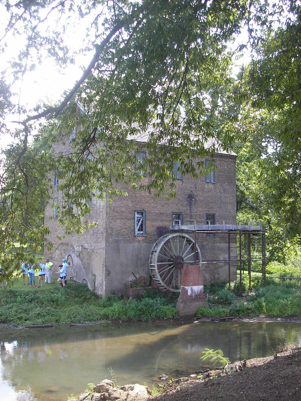
Old Brick Mill
Monument and historic site · National Register of Historic Places · 5.4 mi
Historic building in Lindale, Georgia, United States


United States Post Office and Courthouse
Monument and historic site · National Register of Historic Places · 1.2 mi
Historic building in Rome, Georgia, United States

Oak Hill & The Martha Berry Museum
Museum · 0.8 mi
Museum in Rome, Georgia
Tomb of the Known Soldier
Monument and historic site · 1.2 mi
Grave site in Myrtle Hill Cemetery in Rome, Georgia, United States
8 more on the map.
Parks, trails and playgrounds20




8 more on the map.
Restaurants and cafes76

Golden Crown Chinese Restaurant
Restaurant · Chinese · 2.3 mi
1850 Redmond Cir, Rome
Mo 11:30-20:00, Tu 11:00-20:00, We 11:00-16:00, Th-Fr 11:00-02:30
NYC Eats
Restaurant · American, Burger, Grill, Mediterranean · 2.2 mi
2108 Shorter Avenue
Mo-Su 11:00-20:00

Jerusalem Grill
Restaurant · Mediterranean · 0.4 mi
223 Turner McCall Boulevard
Su,Mo-Sa 11:00-19:15,11:00-18:15

64 more on the map.
Where to stay14
OYO Hotels - Rome West
Motel and hotel · 2.4 mi
2209 Shorter Avenue Southwest, Rome
Churches and places of worship76
Shopping22
Gas and EV charging19
Schools, colleges and libraries52
Bob Richards Regional Youth Detention Center
School · 1.5 mi
200 Marable Way Nw, Rome
Healthcare11
Map of Rome
250 places. The map loads OpenStreetMap tiles when you open it.
Climate by month
Monthly table
| Month | High | Low | Rain | Snow |
|---|---|---|---|---|
| Jan | 52°F | 30°F | 5.0 in | 0.1 in |
| Feb | 56°F | 33°F | 4.8 in | 0.0 in |
| Mar | 65°F | 39°F | 5.4 in | 0.0 in |
| Apr | 74°F | 46°F | 4.9 in | 0.0 in |
| May | 81°F | 55°F | 4.1 in | 0.0 in |
| Jun | 86°F | 64°F | 4.8 in | 0.0 in |
| Jul | 90°F | 68°F | 4.9 in | 0.0 in |
| Aug | 89°F | 67°F | 4.2 in | 0.0 in |
| Sep | 84°F | 60°F | 3.7 in | 0.0 in |
| Oct | 74°F | 48°F | 3.8 in | 0.0 in |
| Nov | 63°F | 38°F | 4.3 in | 0.0 in |
| Dec | 54°F | 33°F | 5.3 in | 0.3 in |
U.S. Climate Normals 1991-2020 for Rome Hcn (2 mi away), NOAA NCEI.
People and cost of living
American Community Survey 5-year estimates, 2020-2024, U.S. Census Bureau. Estimates have margins of error, larger for small towns.
Disaster history
Floyd County has had 12 federal disaster declarations since 2000, most often for hurricanes.
- 2026-10-09: Hurricane Isaias (Tropical Storm)
- 2026-01-24: Severe Winter Storm (Winter Storm)
- 2024-09-26: Hurricane Helene (Tropical Storm)
- 2020-03-29: Covid-19 Pandemic (Biological)
- 2020-03-13: Covid-19 (Biological)
- 2017-09-15: Hurricane Irma (Hurricane)
OpenFEMA disaster declarations summaries.
Getting there and nearby towns
Richard B Russell Airport (RMG) is the nearest airport with scheduled flights listed in OpenStreetMap, 6 miles away.
- Cedartown 17 mi south, about 28 min by car
- Calhoun 22 mi northeast, about 35 min by car
- Cartersville 23 mi east, about 37 min by car
- Dallas 31 mi southeast, about 50 min by car
- Acworth 32 mi southeast, about 52 min by car
- Fort Payne 32 mi northwest, about 51 min by car
- Kennesaw 36 mi southeast, about 58 min by car
- Dalton 37 mi north, about 59 min by car
- Canton 40 mi east, about 1 h by car
- Marietta 43 mi southeast, about 1 h 15 min by car
Drive times are estimates from straight-line distance, not routes.
Local news
Headlines from INDB, the NEMICO news database.
Reviews, tips and questions
Loading what members have shared...
Sources and licences
- NCES EDGE (Public domain): public schools
- NOAA NCEI U.S. Climate Normals 1991-2020 (Public domain): climate by month
- OpenFEMA (Public domain): disaster declarations
- OpenStreetMap contributors (ODbL 1.0): places, airports, map data
- U.S. Census Bureau (Public domain): population, income, housing, education, commute
- Wikidata (CC0 1.0): elevation, founding date, time zone, website, landmarks and historic places
- Wikimedia Commons (see each image): photos
- Wikipedia (CC BY-SA 4.0): overview and history text
Photo credits
- Rome Georgia from Myrtle Hill Cemetery, Matt Weaver, Public domain
- Shorter University School of Education - panoramio, Thomson M, CC BY 3.0
- Rome Georgia Historic Clocktower on Neely Hill, Matt Weaver, Public domain
- Chieftains, Culby ( talk ) en:User:Cculber007, Public domain
- MHC Main Gate, Culby ( talk )Cculber007 Uploaded by Cculber007 at en.wikipedia, Public domain
- Clock Tower; Rome, Georgia; June 23, 2011, Stephen Matthew Milligan, CC BY-SA 3.0
- Floyd County Administration Building; Rome, Georgia; June 23, 2011, Stephen Matthew Milligan, CC BY-SA 3.0
- Lindale Grist Mill, Blastoids, CC BY-SA 4.0
- Mary Hall at Berry College, Own work by Froggerlaura ( talk ), CC BY 3.0
Page built October 30, 2026. Spotted a mistake? Tell us or suggest a place.