


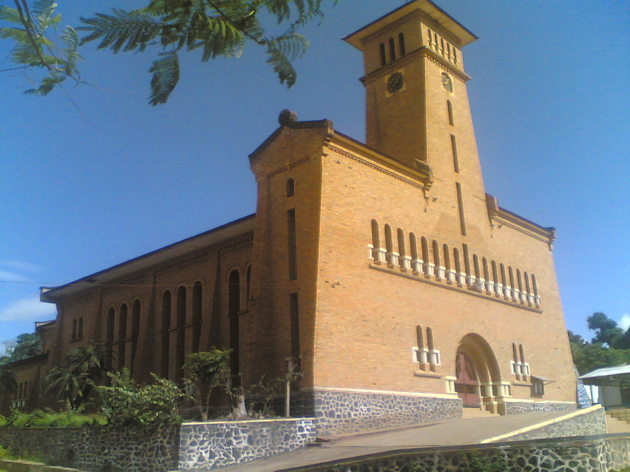


Boma, Democratic Republic of the Congo
Boma is a city of 297,009 people in Bas-Congo, Democratic Republic of the Congo.
Why visit Boma
Townapedia lists 3 museums and landmarks, 6 places to eat and 6 places to stay in and around town.
Weather in Boma
Forecast from MET Norway (CC BY 4.0). Full forecast
About Boma
Boma is a port town on the Congo River, some 100 kilometres (62 mi) upstream from the Atlantic Ocean, in the Kongo Central Province of the Democratic Republic of the Congo (DRC), adjacent to the border with Angola. It had an estimated population of 162,521 in 2012.
From the Wikipedia article Boma, Democratic Republic of the Congo (this version), under CC BY-SA 4.0.
Museums and landmarks3

Former residence of the Governor-General
Museum
(EN) Built in 1908, the house is a steel structure on stilts (FR) Construite en 1908, la maison est une structure en acier sur pilotis

Restaurants and cafes6

Yema Restaurant & Terrasse
Restaurant · Regional, Chicken, French, International, Fish And Chips, Seafood · 0.8 km
2515 Route du Commerce, Boma
Mo-Su 11:00-22:00

Where to stay6


Churches and places of worship9
Our Lady of the Assumption Cathedral, Boma
Church
Church in Boma, Democratic Republic of the Congo
Cathédrale Notre-Dame-de-l'Assomption
Church · Catholic
Built in 1920 in red bricks

History
Boma was founded by European merchants in the 16th century as an entrepôt, including for the slave trade. Trade was chiefly in the hands of Dutch merchants, but British, French and Portuguese firms also had factories there. No European power exercised sovereignty, though claims were from time to time put forward by Portugal.
British explorer Henry Morton Stanley arrived here on 9 August 1877, after crossing Africa from east to west.
In 1884 the people of Boma were forced to grant a protectorate of their country to the International Association of the Congo, made up of European powers. In 1886 King Leopold of Belgium established the Congo Free State, designating Boma as its capital. He ran the state as his personal fiefdom for several years, nearly enslaving many Congolese with a private military, and abusing them to force rubber production. International outrage and action by the Belgian legislature resulted in the government taking over supervision of what was established as the colony of the Belgian Congo in 1908.
Boma continued as the capital of the Belgian Congo until 1923. Léopoldville, since renamed as Kinshasa, was designated as the new capital.
From the History section of Boma, Democratic Republic of the Congo on Wikipedia, under CC BY-SA 4.0.
Shopping1
Gas and EV charging1
Schools, colleges and libraries4
Healthcare1
Map of Boma
31 places. The map loads OpenStreetMap tiles when you open it.
Getting there and nearby towns
Boma Airport (BOA) is the nearest airport with scheduled flights listed in OpenStreetMap, 8 km away.
- Matadi 45 km east, about 45 min by car
- Kenge 67 km east, about 1 h by car
- Moanda 76 km west, about 1 h 15 min by car
Drive times are estimates from straight-line distance, not routes.
Local news
Headlines from INDB.
Reviews, tips and questions
Loading what members have shared...
Sources and licences
- GeoNames (CC BY 4.0): population, coordinates, regions and time zone
- Mapillary (see each image): photos
- OpenStreetMap contributors (ODbL 1.0): places, airports, map data
- Wikidata (CC0 1.0): elevation, founding date, time zone, website, landmarks and historic places
- Wikimedia Commons (see each image): photos
- Wikipedia (CC BY-SA 4.0): overview and history text
Photo credits
- Boma DR Congo, Χρίστος Ιμμανοελ, CC BY-SA 4.0
- Boma cathedral, radiookapi, CC BY 2.0
- Residentie van de gouverneur-generaal, PClement, CC BY-SA 3.0
- Porte Manteau, Armel Clément NZUNGU, CC BY-SA 4.0
- Lit Et Moustiquaire, Armel Clément NZUNGU, CC BY-SA 4.0
- Douche 01, Armel Clément NZUNGU, CC BY-SA 4.0
- Passage to the Congo in 1939 (31141249196), Liberaal Archief, Public domain
- Street-level photo, jwilbrink, CC BY-SA 4.0

Page built November 8, 2026. Spotted a mistake? Tell us or suggest a place.