
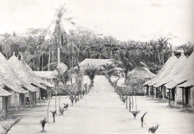

Isiro, Democratic Republic of the Congo
Isiro is a regional capital of 255,409 people in Haut-Uele, Democratic Republic of the Congo.
Why visit Isiro
Townapedia lists 1 museum or landmark, 2 parks and trails and 5 places to stay in and around town.
Weather in Isiro
Forecast from MET Norway (CC BY 4.0). Full forecast
About Isiro
Isiro (pronounced [iˈsiro]), formerly known as Paulis, is the capital of Haut-Uele Province in the northeastern part of the Democratic Republic of the Congo. It lies between the equatorial forest and the savannah and its main resource is coffee. Isiro's population is estimated at approximately 182,000. Most people speak Pa-Zande (Zande language), Lingala and Swahili.
From the Wikipedia article Isiro (this version), under CC BY-SA 4.0.
Museums and landmarks1

Parks, trails and playgrounds2


Where to stay5

Churches and places of worship6


Mamá na bísó ya Anzelu wa Mokonzi asangelí ya Tely
Church · Roman Catholic · 1.4 km
History
Isiro was named Paulis after colonel, later diplomat, Albert Paulis when it was part of the Belgian Congo. The city was developed in 1934 and reached its peak in 1957. In the troubled days of Congo's independence and its aftermath, operation Black Dragoon brought fighting between Belgian paratroopers and local Simba militias.
In 1998, Isiro became the home of a newly created Dominican-operated university called Université de l'Uélé. It is the third city in Orientale province (after Kisangani and Bunia) to welcome a university.
In 2015 Isiro became the capital of the Province of Haut-Uele, under governor Jean-Pierre Lola Kisanga 2015-2019.
From the History section of Isiro on Wikipedia, under CC BY-SA 4.0.
Schools, colleges and libraries1
Healthcare3
Map of Isiro
18 places. The map loads OpenStreetMap tiles when you open it.
Getting there and nearby towns
Isiro Matari (IRP) is the nearest airport with scheduled flights listed in OpenStreetMap, 7 km away.
- Wamba 81 km southeast, about 1 h 15 min by car
Drive times are estimates from straight-line distance, not routes.
Local news
Headlines from INDB.
Reviews, tips and questions
Loading what members have shared...
Sources and licences
- GeoNames (CC BY 4.0): population, coordinates, regions and time zone
- OpenStreetMap contributors (ODbL 1.0): places, airports, map data
- Wikidata (CC0 1.0): elevation, founding date, time zone, website, landmarks and historic places
- Wikimedia Commons (see each image): photos
- Wikipedia (CC BY-SA 4.0): overview and history text
Photo credits
- Isiro, Unknown author Unknown author, Public domain
Page built November 8, 2026. Spotted a mistake? Tell us or suggest a place.