


Kisangani, Democratic Republic of the Congo
Kisangani is a regional capital of 1,602,144 people in Tshopo, Democratic Republic of the Congo.
Why visit Kisangani
Townapedia lists 3 museums and landmarks, 5 parks and trails, 27 places to eat, 11 places to stay and 3 attractions in and around town.
Highlights include Boyoma Falls.
Weather in Kisangani
Forecast from MET Norway (CC BY 4.0). Full forecast
About Kisangani
Kisangani (), formerly Stanleyville (Dutch: Stanleystad), is the capital of Tshopo Province, located on the Congo River in the eastern part of the central Congo Basin in the Democratic Republic of the Congo. It is the country's fifth-most populous urban area, with an estimated population of 1,602,144 as of 2016, and the largest of the cities in the tropical woodlands of the Congo.
From the Wikipedia article Kisangani (this version), under CC BY-SA 4.0.
Travel tips from other travellers: Kisangani on Wikivoyage (CC BY-SA 4.0).
Things to do3

Boyoma Falls
Waterfall · 3.2 km
Series of waterfalls on the Congo River in Orientale Province, Democratic Republic of the Congo


Museums and landmarks3

Parks, trails and playgrounds5



Restaurants and cafes27





15 more on the map.
Where to stay11
Churches and places of worship14
Shopping6
Gas and EV charging10
Schools, colleges and libraries42
Insitut de l'Unikis
School · Baptist · 2.2 km
Bloc Unikisi, Quartier Plateau Médical, Comune Makiso, Kisangani
Institut Facultaire des Sciences Agronomique de Yangambi
School · 3.0 km
Quartier Plateau Médical, Commune Makiso, Kisangani
Healthcare8
Map of Kisangani
129 places. The map loads OpenStreetMap tiles when you open it.
Getting there and nearby towns
Bangoka International Airport (FKI) is the nearest airport with scheduled flights listed in OpenStreetMap, 17 km away.
- Yangambi 88 km west, about 1 h 30 min by car
Drive times are estimates from straight-line distance, not routes.
Local news
Headlines from INDB.
Reviews, tips and questions
Loading what members have shared...
Sources and licences
- GeoNames (CC BY 4.0): population, coordinates, regions and time zone
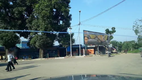
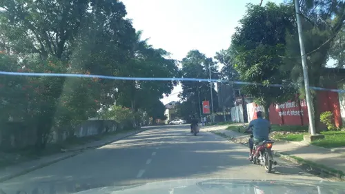
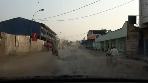
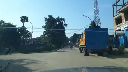
- Mapillary (see each image): photos
- OpenStreetMap contributors (ODbL 1.0): places, airports, map data
- Wikidata (CC0 1.0): elevation, founding date, time zone, website, landmarks and historic places
- Wikimedia Commons (see each image): photos
- Wikipedia (CC BY-SA 4.0): overview and history text
Photo credits
- Kisangani rond-point Cathédrale et Congo Palace, Piet Clement, CC BY-SA 3.0
- Kisangani Hotel congo palace, Yannick Ikombe, CC0
- Palace kisangani Hotel congo, Yannick Ikombe, CC0
- Hotel congo palace kisangani, Ewalojean, CC0
- Hotel kisangani congo palace, Yannick Ikombe, CC0
- Hotel de kisangani palace, Yannick Ikombe, CC0
- Rond point combattant kisangani, Yannick Ikombe, CC0
- Avenue de l'archidiose de kisangani, Yannick Ikombe, CC0
- Sonahydro kisangani, Yannick Ikombe, CC0
- Espace martyr de la ville kisangani, Yannick Ikombe, CC0
- Espace martyr de kisangani, Yannick Ikombe, CC0
- Place de martyr de la ville kisangani, Yannick Ikombe, CC0
- Rond point cinquentenaire kisangani, Yannick Ikombe, CC0
- Du cano de kisangani, Yannick Ikombe, CC0
- Saïo kisangani, Yannick Ikombe, CC0
- Commune de la ville de KISANGANI, Yannick Ikombe, CC0
- L'entré de l'espace martyrs de kisangani, Yannick Ikombe, CC0
- Kisangani de martyrs, Yannick Ikombe, CC0
- Martyrs de kisangani de la ville, Yannick Ikombe, CC0
- Cinquantenaire de kisangani, Yannick Ikombe, CC0
- Rond point cinquantenaire de kisangani, Yannick Ikombe, CC0
- Zaire kisangani stroom 11 copy, Ad Meskens, CC BY-SA 3.0
- Kisangani cathédrale Notre Dame du Très Saint Rosaire, Piet Clement, CC BY-SA 3.0
- Amphithéâtre Université de Kisangani, BCeCo, CC BY-SA 3.0
- HOTEL CONGO PALACE KIS, Ewalojean, CC0
- Hotel congo palace de la ville, Yannick Ikombe, CC0
- RESTAURANT - HOTEL DE LA GALERIE DU CENTRE (4), AdamLynnMcGill007, CC0
- RESTAURANT - HOTEL DE LA GALERIE DU CENTRE (3), AdamLynnMcGill007, CC0
- RESTAURANT - HOTEL DE LA GALERIE DU CENTRE (1), AdamLynnMcGill007, CC0
- RESTAURANT - HOTEL DE LA GALERIE DU CENTRE (2), AdamLynnMcGill007, CC0
- Edgard photo, Edgard Kalume, CC0
- PRIMUS BRALIMA, AdamLynnMcGill007, CC BY-SA 4.0
- Rond point combattant boyoma, Yannick Ikombe, CC0
- Rond point combattant, Yannick Ikombe, CC0
- Mc-cool Anguzo sur scène, CHANTY PROD, CC0
- Hotel congo palace, Yannick Ikombe, CC0
- Station sonahydro, Yannick Ikombe, CC0
- Espace martyr de kis, Yannick Ikombe, CC0
- Du cano, Yannick Ikombe, CC0
- Rond poind du cano, Yannick Ikombe, CC0
- Route stade lumumba, Yannick Ikombe, CC0
- Street-level photo, pmbuya, CC BY-SA 4.0
- Street-level photo, pmbuya, CC BY-SA 4.0
- Street-level photo, pmbuya, CC BY-SA 4.0
- Street-level photo, pmbuya, CC BY-SA 4.0
- Street-level photo, pmbuya, CC BY-SA 4.0
- Street-level photo, pmbuya, CC BY-SA 4.0
- Street-level photo, pmbuya, CC BY-SA 4.0
- Street-level photo, pmbuya, CC BY-SA 4.0
- Street-level photo, pmbuya, CC BY-SA 4.0
- Street-level photo, pmbuya, CC BY-SA 4.0
- Street-level photo, pmbuya, CC BY-SA 4.0
- Street-level photo, pmbuya, CC BY-SA 4.0
- Street-level photo, pmbuya, CC BY-SA 4.0
- Street-level photo, Djikolmbaye, CC BY-SA 4.0
- Street-level photo, aicprogetti2, CC BY-SA 4.0
- Street-level photo, miannare, CC BY-SA 4.0


Page built November 8, 2026. Spotted a mistake? Tell us or suggest a place.