



Why visit Channelview
Townapedia lists 16 museums and landmarks, 6 parks and trails, 40 places to eat, 17 places to stay and 1 attraction in and around town.
Highlights include Sam Houston Ship Channel Bridge, San Jacinto Battleground State Historic Site, USS Texas and Meadowbrook Park.
August is the warmest month, with average highs of 94°F; January lows average 44°F.
Weather in Channelview
Forecast from the National Weather Service. Full forecast
About Channelview
Channelview is a census-designated place (CDP) in the U.S. state of Texas on the east side of Houston in Harris County. Its population was 45,688 at the 2020 U.S. census.
From the Wikipedia article Channelview, Texas (this version), under CC BY-SA 4.0.
Things to do1
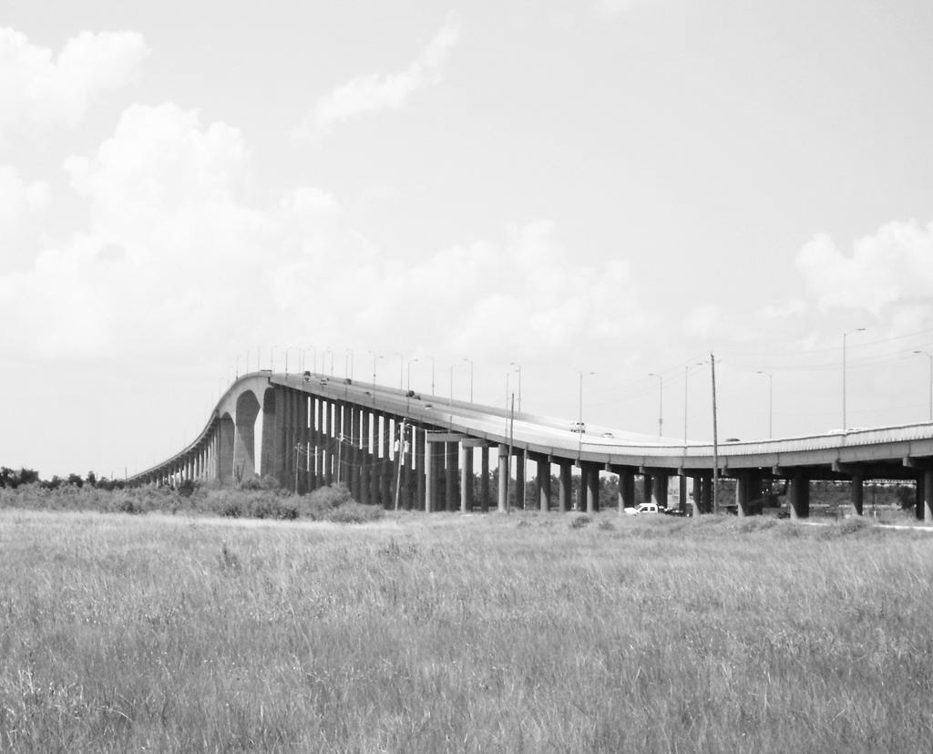
Sam Houston Ship Channel Bridge
Bridge · 4.4 mi
Bridge in Harris County, Texas
Museums and landmarks16

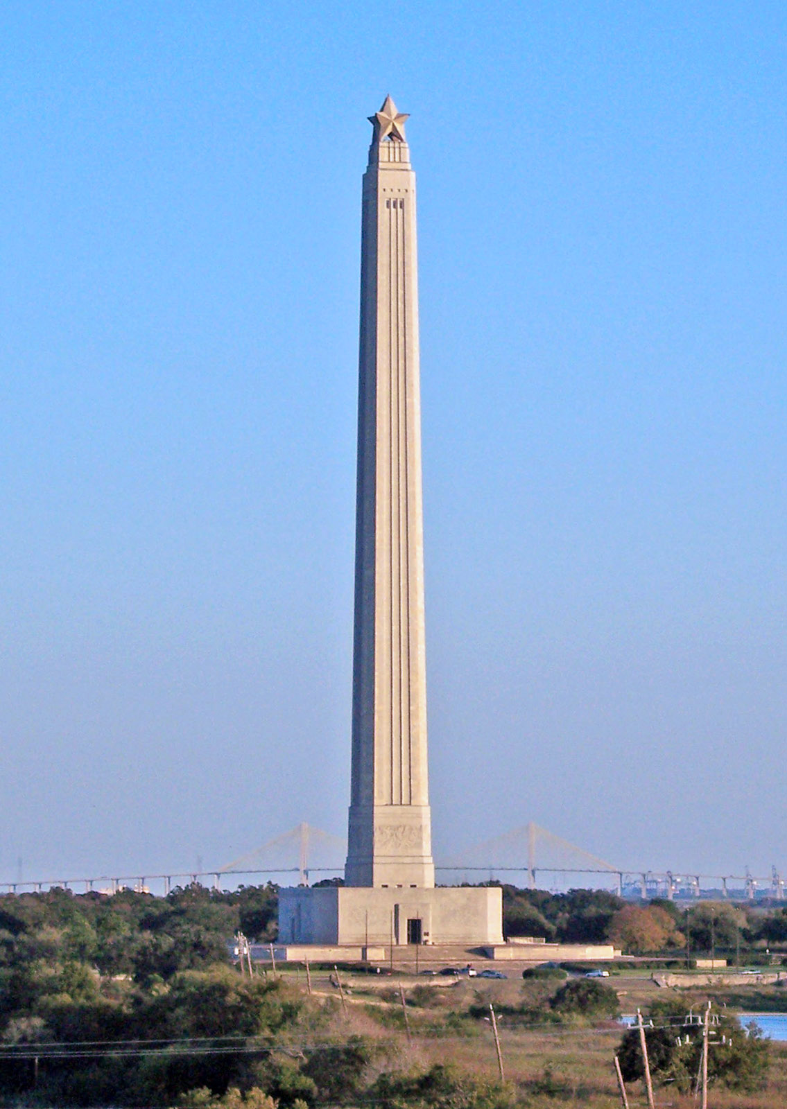
San Jacinto Battleground State Historic Site
Monument and historic site · National Register of Historic Places · 3.7 mi
Historic site in Houston (vicinity), Harris County, Texas


USS Texas
Monument and historic site · National Register of Historic Places · 3.0 mi
1912 New York-class battleship
San Jacinto Monument
Monument and historic site · 3.7 mi
Masonry column in Harris County, Texas, U.S

Ingenia Polymers Houston
Monument and historic site · 3.0 mi
2222 Appelt Drive
Mo-Fr 08:00-12:00
4 more on the map.
Parks, trails and playgrounds6


River Terrace Golf Course
Golf course · 2.5 mi
16777 Wallisville Rd, Houston

Restaurants and cafes40

Baytown Seafood
Restaurant · Seafood · 2.9 mi
14602 Woodforest Boulevard
Mo-Th 11:00-20:30; Fr-Sa 11:00-21:30; Su 11:00-19:30
Olive Garden
Restaurant · Italian · 3.0 mi
15525 Wallisville Road, Houston
Su-Th 11:00-22:00, Fr-Sa 11:00-23:00
Osaka Japanese Steakhouse
Restaurant · Japanese · 3.3 mi
15242 Wallisville Road
Mo-Th 11:00-21:30; Fr 11:00-22:30; Sa 11:00-22:30; Su 00:00-21:30


28 more on the map.
History
Channelview was given its name from its located on the northeastern curve of the Houston Ship Channel. The site of Channelview was home to Lorenzo de Zavala, one of the founding fathers of the Republic of Texas. During World War II, the area south of Market to the Ship Channel, and what is now DeZavala St. to the tollway, was part of the U.S. Army San Jacinto Ordnance Depot.
In 1990, an explosion occurred at the ARCO petrochemical plant in Channelview that killed 17 people and injured five others.
In 1991, Channelview was the site of a notable murder plot. Wanda Webb Holloway was convicted of attempting to hire a hitman to kill the mother of her daughter's junior high school cheerleading rival.
In 1992, Channelview was struck by Houston's only ever recorded F4 tornado just before Thanksgiving on November 21st,1992. The tornado grew to over a mile wide during its peak intensity.
In 1997, Coy Wayne Wesbrook committed mass murder in Channelview, killing five people.
From the History section of Channelview, Texas on Wikipedia, under CC BY-SA 4.0.
Where to stay17
La Quinta Inn & Suites Houston Channelview
Motel and hotel · 3.0 mi
5520 East Sam Houston Parkway North, Houston
Econo Lodge Inn & Suites
Motel and hotel · 0.9 mi
16007 East Freeway, Channelview
Churches and places of worship21
Channelview Baptist Church
Church · Baptist · 1.5 mi
970 Dell Dale Street, Channelview
First Assembly of God of Channelview
Church · Pentecostal · 1.3 mi
330 Sheldon Road, Channelview
Shopping6
Gas and EV charging11
Schools, colleges and libraries54
Academic Counseling And Transition Academy
School · 0.7 mi
915 Sheldon Rd, Channelview
Healthcare1
Map of Channelview
173 places. The map loads OpenStreetMap tiles when you open it.
Climate by month
Monthly table
| Month | High | Low | Rain | Snow |
|---|---|---|---|---|
| Jan | 63°F | 44°F | 4.0 in | 0.0 in |
| Feb | 67°F | 49°F | 2.8 in | 0.0 in |
| Mar | 73°F | 54°F | 3.8 in | 0.0 in |
| Apr | 79°F | 61°F | 5.2 in | 0.0 in |
| May | 86°F | 69°F | 5.1 in | 0.0 in |
| Jun | 91°F | 75°F | 7.9 in | 0.0 in |
| Jul | 93°F | 77°F | 4.5 in | 0.0 in |
| Aug | 94°F | 77°F | 3.4 in | 0.0 in |
| Sep | 90°F | 72°F | 4.5 in | 0.0 in |
| Oct | 82°F | 63°F | 5.4 in | 0.0 in |
| Nov | 72°F | 53°F | 3.4 in | 0.0 in |
| Dec | 65°F | 46°F | 4.3 in | 0.0 in |
U.S. Climate Normals 1991-2020 for Houston-Port (10 mi away), NOAA NCEI.
People and cost of living
American Community Survey 5-year estimates, 2020-2024, U.S. Census Bureau. Estimates have margins of error, larger for small towns.
Disaster history
Harris County has had 26 federal disaster declarations since 2000, most often for hurricanes.
- 2024-07-09: Hurricane Beryl (Hurricane)
- 2024-05-17: Severe Storms, Straight-Line Winds, Tornadoes, And Flooding (Flood)
- 2021-02-19: Severe Winter Storms (Severe Ice Storm)
- 2021-02-14: Severe Winter Storm (Severe Ice Storm)
- 2020-08-24: Tropical Storms Marco And Laura (Hurricane)
- 2020-07-26: Hurricane Hanna (Hurricane)
OpenFEMA disaster declarations summaries.
Getting there and nearby towns
Baytown Airport (HPY) is the nearest airport with scheduled flights listed in OpenStreetMap, 10 miles away.
- Baytown 9 mi east, about 15 min by car
- Pasadena 10 mi south, about 16 min by car
- Atascocita 14 mi north, about 22 min by car
- Houston 16 mi west, about 27 min by car
- Aldine 18 mi northwest, about 29 min by car
- Pearland 21 mi southwest, about 33 min by car
- League City 21 mi south, about 34 min by car
- Bellaire 22 mi west, about 35 min by car
- Alvin 26 mi south, about 42 min by car
- Sugar Land 34 mi southwest, about 55 min by car
Drive times are estimates from straight-line distance, not routes.
Local news
Headlines from INDB, the NEMICO news database.
Reviews, tips and questions
Loading what members have shared...
Sources and licences
- NCES EDGE (Public domain): public schools
- NOAA NCEI U.S. Climate Normals 1991-2020 (Public domain): climate by month
- OpenFEMA (Public domain): disaster declarations
- OpenStreetMap contributors (ODbL 1.0): places, airports, map data
- U.S. Census Bureau (Public domain): population, income, housing, education, commute
- Wikidata (CC0 1.0): elevation, founding date, time zone, website, landmarks and historic places
- Wikimedia Commons (see each image): photos
- Wikipedia (CC BY-SA 4.0): overview and history text
Photo credits
- Tug Mr. Bennett, San Jacinto River, Channelview, Texas 0226111305 (5483367968), Patrick Feller from Humble, Texas, USA, CC BY 2.0
- USS Texas BB-35, Self-made photo by Jacobst, Public domain
- UAV view of the San Jacinto Battlefield site and Texas Monument, Steve Rowell, CC BY-SA 3.0
- San Jacinto Monument, Tijuana Brass at English Wikipedia, Public domain
- Sam Houston Tollway Ship Channel Bridge 0804091506BW, Patrick Feller from Humble, Texas, USA, CC BY 2.0
- ISS055-E-64640 - View of Earth, Earth Science and Remote Sensing Unit, NASA Johnson Space Center, Public domain
- ISS021-E-21456 - View of Earth, Earth Science and Remote Sensing Unit , Lyndon B. Johnson Space Center, Public domain
- ISS044-E-43814 - View of Earth, Earth Science and Remote Sensing Unit , Lyndon B. Johnson Space Center, Public domain
- ISS067-E-183990 - View of Earth, Earth Science and Remote Sensing Unit , Lyndon B. Johnson Space Center, Public domain
- Accommodations Barge, Houston Ship Channel 0407101334, Patrick Feller, CC BY 2.0
- White Power graffiti in Houston, Patrick Feller from Dallas, Texas, USA, CC BY 2.0
- USS Texas Battleship BB-35 - 51676724573, Eric Friedebach, CC BY 2.0
- USS Texas Battleship BB-35 - 51676722938, Eric Friedebach, CC BY 2.0
- USS Texas Battleship BB-35 - 51677358740, Eric Friedebach, CC BY 2.0
- USS Texas Battleship BB-35 - 51676723928, Eric Friedebach, CC BY 2.0
- USS Texas Battleship BB-35 - 51676480491, Eric Friedebach, CC BY 2.0
- USS Texas Battleship BB-35 - 51676724763, Eric Friedebach, CC BY 2.0
- USS Texas Battleship BB-35 - 51676479701, Eric Friedebach, CC BY 2.0
- USS Texas Battleship BB-35 - 51675675142, Eric Friedebach, CC BY 2.0
- USS Texas Battleship BB-35 - 51675675787, Eric Friedebach, CC BY 2.0
- USS Texas Battleship BB-35 - 51675674707, Eric Friedebach, CC BY 2.0
- USS Texas Battleship BB-35 - 51677150684, Eric Friedebach, CC BY 2.0
- USS Texas Battleship BB-35 - 51676481061, Eric Friedebach, CC BY 2.0
- USS Texas Battleship BB-35 - 51677151094, Eric Friedebach, CC BY 2.0
- USS Texas Battleship BB-35 - 51675674317, Eric Friedebach, CC BY 2.0
- USS Texas Battleship BB-35 - 51676479991, Eric Friedebach, CC BY 2.0
- USS Texas Battleship BB-35 - 51675676527, Eric Friedebach, CC BY 2.0
- USS Texas Battleship BB-35 - 51677357975, Eric Friedebach, CC BY 2.0
- USS Texas Battleship BB-35 - 51676478926, Eric Friedebach, CC BY 2.0
- USS Texas Battleship BB-35 - 51677357040, Eric Friedebach, CC BY 2.0
- USS Texas Battleship BB-35 - 51677150434, Eric Friedebach, CC BY 2.0
- USS Texas Battleship BB-35 - 51677152654, Eric Friedebach, CC BY 2.0
- USS Texas Battleship BB-35 - 51677147729, Eric Friedebach, CC BY 2.0
- Lynchburg Ferry (4286322005), maorlando - God keeps me as I lean on Him!! from Far NW Houston, Pinehurst, Texas, U.S.A., CC BY-SA 2.0
- USS Texas Battleship BB-35 - 51676721933, Eric Friedebach, CC BY 2.0
- USS Texas Battleship BB-35 - 51677150024, Eric Friedebach, CC BY 2.0
- USS Texas Battleship BB-35 - 51675673562, Eric Friedebach, CC BY 2.0
- USS Texas Battleship BB-35 - 51675673372, Eric Friedebach, CC BY 2.0


Page built October 30, 2026. Spotted a mistake? Tell us or suggest a place.