


Chatham, Virginia
Chatham is a town of 1,448 people in Pittsylvania County, Virginia, founded in 1874.
Why visit Chatham
Townapedia lists 13 museums and landmarks, 6 parks and trails, 11 places to eat, 1 place to stay and 1 attraction in and around town.
Highlights include Hargrave Military Academy and Bill's Diner.
July is the warmest month, with average highs of 86°F; January lows average 24°F.
Weather in Chatham
Forecast from the National Weather Service. Full forecast
About Chatham
Chatham is a town in and county seat of Pittsylvania County, Virginia, United States. Chatham's population was 1,232 at the 2020 census. It is included in the Danville, Virginia metropolitan area. The town was originally called Competition, but the name was changed to Chatham by the Virginia General Assembly on May 1, 1852.
From the Wikipedia article Chatham, Virginia (this version), under CC BY-SA 4.0.
Things to do1

Museums and landmarks13

Hargrave Military Academy
Monument and historic site · Baptist · National Register of Historic Places · 1.4 mi
School in Chatham, Virginia, United States
200 Military Drive, Chatham

Bill's Diner
Monument and historic site · National Register of Historic Places · 0.9 mi
Historic commercial building in Virginia, United States
Burnett's Diner
Monument and historic site · National Register of Historic Places · 0.9 mi
Historic commercial building in Virginia, United States

Chatham Historic District
Monument and historic site · National Register of Historic Places · 0.9 mi
Historic district in Virginia, United States
Chatham Southern Railway Depot
Monument and historic site · National Register of Historic Places · 0.6 mi
Railway station in Chatham, the United States of America
Clerk's Office
Monument and historic site · National Register of Historic Places · 1.0 mi
Historic building in Chatham, Virginia, United States
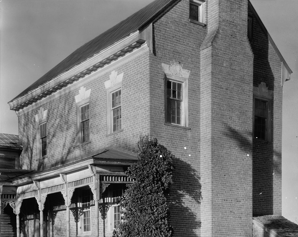
Little Cherrystone
Monument and historic site · National Register of Historic Places · 2.5 mi
Historic house in Virginia, United States


Mountain View
Monument and historic site · National Register of Historic Places · 2.0 mi
Historic house in Virginia, United States
Pittsylvania County Courthouse
Monument and historic site · National Register of Historic Places · 0.9 mi
Historic courthouse in Virginia, US

1 more on the map.
Parks, trails and playgrounds6

Restaurants and cafes11


Callands Coffee
Cafe · Coffee Shop · 1.0 mi
11 South Main Street, Chatham
Mo-Fr 07:00-15:00; Sa 08:00-12:00

Hunt & Company Restaurant and Catering
Diner · American · 0.9 mi
24 Reid Street, Chatham

History
It is the home to the oldest continually used building in Pittsylvania County, once an 18th-century tavern, since turned into a house and now occupied by Chatham Hall faculty.
Chatham is the county seat for Pittsylvania County and has held that status since 1777. There is a large U.S. Department of Agriculture office to support farmers in the area and a small branch office of the U.S. Forest Service. Virginia has built a new state prison at the site of an old work-release camp; this led to infrastructure upgrades in fire and water services to support the increased population.
Chatham did not see any battle action during the Civil War although it is between Richmond, the capital of the Confederacy, and Danville, which contained Confederate prisons for captured Union soldiers. On Confederate Memorial Day each year, the local chapter of the United Daughters of the Confederacy places flowers at the statue of a Confederate soldier which is prominent in the front of the historic Pittsylvania County Court House. There is a walking tour of this downtown historic district and a brochure for this is available at the Town Hall, or at the Historical Society building next to Town Hall. There are several bed & breakfast establishments located on Main Street in historic Greek Revival homes.
From the History section of Chatham, Virginia on Wikipedia, under CC BY-SA 4.0.
Where to stay1
Churches and places of worship13
Samuel Harris Memorial Baptist Church
Church · Baptist · 1.6 mi
525 Samuel Harris Lane, Chatham
Shopping4
Gas and EV charging2
Schools, colleges and libraries12
Chatham Hall
School · Episcopal · 1.2 mi
800 Chatham Hall Circle, Chatham
Pittsylvania Regional Alternative School/Stem Academy
School · 1.6 mi
956 Woodlawn Academy Road, Chatham
Pittsylvania Vocational-Technical Center
School · 3.4 mi
11700 Us Highway 29, Chatham
Regional Alternative/Pittslvania Co
School · 1.6 mi
956 Woodlawn Academy, Chatham
Healthcare3
PATHS Community Medical Center
Clinic and pharmacy · 0.9 mi
30 South Main Street, Chatham
Map of Chatham
66 places. The map loads OpenStreetMap tiles when you open it.
Climate by month
Monthly table
| Month | High | Low | Rain | Snow |
|---|---|---|---|---|
| Jan | 47°F | 24°F | 4.2 in | 1.9 in |
| Feb | 51°F | 26°F | 2.8 in | 1.6 in |
| Mar | 59°F | 32°F | 4.0 in | 1.0 in |
| Apr | 69°F | 41°F | 3.9 in | 0.0 in |
| May | 76°F | 51°F | 4.5 in | 0.0 in |
| Jun | 83°F | 60°F | 4.2 in | 0.0 in |
| Jul | 86°F | 65°F | 4.2 in | 0.0 in |
| Aug | 85°F | 63°F | 4.1 in | 0.0 in |
| Sep | 79°F | 56°F | 5.0 in | 0.0 in |
| Oct | 70°F | 43°F | 3.5 in | 0.0 in |
| Nov | 59°F | 32°F | 3.5 in | 0.0 in |
| Dec | 50°F | 27°F | 3.8 in | 1.3 in |
U.S. Climate Normals 1991-2020 for Chatham (1 mi away), NOAA NCEI.
People and cost of living
American Community Survey 5-year estimates, 2020-2024, U.S. Census Bureau. Estimates have margins of error, larger for small towns.
Disaster history
Pittsylvania County has had 17 federal disaster declarations since 2000, most often for hurricanes.
- 2026-01-23: Severe Winter Storm (Winter Storm)
- 2025-04-04: Severe Winter Storms And Flooding (Severe Storm)
- 2024-10-01: Tropical Storm Helene (Tropical Storm)
- 2024-09-29: Post-Tropical Cyclone Helene (Tropical Storm)
- 2021-05-10: Severe Winter Storms (Severe Ice Storm)
- 2020-04-02: Covid-19 Pandemic (Biological)
OpenFEMA disaster declarations summaries.
Getting there and nearby towns
Danville Regional Airport (DAN) is the nearest airport with scheduled flights listed in OpenStreetMap, 17 miles away.
- Blairs 8 mi south, about 13 min by car
- Danville 16 mi south, about 26 min by car
- Altavista 22 mi north, about 36 min by car
- Martinsville 27 mi west, about 44 min by car
- Eden 28 mi southwest, about 46 min by car
- Yanceyville 28 mi south, about 45 min by car
- Brookneal 30 mi northeast, about 48 min by car
- Timberlake 36 mi north, about 58 min by car
- Reidsville 36 mi southwest, about 58 min by car
- Lynchburg 42 mi north, about 1 h 15 min by car
Drive times are estimates from straight-line distance, not routes.
Local news
Headlines from INDB, the NEMICO news database.
Reviews, tips and questions
Loading what members have shared...
Sources and licences
- NCES EDGE (Public domain): public schools
- NOAA NCEI U.S. Climate Normals 1991-2020 (Public domain): climate by month
- OpenFEMA (Public domain): disaster declarations
- OpenStreetMap contributors (ODbL 1.0): places, airports, map data
- U.S. Census Bureau (Public domain): population, income, housing, education, commute
- Wikidata (CC0 1.0): elevation, founding date, time zone, website, landmarks and historic places
- Wikimedia Commons (see each image): photos
- Wikipedia (CC BY-SA 4.0): overview and history text
Photo credits
- 2017-06-27 12 56 42 View north along U.S. Route 29 Business (Main Street) at Minor Road (Virginia State Secondary Route 1427) in Chatham, Pittsylvania County, Virginia, Famartin, CC BY-SA 4.0
- Chatham Southern Railway Depot, Nyttend, Public domain
- Depot and Main, Chatham, Nyttend, Public domain
- Chatham 2022, Mojo Hand, CC BY-SA 4.0
- Nave, Emmanuel Episcopal Church, Chatham, VA, 434History, CC BY 4.0
- Emmanuel Episcopal Church, Chatham Virginia, Front Facade, 434History, CC BY 4.0
- HMAmainbuilding, User:Leon Rue, Public domain
- Detail Moses House near Chatham Pittsylvania County Virginia by Frances Benjamin Johnston, Frances Benjamin Johnston, Public domain
- Mountain View Pittsylvania County Virginia by Frances Benjamin Johnston, Frances Benjamin Johnston, Public domain
- Chatham, Virginia (8596731851) (2), Doug Kerr from Albany, NY, United States, CC BY-SA 2.0
- ISS018-E-28959 - View of Earth, Earth Science and Remote Sensing Unit , Lyndon B. Johnson Space Center, Public domain
- ISS027-E-10271 - View of Earth, Earth Science and Remote Sensing Unit , Lyndon B. Johnson Space Center, Public domain
- ISS065-E-96125 - View of Earth, Earth Science and Remote Sensing Unit , Lyndon B. Johnson Space Center, Public domain
- ISS013-E-44983 - View of Virginia, Earth Science and Remote Sensing Unit , Lyndon B. Johnson Space Center, Public domain
- Burnett's Diner, Nyttend, Public domain
- Pittsylvania County Clerk's Office, Nyttend, Public domain
- Pittsylvania courthouse, Mojo Hand, CC BY-SA 4.0
- Emmanuel Episcopal Church, triple-pointed Tiffany lancet window, 434History, CC BY 4.0
- Pruden Hall, Mojo Hand, CC BY-SA 4.0


Page built October 30, 2026. Spotted a mistake? Tell us or suggest a place.