


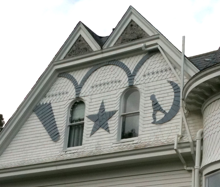

Clatskanie, Oregon
Clatskanie is a city of 2,364 people in Columbia County, Oregon, founded in 1891.
Why visit Clatskanie
Townapedia lists 3 museums and landmarks, 3 parks and trails, 9 places to eat, 2 places to stay and 3 attractions in and around town.
Highlights include Clatskanie Food Hub and Thomas J. Flippin House.
August is the warmest month, with average highs of 76°F; February lows average 33°F.
Weather in Clatskanie
Forecast from the National Weather Service. Full forecast
About Clatskanie
Clatskanie is a city in Columbia County, Oregon, United States. It was named for the Tlatskanai Native American tribe, and the Clatskanie River which flows through the town and empties into the Columbia River about four miles to the north. As of the 2020 census, Clatskanie had a population of 1,716.
From the Wikipedia article Clatskanie, Oregon (this version), under CC BY-SA 4.0.
Things to do3

Clatskanie Food Hub
Farm and orchard
All locally grown produce.
Art Steele
Th 14:00-18:00; Fr-Su 10:00-18:00


Museums and landmarks3

Thomas J. Flippin House
Monument and historic site · National Register of Historic Places
Historic house in Clatskanie, Oregon, USA
Parks, trails and playgrounds3

Restaurants and cafes9






History
The town was originally called Bryantville after the large family who were among the first filers of Donation Land Claims in the area in 1852–1853. However, the first postmaster, Enoch Conyers, who was married to one of the Bryant daughters, changed the name to Clatskanie after the Tlatskanai Native American tribe.
According to the Clatsop County pioneer Silas B. Smith, Tlatskanai was a point in the Nehalem River that was reached from the Columbia River by way of the Youngs River or by way of the Clatskanie River. The native inhabitants, who were not in the habit of naming streams, did not use the word Tlatskanai for the streams they would follow in order to get to that point, but the white men who settled here later did apply the name to the streams.
Many of Clatskanie's inhabitants are of Nordic heritage, specifically Finnish, Swedish, and Norwegian.
From the History section of Clatskanie, Oregon on Wikipedia, under CC BY-SA 4.0.
Where to stay2
Churches and places of worship4
Faith Lutheran Church
Church · Lutheran · 0.6 mi
1010 Northeast 5th Street, Clatskanie
Gateway Worship Center
Church · Assemblies Of God · 0.4 mi
610 Northwest 5th Street, Clatskanie
Shopping4
Gas and EV charging2
Schools, colleges and libraries4
Healthcare2
Map of Clatskanie
36 places. The map loads OpenStreetMap tiles when you open it.
Climate by month
Monthly table
| Month | High | Low | Rain | Snow |
|---|---|---|---|---|
| Jan | 47°F | 33°F | 8.3 in | 0.5 in |
| Feb | 50°F | 33°F | 5.7 in | 0.7 in |
| Mar | 54°F | 35°F | 6.1 in | 0.2 in |
| Apr | 59°F | 38°F | 4.3 in | 0.0 in |
| May | 65°F | 44°F | 2.7 in | 0.0 in |
| Jun | 69°F | 48°F | 1.7 in | 0.0 in |
| Jul | 75°F | 52°F | 0.6 in | 0.0 in |
| Aug | 76°F | 52°F | 0.7 in | 0.0 in |
| Sep | 72°F | 48°F | 2.1 in | 0.0 in |
| Oct | 62°F | 41°F | 4.5 in | 0.0 in |
| Nov | 52°F | 36°F | 8.6 in | 0.1 in |
| Dec | 46°F | 33°F | 9.4 in | 0.8 in |
U.S. Climate Normals 1991-2020 for Clatskanie (0 mi away), NOAA NCEI.
People and cost of living
American Community Survey 5-year estimates, 2020-2024, U.S. Census Bureau. Estimates have margins of error, larger for small towns.
Disaster history
Columbia County has had 12 federal disaster declarations since 2000, most often for severe storms.
- 2020-09-15: Wildfires And Straight-Line Winds (Fire)
- 2020-03-28: Covid-19 Pandemic (Biological)
- 2020-03-13: Covid-19 (Biological)
- 2017-08-08: Severe Winter Storms, Flooding, Landslides, And Mudslides (Severe Storm)
- 2016-02-17: Severe Winter Storms, Straight-Line Winds, Flooding, Landslides, And Mudslides (Severe Storm)
- 2012-03-02: Severe Winter Storm, Flooding, Landslides, And Mudslides (Flood)
OpenFEMA disaster declarations summaries.
Getting there and nearby towns
Southwest Washington Regional Airport (KLS) is the nearest airport with scheduled flights listed in OpenStreetMap, 15 miles away.
- Longview 12 mi east, about 19 min by car
- Kelso 15 mi east, about 25 min by car
- St. Helens 25 mi southeast, about 41 min by car
- Warren 25 mi southeast, about 41 min by car
- Astoria 30 mi west, about 48 min by car
- Ridgefield 32 mi southeast, about 52 min by car
- Felida 36 mi southeast, about 58 min by car
- Salmon Creek 38 mi southeast, about 1 h by car
- Hillsboro 42 mi south, about 1 h 15 min by car
- Vancouver 44 mi southeast, about 1 h 15 min by car
Drive times are estimates from straight-line distance, not routes.
Local news
Headlines from INDB, the NEMICO news database.
Reviews, tips and questions
Loading what members have shared...
Sources and licences
- NOAA NCEI U.S. Climate Normals 1991-2020 (Public domain): climate by month
- OpenFEMA (Public domain): disaster declarations
- OpenStreetMap contributors (ODbL 1.0): places, airports, map data
- U.S. Census Bureau (Public domain): population, income, housing, education, commute
- Wikidata (CC0 1.0): elevation, founding date, time zone, website, landmarks and historic places
- Wikimedia Commons (see each image): photos
- Wikipedia (CC BY-SA 4.0): overview and history text
Photo credits
- Skyline - Clatskanie Oregon, Tedder, CC BY 3.0
- Clatskanie IOOF Hall - Clatskanie Oregon, Ian Poellet, CC BY-SA 3.0
- Flippin House - Clatskanie Oregon, Ian Poellet, CC BY-SA 3.0
- Flippin House rear - Clatskanie Oregon, Ian Poellet, CC BY-SA 3.0
- Flippin House siding detail - Clatskanie Oregon, Ian Poellet, CC BY-SA 3.0
- ISS016-E-23874 - View of Earth, Earth Science and Remote Sensing Unit , Lyndon B. Johnson Space Center, Public domain
- ISS036-E-47927 - View of Earth, Earth Science and Remote Sensing Unit , Lyndon B. Johnson Space Center, Public domain
- ISS066-E-137976 - View of Earth, Earth Science and Remote Sensing Unit , Lyndon B. Johnson Space Center, Public domain
- ISS066-E-137977 - View of Earth, Earth Science and Remote Sensing Unit , Lyndon B. Johnson Space Center, Public domain
- ISS066-E-137975 - View of Earth, Earth Science and Remote Sensing Unit , Lyndon B. Johnson Space Center, Public domain


Page built October 30, 2026. Spotted a mistake? Tell us or suggest a place.