
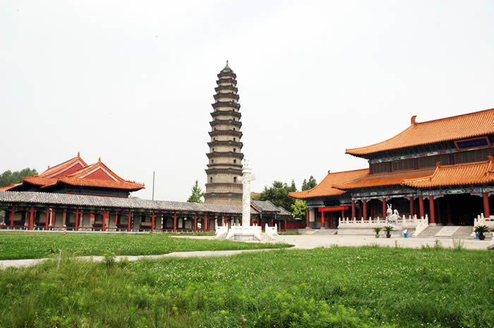

Why visit Wenshang
Townapedia lists 5 parks and trails, 6 places to eat and 1 place to stay in and around town.
Weather in Wenshang
Forecast from MET Norway (CC BY 4.0). Full forecast
About Wenshang
Wenshang County (simplified Chinese: 汶上县; traditional Chinese: 汶上縣; pinyin: Wénshàng Xiàn) is a county of southwestern Shandong province, People's Republic of China. It is under the administration of Jining City. The population was 725,971 in 1999.
From the Wikipedia article Wenshang County (this version), under CC BY-SA 4.0.
Parks, trails and playgrounds5

Restaurants and cafes6

Where to stay1

Shopping1

History
The northern area of Wenshang County was the state of Cheng (郕) during the Zhou dynasty in the first millennium BC. In some Chinese legends, it was the location where Jie, the last king of the Xia, was caught and deposed by Wuzi after the Battle of Mingtiao, initiating the Shang under its King Tang c. 1600 BC.
From the History section of Wenshang County on Wikipedia, under CC BY-SA 4.0.
Schools, colleges and libraries3
Healthcare3
Map of Wenshang
19 places. The map loads OpenStreetMap tiles when you open it.
Getting there and nearby towns
Jining Da´an Airport (JNG) is the nearest airport with scheduled flights listed in OpenStreetMap, 24 km away.
- Zhoucheng 26 km northwest, about 26 min by car
- Ningyang 27 km east, about 27 min by car
- Yanzhou 36 km southeast, about 36 min by car
- Jining 37 km south, about 37 min by car
- Qufu 47 km east, about 47 min by car
- Juye 54 km southwest, about 54 min by car
- Zoucheng 56 km southeast, about 56 min by car
- Pingyin 62 km north, about 1 h by car
- Feicheng 63 km northeast, about 1 h by car
- Tai’an 76 km northeast, about 1 h 15 min by car
Drive times are estimates from straight-line distance, not routes.
Local news
Headlines from INDB.
Reviews, tips and questions
Loading what members have shared...
Sources and licences
- GeoNames (CC BY 4.0): population, coordinates, regions and time zone
- OpenStreetMap contributors (ODbL 1.0): places, airports, map data
- Wikidata (CC0 1.0): elevation, founding date, time zone, website
- Wikimedia Commons (see each image): photos
- Wikipedia (CC BY-SA 4.0): overview and history text
Photo credits
- Wenshang, Dengchiyu, CC BY-SA 3.0
Page built November 3, 2026. Spotted a mistake? Tell us or suggest a place.