


Columbus, Ohio
Columbus is a city of 914,802 people in Delaware County, Ohio, founded in 1812.
Why visit Columbus
Townapedia lists 79 museums and landmarks, 12 parks and trails, 160 places to eat, 3 places to stay and 8 attractions in and around town.
Highlights include Capitol Theatre - Riffe Center, Palace Theatre, 16 East Broad Street and A.B. Graham House.
July is the warmest month, with average highs of 85°F; January lows average 21°F.
Weather in Columbus
Forecast from the National Weather Service. Full forecast
About Columbus
Columbus is the capital and most populous city of the U.S. state of Ohio. With a population of 905,748 at the 2020 census, it is the 14th-most populous city in the U.S., second-most populous city in the Midwest (after Chicago), and third-most populous U.S. state capital (after Phoenix, Arizona, and Austin, Texas). The Columbus metropolitan area, with an estimated 2.23 million residents, is the largest metropolitan area entirely in Ohio and 32nd-largest metropolitan area in the U.S. Columbus is the county seat of Franklin County; it also extends into Delaware and Fairfield counties.
From the Wikipedia article Columbus, Ohio (this version), under CC BY-SA 4.0.
Things to do8

Palace Theatre
Cinema and theater · 1.9 mi
Performing arts center in Columbus, Ohio, a former movie theater

Rich Street Bridge
Bridge · 2.3 mi
Bridge in United States of America

Museums and landmarks79

16 East Broad Street
Monument and historic site · National Register of Historic Places · 1.9 mi
Building in Columbus, Ohio

A.B. Graham House
Monument and historic site · National Register of Historic Places · 3.2 mi
House in Columbus, Ohio

A.G. Grant Homestead
Monument and historic site · National Register of Historic Places · 9.1 mi
Historic house in Ohio, United States

Agler–La Follette House
Monument and historic site · National Register of Historic Places · 3.7 mi
House in Mifflin Township, Ohio

Bank Block Building
Monument and historic site · National Register of Historic Places · 3.2 mi
Shopping center in Grandview Heights, Ohio
Berry Brothers Bolt Works
Monument and historic site · National Register of Historic Places · 0.7 mi
Former factory in Columbus, Ohio

Born Capital Brewery Bottling Works
Monument and historic site · National Register of Historic Places · 2.7 mi
Historic building in Columbus, Ohio, United States
Broad Street Christian Church
Monument and historic site · National Register of Historic Places · 1.7 mi
Church building in Ohio, United States of America
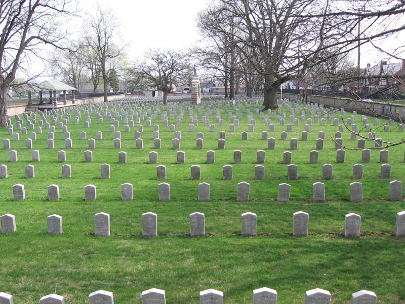
Camp Chase
Monument and historic site · National Register of Historic Places · 5.7 mi
Military camp in Columbus, Ohio, USA

Central High School
Monument and historic site · National Register of Historic Places · 2.3 mi
Historic building in Columbus, Ohio, United States
Columbus Museum of Art
Monument and historic site · National Register of Historic Places · 1.6 mi
Museum in Columbus, Ohio, United States


Columbus State Hospital
Monument and historic site · National Register of Historic Places · 4.2 mi
Former hospital in Columbus, Ohio
67 more on the map.
Parks, trails and playgrounds12

Bicentennial Park
Park · 2.4 mi
Park in Columbus, Ohio, United States of America
Ohio Police and Fire Memorial Park
Park · 2.0 mi
Memorial and park in Columbus, Ohio, U.S.

James O Casto Park (Trailhead)
Hiking and trails · 7.4 mi
Park with trail user amenities including car parking, portable restroom, and seating. www.centralohiogreenways.com
5487 Cedardale Drive, Westerville

Restaurants and cafes160

Akai Hana
Restaurant · Japanese · 5.6 mi
1173 Old Henderson Road, Columbus
Mo-Th 17:00-21:00; Fr-Sa 16:00-21:00; Su 16:00-20:00
Chili Verde
Restaurant · Mexican · 11.2 mi
1522 Gemini Place, Columbus
Mo-Th 11:00-20:30; Fr 11:00-21:00; Sa 10:00-21:00; Su 10:00-14:30
Cottage Inn Pizza
Restaurant · Pizza · 1.8 mi
2167 North High Street, Columbus
Tu,We,Su 10:00-22:00, Th 10:00-24:00, Fr,Sa 10:00-02:00

Hound Dog's Pizza
Restaurant · Pizza · 2.5 mi
2657 North High Street, Columbus
Mo-Tu 09:00-23:00; We-Th 10:00-23:00; Fr-Sa 10:00-24:00; Su 10:00-23:00
Jack & Benny's
Restaurant · Breakfast · 2.3 mi
2563 North High Street, Columbus
Mo-Fr 07:00-15:00; Sa-Su 08:00-15:00
Kafe Kerouac
Cafe · Coffee Shop · 1.9 mi
2250 North High Street
Mo-Th 08:00-24:00; Fr 08:00-01:00; Sa 09:45-01:00; Su 10:00-22:00
Martini Modern Italian
Restaurant · Italian · 1.4 mi
445 North High Street, Columbus
Mo-Th 16:00-22:00; Fr,Sa 16:00-23:00; Su 16:00-21:00
Noodles & Company
Restaurant · Pasta · 11.2 mi
1528 Gemini Place, Columbus
Su-We 10:30-21:00; Th-Sa 10:30-22:00
148 more on the map.
Where to stay3
Churches and places of worship301
Amazing Grace Baptist Church
Church · Independent Fundamental Baptist · 3.3 mi
1288 West Broad Street, Columbus
Saint Agnes Church
Church · Roman Catholic · 5.2 mi
2364 West Mound Street, Columbus
Bethel International United Methodist Church
Church · Methodist · 6.4 mi
1220 Bethel Road, Columbus
Shopping15
Gas and EV charging17
Schools, colleges and libraries105
Horizon Science Academy Columbus High School
School · 5.2 mi
1070 Morse Road, Columbus
Charles School At Ohio Dominican University
School · 2.0 mi
1270 Brentnell Ave, Columbus
Healthcare9
Map of Columbus
250 places. The map loads OpenStreetMap tiles when you open it.
Climate by month
Monthly table
| Month | High | Low | Rain |
|---|---|---|---|
| Jan | 36°F | 21°F | 3.1 in |
| Feb | 40°F | 23°F | 2.6 in |
| Mar | 51°F | 31°F | 3.9 in |
| Apr | 64°F | 41°F | 4.0 in |
| May | 74°F | 51°F | 4.8 in |
| Jun | 82°F | 61°F | 4.7 in |
| Jul | 85°F | 65°F | 4.3 in |
| Aug | 84°F | 62°F | 3.8 in |
| Sep | 78°F | 55°F | 3.8 in |
| Oct | 66°F | 43°F | 3.2 in |
| Nov | 52°F | 33°F | 3.0 in |
| Dec | 41°F | 27°F | 3.4 in |
U.S. Climate Normals 1991-2020 for Columbus Wcmh (3 mi away), NOAA NCEI.
People and cost of living
American Community Survey 5-year estimates, 2020-2024, U.S. Census Bureau. Estimates have margins of error, larger for small towns.
Disaster history
Delaware County has had 12 federal disaster declarations since 2000, most often for severe storms.
- 2024-05-02: Tornadoes (Tornado)
- 2020-03-31: Covid-19 Pandemic (Biological)
- 2020-03-13: Covid-19 (Biological)
- 2012-06-30: Severe Storms (Severe Storm)
- 2008-10-24: Severe Wind Storm Associated With Tropical Depression Ike (Severe Storm)
- 2008-04-24: Record Snow And Near Record Snow (Snowstorm)
OpenFEMA disaster declarations summaries.
Getting there and nearby towns
- Bexley 3 mi southeast, about 5 min by car
- Upper Arlington 5 mi northwest, about 9 min by car
- Whitehall 6 mi east, about 9 min by car
- Gahanna 7 mi northeast, about 11 min by car
- Worthington 8 mi north, about 13 min by car
- Grove City 9 mi southwest, about 15 min by car
- Hilliard 10 mi west, about 16 min by car
- Westerville 10 mi north, about 16 min by car
- Reynoldsburg 11 mi east, about 17 min by car
- Dublin 12 mi northwest, about 20 min by car
Drive times are estimates from straight-line distance, not routes.
Local news
Headlines from INDB, the NEMICO news database.
Reviews, tips and questions
Loading what members have shared...
Sources and licences
- NCES EDGE (Public domain): public schools
- NOAA NCEI U.S. Climate Normals 1991-2020 (Public domain): climate by month
- OpenFEMA (Public domain): disaster declarations
- OpenStreetMap contributors (ODbL 1.0): places, airports, map data
- U.S. Census Bureau (Public domain): population, income, housing, education, commute
- Wikidata (CC0 1.0): elevation, founding date, time zone, website, landmarks and historic places
- Wikimedia Commons (see each image): photos
- Wikipedia (CC BY-SA 4.0): overview and history text
Photo credits
- Officers' Quarters, Fort Hayes — Columbus, Ohio, Pythaglio, CC BY-SA 2.0
- Grove city ag grant homestead, Wdzinc, CC BY-SA 3.0
- Great Southern, Columbus, Ɱ, CC BY-SA 4.0
- Columbus - The Hayden (OHPTC) - 44486602260, Ohio Redevelopment Projects - ODSA, CC BY 2.0
- Sullivant Land Office 02, Ɱ, CC BY-SA 4.0
- Franklinton Apartments at Broad and Hawkes, Wdzinc, CC BY-SA 3.0
- Columbus Central High School, Nyttend, Public domain
- Central Presbyterian Church, Columbus, Nyttend, Public domain
- OrtonHall, Analogue Kid, CC BY 2.5
- New Hayden Building, Nyttend, Public domain
- Columbus ohio coe house, Wdzinc, CC BY-SA 3.0
- Columbus, OH train station, Ron Reiring, CC BY 2.0
- Columbus Engine House No. 6, Kevin Payravi, CC BY-SA 4.0
- Grove city gantz homestead, Wdzinc, CC BY-SA 3.0
- Agler-La Follette House, Wdzinc, CC BY-SA 3.0
- Columbus-ohio-leveque-tower, Unknown author, Public domain
- Elam Drake House & Farm, Wdzinc, CC BY-SA 3.0
- 477 Front St., Columbus, OH, Ambaker1067, CC BY-SA 4.0
- Valley Dale Ballroom, Wdzinc, CC BY-SA 3.0
- North High School in Columbus Ohio, Wdzinc, CC BY-SA 3.0
- Columbus Ohio Born Brewery, Wdzinc, CC BY-SA 3.0
- Gilbert H. Hamilton House, Wdzinc, CC BY-SA 3.0
- Pataskala United Methodist Church, Wdzinc, CC BY-SA 3.0
- Photo JD Healy Old Beechwold Historic 9213, AlphaChiBuckeye, CC BY-SA 3.0
- Municipal Light Plant 02, Ɱ, CC BY-SA 4.0
- GVcommercial, Columbusite, CC BY 3.0
- Highbank Park Works from crossing, Nyttend, Public domain
- Lubal Manufacturing Co, Columbus, OH 01, Ɱ, CC BY-SA 4.0
- Indianaola Middle School Entrance, Hamaxides, CC BY-SA 4.0
- A.B. Graham House, Nyttend, Public domain
- Photo 975 South High JD Healy, J.D. Healy, CC BY-SA 3.0
- Ohio Theatre, The original uploader was Analogue Kid at English Wikipedia ., CC BY 2.5
- Shrum Mound aerial 3, Kevin Payravi, CC BY-SA 4.0
- Columbus Ohio Greenlawn Abbey Mausoleum, Wdzinc, CC BY-SA 3.0
- Camp chase 1, User Georgeccampbell on en.wikipedia, Public domain
- Pataskala Presbyterian Church, Wdzinc, CC BY-SA 3.0
- Columbus State Hospital c. 1880, Unknown author Unknown author, Public domain
- US Courthouse-PO, Columbus 01, Ɱ, CC BY-SA 4.0
- Samuel Landes House, Ɱ, CC BY-SA 4.0


Page built October 30, 2026. Spotted a mistake? Tell us or suggest a place.