

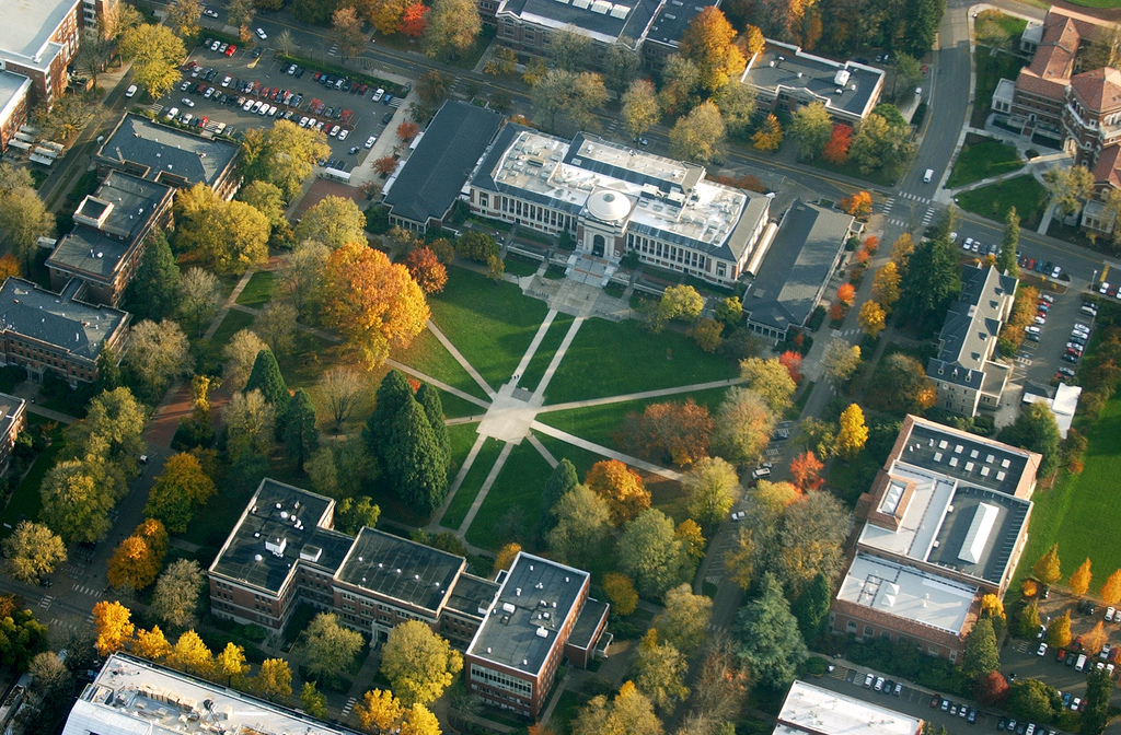


Corvallis, Oregon
Corvallis is a city of 59,960 people in Benton County, Oregon, founded in 1845.
Why visit Corvallis
Townapedia lists 39 museums and landmarks, 68 parks and trails, 203 places to eat, 11 places to stay and 13 attractions in and around town.
Highlights include Flicker and Fir, Majestic Theatre, Avery–Helm Historic District and College Hill West Historic District.
Weather in Corvallis
Forecast from the National Weather Service. Full forecast
About Corvallis
Corvallis is a city in and the county seat of Benton County in central western Oregon, United States. It is the principal city of the Corvallis, Oregon Metropolitan Statistical Area, which encompasses all of Benton County. As of the 2023 Census Population Estimates, the population was 61,087, making it the 9th most populous city in Oregon. This includes the 24,900 Oregon State University students at the main campus in Corvallis, over 5,250 of whom live in one of 16 residence halls on the main campus.
From the Wikipedia article Corvallis, Oregon (this version), under CC BY-SA 4.0.
Things to do13


LaSells Stewart Center
Cinema and theater · 0.8 mi
Performing arts and conference center on the Oregon State University campus in Corvallis, Oregon, United States


1 more on the map.
Museums and landmarks39

Avery–Helm Historic District
Monument and historic site · National Register of Historic Places · 1.0 mi
Historic district in Corvallis, Oregon, USA

College Hill West Historic District
Monument and historic site · National Register of Historic Places
Historic district in Corvallis, Oregon, USA

Irish Bend Covered Bridge
Bridge · National Register of Historic Places · 1.1 mi
Historic covered bridge near Corvallis, Oregon, USA
Southwest Campus Way, Corvallis


Whiteside Theatre
Monument and historic site · National Register of Historic Places · 0.9 mi
Movie theater in Corvallis, Oregon, United States
361 Southwest Madison Avenue, Corvallis

Benton County Courthouse
Monument and historic site · National Register of Historic Places · 0.9 mi
Courthouse in Corvallis, Oregon, USA
Benton County State Bank Building
Monument and historic site · National Register of Historic Places · 1.1 mi
Historic building in Corvallis, Oregon, USA
Benton Hotel
Monument and historic site · National Register of Historic Places · 0.9 mi
Hotel building in Oregon, United States of America
Charles and Ibby Whiteside House
Monument and historic site · National Register of Historic Places · 0.7 mi
Historic house in Corvallis, Oregon, USA
Charles Gaylord House
Monument and historic site · National Register of Historic Places · 0.8 mi
Historic house in Corvallis, Oregon, USA
Children's Farm Home School
Monument and historic site · National Register of Historic Places · 4.1 mi
Historic building near Corvallis, Oregon, USA
Corvallis Hotel
Monument and historic site · National Register of Historic Places · 1.1 mi
Hotel in Oregon, United States of America
Crystal Lake Cemetery
Monument and historic site · National Register of Historic Places · 2.0 mi
Cemetery in Corvallis, Oregon
27 more on the map.
Parks, trails and playgrounds68



56 more on the map.
Restaurants and cafes203

American Dream Pizza
Restaurant · Pizza · 1.0 mi
214 Southwest 2nd Street, Corvallis
Th 11:00-23:00; Fr-Sa 11:00-24:00; Su-We 11:00-22:00

Applebee's
Diner · American · 1.8 mi
1915 Northeast Four Acre Place, Corvallis
Mo-Fr 11:00-24:00; Sa,Su 00:00-01:00,11:00-24:00
Bo & Vine
Restaurant · Burger · 0.9 mi
110 Northwest 3rd Street, Corvallis
Mo-Th 11:00-21:00; Fr-Sa 11:00-22:00; Su 11:00-20:00
Bombs Away Cafe
Restaurant · Mexican
2527 Monroe Avenue, Corvallis
Mo-Fr 12:00-24:00; Sa 10:00-24:00; Su 10:00-15:00
Buffalo Wild Wings
Restaurant · Wings · 1.5 mi
1820 Northwest 9th Street, Corvallis
Mo-Sa 11:00-24:00; Su 11:00-22:00
China Delight Restaurant & Lounge
Restaurant · Chinese · 1.0 mi
325 Northwest 2nd Street, Corvallis
Mo-Fr 11:00-02:30; Sa 12:00-02:30; Su 12:00-21:00

Dutch Bros. Coffee
Cafe · Coffee Shop · 0.9 mi
425 Northwest Harrison Boulevard, Corvallis
Mo-Fr 05:00-23:00; Sa-Su 05:30-23:00
Dutch Bros. Coffee
Cafe · Coffee Shop · 1.5 mi
1765 Northwest 9th Street, Corvallis
Mo-Fr 05:00-23:00; Sa-Su 05:30-23:00
Evergreeen Indian Cusine
Restaurant · Indian · 0.9 mi
136 Southwest 3rd Street, Corvallis
We-Mo 11:30-14:30,17:00-21:30; Tu off
191 more on the map.
Where to stay11
Best Western Grand Manor and Suites
Motel and hotel · 1.3 mi
925 Northwest Garfield Avenue, Corvallis
Holiday Inn Corvallis
Motel and hotel · 1.1 mi
781 Northeast 2nd Street, Corvallis
Churches and places of worship39
Corvallis Arts Center
Church · National Register of Historic Places · 0.8 mi
First Congregational Church
Church · National Register of Historic Places · 0.7 mi
Beautiful Savior Evangelical Lutheran Church
Church · Lutheran · 1.8 mi
2605 Northwest 13th Street, Corvallis
Kingdom Hall of Jehovah's Witnesses
Church · Jehovahs Witness · 1.2 mi
1330 Southwest 35th Street, Corvallis
Shepherd of the Valley Lutheran Church
Church · Lutheran · 1.8 mi
2650 Northwest Highland Drive, Corvallis
Corvallis Seventh-day Adventist Church
Church · Seventh Day Adventist · 1.0 mi
3160 Southwest Western Boulevard, Corvallis
Shopping39
Gas and EV charging22
OSU - 15th & Jefferson Way Lot
EV charging · 0.5 mi
1220 Southwest Jefferson Way, Corvallis
Schools, colleges and libraries27
Crescent Valley High School
School · 3.3 mi
4444 Northwest Highland Drive, Corvallis
Healthcare11
Samaritan Physical Rehabilitation Specialists - Corvallis
Clinic and pharmacy · 0.8 mi
815 Northwest 9th Street, Corvallis
Samaritan Pediatrics
Clinic and pharmacy · 0.7 mi
777 Northwest 9th Street, Corvallis
Map of Corvallis
250 places. The map loads OpenStreetMap tiles when you open it.
People and cost of living
American Community Survey 5-year estimates, 2020-2024, U.S. Census Bureau. Estimates have margins of error, larger for small towns.
Disaster history
Benton County has had 11 federal disaster declarations since 2000, most often for severe storms.
- 2024-04-13: Severe Winter Storms, Straight-Line Winds, Landslides, And Mudslides (Severe Storm)
- 2021-05-04: Severe Winter Storm (Severe Storm)
- 2020-09-15: Wildfires And Straight-Line Winds (Fire)
- 2020-03-28: Covid-19 Pandemic (Biological)
- 2020-03-13: Covid-19 (Biological)
- 2014-04-04: Severe Winter Storm (Severe Storm)
OpenFEMA disaster declarations summaries.
Getting there and nearby towns
Corvallis Municipal Airport (CVO) is the nearest airport with scheduled flights listed in OpenStreetMap, 5 miles away.
- Philomath 4 mi southwest, about 7 min by car
- Adair Village 8 mi northeast, about 12 min by car
- Tangent 8 mi east, about 14 min by car
- Albany 10 mi northeast, about 16 min by car
- Millersburg 13 mi northeast, about 20 min by car
- Halsey 15 mi southeast, about 25 min by car
- Jefferson 17 mi northeast, about 27 min by car
- Lebanon 18 mi east, about 30 min by car
- Salem 27 mi northeast, about 44 min by car
- Eugene 36 mi south, about 58 min by car
Drive times are estimates from straight-line distance, not routes.
Local news
Headlines from INDB, the NEMICO news database.
Reviews, tips and questions
Loading what members have shared...
Sources and licences
- NCES EDGE (Public domain): public schools
- OpenFEMA (Public domain): disaster declarations
- OpenStreetMap contributors (ODbL 1.0): places, airports, map data
- U.S. Census Bureau (Public domain): population, income, housing, education, commute
- Wikidata (CC0 1.0): elevation, founding date, time zone, website, landmarks and historic places
- Wikimedia Commons (see each image): photos
- Wikipedia (CC BY-SA 4.0): overview and history text
Photo credits
- Benton County Courthouse Greg Keene, Gregkeene, CC BY 3.0 us
- OSU by air, saml123, CC BY 2.0
- Whiteside Theatre Corvallis, 46percent, Public domain
- Reed House - Corvallis Oregon, Ian Poellet, CC BY-SA 3.0
- Francis House - Corvallis Oregon, Ian Poellet, CC BY-SA 3.0
- Irish Bend Covered Bridge, Unknown author, Public domain
Page built October 30, 2026. Spotted a mistake? Tell us or suggest a place.