




Cotati, California
Cotati is a city of 7,489 people in Sonoma County, California, founded in 1963.
Why visit Cotati
Townapedia lists 5 museums and landmarks, 30 parks and trails, 65 places to eat, 7 places to stay and 1 attraction in and around town.
Highlights include Sonoma State University.
September is the warmest month, with average highs of 82°F; December lows average 38°F.
Weather in Cotati
Forecast from the National Weather Service. Full forecast
About Cotati
Cotati (, ; Miwok: Kota’ti) is a city in Sonoma County, California, United States, located approximately 45 mi (70 km) north of San Francisco in the 101 corridor between Rohnert Park and Petaluma. Cotati's population as of the 2020 Census was 7,584, making it the least populous incorporated community in Sonoma County.
From the Wikipedia article Cotati, California (this version), under CC BY-SA 4.0.
Things to do1


Sonoma State University
School · 2.0 mi
Public university in Rohnert Park in Sonoma County, California, United States
Museums and landmarks5

Veterans Memorial Building
Monument and historic site · 0.6 mi
8505 Park Avenue, Cotati
Parks, trails and playgrounds30

18 more on the map.
Restaurants and cafes65



Chuck E. Cheese
Restaurant · Pizza · 1.6 mi
601 Rohnert Park Expressway, Rohnert Park
Mo-Su 11:00-20:00
Quickly
Cafe · Bubble Tea · 1.4 mi
1451 Southwest Boulevard, Rohnert Park
Mo-Fr 11:30-20:00; Sa-Su 12:00-20:00

53 more on the map.
History
The Coast Miwok civilization thrived in the Cotati area since at least 2000 BC, with principal villages built near major streams. Documented villages in the area included Lumen-takala (northeast of present-day Cotati), Payinecha (west of present-day Cotati), and Kotati.
In 1827, an Irishman named John Thomas Reed ventured into Miwok territory and built a cabin near Crane Creek. After the natives burned it, he retreated south to Mill Valley.
From the History section of Cotati, California on Wikipedia, under CC BY-SA 4.0.
Where to stay7
Hampton Inn & Suites Rohnert Park - Sonoma County
Motel and hotel · 1.5 mi
6248 Redwood Drive, Rohnert Park
Home2 Suites by Hilton Rohnert Park Sonoma County
Motel and hotel · 1.3 mi
6490 Redwood Drive, Rohnert Park
Budget Inn Expressway Hub
Motel and hotel · 1.4 mi
6298 Redwood Drive, Rohnert Park
Motel 6 Rohnert Park, CA
Motel and hotel · 1.5 mi
6145 Commerce Boulevard, Rohnert Park
Churches and places of worship7
Shopping12
Gas and EV charging9
Schools, colleges and libraries47
Rohnert Park Cotati Regional Library
Library · 1.4 mi
6250 Lynne Conde Way, Rohnert Park
Healthcare1
Map of Cotati
184 places. The map loads OpenStreetMap tiles when you open it.
Climate by month
Monthly table
| Month | High | Low | Rain | Snow |
|---|---|---|---|---|
| Jan | 58°F | 39°F | 4.8 in | 0.0 in |
| Feb | 61°F | 40°F | 5.2 in | 0.0 in |
| Mar | 64°F | 42°F | 3.3 in | 0.0 in |
| Apr | 68°F | 44°F | 1.7 in | 0.0 in |
| May | 72°F | 47°F | 0.9 in | 0.0 in |
| Jun | 78°F | 50°F | 0.3 in | 0.0 in |
| Jul | 81°F | 52°F | 0.0 in | 0.0 in |
| Aug | 81°F | 53°F | 0.1 in | 0.0 in |
| Sep | 82°F | 51°F | 0.1 in | 0.0 in |
| Oct | 76°F | 48°F | 1.3 in | 0.0 in |
| Nov | 66°F | 42°F | 2.7 in | 0.0 in |
| Dec | 58°F | 38°F | 5.2 in | 0.0 in |
U.S. Climate Normals 1991-2020 for Petaluma Ap Hcn (7 mi away), NOAA NCEI.
People and cost of living
American Community Survey 5-year estimates, 2020-2024, U.S. Census Bureau. Estimates have margins of error, larger for small towns.
Disaster history
Sonoma County has had 23 federal disaster declarations since 2000, most often for fires.
- 2023-04-03: Severe Winter Storms, Straight-Line Winds, Flooding, Landslides, And Mudslides (Severe Storm)
- 2023-03-10: Severe Winter Storms, Flooding, Landslides, And Mudslides (Flood)
- 2023-01-14: Severe Winter Storms, Flooding, Landslides, And Mudslides (Flood)
- 2023-01-09: Severe Winter Storms, Flooding, And Mudslides (Flood)
- 2020-10-16: Wildfires (Fire)
- 2020-09-27: Glass Fire (Fire)
OpenFEMA disaster declarations summaries.
Getting there and nearby towns
Belos Cavalos Airport (CA39) is the nearest airport with scheduled flights listed in OpenStreetMap, 11 miles away.
- Rohnert Park 1 mi north, about 2 min by car
- Sonoma State University 2 mi northeast, about 4 min by car
- Penngrove 3 mi southeast, about 5 min by car
- Petaluma 7 mi southeast, about 12 min by car
- Santa Rosa 8 mi north, about 13 min by car
- Glen Ellen 9 mi east, about 15 min by car
- Eldridge 11 mi east, about 18 min by car
- Graton 11 mi northwest, about 18 min by car
- Kenwood 11 mi northeast, about 18 min by car
- Boyes Hot Springs 12 mi east, about 19 min by car
Drive times are estimates from straight-line distance, not routes.
Local news
Headlines from INDB, the NEMICO news database.
Reviews, tips and questions
Loading what members have shared...
Sources and licences
- NCES EDGE (Public domain): public schools
- NOAA NCEI U.S. Climate Normals 1991-2020 (Public domain): climate by month
- OpenFEMA (Public domain): disaster declarations
- OpenStreetMap contributors (ODbL 1.0): places, airports, map data
- U.S. Census Bureau (Public domain): population, income, housing, education, commute
- Wikidata (CC0 1.0): elevation, founding date, time zone, website, landmarks and historic places
- Wikimedia Commons (see each image): photos
- Wikipedia (CC BY-SA 4.0): overview and history text
Photo credits
- Church of the Oaks 10252, Stepheng3, CC BY-SA 3.0
- Cotati Fowl 10222, Stepheng3, CC BY-SA 3.0
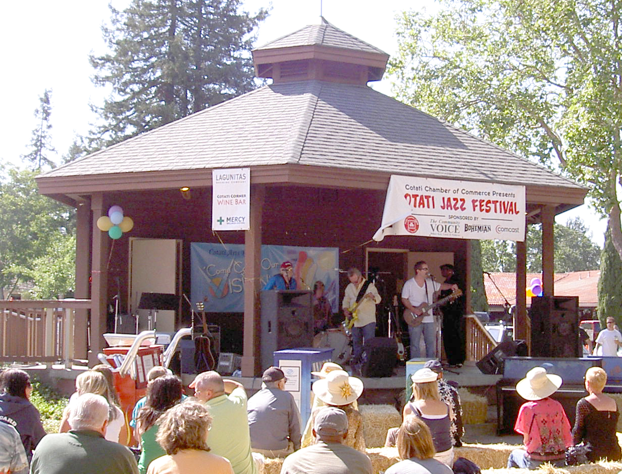
- Cotati Jazz 3656, Stepheng3, Public domain
- Cotati Jazz 3664, Stepheng3, Public domain
- Mercy Wellness (Cotati, California) 02, Missvain, CC0
- Mercy Wellness (Cotati, California) 01, Missvain, CC0
- Lowe's in Cotati, California - October 2022 - Sarah Stierch 02, Missvain, CC BY 4.0
- Cotati station building, April 2018, Pi.1415926535, CC BY-SA 3.0
- Clocktower of Cotati station, April 2018, Pi.1415926535, CC BY-SA 3.0
- North end of Cotati station, April 2018, Pi.1415926535, CC BY-SA 3.0
- Northbound shelter at Cotati station, April 2018, Pi.1415926535, CC BY-SA 3.0
- Platforms at Cotati station, April 2018, Pi.1415926535, CC BY-SA 3.0
- SSU Salazar Hall 4646, Stepheng3, CC BY-SA 3.0
- Jim Boggio statue, Tom W.M., CC BY-SA 4.0
- La Plaza Park, Mx. Granger, CC0
- Elect a clown expect a circus - April 2025 - Sarah Stierch, Missvain, CC0
- Spilosoma vestalis, the Vestal tiger-moth in profile, JayWalsh, CC BY-SA 4.0
- Acme Burger - January 2023 - Sarah Stierch 10, Missvain, CC BY 4.0
- Acme Burger - January 2023 - Sarah Stierch 01, Missvain, CC BY 4.0
- Acme Burger - January 2023 - Sarah Stierch 08, Missvain, CC BY 4.0
- Acme Burger - January 2023 - Sarah Stierch 09, Missvain, CC BY 4.0
- Acme Burger - January 2023 - Sarah Stierch 06, Missvain, CC BY 4.0
- Acme Burger - January 2023 - Sarah Stierch 05, Missvain, CC BY 4.0
- Acme Burger - January 2023 - Sarah Stierch 13, Missvain, CC BY 4.0
- Acme Burger - January 2023 - Sarah Stierch 15, Missvain, CC BY 4.0
- Acme Burger - January 2023 - Sarah Stierch 02, Missvain, CC BY 4.0
- Acme Burger - January 2023 - Sarah Stierch 14, Missvain, CC BY 4.0
- Acme Burger - January 2023 - Sarah Stierch 11, Missvain, CC BY 4.0
- Acme Burger - January 2023 - Sarah Stierch 12, Missvain, CC BY 4.0
- Acme Burger - January 2023 - Sarah Stierch 07, Missvain, CC BY 4.0
- Red Bird Bakery - January 2023 - Sarah Stierch 01, Missvain, CC BY 4.0
- Acme Burger - January 2023 - Sarah Stierch 04, Missvain, CC BY 4.0
- Red Bird Bakery - January 2023 - Sarah Stierch 02, Missvain, CC BY 4.0
- Acme Burger - January 2023 - Sarah Stierch 03, Missvain, CC BY 4.0
- Tech High Front Quad Entrance, Frigyes06, CC BY-SA 4.0
- Sonoma County Transit 230 turning left in Rohnert Park, Evan0512, CC BY-SA 4.0
- Page Elementary 10239, Stepheng3, CC BY-SA 3.0
- There's No Place Like Home (4340004096), cogdogblog, CC BY 2.0
- Taylor Mtn Sonoma County 10233, Stepheng3, CC BY-SA 3.0


Page built October 30, 2026. Spotted a mistake? Tell us or suggest a place.