
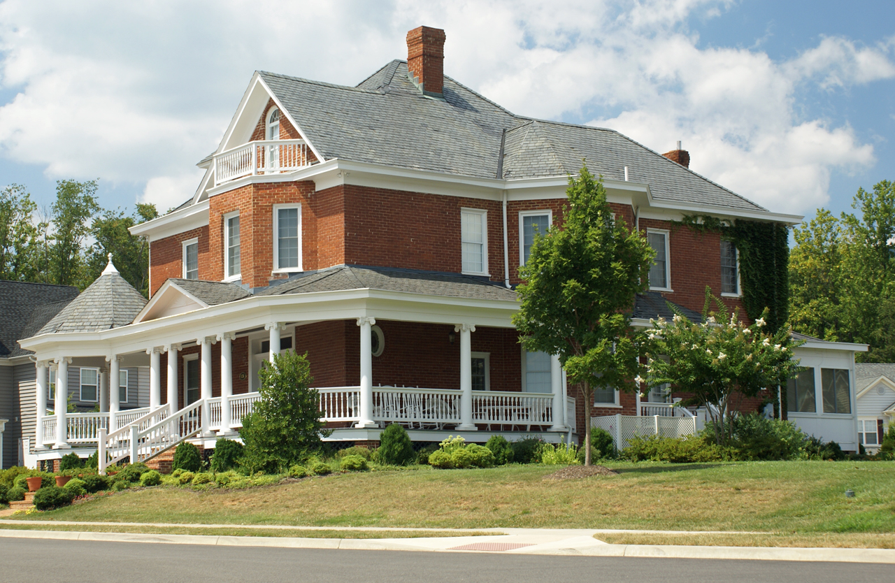


Why visit Crozet
Townapedia lists 8 museums and landmarks, 2 parks and trails, 23 places to eat and 2 attractions in and around town.
Highlights include Beaver Creek Mountain, Blue Ridge Farm, Casa Maria and Old Trail Golf Club.
July is the warmest month, with average highs of 86°F; January lows average 24°F.
Weather in Crozet
Forecast from the National Weather Service. Full forecast
About Crozet
Crozet kroh-ZAY is a census-designated place (CDP) in Albemarle County in the Commonwealth of Virginia, United States. It sits along the I-64 corridor, about 12 miles (19 km) west of Charlottesville and 21 miles (34 km) east of Staunton. Crozet is part of the Charlottesville Metropolitan Statistical Area. As of the 2020 census, Crozet had a population of 9,224.
From the Wikipedia article Crozet, Virginia (this version), under CC BY-SA 4.0.
Things to do2

Museums and landmarks8

Blue Ridge Farm
Monument and historic site · National Register of Historic Places · 2.8 mi
Building in Virginia, United States

Casa Maria
Monument and historic site · National Register of Historic Places · 3.8 mi
Building in Virginia, United States

Crozet Historic District
Monument and historic site · National Register of Historic Places · 0.5 mi
Historic district in Albemarle County, Virginia

Malvern
Monument and historic site · National Register of Historic Places · 4.0 mi
Historic house in Virginia, United States

Mirador
Monument and historic site · National Register of Historic Places · 3.7 mi
Greenwood, Virginia

Seven Oaks Farm and Black's Tavern
Monument and historic site · National Register of Historic Places · 3.1 mi
Building in Virginia, United States

The Cedars
Monument and historic site · National Register of Historic Places · 2.8 mi
Building in Virginia, United States


The Miller School of Albemarle
Monument and historic site · National Register of Historic Places · 4.0 mi
Co-ed boarding & day school in Charlottesville, Virginia, USA
Parks, trails and playgrounds2


Restaurants and cafes23

Crozet Seafood Supply
Restaurant · Seafood · 1.3 mi
375 Four Leaf Lane, Charlottesville
Mo 11:00-18:00; Tu-Sa 10:00-18:00; Su 11:00-16:00

Praha Bohemian Bakery and Cafe
Cafe · American, Czech
5778 Three Notch'd Road, Crozet
Mo-Su 07:00-17:00

Tea House
Restaurant · Chinese · 1.3 mi
325 Four Leaf Lane, Charlottesville
Su,Tu-Th 11:30-21:30; Fr-Sa 11:30-22:00
Crozet Crepe Company
Restaurant · 1.3 mi
325 Four Leaf Lane, Charlottesville
Tu-Fr 07:00-15:00; Fr-Sa 08:00-15:00
Fardowners
Diner · American
5773 The Square, Crozet
Mo 11:30-21:00; Tu-Th 15:00-21:00; Fr-Sa 11:30-22:00; Su 10:00-14:00

Pro Re Nata Brewery
Brewery and winery · 1.5 mi
6135 Rockfish Gap Turnpike, Crozet
Th 11:00-22:00; Fr-Sa 11:00-23:00; Su 11:00-21:00
Love2Eat Thai Cuisine
Restaurant · Thai · 1.3 mi
540 Radford Lane, Charlottesville
Mo-Tu,Th-Fr 11:00-21:00; Sa-Su 12:00-14:30
11 more on the map.
History
Originally called "Wayland's Crossing," it was renamed in 1870 in honor of Colonel Claudius Crozet, the French-born civil engineer who directed the construction of the Blue Ridge Tunnel. The cornerstone of Crozet is believed to have been Pleasant Green, a property also known as the Ficklin-Wayland Farm, located yards from the actual Wayland Crossing. Claudius Crozet is said to have lodged in that property while surveying the land that today honors his name.
From the History section of Crozet, Virginia on Wikipedia, under CC BY-SA 4.0.
Churches and places of worship6
Union Mission Baptist Church
Church · Baptist · 0.5 mi
5456 Union Mission Lane, Albemarle County
Shopping3
Gas and EV charging5
Schools, colleges and libraries12
Virginia L. Murray Elementary
School · 4.6 mi
3251 Morgantown Road, Charlottesville
Healthcare4
UVA Family Medicine and Specialty Care
Clinic and pharmacy · 1.2 mi
375 Four Leaf Lane, Charlottesville
Map of Crozet
65 places. The map loads OpenStreetMap tiles when you open it.
Climate by month
Monthly table
| Month | High | Low | Rain | Snow |
|---|---|---|---|---|
| Jan | 45°F | 24°F | 3.5 in | 4.1 in |
| Feb | 49°F | 25°F | 2.8 in | 3.1 in |
| Mar | 58°F | 30°F | 3.9 in | 1.4 in |
| Apr | 69°F | 40°F | 3.3 in | 0.0 in |
| May | 74°F | 51°F | 4.3 in | 0.0 in |
| Jun | 81°F | 60°F | 4.8 in | 0.0 in |
| Jul | 86°F | 64°F | 4.5 in | 0.0 in |
| Aug | 84°F | 63°F | 3.4 in | 0.0 in |
| Sep | 78°F | 56°F | 5.1 in | 0.0 in |
| Oct | 69°F | 44°F | 3.7 in | 0.0 in |
| Nov | 59°F | 33°F | 3.8 in | 0.1 in |
| Dec | 49°F | 26°F | 3.6 in | 2.2 in |
U.S. Climate Normals 1991-2020 for Free Union (6 mi away), NOAA NCEI.
People and cost of living
American Community Survey 5-year estimates, 2020-2024, U.S. Census Bureau. Estimates have margins of error, larger for small towns.
Disaster history
Albemarle County has had 16 federal disaster declarations since 2000, most often for hurricanes.
- 2026-01-23: Severe Winter Storm (Winter Storm)
- 2024-10-01: Tropical Storm Helene (Tropical Storm)
- 2022-03-11: Severe Winter Storm And Snowstorm (Severe Storm)
- 2020-04-02: Covid-19 Pandemic (Biological)
- 2020-03-13: Covid-19 (Biological)
- 2018-09-11: Hurricane Florence (Hurricane)
OpenFEMA disaster declarations summaries.
Getting there and nearby towns
Charlottesville-Albemarle Airport (CHO) is the nearest airport with scheduled flights listed in OpenStreetMap, 14 miles away.
- Dooms 9 mi west, about 14 min by car
- Crimora 10 mi northwest, about 17 min by car
- Waynesboro 11 mi west, about 18 min by car
- Charlottesville 12 mi east, about 19 min by car
- Rio 12 mi east, about 20 min by car
- Pantops 14 mi east, about 22 min by car
- Earlysville 14 mi northeast, about 22 min by car
- Nellysford 14 mi southwest, about 23 min by car
- Lyndhurst 14 mi west, about 23 min by car
- Grottoes 16 mi northwest, about 25 min by car
Drive times are estimates from straight-line distance, not routes.
Local news
Headlines from INDB, the NEMICO news database.
Reviews, tips and questions
Loading what members have shared...
Sources and licences
- NCES EDGE (Public domain): public schools
- NOAA NCEI U.S. Climate Normals 1991-2020 (Public domain): climate by month
- OpenFEMA (Public domain): disaster declarations
- OpenStreetMap contributors (ODbL 1.0): places, airports, map data
- U.S. Census Bureau (Public domain): population, income, housing, education, commute
- Wikidata (CC0 1.0): elevation, founding date, time zone, website, landmarks and historic places
- Wikimedia Commons (see each image): photos
- Wikipedia (CC BY-SA 4.0): overview and history text
Photo credits
- BainHouseinCrozet, Photo by Brian Wheeler, Charlottesville Tomorrow., CC BY 2.0
- 2016-06-03 08 17 13 View west along Virginia State Route 240 (Three Notch'd Road) just west of the junction with Railroad Avenue (Virginia State Secondary Route 788) and Crozet Avenue (Virginia State..., Famartin, CC BY-SA 4.0
- 2016-06-03 08 26 20 View east along Virginia State Route 240 (Crozet Avenue) just north of Jarmin Gap Road (Virginia State Secondary Route 691) in Crozet, Albemarle County, Virginia, Famartin, CC BY-SA 4.0
- Andy Thacker Uncle Charlie's Smokehouse Crozet VA June 2008, Artaxerxes, CC BY-SA 3.0
- Brennan Gilmore Charlie's Smokehouse Crozet VA June 2008, Artaxerxes, CC BY-SA 3.0
- CSX train Crozet Virginia, Artaxerxes, CC BY-SA 3.0
- Uncle Charlie's Smokehouse Crozet VA June 2008, Artaxerxes, CC BY-SA 3.0
- Double bass Uncle Charlie's Smokehouse Crozet VA June 2008, Artaxerxes, CC BY-SA 3.0
- 2016-06-03 08 26 34 View east along Virginia State Route 240 (Crozet Avenue) just north of Library Avenue in Crozet, Albemarle County, Virginia, Famartin, CC BY-SA 4.0
- 2019-10-25 15 37 15 View east along Virginia State Route 240 (Three Notch'd Road) just east of Crozet Avenue (Virginia State Route 810) in Crozet, Albemarle County, Virginia, Famartin, CC BY-SA 4.0
- 2016-06-03 08 27 45 View east along Virginia State Route 240 (Three Notch'd Road) just east of Crozet Avenue (Virginia State Secondary Route 810) in Crozet, Albemarle County, Virginia, Famartin, CC BY-SA 4.0
- 2016-06-03 08 27 36 Businesses along Three Notch'd Road (Virginia State Route 240) near Crozet Avenue (Virginia State Secondary Route 810) in Crozet, Albemarle County, Virginia, Famartin, CC BY-SA 4.0
- 2016-06-03 08 26 38 View east along Virginia State Route 240 (Crozet Avenue) just south of The Square (Virginia State Secondary Route 1217) in Crozet, Albemarle County, Virginia, Famartin, CC BY-SA 4.0
- Mack fire engine under railroad trestle intersection Crozet Avenue and Three Notch'd Road-SR 240 downtown Crozet VA June 2008, Artaxerxes, CC BY-SA 3.0
- BP gas station Three Notched Road Crozet VA June 2008, Artaxerxes, CC BY-SA 3.0
- $4.039 gasoline price BP station Crozet VA June 2008, Artaxerxes, CC BY-SA 3.0
- Seven Oaks Farm barn, Nyttend, Public domain
- Mirador Greenwood Albemarle County Virginia by Frances Benjamin Johnston 1926, Frances Benjamin Johnston, Public domain
- The Cedars from US 250, Nyttend, Public domain
- Miller School of Albemarle, Millerkim Kim Kelley-Wagner, CC BY-SA 3.0
- Blue Ridge Farmhouse, Nyttend, Public domain
- St. George and St. George in Crozet, Nyttend, Public domain
- Casa Maria outbuilding, Nyttend, Public domain
- Uncle Charlie's Smokehouse 2, Artaxerxes, CC BY-SA 3.0
- November is coming, again (7895223592), Jamelle Bouie from Washington D.C., United States, CC BY-SA 2.0
- Obama goes down the line (7895251608), Jamelle Bouie from Washington D.C., United States, CC BY-SA 2.0
- Waving and taking pictures (7895252542), Jamelle Bouie from Washington D.C., United States, CC BY-SA 2.0
- Obama (7895242260), Jamelle Bouie from Washington D.C., United States, CC BY-SA 2.0
- Obama hat (7895250404), Jamelle Bouie from Washington D.C., United States, CC BY-SA 2.0
- Kaine greets (7895236364), Jamelle Bouie from Washington D.C., United States, CC BY-SA 2.0
- Making the case (7895244118), Jamelle Bouie from Washington D.C., United States, CC BY-SA 2.0
- Kaine leaving the stage (7895234024), Jamelle Bouie from Washington D.C., United States, CC BY-SA 2.0
- Tim kaine (7895232642), Jamelle Bouie from Washington D.C., United States, CC BY-SA 2.0
- Greeting the kids (7895237400), Jamelle Bouie from Washington D.C., United States, CC BY-SA 2.0
- Forward (7895230654), Jamelle Bouie from Washington D.C., United States, CC BY-SA 2.0
- A star is born (7895229752), Jamelle Bouie from Washington D.C., United States, CC BY-SA 2.0
- Obama (7895239444), Jamelle Bouie from Washington D.C., United States, CC BY-SA 2.0
- Milling around (7895225830), Jamelle Bouie from Washington D.C., United States, CC BY-SA 2.0
- Waiting in line (7895228214), Jamelle Bouie from Washington D.C., United States, CC BY-SA 2.0
- A classic obama pose (7895245118), Jamelle Bouie from Washington D.C., United States, CC BY-SA 2.0


Page built October 30, 2026. Spotted a mistake? Tell us or suggest a place.