

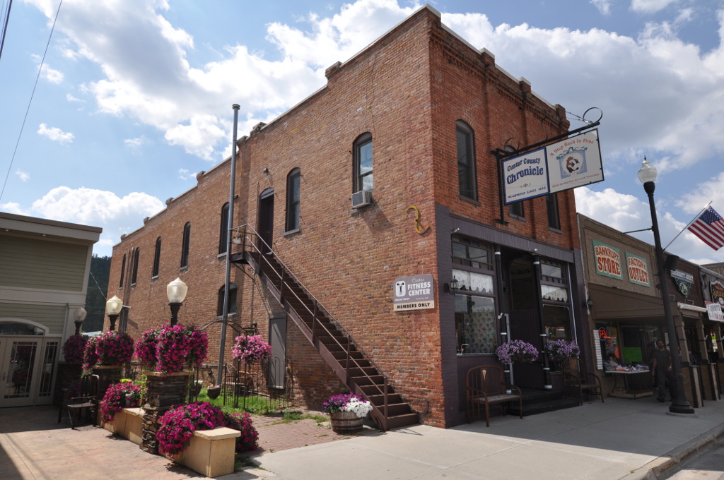


Custer, South Dakota
Custer is a city of 2,341 people in Custer County, South Dakota, founded in 1875.
Why visit Custer
Townapedia lists 6 museums and landmarks, 6 parks and trails, 26 places to eat, 19 places to stay and 3 attractions in and around town.
Highlights include Custer County Courthouse and Garlock Building.
July is the warmest month, with average highs of 80°F; February lows average 16°F, and about 58 inches of snow fall in a normal year.
Weather in Custer
Forecast from the National Weather Service. Full forecast
About Custer
Custer is a city in Custer County, South Dakota, United States. The population was 1,919 at the 2020 census. It is the county seat of Custer County.
From the Wikipedia article Custer, South Dakota (this version), under CC BY-SA 4.0.
Things to do3

Museums and landmarks6

Custer County Courthouse
Monument and historic site · National Register of Historic Places
Courthouse in Custer, South Dakota, United States
Garlock Building
Monument and historic site · National Register of Historic Places
Commercial building in Custer, South Dakota




Parks, trails and playgrounds6


Restaurants and cafes26


Buglin' Bull
Restaurant · American, Burger
511 Mount Rushmore Road, Custer
Su-Th 11:00-20:00; Fr,Sa 11:00-21:00
Pizza Hut
Restaurant · Pizza
549 549 Mount Rushmore Rd, Custer, SD 57730, United States, Custer
Su-Th 11:00-21:00; Fr-Sa 11:00-22:00

The Custer Wolf - Food & Drink
Restaurant · Burger, American, Sandwich
607 Mount Rushmore Road, Custer
Mo-Sa 11:30-20:00
14 more on the map.
History
Custer is the oldest town established by European Americans in the Black Hills. Gold was discovered east of Custer during the Black Hills Expedition, conducted by the 7th Cavalry led by Lt. Colonel George Armstrong Custer, a discovery which initiated the Black Hills Gold Rush.
For thousands of years, the Black Hills had been part of the territory of varying tribes of indigenous peoples. They were within historical territory of the Oglala Sioux at the time of United States encounter, and within the Great Sioux Reservation established by the US Treaty of Fort Laramie (1868). Having established dominance in the area by the eighteenth century, the Oglala Sioux had long considered the Black Hills as sacred land.
After increasing encroachment by Americans and violent confrontations, the U.S. government forced the Sioux to cede much of the Black Hills in 1877, and opened the land for individual purchase and settlement. In 1875 trespassing gold-boomers named their settlement Stonewall (after the Confederate general, Stonewall Jackson), but it was renamed for Custer. Almost abandoned in 1876 after word of the much larger gold strikes in Deadwood Gulch spread, Custer later became an established city.
From the History section of Custer, South Dakota on Wikipedia, under CC BY-SA 4.0.
Where to stay19
Rock Crest Lodge and Cabin
Motel and hotel · 0.5 mi
15 West Mount Rushmore Road, Custer
Churches and places of worship2
Shopping3
Gas and EV charging4
Schools, colleges and libraries6
Healthcare2
Map of Custer
77 places. The map loads OpenStreetMap tiles when you open it.
Climate by month
Monthly table
| Month | High | Low | Rain | Snow |
|---|---|---|---|---|
| Jan | 37°F | 16°F | 0.4 in | 6.6 in |
| Feb | 37°F | 16°F | 0.7 in | 10.7 in |
| Mar | 46°F | 24°F | 0.9 in | 10.7 in |
| Apr | 51°F | 30°F | 2.2 in | 11.0 in |
| May | 61°F | 40°F | 3.5 in | 2.1 in |
| Jun | 72°F | 50°F | 3.4 in | 0.0 in |
| Jul | 80°F | 56°F | 3.2 in | 0.0 in |
| Aug | 79°F | 55°F | 2.4 in | 0.0 in |
| Sep | 71°F | 46°F | 1.5 in | 0.8 in |
| Oct | 56°F | 34°F | 1.4 in | 3.9 in |
| Nov | 45°F | 24°F | 0.6 in | 6.7 in |
| Dec | 36°F | 17°F | 0.4 in | 5.4 in |
U.S. Climate Normals 1991-2020 for Custer (1 mi away), NOAA NCEI.
People and cost of living
American Community Survey 5-year estimates, 2020-2024, U.S. Census Bureau. Estimates have margins of error, larger for small towns.
Disaster history
Custer County has had 13 federal disaster declarations since 2000, most often for fires.
- 2026-04-07: Straight-Line Winds (Straight-Line Winds)
- 2026-03-13: Qury Fire (Fire)
- 2020-04-05: Covid-19 Pandemic (Biological)
- 2020-03-13: Covid-19 (Biological)
- 2019-09-23: Severe Storms And Flooding (Flood)
- 2017-12-13: Legion Lake Fire (Fire)
OpenFEMA disaster declarations summaries.
Getting there and nearby towns
Rapid City Regional Airport (RAP) is the nearest airport with scheduled flights listed in OpenStreetMap, 33 miles away.
- Hill City 11 mi north, about 19 min by car
- Keystone 12 mi northeast, about 20 min by car
- Hermosa 21 mi east, about 34 min by car
- Colonial Pine Hills 22 mi northeast, about 36 min by car
- Johnson Siding 23 mi north, about 38 min by car
- Hot Springs 25 mi south, about 40 min by car
- Rapid City 28 mi northeast, about 46 min by car
- Blackhawk 30 mi northeast, about 48 min by car
- Box Elder 35 mi northeast, about 56 min by car
- Spearfish 51 mi north, about 1 h 15 min by car
Drive times are estimates from straight-line distance, not routes.
Local news
Headlines from INDB, the NEMICO news database.
Reviews, tips and questions
Loading what members have shared...
Sources and licences
- NCES EDGE (Public domain): public schools
- NOAA NCEI U.S. Climate Normals 1991-2020 (Public domain): climate by month
- OpenFEMA (Public domain): disaster declarations
- OpenStreetMap contributors (ODbL 1.0): places, airports, map data
- U.S. Census Bureau (Public domain): population, income, housing, education, commute
- Wikidata (CC0 1.0): elevation, founding date, time zone, website, landmarks and historic places
- Wikimedia Commons (see each image): photos
- Wikipedia (CC BY-SA 4.0): overview and history text
Photo credits
- CusterMainstreet, Posi66, Public domain
- CusterSD GarlockBuilding, Magicpiano, CC BY-SA 4.0
- Custer County 1881 Courthouse Museum SD, Royalbroil, CC BY-SA 4.0
- 1881 Courthouse Museum Custer SD, Jllm06, CC0
Page built October 30, 2026. Spotted a mistake? Tell us or suggest a place.