


Bremerhaven, Germany
Bremerhaven is a city of 118,610 people in Bremen, Germany, founded in May 1, 1827.
Why visit Bremerhaven
Townapedia lists 103 museums and landmarks, 29 parks and trails, 268 places to eat, 25 places to stay and 25 attractions in and around town.
Highlights include Zoo am Meer, Stadttheater Bremerhaven, Wencke-Dock and Altes Kraftwerk.
Weather in Bremerhaven
Forecast from MET Norway (CC BY 4.0). Full forecast
About Bremerhaven
Bremerhaven (German pronunciation: [ˌbʁeːmɐˈhaːfn̩] ; Low German: Bremerhoben) is a port city on the east bank of the Weser estuary in northern Germany. It forms an exclave of the city-state of Bremen. The River Geeste flows through the city before emptying into the Weser.
From the Wikipedia article Bremerhaven (this version), under CC BY-SA 4.0.
Travel tips from other travellers: Bremerhaven on Wikivoyage (CC BY-SA 4.0).
Things to do25

Zoo am Meer
Zoo and aquarium · 1.0 km
7 H.-H.-Meier-Straße, Bremerhaven
Apr-Sep PH,Mo-Su 09:00-19:00; Mar-Oct PH,Mo-Su 09:00-18:00;...

Stadttheater Bremerhaven
Cinema and theater · 1.5 km
Theatre in Bremerhaven, Germany
1-5 Linzer Straße, Bremerhaven



Bremerhaven lighthouse
Lighthouse · 0.9 km
Lighthouse in Free Hanseatic City of Bremen, Germany



Aussichtsplatform SAIL City
Scenic view · 1.2 km
Apr-Sep PH,Mo-Su 09:00-20:30; Oct-Mar PH,Mo-Su 10:00-16:30
13 more on the map.
Museums and landmarks103

Wencke-Dock
Monument and historic site · 1.7 km
Kulturdenkmal, siehe http://wiki.openstreetmap.org/wiki/Bremen/Kulturdenkm%C3%A4ler
24/7

Altes Kraftwerk
Museum · 1.1 km
Kulturdenkmal, siehe http://wiki.openstreetmap.org/wiki/Bremen/Kulturdenkm%C3%A4ler
27 Wiegandstraße

Deutsches Auswandererhaus
Museum · 0.9 km
65 Columbusstraße, Bremerhaven
Mar-Oct Mo-Su 10:00-18:00; Nov-Feb Mo-Su 10:00-17:00; Dec 24 off

Historisches Museum Bremerhaven
Museum · 1.8 km
An der Geeste, Bremerhaven
Tu-Su 10:00-17:00; Dec 24 off; Dec 31 off

Klimahaus Bremerhaven
Museum · 1.2 km
8 Am Längengrad, Bremerhaven
Apr-Aug Mo-Fr 09:00-19:00; Sa-Su 10:00-19:00; PH 10:00-19:00;...

Schulschiff Deutschland
Monument and historic site · 0.8 km
Kulturdenkmal, siehe http://wiki.openstreetmap.org/wiki/Bremen/Kulturdenkm%C3%A4ler
Lloydplatz, Bremerhaven

Bürgermeister-Smidt-Denkmal
Monument and historic site · 1.4 km
Kulturdenkmal, siehe http://wiki.openstreetmap.org/wiki/Bremen/Kulturdenkm%C3%A4ler

Dampfeisbrecher Wal
Monument and historic site · 0.6 km
Kulturdenkmal, siehe http://wiki.openstreetmap.org/wiki/Bremen/Kulturdenkm%C3%A4ler


DIVA
Monument and historic site · 1.6 km
Kulturdenkmal, siehe http://wiki.openstreetmap.org/wiki/Bremen/Kulturdenkm%C3%A4ler

Elbe 3
Monument and historic site · 1.5 km
Kulturdenkmal, siehe http://wiki.openstreetmap.org/wiki/Bremen/Kulturdenkm%C3%A4ler

Emma
Monument and historic site · 1.4 km
Kulturdenkmal, siehe http://wiki.openstreetmap.org/wiki/Bremen/Kulturdenkm%C3%A4ler
91 more on the map.
Parks, trails and playgrounds29

Bürgerpark
Park · 2.6 km
Kulturdenkmal, siehe http://wiki.openstreetmap.org/wiki/Bremen/Kulturdenkm%C3%A4ler

Weser Yacht Club Bremerhaven e. V.
Marina and boat launch · 2.2 km
Open in Google Maps · Wikipedia · +49 471 23531;+49 152 08967637


Akad. Segelclub Bremerhaven e.V. Bremerhavener Fahrtenschipper e.V. Marine-Jugend e.V.
Marina and boat launch · 3.0 km


Sportboothafen Leher Turnerschaft von 1898
Marina and boat launch · 2.2 km


17 more on the map.
Restaurants and cafes268

Strandhalle
Restaurant · 1.1 km
1 H.-H.-Meier-Straße, Bremerhaven
Tu-Fr 12:00-18:00+; Sa,Su 09:00-18:00+

Treffpunkt Kaiserhafen
Bar and pub · 1.9 km
92 Franziusstraße, Bremerhaven
Mo-Sa 00:00-15:00,18:00-22:00; Su,PH 11:30-15:00,06:00-22:00
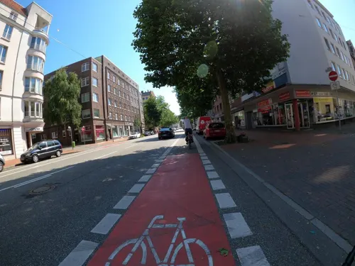
Café Cardoso
Cafe · Portuguese, Cake, Sandwich, Breakfast
33 Hafenstraße, Bremerhaven
Tu-Su 06:00-21:00
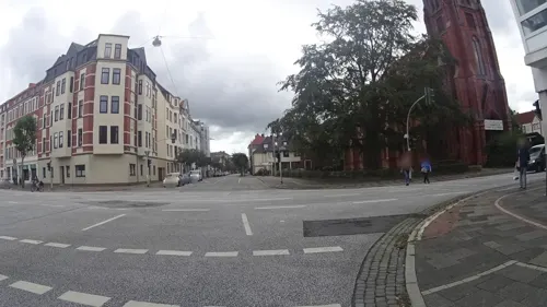
Fischbratküche Höpker
Restaurant · Fish · 2.3 km
34 Bismarckstraße, Bremerhaven
Mo-Fr 11:00-18:15; Sa 11:00-14:30

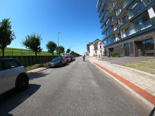
Katie's Café am Deich
Cafe · Cake · 0.7 km
32b Lohmannstraße, Bremerhaven
We-Su 12:00-18:00; Mo,Tu off
Liegeplatz Events im Weser Yacht Club Bremerhaven
Restaurant · Regional, Seafood · 2.2 km
52a Borriesstraße, Bremerhaven
Th-Su 09:00-17:00




256 more on the map.
History
The town was founded in 1827, but neighboring settlements such as Lehe were in the vicinity as early as the 12th century, and Geestendorf was "mentioned in documents of the ninth century". These tiny villages were built on small islands in the swampy estuary. In 1381, the city of Bremen established de facto rule over the lower Weser stream, including Lehe, later therefore called Bremerlehe. Early in 1653, Swedish Bremen-Verden's troops captured Bremerlehe by force.
The Emperor Ferdinand III ordered his vassal Christina of Sweden, then Duchess regnant of Bremen-Verden, to restitute Bremerlehe to Bremen. However, Swedish Bremen-Verden began the First Bremian War (March – July 1654). In the subsequent peace treaty (First Stade Recess; November 1654) Bremen had to cede Bremerlehe and its surroundings to Swedish Bremen-Verden. The latter developed plans to found a fortified town on the site, and much later this location became the present-day city of Bremerhaven. In 1672, under the reign of Charles XI of Sweden, in personal union Duke of Bremen-Verden—colonists tried unsuccessfully to erect a castle (named Carlsburg after Charles XI) there; this fortified structure was meant to protect, as well as control shipping heading for Bremen.
From the History section of Bremerhaven on Wikipedia, under CC BY-SA 4.0.
Where to stay25
Churches and places of worship19
Freikirche der Siebenten-Tags-Adventisten
Church · Seventh Day Adventist · 1.7 km
23 Richard-Wagner-Straße, Bremerhaven
Evangelisch reformierte Kirche
Church · Protestant · 3.0 km
7 Wielandstraße, Bremerhaven
Shopping54
Gas and EV charging14
Schools, colleges and libraries37
Stadtbibliothek Bremerhaven
Library · 1.4 km
10 Bürgermeister-Smidt-Straße, Bremerhaven
Healthcare14
Map of Bremerhaven
250 places. The map loads OpenStreetMap tiles when you open it.
Getting there and nearby towns
Fliegerhorst Nordholz (FCN) is the nearest airport with scheduled flights listed in OpenStreetMap, 25 km away.
- Langen 6 km north, about 6 min by car
- Schiffdorf 6 km southeast, about 6 min by car
- Nordenham 8 km southwest, about 8 min by car
- Loxstedt 10 km southeast, about 10 min by car
- Wremen 11 km north, about 11 min by car
- Elmlohe 12 km east, about 12 min by car
- Stinstedt 13 km southeast, about 13 min by car
- Drangstedt 14 km northeast, about 14 min by car
- Mulsum 13 km north, about 13 min by car
- Dorum 15 km north, about 15 min by car
Drive times are estimates from straight-line distance, not routes.
Local news
Headlines from INDB.
Reviews, tips and questions
Loading what members have shared...
Sources and licences
- GeoNames (CC BY 4.0): population, coordinates, regions and time zone
- Mapillary (see each image): photos
- OpenStreetMap contributors (ODbL 1.0): places, airports, map data
- Wikidata (CC0 1.0): elevation, founding date, time zone, website, landmarks and historic places
- Wikimedia Commons (see each image): photos
- Wikipedia (CC BY-SA 4.0): overview and history text
Photo credits
- Havenwelten Überblick Bremerhaven 2013, Tuxyso, CC BY-SA 3.0
- Zollinlandstadion Bremerhaven, Umkleiden, 2018, XenonX3, CC0
- Zollinlandstadion Bremerhaven, 2018, XenonX3, CC0
- Stolpersteine Bremerhaven – Isidor Kahn, FlorianKlu, CC0
- Stolpersteine Bremerhaven – Irma Kahn, FlorianKlu, CC0
- Stolpersteine Bremerhaven – Moses Kirchheimer, FlorianKlu, CC0
- Stolpersteine Bremerhaven – Johannes Prigge, FlorianKlu, CC0
- Stolpersteine Bremerhaven – Kurt Nathan, FlorianKlu, CC0
- Stolpersteine Bremerhaven – Else Nathan, FlorianKlu, CC0
- Stolpersteine Bremerhaven – Heinz Nathan, FlorianKlu, CC0
- Stolpersteine Bremerhaven – Günter Nathan, FlorianKlu, CC0
- Brunnen am Leger Tor Bremerhaven, Ulli 2mecs, CC BY-SA 4.0
- Stolpersteine Bremerhaven – Ingeborg Goldberger, FlorianKlu, CC0
- Stolpersteine Bremerhaven – Margot Goldberger, FlorianKlu, CC0
- Stolpersteine Bremerhaven – Walter Goldberger, FlorianKlu, CC0
- Standesamt Bremerhaven, Garitzko, Public domain
- Stadttheater - Bremerhaven 01, H. Zell, CC BY-SA 3.0
- Bremerhaven Oberfeuer 01, Jürgen Howaldt, CC BY-SA 4.0
- Bremerhaven-Zoo am Meer 01, Jürgen Howaldt, CC BY-SA 2.0 de
- Hochschule bremerhaven hg, Hannes Grobe 06:45, 30 July 2006 (UTC), CC BY-SA 2.5
- Schulschiff Deutschland in Bremen 01 retuschiert, Dr. Bernd Gross Derivative work MagentaGreen, CC BY-SA 3.0
- Deutsches Auswandererhaus Bremerhaven 09-2008, PhilippN, CC BY-SA 3.0
- BHV Reformierte Schule 1, Mueck ( talk ), CC BY-SA 3.0
- Deutsches Schiffahrtsmuseum, Uwe H. Friese, CC BY-SA 3.0
- Bremerhaven Riesenradblick 1, Corradox, CC BY-SA 4.0
- Radarfunkturm2-Bremerhaven, Arminia, CC BY-SA 3.0
- Bürgermeister-Smidt-Gedächtniskirche (Bremerhaven), Olga Ernst, CC BY-SA 4.0
- Brunnenanlage im Bürgerpark Bremerhaven, Flugschatten, CC BY-SA 3.0
- BHV Christuskirche1, Mueck ( talk ), CC BY-SA 3.0
- Bremerhaven columbus center 2007 raro42, Ralf Roeber, User:Raro42 , www.zeitfenster.de, CC BY-SA 2.0 de
- Dionysiuskirche Bremerhaven-Lehe, Garitzko, Public domain
- Treffpunkt Kaiserhafen-cropped, File:Treffpunkt Kaiserhafen.JPG : Wusel007 derivative work: Jocian, CC BY-SA 3.0
- Havenhostel Bremerhaven, Pujanak, Public domain
- 2012-05-28 Fotoflug Cuxhaven Wilhelmshaven DSCF9374, Martina Nolte, CC BY-SA 3.0 de
- Kaiserschleuse Ostfeuer - Kleiner Glockenturm - Pingelturm - Bremerhaven 01, H. Zell, CC BY-SA 3.0
- Historisches Museum Bremerhaven, Garitzko, Public domain
- Strandhalle bremerhaven hg, Hannes Grobe ( talk ), CC BY 3.0
- Bremerhaven, Marienkirche 02, Anastasiya Lvova, CC BY-SA 4.0
- Leuchtfeuer Geestemole Nord - Bremerhaven 02, H. Zell, CC BY-SA 3.0
- Kreuzkirche Bremerhaven, Garitzko, Public domain
- Pauluskirche Bremerhaven-2, Pauluskirche_Bremerhaven.jpg : Garitzko derivative work: Sir James ( talk ), Public domain
- BHV Pestalozzischule 1, Mueck ( talk ), CC BY-SA 3.0
- WAL 7292, Ein Dahmer, CC BY-SA 4.0
- Nordseestadion, Amoroso8511, CC BY-SA 4.0
- Feuerschiff Elbe 3 in Bremerhaven, C.Mezzo-1 at de.wikipedia, CC BY-SA 3.0
- Bremerhaven, Neuer Hafen, Unterfeuer -- 2024 -- 2180, Dietmar Rabich, CC BY-SA 4.0
- Kraftwerk am Kaiserhafen, Tasmer ( talk ), CC BY-SA 3.0
- Bhv Wenke-dock hg, Hannes Grobe ( talk ), CC BY 3.0
- Bhv Deich37-39 hg, Hannes Grobe ( talk ), CC BY 3.0
- Bhv Theodorheussplatz-smidt hg, Hannes Grobe ( talk ), CC BY 3.0
- BHV DSM Emma1, Mueck ( talk ), CC BY-SA 3.0
- BHV DSM Diva1, Mueck ( talk ), CC BY-SA 3.0
- Weserportsee-nsg-bremerhaven hg, Hannes Grobe, CC BY-SA 3.0
- Drehbrücke, Hauptkanal - panoramio, Rembert Satow, CC BY-SA 3.0
- Lehe Herz-Jesu, Mueck, CC BY-SA 3.0
- Herz-Jesu-Kirche Bremerhaven-Geestemünde-2, Herz-Jesu-Kirche_Bremerhaven-Geestemünde.jpg : Garitzko derivative work: Rabanus Flavus ( talk ), Public domain
- Marienkirche Bremerhaven-Mitte, Garitzko, Public domain
- Lessingschule Bremerhaven, Garitzko, Public domain
- Street-level photo, VIA_KK, CC BY-SA 4.0
- Street-level photo, 48d9dc, CC BY-SA 4.0
- Street-level photo, thetornado76, CC BY-SA 4.0
- Street-level photo, maturion, CC BY-SA 4.0
- Street-level photo, imeem5551, CC BY-SA 4.0
- Street-level photo, VIA_KK, CC BY-SA 4.0
- Street-level photo, thetornado76, CC BY-SA 4.0
- Street-level photo, VIA_KK, CC BY-SA 4.0
- Street-level photo, zoegglmeyr1, CC BY-SA 4.0
- Street-level photo, ramap, CC BY-SA 4.0
- Street-level photo, schakaline, CC BY-SA 4.0
- Street-level photo, StefanS79, CC BY-SA 4.0
- Street-level photo, bufonto, CC BY-SA 4.0
- Street-level photo, 48d9dc, CC BY-SA 4.0
- Street-level photo, changchun1, CC BY-SA 4.0
- Street-level photo, bufonto, CC BY-SA 4.0
- Street-level photo, atze02, CC BY-SA 4.0
- Street-level photo, bernd_niemann, CC BY-SA 4.0
- Street-level photo, bernd_niemann, CC BY-SA 4.0
- Street-level photo, StefanS79, CC BY-SA 4.0
- Street-level photo, bernd_niemann, CC BY-SA 4.0
- Street-level photo, zoegglmeyr1, CC BY-SA 4.0
- Street-level photo, bernd_niemann, CC BY-SA 4.0
- Street-level photo, imeem5551, CC BY-SA 4.0
- Street-level photo, imeem5551, CC BY-SA 4.0
- Street-level photo, maturion, CC BY-SA 4.0


Page built November 8, 2026. Spotted a mistake? Tell us or suggest a place.