


Why visit Köln
Townapedia lists 302 museums and landmarks, 12 parks and trails, 173 places to eat, 25 places to stay and 29 attractions in and around town.
Highlights include Kleines Haus, Oper der Stadt Köln, Käthe Kollwitz Museum and Museum Schnütgen.
Weather in Köln
Forecast from MET Norway (CC BY 4.0). Full forecast
About Köln
Cologne ( kə-LOHN; German: Köln [kœln] ; Kölsch: Kölle [ˈkœ̂lə] ) is the fourth-most populous city of Germany and the largest city of the German state of North Rhine-Westphalia with over one million inhabitants in the city proper and over 3.1 million people in the Cologne Bonn urban region. Cologne is also part of the Rhine-Ruhr metropolitan region, the second biggest metropolitan region by GDP in the European Union. Centred on the left bank of the Rhine, Cologne is located on the River Rhine (Lower Rhine), about 35 kilometres (22 mi) southeast of the North Rhine-Westphalia state capital Düsseldorf and 22 kilometres (14 mi) northwest of Bonn, the former capital of West Germany.
From the Wikipedia article Cologne (this version), under CC BY-SA 4.0.
Travel tips from other travellers: Köln on Wikivoyage (CC BY-SA 4.0).
Things to do29





Bühne der Kulturen
Cinema and theater · 3.3 km
Intercultural theatre in Cologne, Germany

Cathedral Bridge
Bridge · 1.4 km
Former road and rail bridge in Cologne, Germany (1859–1909)
Cologne Opera
Cinema and theater
Building in North Rhine-Westphalia, Germany

Cologne Rodenkirchen Bridge
Bridge · 4.7 km
Freeway(A4)-bridge crossing the Rhine south of Cologne

Deutz Suspension Bridge
Bridge · 1.2 km
Road bridge in Cologne, Germany
17 more on the map.
Museums and landmarks302

Käthe Kollwitz Museum
Museum
24 Neumarkt, Köln
Mo off; Tu-Fr 10:00-18:00; Sa,Su,PH 11:00-18:00; Dec 24-26,31,Jan...

Museum Schnütgen
Museum
29-33 Cäcilienstraße, Köln
Mo off; Tu-We,Fr-Su,PH 10:00-18:00; Th 10:00-20:00; Th[1] 10:00-22:00

Rautenstrauch-Joest-Museum
Museum
Museum in Cologne
10 Leonhard-Tietz-Straße, Köln
Mo off; Tu-We 10:00-18:00; Th 10:00-20:00; Fr-Su,PH 10:00-18:00



Ara Ubiorum
Monument and historic site · 1.1 km
Roman federal altar, around which formed Col. Claudia Ara Agrippinensium, precursor of Köln, Germany

Colonia Claudia Ara Agrippinensium
Monument and historic site · 0.7 km
Roman colony, today Cologne in Germany

290 more on the map.
Parks, trails and playgrounds12


Rheinpark
Park · 2.5 km
Park in Cologne, North Rhine-Westphalia, Germany

Schlosspark Augustusburg
Park · 12.4 km
Park of Augustusburg Palace in Brühl, Rhineland, Germany






Restaurants and cafes173

Puszta Hütte
Restaurant · Hungarian
57 Fleischmengergasse, Köln
Mo-Sa 10:00-20:00; easter -48 days,easter -46 days,easter +1...
Ansgar's
Restaurant · German
73 Kleiner Griechenmarkt, Köln
Tu-Th 16:00-23:00,Fr-Sa 16:00-03:00,Su 16:00-23:00

Bei d'r Tant
Restaurant · German
28 Cäcilienstraße, Köln
Su,PH off; Mo-Th 11:00-24:00; Fr-Sa 11:00-01:00


Cafe Extrablatt
Cafe · Coffee Shop
14-16 Antoniterstraße, Köln
Mo-Th 09:30-22:00; Fr-Sa 09:30-23:00; Su,PH 09:30-18:00
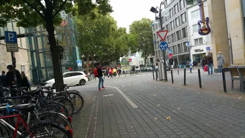
Hard Rock Cafe
Diner · American · 0.6 km
8 Gürzenichstraße, Köln
Mo-Th,Su 12:00-23:00; Fr-Sa 12:00-00:30



Kai Kitchen - modern vietnamese sushi fusion restaurant
Restaurant · Japanese
9-11 Hohe Pforte
Mo-Fr 11:30-15:00,17:00-22:00; Sa,PH 12:00-22:00; Su off
161 more on the map.
Where to stay25
Churches and places of worship26
Madonna in den Trümmern
Church · Catholic · 0.6 km
2 Kolumbastraße, Köln
Church of the Immaculate Conception of the Blessed Virgin Mary in Cologne
Church · 0.8 km
Shopping47
Schools, colleges and libraries25
Healthcare8
Map of Köln
250 places. The map loads OpenStreetMap tiles when you open it.
Getting there and nearby towns
Cologne Bonn Airport (CGN) is the nearest airport with scheduled flights listed in OpenStreetMap, 15 km away.
- Gremberghoven 8 km southeast, about 8 min by car
- Hürth 9 km southwest, about 9 min by car
- Frechen 10 km west, about 10 min by car
- Zündorf 10 km southeast, about 10 min by car
- Eil 10 km southeast, about 10 min by car
- Leverkusen 11 km north, about 11 min by car
- Brühl 12 km south, about 12 min by car
- Wesseling 12 km south, about 12 min by car
- Pulheim 12 km northwest, about 12 min by car
- Bergisch Gladbach 14 km northeast, about 14 min by car
Drive times are estimates from straight-line distance, not routes.
Local news
Headlines from INDB.
Reviews, tips and questions
Loading what members have shared...
Sources and licences
- GeoNames (CC BY 4.0): population, coordinates, regions and time zone
- Mapillary (see each image): photos
- OpenStreetMap contributors (ODbL 1.0): places, airports, map data
- Wikidata (CC0 1.0): elevation, founding date, time zone, website, landmarks and historic places
- Wikimedia Commons (see each image): photos
- Wikipedia (CC BY-SA 4.0): overview and history text
Photo credits
- Stadtbild Köln (50MP), Thomas Wolf , www.foto-tw.de, CC BY-SA 3.0 de
- Stadtbibliothek Köln Rückseite (0031-33), Raimond Spekking, CC BY-SA 4.0
- Peterstraße, Köln-Altstadt-Süd, Blick Richtung Norden-8683, Raimond Spekking, CC BY-SA 4.0
- Stolperstein Köln, Margarete Pins (Peterstraße 26), © 1971markus, CC BY-SA 4.0
- Stolperstein Köln, Liddy Pins (Peterstraße 26), © 1971markus, CC BY-SA 4.0
- Stolpersteine Köln, Peterstraße 26, © 1971markus, CC BY-SA 4.0
- Kaufhof Hauptverwaltung Köln (3972-74), Raymond - Raimond Spekking, CC BY-SA 4.0
- Stolperstein Köln, (Nr. 175) Romm (Peterstraße 31), © 1971markus, CC BY-SA 4.0
- Stolperstein Köln, (Nr. 172) Rommni (Peterstraße 31), © 1971markus, CC BY-SA 4.0
- Stolperstein Köln, (Nr. 177) Romm (Peterstraße 31), © 1971markus, CC BY-SA 4.0
- Stolperstein Köln, (Nr. 174) Rommni (Peterstraße 31), © 1971markus, CC BY-SA 4.0
- Stolperstein Köln, (Nr. 176) Rommni (Peterstraße 31), © 1971markus, CC BY-SA 4.0
- Stolperstein Köln, (Nr. 173) Rommni (Peterstraße 31), © 1971markus, CC BY-SA 4.0
- Stolpersteine Köln, Peterstraße 31, © 1971markus, CC BY-SA 4.0
- Stolperstein Köln, (Nr. 178) Romm (Peterstraße 31), © 1971markus, CC BY-SA 4.0
- Wohnblock Fleischmengergasse 7-13, Köln-8798, Raimond Spekking, CC BY-SA 4.0
- Wohnblock Fleischmengergasse 7-13, Köln-8795, Raimond Spekking, CC BY-SA 4.0
- Stolperstein Köln, Ernst Sander (Kleiner Griechenmarkt 8), © 1971markus, CC BY-SA 4.0
- Studienhaus der VHS Köln-3855, Raimond Spekking, CC BY-SA 4.0
- Stolperstein Köln, Rachela Geppert (Fleischmengergasse 24), © 1971markus, CC BY-SA 4.0
- Stolpersteine Köln, Fleischmengergasse 24, © 1971markus, CC BY-SA 4.0
- Oper Köln (4202-04), Raimond Spekking, CC BY-SA 4.0
- Gloria-Theater-Koeln-Aussenansicht, Gloria-Theater, Köln, CC BY-SA 3.0 de
- Arkadaş Theater, Köln-5172, Raimond Spekking, CC BY-SA 4.0
- Dombruecke 1850, Unknown author, Public domain
- Rodenkirchener-bruecke-panorama, A.Savin, CC BY-SA 3.0
- Deutzer Brücke - Panorama from south, Raimond Spekking, CC BY-SA 4.0
- Kulturquartier Köln - Rautenstrauch-Joest-Museum - Vorderseite (6904-06), Raimond Spekking, CC BY-SA 4.0
- Kapitol Köln front1, Own work, CC BY 3.0 de
- Farina-Haus Köln (4213-15), Raimond Spekking, CC BY-SA 4.0
- Kölner Zoo (Flight over Cologne), Neuwieser, CC BY-SA 2.0
- Cologne Rheinpark view to SW, Till Niermann, CC BY-SA 3.0
- Aerial image of the Augustusburg Palace gardens (view from the south), Carsten Steger, CC BY-SA 4.0
- Köln-Neustadt-Nord Elsa-Brändström-Straße 9 Rückseite, HOWI - Horsch, Willy, CC BY 3.0
- Köln-Volksgarten Weiher, Schweinepeterle, Public domain
- Worringerbruch03, A.Savin, CC BY-SA 3.0
- St. Aposteln Köln - Ostseite (4539), Raimond Spekking, CC BY-SA 4.0
- Köln Pantaleon von W3, Beckstet at German Wikipedia, CC BY-SA 3.0
- Severeinskirche aus Severinstorburg 2009, Elke Wetzig ( Elya ), CC BY-SA 3.0
- Christus auferstehung 2009, Elke Wetzig ( Elya ), CC BY-SA 3.0
- Minoritenkirche Köln im Frühling (1892-94), Raimond Spekking, CC BY-SA 4.0
- Main entrance at CBS, Babbelbabbel, CC BY-SA 3.0
- Deutsche Sporthochschule Köln, Haupteingang, Duhon, CC BY 3.0
- Hochschule für Musik und Tanz Köln-5617, Raimond Spekking, CC BY-SA 4.0
- Kölnischer Kunstverein - Die Brücke (3279-81), Raimond Spekking, CC BY-SA 4.0
- Antoniterkirche (Köln) (04) a, Chris06, CC BY-SA 4.0
- Rheinische Fachhochschule Köln, Schaevenstr. 1b-8807, Raimond Spekking, CC BY-SA 4.0
- Museum Schnütgen - St. Cäcilien - innenaufnahme-4459, Raimond Spekking, CC BY-SA 4.0
- Köln st cäcilien, Hans Peter Schaefer http://www.reserv-a-rt.de, CC BY-SA 3.0
- St. Georg Köln, Nordseite-0579, Raimond Spekking, CC BY-SA 4.0
- Käthe-Kollwitz-Museum Köln, Raimond Spekking, CC BY-SA 4.0
- Mariaamkapitol 16-02-2009 15-36-21, Paul Hermans, CC BY-SA 3.0
- Dreikoenigenpforte0032, Sebastian Mehlmacher, CC BY-SA 3.0
- Puszta-Hütte Köln (0022-34), Raymond - Raimond Spekking, CC BY-SA 3.0
- Köln Weyerstraße 96 Haus Töller, HOWI - Horsch, Willy, CC BY-SA 4.0
- Friedrich-Wilhelm-Gymnasium-Köln, HOWI - Horsch, Willy, CC BY 3.0
- Galeria Kaufhof Köln (4022-24), Raimond Spekking, CC BY-SA 4.0
- Theater am Dom - Opern Passagen, Köln (2), © 1971markus, CC BY-SA 4.0
- St-Kolumba-Köln-Kolumbahof-009, HOWI - Horsch, Willy, CC BY-SA 4.0
- Volkshochschule Köln (5161), Raimond Spekking, CC BY-SA 4.0
- HSD Hochschule Döpfer, Köln-5248, Raimond Spekking, CC BY-SA 4.0
- Neumarkt-Galerie, Köln mit Skulptur Dropped Cone - Claes Oldenburg und Coosje van Bruggen-8364, Raimond Spekking, CC BY-SA 4.0
- Schauspiel Köln (4227-29), Raimond Spekking, CC BY-SA 4.0
- Belgisches Haus Köln (6228), Raimond Spekking, CC BY-SA 4.0
- Gesundheitsamt Köln (2950-52), Raimond Spekking, CC BY-SA 4.0
- Köln Hotel im Wasserturm Kaygasse 2, HOWI - Horsch, Willy, CC BY 3.0
- St. Peter Köln - Südseite (4945-47), Raimond Spekking, CC BY-SA 4.0
- Karstadt Köln - Breite Strasse (2956-58), Raimond Spekking, CC BY-SA 4.0
- Oper Köln - Brücke zur Opernterrasse-8313, Raimond Spekking, CC BY-SA 4.0
- Kino 813 Kölnischer Kunstverein, Thomas Vogt, CC BY 2.0
- Finanzamt Köln-Mitte-0597, Raimond Spekking, CC BY-SA 4.0
- Max-Dietlein-Park Cologne Germany, Markbenecke, CC BY-SA 4.0
- Bei d'r Tant, Cäcilienstraße 28, Köln-4563, Raimond Spekking, CC BY-SA 4.0
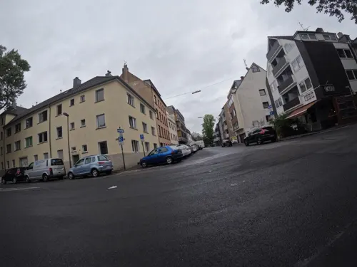
- Street-level photo, popball, CC BY-SA 4.0
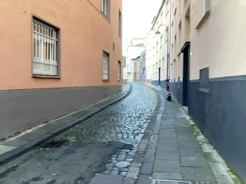
- Street-level photo, raymond, CC BY-SA 4.0
- Street-level photo, countzero5, CC BY-SA 4.0
- Street-level photo, mfa, CC BY-SA 4.0
- Street-level photo, noel, CC BY-SA 4.0
- Street-level photo, marccologne, CC BY-SA 4.0
- Street-level photo, marccologne, CC BY-SA 4.0
- Street-level photo, marccologne, CC BY-SA 4.0
- Street-level photo, deepblue66, CC BY-SA 4.0
- Street-level photo, popball, CC BY-SA 4.0
- Street-level photo, marccologne, CC BY-SA 4.0
- Street-level photo, marccologne, CC BY-SA 4.0
- Street-level photo, marccologne, CC BY-SA 4.0
- Street-level photo, marccologne, CC BY-SA 4.0
- Street-level photo, viakoeln, CC BY-SA 4.0
- Street-level photo, raymond, CC BY-SA 4.0
- Street-level photo, viakoeln, CC BY-SA 4.0
- Street-level photo, popball, CC BY-SA 4.0
- Street-level photo, popball, CC BY-SA 4.0
- Street-level photo, countzero5, CC BY-SA 4.0
- Street-level photo, mfa, CC BY-SA 4.0
- Street-level photo, avataryt, CC BY-SA 4.0


Page built November 8, 2026. Spotted a mistake? Tell us or suggest a place.