


Offenbach, Germany
Bundestagswahlkreis Offenbach
Offenbach is a city of 119,192 people in Hesse, Germany.
Why visit Offenbach
Townapedia lists 197 museums and landmarks, 12 parks and trails, 250 places to eat, 21 places to stay and 4 attractions in and around town.
Highlights include Goethe Tower, Theater t-raum, Klingspor Museum and Deutsches Ledermuseum.
Weather in Offenbach
Forecast from MET Norway (CC BY 4.0). Full forecast
About Offenbach
Offenbach is an electoral constituency (German: Wahlkreis) represented in the Bundestag. It elects one member via first-past-the-post voting. Under the current constituency numbering system, it is designated as constituency 184. It is located in southern Hesse, comprising the city of Offenbach am Main and the western part of the Landkreis Offenbach district.
From the Wikipedia article Offenbach (electoral district) (this version), under CC BY-SA 4.0.
Things to do4

Goethe Tower
Monument and historic site · 4.1 km
Observation tower in Frankfurt, Germany

Museums and landmarks197

Klingspor Museum
Museum · 0.9 km
Schriftkunst
80 Herrnstraße, Offenbach am Main
Tu-Th 13:00-18:00, Fr 14:00-21:00, Sa,Su,PH 11:00-18:00

Deutsches Ledermuseum
Museum · 0.9 km
86 Frankfurter Straße, Offenbach am Main
Tu-Fr 10:00-17:00, Sa,Su,PH 11:00-18:00
Digital Retro Park / Commons Cafe
Museum
Ein Museum der Heimcomputergeschichte zum anfassen, mit Maker, Workshop & Veranstaltungscafe, Sitzgelegenheiten / Makerspace mit großem...
13-15 Frankfurter Straße, Offenbach am Main
Sa 11:00- 17:00

Haus der Stadtgeschichte
Museum · 0.9 km
61 Herrnstraße, Offenbach am Main
Tu,We,Fr 13:00-18:00, Th 14:00-21:00, Sa,Su,PH 11:00-18:00

Memorial at the Frankfurt Grossmarkthalle
Monument and historic site · 4.5 km
Holocaust memorial in Frankfurt, Germany


Büsing Palais
Monument and historic site · 0.9 km
82 Herrnstraße, Offenbach am Main

historisches Stellwerk
Monument and historic site
Ehemaliges Stellwerksgebäude
Bismarckstraße, Offenbach am Main

Isenburger Schloss
Monument and historic site · 0.8 km
66 Schloßstraße, Offenbach am Main


185 more on the map.
Parks, trails and playgrounds12





Restaurants and cafes250
Backschaft
Restaurant · Regional · 1.0 km
Backschaft ist ein Restaurantboot am Mainufer Offenbachs
1 Maindammweg, Offenbach am Main
Th-Sa 18:00-22:00, Jun-Sep off

Anatolia Restaurant
Restaurant · Turkish · 0.8 km
54 Kaiserstraße, Offenbach am Main
Mo-Sa 10:00-23:30; Su 10:00-23:00
Cafe am Rathaus
Cafe · Regional · 0.6 km
18 Stadthof, Offenbach am Main
Mo-Fr 08:00-18:00,Sa 09:00-18:00, Oct-Mar Su 12:00-18:00
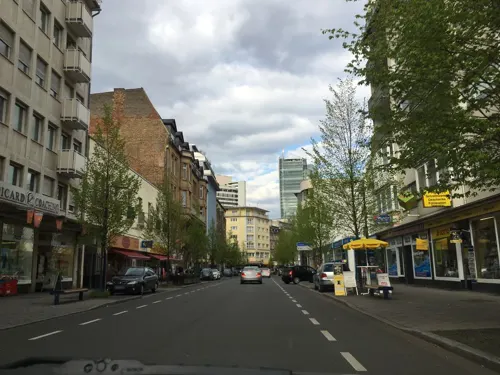
Fischmarkt Mare Azzurro
Restaurant · Seafood · 0.8 km
66 Frankfurter Straße, Offenbach am Main
Mo-Su 12:00-22:00
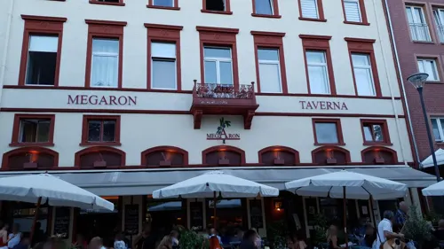
Gasthaus zum Stern
Restaurant · Regional
7 Wilhelmsplatz, Offenbach am Main
Tu,Fr-Su 10:00-24:00; We,Th 12:00-24:00
KiBi
Restaurant · Sushi, Vietnamese · 1.1 km
21 Speyerstraße, Offenbach am Main
Tu-Th 11:00-15:00,17:00-22:30, Fr-Sa 11:00-22:30, Su 12:00-22:00
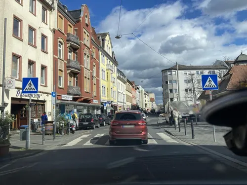
Markthaus am Wilhelmsplatz
Restaurant · Regional
9b Bieberer Straße, Offenbach am Main
Tu,Fr,Sa 09:00-23:00; We,Th
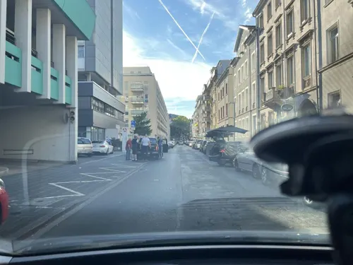
Mykonos
Restaurant · Greek · 1.1 km
65 Domstraße, Offenbach am Main
Tu-Sa 17:00-23:00; Su,PH 12:00-23:00
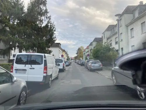
Papi
Restaurant · Italian · 0.7 km
39 Friedrichsring, Offenbach am Main
Tu-Th,Su 12:00-22:00, Fr-Sa 12:00-23:00
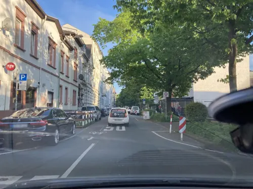
ViPiano
Restaurant · Italian · 0.9 km
40 Birkenlohrstraße, Offenbach am Main
Mo-Fr,Su 10:30-14:30, Mo-Sa 18:00-23:00,Su 18:00-22:00
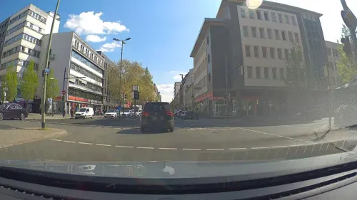
White Elefant
Restaurant · Indian · 0.8 km
45 Ludwigstraße, Offenbach am Main
Su-Fr 11:00-14:00,17:00-23:00; Sa 17:00-23:30


238 more on the map.
History
Offenbach was created in 1949, then known as Offenbach/M. It acquired its current name in the 1965 election. In the 1949 election, it was Hesse constituency 19 in the numbering system. From 1953 through 1976, it was number 144. From 1980 through 1998, it was number 142. In the 2002 and 2005 elections, it was number 186. In the 2009 through 2021 elections, it was number 185. From the 2025 election, it has been number 184.
Originally, the constituency comprised the independent city of Offenbach am Main and the Landkreis Offenbach district. In the 1965 through 1972 elections, it comprised the city of Offenbach am Main and the entirety of the Landkreis Offenbach district excluding the municipalities of Dietzenbach, Dreieichenhain, Dudenhofen, Froschhausen, Götzenhain, Hainhausen, Hainstadt, Jügesheim, Klein-Auheim, Klein-Krotzenburg, Klein-Welzheim, Mainflingen, Offenthal, Rembrücken, Seligenstadt, Steinheim am Main, Weiskirchen, and Zellhausen. In the 1976 through 1998 elections, it acquired a configuration very similar to its current borders, but excluding the municipality of Dietzenbach from the Landkreis Offenbach district. It acquired its current borders in the 2002 election.
From the History section of Offenbach (electoral district) on Wikipedia, under CC BY-SA 4.0.
Where to stay21
Four Points by Sheraton Offenbach Plaza
Motel and hotel · 1.0 km
7 Ernst-Griesheimer-Platz, Offenbach am Main
Churches and places of worship28
Französisch-Reformierte Kirche
Church · Lutheran · 0.7 km
43 Herrnstraße, Offenbach am Main
Kirche Jesu Christi der Heiligen der Letzten Tage
Church · Mormon · 0.9 km
7 Arthur-Zitscher-Straße
Shopping43
Schools, colleges and libraries18
Sankt Georgen Graduate School of Philosophy and Theology
School · 3.9 km
Healthcare17
Map of Offenbach
250 places. The map loads OpenStreetMap tiles when you open it.
Getting there and nearby towns
Frankfurt Airport (FRA) is the nearest airport with scheduled flights listed in OpenStreetMap, 18 km away.
- Mühlheim am Main 5 km east, about 5 min by car
- Heusenstamm 6 km southeast, about 6 min by car
- Frankfurt am Main 6 km west, about 6 min by car
- Obertshausen 7 km southeast, about 7 min by car
- Maintal 7 km northeast, about 7 min by car
- Neu-Isenburg 8 km southwest, about 8 min by car
- Bad Vilbel 9 km north, about 9 min by car
- Wiesbaden 37 km west, about 37 min by car
- Mannheim 71 km south, about 1 h 15 min by car
- Heidelberg 77 km south, about 1 h 15 min by car
Drive times are estimates from straight-line distance, not routes.
Local news
Headlines from INDB.
Reviews, tips and questions
Loading what members have shared...
Sources and licences
- GeoNames (CC BY 4.0): population, coordinates, regions and time zone
- Mapillary (see each image): photos
- OpenStreetMap contributors (ODbL 1.0): places, airports, map data
- Wikidata (CC0 1.0): elevation, founding date, time zone, website, landmarks and historic places
- Wikimedia Commons (see each image): photos
- Wikipedia (CC BY-SA 4.0): overview and history text
Photo credits
- Offenbach Altkatholische Pfarrkirche 2011020, Rudolf Stricker, Attribution
- Wilhelmstraße 26, 1, Offenbach am Main, GeorgDerReisende, CC BY-SA 4.0
- Waldstraße, 1, Offenbach, GeorgDerReisende, CC BY-SA 4.0
- Feldstraße, 6, Offenbach, GeorgDerReisende, CC BY-SA 4.0
- Wilhelmstraße, 1, Offenbach, GeorgDerReisende, CC BY-SA 4.0
- Wilhelmstraße, 2, Offenbach, GeorgDerReisende, CC BY-SA 4.0
- Waldstraße 62, 1, Offenbach, GeorgDerReisende, CC BY-SA 4.0
- Stolpersteinlage, 2, Bismarckstraße 67, Offenbach am Main, GeorgDerReisende, CC BY-SA 4.0
- Stolperstein Paula Luise Schönhof, 1, Bismarckstraße 67, Offenbach am Main, GeorgDerReisende, CC BY-SA 4.0
- Stolperstein Otto Schönhof, 1, Bismarckstraße 67, Offenbach am Main, GeorgDerReisende, CC BY-SA 4.0
- Bismarckstraße 67, 1, Offenbach am Main, GeorgDerReisende, CC BY-SA 4.0
- Wilhelmstraße 38, 1, Offenbach, GeorgDerReisende, CC BY-SA 4.0
- Stolpersteinlage, 2, Wilhelmstraße 38, Offenbach, GeorgDerReisende, CC BY-SA 4.0
- Stolpersteinlage, 1, Wilhelmstraße 38, Offenbach, GeorgDerReisende, CC BY-SA 4.0
- Stolperstein Frieda Windecker, 1, Wilhelmstraße 38, Offenbach, GeorgDerReisende, CC BY-SA 4.0
- Stolperstein Julie Windecker, 1, Wilhelmstraße 38, Offenbach, GeorgDerReisende, CC BY-SA 4.0
- Stolperstein Heinrich Windecker, 1, Wilhelmstraße 38, Offenbach, GeorgDerReisende, CC BY-SA 4.0
- Stolperstein Sigrid Windecker, 1, Wilhelmstraße 38, Offenbach, GeorgDerReisende, CC BY-SA 4.0
- Groß-Hasenbach-Straße 6,7,8 Offenbach - panoramio, h4ck3rm1k3, CC BY-SA 3.0
- Groß-Hasenbach-Straße 12, 1, Offenbach am Main, GeorgDerReisende, CC BY-SA 4.0
- Stolperstein Max Siegel, 1, Groß-Hasenbach-Straße 12, Offenbach am Main, GeorgDerReisende, CC BY-SA 4.0
- Stolpersteinlage, 1, Groß-Hasenbach-Straße 12, Offenbach am Main, GeorgDerReisende, CC BY-SA 4.0
- Stolperstein Ferdinand Siegel, 1, Groß-Hasenbach-Straße 12, Offenbach am Main, GeorgDerReisende, CC BY-SA 4.0
- Stolperstein Johanna Siegel, 1, Groß-Hasenbach-Straße 12, Offenbach am Main, GeorgDerReisende, CC BY-SA 4.0
- Stolperstein Emmy Siegel, 1, Groß-Hasenbach-Straße 12, Offenbach am Main, GeorgDerReisende, CC BY-SA 4.0
- Frankfurt Skyline von Offenbach 2011-09, Matthias Nonnenmacher, CC BY-SA 4.0
- Offenbach Waldstrasse 2011-09, Matthias Nonnenmacher, CC BY-SA 4.0
- Tunnel, 1, Offenbach, GeorgDerReisende, CC BY-SA 4.0
- Ehem. Jüdischer Friedhof Offenbach Hauptbahnhof Park DSCN6883, James Michael DuPont, CC BY-SA 3.0
- Ehem. Jüdischer Friedhof Offenbach Hauptbahnhof Park DSCN6884, James Michael DuPont, CC BY-SA 3.0
- Senefelderstraße, 1, Offenbach, GeorgDerReisende, CC BY-SA 4.0
- Offenbach, Germany - panoramio - h4ck3rm1k3 (23), h4ck3rm1k3, CC BY-SA 3.0
- Goetheturm, No machine-readable author provided. Popie~commonswiki assumed (based on copyright claims)., CC BY-SA 3.0
- Klingspor-Museum, diba, CC BY-SA 2.0 de
- Erinnerungsstaette Grossmarkthalle Frankfurt.Foto-Norbert Miguletz1, Norbert Miguletz (Frankfurt), CC BY 3.0
- Exotarium, Zoo Frankfurt, Unknown author, CC BY-SA 3.0
- Heilig-Geist-Kirche, Frankfurt-Riederwald, Sebastian Kasten, CC BY-SA 3.0
- Oberrad, Herz-Jesu-Kirche, Karsten Ratzke, CC0
- Heilig Kreuz Innenraum 11112012, Total number of my uploaded files : 1116, CC BY-SA 4.0
- FFM Herz-Jesu-Kirche Ostseite Totale, Frank Behnsen, CC BY-SA 3.0
- St.Wendel-Kirche (2), Gaki64, CC BY-SA 3.0
- Mensa-im-park-pth-sankt-georgen-frankfurt-main, Ulla Schmitz, CC BY-SA 3.0
- HfG Offenbach 03, diba, CC BY-SA 3.0 de
- Franzoesisch reformierte Kirche Offenbach, Eva K., GFDL 1.2
- Deutsches Ledermuseum, Stadt Offenbach am Main, CC BY-SA 2.0
- Offenbach Isenburger Schloss d, diba, CC BY-SA 2.0 de
- Offenbach Büsing Palais a, diba, CC BY-SA 2.0 de
- Monopterus im Büsingpark, Unknown author Unknown author, Attribution
- Klinikum-offenbach-2010, Christos Vittoratos (oder/or: " ChristosV " ), CC BY-SA 3.0
- Offenbacher Lili-Park, Lili-Tempel (5953888635), Stadt Offenbach am Main, CC BY-SA 2.0
- Stadtbibliothek Offenbach 05, diba, CC BY-SA 3.0 de
- Offenbach Altkatholische Pfarrkirche 20070822, Rudolf Stricker, Public domain
- Marienkirche auf der Bieberer Straße, Unknown author Unknown author, Attribution
- Novotny Mähner Assoziierte, diba, CC BY-SA 2.0 de
- Offenbach, Kirche Jesu Christi, Karsten Ratzke, CC0
- St josef offenbach by hugo schmoelz, Hugo Schmölz, Public domain
- Offenbach St. Paul Front Dominikus Böhm 2009 2, Offenbach_St._Paul_Front_Dominikus_Böhm_2009.jpg : Elke Wetzig ( elya ) derivative work: Lady Whistler ( talk ), CC BY-SA 3.0
- Stolperstein für Wilhelm Knöchel, Wilhelmstraße 26, Offenbach am Main, Hesse, Deutschland - 20110213, Mdupont (James Michael DuPont) ., CC BY-SA 3.0
- Offenbach, Martin-Luther-Park - geo.hlipp.de - 38576, Paul L on geo.hlipp.de, CC BY-SA 2.0
- Haus der Stadtgeschichte Offenbach, Lady Whistler (Special Thx to Lilith-Denoire), CC BY-SA 3.0 de
- Street-level photo, chuck, CC BY-SA 4.0
- Street-level photo, marianna_g, CC BY-SA 4.0
- Street-level photo, joskohorvat, CC BY-SA 4.0
- Street-level photo, joskohorvat, CC BY-SA 4.0
- Street-level photo, robffm, CC BY-SA 4.0
- Street-level photo, robffm, CC BY-SA 4.0
- Street-level photo, mfa, CC BY-SA 4.0
- Street-level photo, poxonline, CC BY-SA 4.0
- Street-level photo, foxman, CC BY-SA 4.0
- Street-level photo, robffm, CC BY-SA 4.0
- Street-level photo, robffm, CC BY-SA 4.0
- Street-level photo, robffm, CC BY-SA 4.0
- Street-level photo, robffm, CC BY-SA 4.0
- Street-level photo, foxman, CC BY-SA 4.0
- Street-level photo, joskohorvat, CC BY-SA 4.0
- Street-level photo, robffm, CC BY-SA 4.0
- Street-level photo, robffm, CC BY-SA 4.0
- Street-level photo, asturksever, CC BY-SA 4.0
- Street-level photo, robffm, CC BY-SA 4.0
- Street-level photo, evita_manou, CC BY-SA 4.0
- Street-level photo, robffm, CC BY-SA 4.0
- Street-level photo, wegavision, CC BY-SA 4.0
- Street-level photo, chuck, CC BY-SA 4.0
- Street-level photo, robffm, CC BY-SA 4.0
- Street-level photo, robffm, CC BY-SA 4.0
- Street-level photo, robffm, CC BY-SA 4.0
- Street-level photo, flidolin, CC BY-SA 4.0


Page built November 8, 2026. Spotted a mistake? Tell us or suggest a place.