


Why visit Wangen
Townapedia lists 15 museums and landmarks, 42 parks and trails, 69 places to eat, 11 places to stay and 3 attractions in and around town.
Highlights include Lichtspielhaus Sohler, Wangener Puppentheater, Städtische Museen Wangen im Allgäu and Burg Oflings.
Weather in Wangen
Forecast from MET Norway (CC BY 4.0). Full forecast
Things to do3


Museums and landmarks15

Städtische Museen Wangen im Allgäu
Museum
Kulturgeschichtliches Museum
1 Eselberg, Wangen im Allgäu
Apr 01-Oct 31: Tu-Fr,Su 14:00-17:00; Sa 11:00-17:00



Waggonhäuschen
Monument and historic site · 0.9 km
Geöffnet bei trockenem Wetter
20 Herzmannser Weg, Wangen im Allgäu
Th 14:30-17:30


3 more on the map.
Parks, trails and playgrounds42



30 more on the map.
Restaurants and cafes69


Alte Kanzlei
Restaurant · Italian
15 Spitalstraße, Wangen im Allgäu
Mo,Th-Su 17:00-01:00; Tu-We closed
Bombay im Kempter
Restaurant · Indian
54 Bindstraße, Wangen im Allgäu
Mo,We-Sa 17:00-22:00; Su 11:30-22:00; Tu off

Café Lädele
Cafe · Cake · 2.4 km
Das Café Lädele hat bei Regenwetter geschlossen.
25 Nelkenstraße, Wangen im Allgäu
Su 13:00-18:00
Gasthaus Lamm
Restaurant · German, Regional
60 Bindstraße, Wangen im Allgäu
Mo off; Tu-Th,Sa,Su 11:30-14:00,17:00-23:00; Fr 17:00-23:00
Gasthaus zum Stiefel
Restaurant · Regional
6 Eselberg, Wangen im Allgäu
Tu-Th 11:00-14:00,17:00-22:00; Fr-Sa 11:00-14:00,17:00-23:00; Su-Mo closed
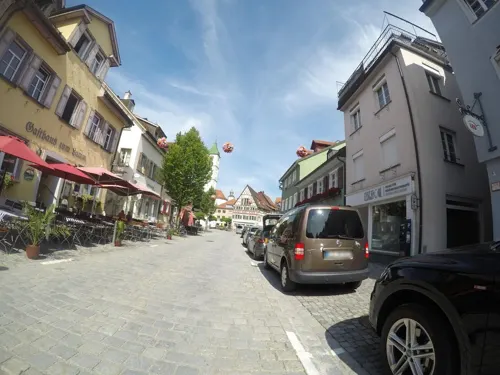
Hong Kong China-Restaurant
Restaurant · Chinese
62 Bindstraße, Wangen im Allgäu
Mo,Tu,Th-Su 11:30-14:30,17:00-22:00; We,PH off
Romantica
Restaurant · Italian, Pizza
20 Karlstraße, Wangen im Allgäu
Mo-Th,Su 11:30-22:00; Fr-Sa 11:30-23:00
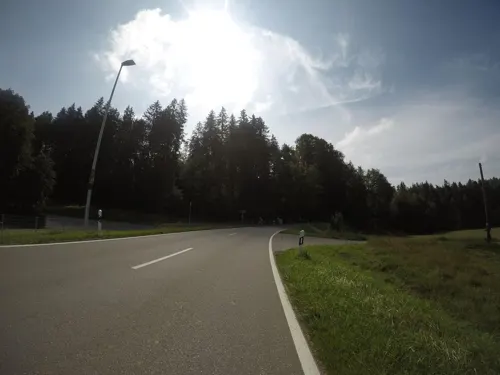


Schwarzer Hasen
Restaurant · German · 1.9 km
6 Argenauweg, Wangen im Allgäu
We-Mo 11:30-14:00,17:30-22:00; PH,Tu off
57 more on the map.
Where to stay11
Churches and places of worship20
St.-Wolfgang-Kapelle
Church · Roman Catholic · 1.4 km
37 Friedhofweg, Wangen im Allgäu
Stadtpfarrkirche Sankt Martin, Gallus und Magnus
Church · Catholic
2 Marktplatz, Wangen im Allgäu
Kapelle Herfatz (St. Silvester)
Church · Roman Catholic · 2.0 km
1 Leupolzer Straße, Wangen im Allgäu
Shopping35
Gas and EV charging7
Schools, colleges and libraries7
Healthcare7
Map of Wangen
216 places. The map loads OpenStreetMap tiles when you open it.
Getting there and nearby towns
Friedrichshafen Airport (FDH) is the nearest airport with scheduled flights listed in OpenStreetMap, 24 km away.
- Niederwangen 3 km southwest, about 3 min by car
- Amtzell 6 km west, about 6 min by car
- Opfenbach 6 km south, about 6 min by car
- Eglofs 8 km east, about 8 min by car
- Heimenkirch 9 km southeast, about 9 min by car
- Hergensweiler 9 km southwest, about 9 min by car
- Lindenberg 10 km south, about 10 min by car
- Vogt 10 km northwest, about 10 min by car
- Weingarten 20 km northwest, about 20 min by car
- Ulm 80 km north, about 1 h 15 min by car
Drive times are estimates from straight-line distance, not routes.
Local news
Headlines from INDB.
Reviews, tips and questions
Loading what members have shared...
Sources and licences
- GeoNames (CC BY 4.0): population, coordinates, regions and time zone
- Mapillary (see each image): photos
- OpenStreetMap contributors (ODbL 1.0): places, airports, map data
- Wikidata (CC0 1.0): elevation, founding date, time zone, website
- Wikimedia Commons (see each image): photos
Photo credits
- Wangen Evangelische Stadtkirche 04, Photo: Andreas Praefcke, CC BY 4.0
- Wangen GEG-Gebäude 02, Photo: Andreas Praefcke, CC BY 4.0
- Wangen Evangelische Stadtkirche 05, Photo: Andreas Praefcke, CC BY 4.0
- Wangen GEG-Gebäude 03, Photo: Andreas Praefcke, CC BY 4.0
- Wangen GEG-Gebäude 04, Photo: Andreas Praefcke, CC BY 4.0
- Wangen Evangelische Stadtkirche Fenster 1 04, Photo: Andreas Praefcke, Public domain
- Wangen Evangelische Stadtkirche Fenster 1 02, Photo: Andreas Praefcke, Public domain
- Wangen Evangelische Stadtkirche Fenster 1 03, Photo: Andreas Praefcke, Public domain
- Wangen Evangelische Stadtkirche Fenster 2 01, Photo: Andreas Praefcke, Public domain
- Wangen Evangelische Stadtkirche Fenster 1 01, Photo: Andreas Praefcke, Public domain
- Wangen Evangelische Stadtkirche Fenster 2 02, Photo: Andreas Praefcke, Public domain
- Wangen Evangelische Stadtkirche Altar, Photo: Andreas Praefcke, CC BY 4.0
- Wangen Evangelische Stadtkirche Fenster 3 01, Photo: Andreas Praefcke, Public domain
- Wangen Evangelische Stadtkirche Kanzel, Photo: Andreas Praefcke, CC BY 4.0
- 612 und 628 im Bahnhof Wangen, Simon Scharfenberger ( Altsprachenfreund ), CC BY-SA 4.0
- Wangen Evangelische Stadtkirche Blick zur Empore 1, Photo: Andreas Praefcke, CC BY 4.0
- Wangen GEG-Gebäude 01, Photo: Andreas Praefcke, CC BY 4.0
- Wangen Evangelische Stadtkirche Bauinschrift, Photo: Andreas Praefcke, CC BY 4.0
- Wangen Evangelische Stadtkirche Blick zur Empore 2, Photo: Andreas Praefcke, CC BY 4.0
- Wangen Evangelische Stadtkirche Blick zum Chor 1, Photo: Andreas Praefcke, CC BY 4.0
- Wangen Evangelische Stadtkirche Orgel, Photo: Andreas Praefcke, CC BY 4.0
- Wangen Evangelische Stadtkirche Blick zum Chor 2, Photo: Andreas Praefcke, CC BY 4.0
- 223 und 628 in Wangen (Allgäu), Altsprachenfreund, CC BY-SA 4.0
- Wangen Evangelische Stadtkirche Vorraum Boden, Photo: Andreas Praefcke, CC BY 4.0
- Haus am Adlerareal, Wangen im Allgäu (2016), Simon Scharfenberger, CC BY-SA 4.0
- Wangen Evangelische Stadtkirche Blick zum Chor 3, Photo: Andreas Praefcke, CC BY 4.0
- Wangen Evangelische Stadtkirche 03, Photo: Andreas Praefcke, CC BY 4.0
- D-BW-Wangen iA - Bahnhof, ANKAWÜ, CC BY-SA 3.0
- Hausbahnsteig des Bahnhofs Wangen (Allgäu) 3, Altsprachenfreund, CC BY-SA 4.0
- Burg Oflings GO-2, Gras-Ober, CC BY-SA 3.0
- Fidelisbaeck in Wangen im Allgäu, Robin Müller, CC BY-SA 3.0
- Burgruine Praßberg GO-2, Gras-Ober, CC BY-SA 3.0
- Wangen im Allgäu Ravensburger Tor 570, GFreihalter, CC BY-SA 4.0
- Wangen Rochuskapelle außen 01, This image was uploaded as part of Wiki Loves Monuments 2011 ., CC BY 3.0
- Wangen Pfarrkirche St Martinus außen 2, Photo: Andreas Praefcke, CC BY 3.0
- Wangen Martinstor Stadtseite, Photo: Andreas Praefcke, CC BY 3.0
- Wangen Evangelische Stadtkirche 02, Photo: Andreas Praefcke, CC BY 4.0
- Kirchturm - panoramio (25), Richard Mayer, CC BY 3.0
- St.Wolfgang - panoramio (2), Richard Mayer, CC BY 3.0
- Wangen Spitalkirche außen 2, Photo: Andreas Praefcke, CC BY 3.0
- Wangen im Allgäu - Badstube in der Lange Gasse, Franzfoto, CC BY-SA 3.0
- Wangen - Eselsmühle mit Fachwerkgiebel, Franzfoto, CC BY-SA 3.0
- Denkmal von Joseph Anton von Gegenbaur in Wangen im Allgäu, Maimaid, CC BY-SA 4.0
- Street-level photo, ray66, CC BY-SA 4.0
- Street-level photo, ray66, CC BY-SA 4.0
- Street-level photo, ray66, CC BY-SA 4.0
- Street-level photo, ray66, CC BY-SA 4.0
- Street-level photo, bitnapper, CC BY-SA 4.0
- Street-level photo, ray66, CC BY-SA 4.0
- Street-level photo, nvbwseifert, CC BY-SA 4.0
- Street-level photo, ray66, CC BY-SA 4.0
- Street-level photo, ray66, CC BY-SA 4.0
- Street-level photo, ray66, CC BY-SA 4.0
- Street-level photo, mcliquid, CC BY-SA 4.0
- Street-level photo, umap, CC BY-SA 4.0
- Street-level photo, umap, CC BY-SA 4.0
- Street-level photo, DruideBizeps, CC BY-SA 4.0


Page built November 8, 2026. Spotted a mistake? Tell us or suggest a place.