


Westerland, Germany
Westerland is a town of 12,500 people in Schleswig-Holstein, Germany.
Why visit Westerland
Townapedia lists 19 museums and landmarks, 7 parks and trails, 137 places to eat, 49 places to stay and 7 attractions in and around town.
Highlights include Sylt Aquarium, Tierpark Tinnum, Wasserturm Westerland and Galerie am Meer.
Weather in Westerland
Forecast from MET Norway (CC BY 4.0). Full forecast
About Westerland
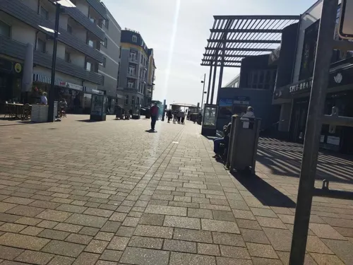
Westerland (German pronunciation: [ˈvɛstɐlant] ; Danish: Vesterland; Söl'ring North Frisian: Weesterlön’) is a seaside resort and a former municipality located on the German North Sea island of Sylt. Since 1 January 2009, Westerland has been part of the municipality Gemeinde Sylt. Westerland is part of the Nordfriesland district in Schleswig-Holstein. It is the largest resort on the island, the local transportation hub and the centre of Sylt's tourist industry.
From the Wikipedia article Westerland, Germany (this version), under CC BY-SA 4.0.
Things to do7



Kampen lighthouse
Lighthouse · 4.9 km
Lighthouse in Schleswig-Holstein, Germany

Kinowelt
Cinema and theater
9 Strandstraße, Sylt
"Jeweils 30 Minuten vor Beginn der ersten Vorstellung des Tages"


Museums and landmarks19

Wasserturm Westerland
Monument and historic site · 0.9 km
14 Industrieweg, Sylt




7 more on the map.
Parks, trails and playgrounds7

Freizeitbad Sylter Welle
Sports field and stadium
32 Strandstraße, Sylt
Tu,Th,Sa 07:00-10:00 open "Frühschwimmen", Mo-Su 10:00-22:00 open




Restaurants and cafes137
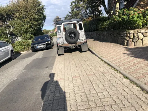
Friesenstube
Restaurant · Regional · 0.6 km
Es sollte telefonisch reserviert werden.
4 Gaadt
Tu-Su,PH 17:30+
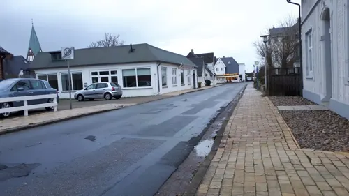
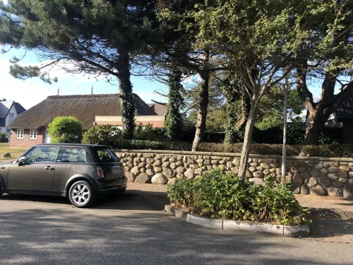
Tobis Hüs
Restaurant · Barbecue · 0.6 km
Reservierung möglich unter https://www.tobishues.de/reservierung/
7 Gaadt, Sylt
Mo-Sa 17:00-23:00; Su off
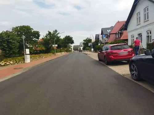
Abeling
Bakery
Einige Brötchen sind vegan, aber nicht gekennzeichnet. Es gibt ein Bio-Brot.
15 Maybachstraße, Sylt
Mo-Sa 06:30-18:00; Su,PH 07:00-11:00

Beachhouse Sylt
Restaurant · German
Auf Nachfrage gibt es auch vegane Gerichte.
41 Käpt'n-Christiansen-Straße, Sylt
We-Su 11:30-23:30+; Mo off



125 more on the map.
History
Westerland is partly one of the younger settlements on the island of Sylt. After the All Saints' Day Flood of 1436 had destroyed the biggest part of the community of Eidum (except for the area that is today called Enden and the Church), the survivors built a new community to the northeast on a heath. The new settlement was called Hedigen (heath area).
In the 16th century most of the people on Sylt were involved in the hunting of Herring near Heligoland, Westerland was no exception.
The Old Church of Eidum St. Niels was demolished in 1634, mainly due to a particularly bad stench, and rebuild in the heath area, far away from the sea, in 1636.
Westerlant (probably an old field name used by the people of Tinnum) had its first documentary mention in 1462. In 1636, there were 43 and, in 1695, 76 taxable houses.
The village grew rapidly during the 17th and 18th centuries because people experienced a great increase in wealth thanks to whaling. Previously, people had only lived from the sea and what little their fields could provide (they were often destroyed by the wandering dunes or flooding).
From the History section of Westerland, Germany on Wikipedia, under CC BY-SA 4.0.
Where to stay49
Churches and places of worship9
Dorfkirche Sankt Niels
Church · Lutheran · 0.9 km
37 Kirchenweg, Sylt
Evangelisch-Freikirchliche Gemeinde
Church · Baptist · 0.6 km
5 Kuhrtstraße, Sylt
Königreichssaal Zeugen Jehovas
Church · Jehovahs Witness · 1.4 km
3 Kampende, Sylt
Shopping52
Gas and EV charging4
Schools, colleges and libraries5
Healthcare6
Map of Westerland
250 places. The map loads OpenStreetMap tiles when you open it.
Getting there and nearby towns
Sylt Airport (GWT) is the nearest airport with scheduled flights listed in OpenStreetMap, 2 km away.
- Tinnum 2 km southeast, about 2 min by car
- Keitum 5 km east, about 5 min by car
- Kampen 6 km northeast, about 6 min by car
- Rantum 7 km south, about 7 min by car
- Morsum 10 km southeast, about 10 min by car
- List 15 km northeast, about 15 min by car
- Hörnum 17 km south, about 17 min by car
- Oldsum 22 km southeast, about 22 min by car
- Utersum 23 km south, about 23 min by car
- Klanxbüll 24 km east, about 24 min by car
Drive times are estimates from straight-line distance, not routes.
Local news
Headlines from INDB.
Reviews, tips and questions
Loading what members have shared...
Sources and licences
- GeoNames (CC BY 4.0): population, coordinates, regions and time zone
- Mapillary (see each image): photos
- OpenStreetMap contributors (ODbL 1.0): places, airports, map data
- Wikidata (CC0 1.0): elevation, founding date, time zone, website, landmarks and historic places
- Wikimedia Commons (see each image): photos
- Wikipedia (CC BY-SA 4.0): overview and history text
Photo credits
- Rathaus Westerland, Drow69, CC BY-SA 4.0
- Hotel Stadt Hamburg, Westerland (Sylt), Gerd Fahrenhorst, CC BY 4.0
- Westerland Neue Straße Kanaldeckel, Leit, CC BY-SA 4.0
- Westerland-Sylt - panoramio, easy4444, CC BY 3.0
- Lloyd Shoes Westerland, Gerd Fahrenhorst, CC BY 4.0
- 20170412 xl P1100828-Gezeitenanzeigen-Westerland, Molgreen, CC BY-SA 4.0
- Sylter Bank Westerland, PKautz, CC BY-SA 3.0
- 20170409 xl P1100632-Westerland, Molgreen, CC BY-SA 4.0
- Wellensteyn Westerland, Gerd Fahrenhorst, CC BY 4.0
- 20170409 xl P1100634-Westerland-Sonnenuntergang, Molgreen, CC BY-SA 4.0
- Strandstraße 12-18 Westerland 2015 SE, Hans G. Oberlack, CC BY-SA 4.0
- Strandstraße 12-18 Westerland 2015 SW 01, Hans G. Oberlack, CC BY-SA 4.0
- Strandstraße 12-18 Westerland 2015 N, Hans G. Oberlack, CC BY-SA 4.0
- Strandstraße 12-18 Westerland 2015 NE, Hans G. Oberlack, CC BY-SA 4.0
- Strandstraße 12-18 Westerland 2015 NNE, Hans G. Oberlack, CC BY-SA 4.0
- Westerland, Andreas-Nielsen-Straße 1, Casino 4, 4spring, CC0
- Adler-Schiffe Büro Westerland, Gerd Fahrenhorst, CC BY 4.0
- Gedenktafel Warschauer Aufstand am Rathaus Westerland, Ulli 2mecs, CC BY-SA 4.0
- Westerland, Andreas-Nielsen-Straße 1, Casino 3, 4spring, CC0
- Ehemalige Feuerwehr Westerland 2018 NW, Hans G. Oberlack, CC BY-SA 4.0
- Stolperstein Westerland Sylt Nikolaus Ehlers, Jt wob ( Diskussion ) 22:40, 29. Jul. 2021 (CEST), CC BY-SA 4.0
- Westerland, Andreas-Nielsen-Straße 1, Casino 2, 4spring, CC0
- Westerland Andreas-Nielsen-Straße 1, Arnoldius, CC BY-SA 4.0
- Ehern. Kurhaus Westerland im Winter, Ulli 2mecs, CC BY-SA 4.0
- 20170411 xl P1100815-BIO-Markt-Westerland-Sylt, Molgreen, CC BY-SA 4.0
- Westerland, Andreas-Nielsen-Straße 1, Casino 1, 4spring, CC0
- Kampen Leuchtturm 2, Oberlausitzerin64, CC BY-SA 4.0
- Severinskirche Keitum, Holger Weinandt, CC BY-SA 3.0
- Westerland Sankt Niels SO, Arnoldius, CC BY-SA 4.0
- Westerland St. Christophorus 2, Westerland_St._Christophorus.jpg : User:Tolanor ( Tolanor ) derivative work: Rabanus Flavus ( talk ), CC BY-SA 3.0
- Sylt Aquarium (Westerland), Magnus Manske, CC BY-SA 3.0
- Westerland Nicolaikirche, Uwe Barghaan, CC BY 3.0
- SRBKaatje1, Chris Hartmann, CC BY-SA 3.0
- Tinnumburg auf Sylt im Luftbild, Psittacuso, CC BY-SA 4.0
- Vesterland danske Kirke, Magnus Manske, CC BY-SA 4.0
- Kreuze Friedhof der Heimatlosen, Gerhard Elsner, CC BY 3.0
- Reisende im Wind, Martin Wolke, Sylt (2) - JD, © JD (de.wikipedia.org), CC BY-SA 4.0
- Westerland Sylter Welle, Magnus Manske, CC BY-SA 3.0
- 20231014 xl 1801-Hotel Miramar, Molgreen, CC BY-SA 4.0
- Westerland Wasserturm 1, Oberlausitzerin64, CC BY-SA 4.0
- Denkmal für Heinrich von Stephan in Westerland, Magnus Manske, CC BY-SA 3.0
- SRBKaatje2, Chris Hartmann, CC BY-SA 3.0
- 20150322 xl 3517-Sylt-Westerland-Bahnhof mit Skulptur Reisende im Wind von Bildhauer Martin Wolke, Molgreen, CC BY-SA 4.0
- 20261020 xl 1136-Schule St. Nicolai, Molgreen, CC BY-SA 3.0
- Street-level photo, figij005, CC BY-SA 4.0
- Street-level photo, figij005, CC BY-SA 4.0
- Street-level photo, mjay, CC BY-SA 4.0
- Street-level photo, bernd_niemann, CC BY-SA 4.0
- Street-level photo, bernd_niemann, CC BY-SA 4.0
- Street-level photo, figij005, CC BY-SA 4.0
- Street-level photo, bernd_niemann, CC BY-SA 4.0
- Street-level photo, changchun1, CC BY-SA 4.0
- Street-level photo, changchun1, CC BY-SA 4.0
- Street-level photo, changchun1, CC BY-SA 4.0
- Street-level photo, changchun1, CC BY-SA 4.0
- Street-level photo, bernd_niemann, CC BY-SA 4.0
- Street-level photo, changchun1, CC BY-SA 4.0
- Street-level photo, figij005, CC BY-SA 4.0
- Street-level photo, changchun1, CC BY-SA 4.0
- Street-level photo, changchun1, CC BY-SA 4.0
- Street-level photo, bernd_niemann, CC BY-SA 4.0
- Street-level photo, changchun1, CC BY-SA 4.0
- Street-level photo, mjay, CC BY-SA 4.0
- Street-level photo, changchun1, CC BY-SA 4.0
- Street-level photo, mjay, CC BY-SA 4.0
- Street-level photo, changchun1, CC BY-SA 4.0
- Street-level photo, changchun1, CC BY-SA 4.0
- Street-level photo, systec, CC BY-SA 4.0
- Street-level photo, oro, CC BY-SA 4.0
- Street-level photo, changchun1, CC BY-SA 4.0
- Street-level photo, strubbl, CC BY-SA 4.0
- Street-level photo, strubbl, CC BY-SA 4.0
- Street-level photo, changchun1, CC BY-SA 4.0


Page built November 8, 2026. Spotted a mistake? Tell us or suggest a place.