


Wolfsburg, Germany
Wolfsburg is a city of 123,064 people in Lower Saxony, Germany, founded in 1938.
Why visit Wolfsburg
Townapedia lists 35 museums and landmarks, 56 parks and trails, 240 places to eat, 24 places to stay and 11 attractions in and around town.
Highlights include Delphin-Palast, Scharoun-Theater Wolfsburg, phaeno and Planetarium Wolfsburg.
Weather in Wolfsburg
Forecast from MET Norway (CC BY 4.0). Full forecast
About Wolfsburg
Wolfsburg (German: [ˈvɔlfsbʊʁk] ; Eastphalian: Wulfsborg) is the fifth-largest city in the German state of Lower Saxony. It lies on the river Aller, 75 kilometres (47 mi) east of Hanover and 230 kilometres (143 mi) west of Berlin.
From the Wikipedia article Wolfsburg (this version), under CC BY-SA 4.0.
Travel tips from other travellers: Wolfsburg on Wikivoyage (CC BY-SA 4.0).
Things to do11
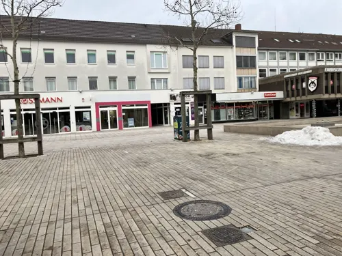
Delphin-Palast
Cinema and theater · 0.8 km
39 Porschestraße, Wolfsburg
Th 16:15-20:15; Fr 16:15-20:15; Sa 13:15-20:15; Su 13:15-20:15; We...


CinemaxX Wolfsburg
Cinema and theater · 0.9 km
Building:levels=6 resultiert aus "gleicher Höhe" wie Tryp-Hotel
4 Willy-Brandt-Platz, Wolfsburg


Wolfsburger Figurentheater Compagnie
Cinema and theater · 1.4 km
4 An der St. Annen-Kirche, Wolfsburg

Museums and landmarks35

phaeno
Museum · 1.1 km
Wissenschaftsmuseum
1 Willy-Brandt-Platz, Wolfsburg
Tu-Fr 09:00-17:00; Sa,Su,PH 10:00-18:00


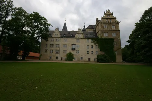
Kunstverein Wolfsburg
Museum · 2.4 km
8 Schloßstraße, Wolfsburg
We-Fr 10:00-17:00, Sa 13:00-18:00, Su 11:00-18:00; PH 11:00-18:00
Städtische Galerie
Museum · 2.3 km
8 Schloßstraße, Wolfsburg
Tu 13:00-20:00, We-Fr 10:00-17:00, Sa 13:00-18:00, Su 11:00-18:00;...



Kunstmuseum Wolfsburg
Museum · 0.8 km
Museum in Germany
1 Hollerplatz, Wolfsburg

Wolfsburg Castle
Monument and historic site · 2.3 km
8 Schloßstraße, Wolfsburg
Stadtmuseum Schloss Wolfsburg
Museum · 2.3 km
8 Schloßstraße, Wolfsburg
We-Fr 12:00-18:00; Sa 12:00-18:00; Su 12:00-18:00; PH 12:00-18:00
Künstlergruppe Galerie und Kunstschule Porschehütte
Museum · 1.0 km
11 Sauerbruchstraße, Wolfsburg
Su 14:00-17:00

23 more on the map.
Parks, trails and playgrounds56

Badeland Wolfsburg
Sports field and stadium · 2.9 km
4 Allerpark, Wolfsburg
Mo-Fr 06:00-22:00; Sa 08:00-22:00; Su,PH 08:00-20:00

Autostadt
Sports field and stadium · 1.9 km
Museum and park in Wolfsburg, Germany
Mo-Su 09:00-18:00; Dec 24 off; Dec 31 off


VW-Bad
Sports field and stadium · 1.8 km
May-Aug Mo-Sa 06:00-20:00, Su 08:00-20:00, Sep-Apr closed



1. Motorbootclub Wolfsburg
Marina and boat launch · 2.3 km
Die Hafenanlage direkt am Stadion hat ca. 47 Liegeplätze und verfügt über eine Slippe, 10 t Kran (für Notfälle, Wasser- und...


VfL-Stadion am Elsterweg
Sports field and stadium · 1.6 km
5 Elsterweg, Wolfsburg
Wolfsburger Yacht Club Allertal
Marina and boat launch · 3.1 km
Der Allersee ist 30 ha groß. Es sind 40 Wasser- und 70 Landliegeplätze vorhanden die auch von Gästenliegern benutzt werden können....


44 more on the map.
Restaurants and cafes240
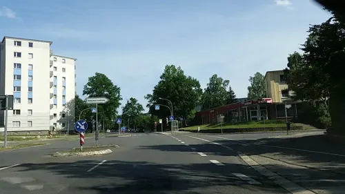
Konstantinopel
Restaurant · Greek · 1.6 km
Griechisches Restaurant
2 Eichelkamp, Wolfsburg
Tu-Sa 16:45-21:30; Su 11:30-21:30

Zum Tannenhof
Restaurant · German, Regional
49 Kleiststraße, Wolfsburg
Tu-Sa 18:00-23:00; Sa-Su 10:00-13:00
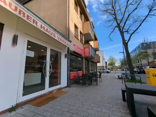
Bingo Bingo
Restaurant · Italian
15 Schachtweg, Wolfsburg
Mo-Fr 11:00-14:30, 17:00-22:30; Sa 12:00-15:00, 17:00-22:30; Su off
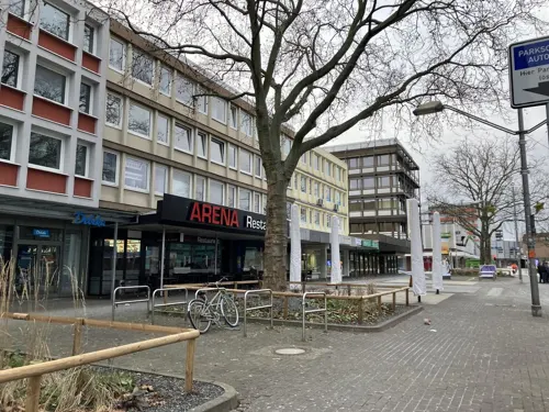
EAT Grill & Bar
Restaurant · Burger · 0.9 km
26-30 Porschestraße, Wolfsburg
Mo-Th 10:00-24:00, Fr,Sa 10:00-01:00, Su 10:00-23:30
Ferdinands
Restaurant · Bowls · 2.9 km
5 Neue Reihe, Wolfsburg
Su off, Mo off, Tu-Sa 11:30-14:00, Tu-Sa 17:30-22:00
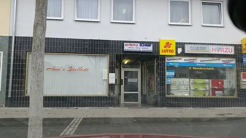
Glöckl
Restaurant · Burger · 1.8 km
20 Reislinger Straße, Wolfsburg
Mo-Fr 11:30-20:00; Su 15:00-20:00; Sa,PH off
Italian's
Restaurant · Italian · 0.9 km
26-30 Porschestraße, Wolfsburg
Su-Th 11:30-23:00; Fr-Sa 11:30-00:00


Santorini
Restaurant · Greek · 2.3 km
4 In den Allerwiesen, Wolfsburg
May-Sep 11:00-22:00; Oct-Apr 11:00-14:30, 17:00-22:00
228 more on the map.
History
The Wolfsburg Castle was first mentioned in 1302 in a document as the domicile of the noble lineage of Bartensleben. Originally a keep next to the Aller, it was protected by a moat some centuries later. In 1372, the first documentary reference to the Burg Neuhaus ('castle of Neuhaus') near Wolfsburg appeared. After the extinction of the Bartensleben line in 1742, the property and its Schloss Wolfsburg ('Wolfsburg castle') passed on to the Counts of Schulenburg. The communal manor was an important employer for the nearby settlements Rothenfelde and Heßlingen.
Some of today's urban districts, including Vorsfelde and the villages transferred to Wolfsburg from the county of Helmstedt, belonged to the Principality of Brunswick-Wolfenbüttel. Fallersleben and other villages belonged to the Electorate of Braunschweig-Lüneburg, which later developed into the Kingdom of Hanover and became a Prussian province in 1866. Other urban districts, including Heßlingen, belonged to the Prussian Duchy of Magdeburg. In 1932, these districts were detached from the Prussian Province of Saxony and integrated into the Province of Hanover.
From the History section of Wolfsburg on Wikipedia, under CC BY-SA 4.0.
Where to stay24
Churches and places of worship30
Shopping58
Gas and EV charging56
Schools, colleges and libraries38
Healthcare17
Map of Wolfsburg
250 places. The map loads OpenStreetMap tiles when you open it.
Getting there and nearby towns
Forschungsflughafen Braunschweig-Wolfsburg (BWE) is the nearest airport with scheduled flights listed in OpenStreetMap, 19 km away.
- Detmerode 4 km southwest, about 4 min by car
- Weyhausen 6 km northwest, about 6 min by car
- Tappenbeck 6 km northwest, about 6 min by car
- Osloß 8 km northwest, about 8 min by car
- Jembke 9 km north, about 9 min by car
- Danndorf 9 km east, about 9 min by car
- Bokensdorf 9 km northwest, about 9 min by car
- Rühen 10 km northeast, about 10 min by car
- Calberlah 10 km west, about 10 min by car
- Allerbüttel 9 km west, about 9 min by car
Drive times are estimates from straight-line distance, not routes.
Local news
Headlines from INDB.
Reviews, tips and questions
Loading what members have shared...
Sources and licences
- GeoNames (CC BY 4.0): population, coordinates, regions and time zone
- Mapillary (see each image): photos
- OpenStreetMap contributors (ODbL 1.0): places, airports, map data
- Wikidata (CC0 1.0): elevation, founding date, time zone, website, landmarks and historic places
- Wikimedia Commons (see each image): photos
- Wikipedia (CC BY-SA 4.0): overview and history text
Photo credits
- Wolfsburg Schloss Suedfluegel, Radler59, CC BY-SA 4.0
- Wolfsburg Friedenskirche 2023, Kirchenfan, CC0
- Wolfsburg Pestalozzischule, Reise Reise, CC BY-SA 3.0
- Wolfsburg Christopher Street Day 2025 14, Elmschrat, CC BY-SA 4.0
- Wolfsburg Christopher Street Day 2025 23, Elmschrat, CC BY-SA 4.0
- Wolfsburg Christopher Street Day 2025 21, Elmschrat, CC BY-SA 4.0
- Wolfsburg Christopher Street Day 2025 20, Elmschrat, CC BY-SA 4.0
- Wolfsburg Christopher Street Day 2025 09, Elmschrat, CC BY-SA 4.0
- Wolfsburg Christopher Street Day 2025 22, Elmschrat, CC BY-SA 4.0
- Wolfsburg Christopher Street Day 2025 10, Elmschrat, CC BY-SA 4.0
- Wolfsburg Christopher Street Day 2025 24, Elmschrat, CC BY-SA 4.0
- Wolfsburg Christopher Street Day 2025 16, Elmschrat, CC BY-SA 4.0
- Wolfsburg Christopher Street Day 2025 25, Elmschrat, CC BY-SA 4.0
- Wolfsburg Jugendherberge, Reise Reise, CC BY-SA 4.0
- Wolfsburg Christopher Street Day 2025 07, Elmschrat, CC BY-SA 4.0
- Wolfsburg Christopher Street Day 2025 08, Elmschrat, CC BY-SA 4.0
- Wolfsburg Christopher Street Day 2025 06, Elmschrat, CC BY-SA 4.0
- Wolfsburg Tagesklinik k, Kirchenfan, CC0
- Wolfsburg Tagesklinik, Kirchenfan, CC0
- Wolfsburg Kreuzkirche C, Kirchenfan, CC0
- Kreuzkirche Wolfsburg 2022, Kirchenfan, CC0
- Carl-Hahn-Schule Wolfsburg, Schachtweg, Gerd Fahrenhorst, CC BY 4.0
- Wolfsburg Friedenskirche, Reise Reise, CC BY-SA 3.0
- Wolfsburg BBS I Schachtweg, Reise Reise, CC BY-SA 3.0
- Kunstmuseum Wolfsburg Hollerplatz A, Kintaiyo, CC BY-SA 3.0
- 14-01-18-autostadt-wob-037, Ralf Roletschek, CC BY 3.0
- Allerpark und Schloss, Axel Hindemith, CC BY 3.0
- Lehre Kirche, Kirchenfan, CC0
- Phaeno Suedseite RB, Richard Bartz, CC BY-SA 3.0
- Wolfsburg VfL-Stadion 2, Reise Reise, CC BY-SA 4.0
- Aerial image of Wolfsburg Castle (view from the south), Carsten Steger, CC BY-SA 4.0
- Ratsgymnasium Wolfsburg, Tetraeder~commonswiki, CC BY-SA 4.0
- Wolfsburg THG Innenhof, Vanellus Foto, CC BY-SA 3.0
- Scharoun, Hans - Theater (Wolfsburg) 1600px, Photographed by Janek Pfeifer, Uploaded to de.wikipedia 01:22, 10. Jan 2005 by de:Benutzer:Janekpfeifer, CC BY-SA 3.0
- 2023-12-15 Grizzlys Wolfsburg gegen Nürnberg Ice Tigers (Deutsche Eishockey-Liga 2023-24) by Sandro Halank–138, Sandro Halank, Wikimedia Commons, CC BY-SA 4.0
- Wolfsburg Heilig-Geist 2012, Kirchenfan, CC0
- Wolfsburg Stephanus, Kirchenfan, CC0
- Wolfsburg Christuskirche 2012, Kirchenfan, CC0
- Mahnmal Klieversberg, Vanellus Foto, CC BY-SA 3.0
- Ritz-Carlton, Wolfsburg (P1100712), Matti Blume, CC BY-SA 4.0
- Badeland von oben, Vanellus Foto, CC BY-SA 3.0
- AOK Stadion Außenansicht, Wolfsburg AG, CC BY-SA 3.0 de
- Wolfsburg Pauluskirche, Kirchenfan, CC0
- Wolfsburg VW-Bad Eingang, Vanellus, CC BY-SA 4.0
- ZeitHaus, Wolfsburg (P1100711), MB-one, CC BY-SA 4.0
- Wolfsburg Erloeserkirche, Kirchenfan, CC0
- Klieversberg Ref Kirche 2016, Axel Hindemith, CC BY-SA 3.0
- Wolfsburg VWHochhaus, Vanellus Foto, CC BY-SA 3.0
- Volkswagen-Arena Gästeblock, Saubär, CC BY-SA 3.0
- Wolfsburg Kirche Christophorus 2008, Kirchenfan, CC0
- Wolfsburg Kirche St. Bernward, Kirchenfan, CC0
- Hesslingen Annenkirche 2016, Kirchenfan, CC0
- Wolfsburg Marienkirche 2018-2, Kirchenfan, CC0
- Sonnenuhr am Planetarium Wolfsburg, Gerd Fahrenhorst, CC BY 4.0
- Street-level photo, tian, CC BY-SA 4.0
- Street-level photo, tian, CC BY-SA 4.0
- Street-level photo, u14183, CC BY-SA 4.0
- Street-level photo, ente, CC BY-SA 4.0
- Street-level photo, tian, CC BY-SA 4.0
- Street-level photo, tian, CC BY-SA 4.0
- Street-level photo, andreas1974, CC BY-SA 4.0
- Street-level photo, VIA_AE, CC BY-SA 4.0
- Street-level photo, tian, CC BY-SA 4.0
- Street-level photo, tian, CC BY-SA 4.0
- Street-level photo, tian, CC BY-SA 4.0
- Street-level photo, VIA_AE, CC BY-SA 4.0
- Street-level photo, tian, CC BY-SA 4.0
- Street-level photo, tian, CC BY-SA 4.0
- Street-level photo, tian, CC BY-SA 4.0
- Street-level photo, tian, CC BY-SA 4.0
- Street-level photo, andreas1974, CC BY-SA 4.0
- Street-level photo, tian, CC BY-SA 4.0
- Street-level photo, tian, CC BY-SA 4.0
- Street-level photo, changchun1, CC BY-SA 4.0
- Street-level photo, u14183, CC BY-SA 4.0
- Street-level photo, geo, CC BY-SA 4.0
- Street-level photo, tian, CC BY-SA 4.0
- Street-level photo, ente, CC BY-SA 4.0


Page built November 8, 2026. Spotted a mistake? Tell us or suggest a place.